Key Takeaways:
- 60% of U.S. utilities are private and not marked by 811—commercial properties, HOAs, and site infrastructure require private locators to map the complete subsurface picture.
- CA Government Code 4216 violations carry $50,000 fines and potential jail time—expired 811 tickets, missing white-lining, or excavating within 24-inch tolerance zones without hand tools trigger criminal penalties.
- One avoided utility strike justifies 112-187 test holes at $500 each—with average strike costs hitting $56,000 plus 2-3 months downtime, vacuum excavation potholing delivers 112:1 ROI.
- Riverside County projects cross multiple permit jurisdictions simultaneously—EMWD, Western MWD, Caltrans D8, and city agencies each demand separate coordination with processing times from 2 weeks to 6 months.
- Ground-penetrating radar identifies 10-50% more utilities than records-only searches—fiber optic cables cause 50% of national damages, and PVC lines, invisible to electromagnetic locating, require GPR technology for detection.
Riverside County presents excavators with a jurisdictional maze that few regions match. Overlapping city boundaries, competing utility districts, and extreme soil variability create conditions where standard dig protocols fail. The stakes are higher here—one project can cross three permit authorities and encounter five different utility owners within a single block.
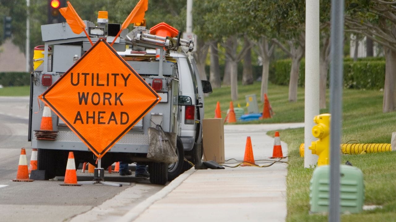
Digging in Riverside County? Read This First
How do population growth and infrastructure density increase subsurface congestion?
Riverside County’s explosive growth created a patchwork subsurface. Unincorporated areas blend with cities like Riverside, Corona, Murrieta, and Temecula, stacking jurisdictions on top of each other. Development from the 1980s-2000s produced better record-keeping than older areas, but construction outpaced documentation—as-builts lag reality by months or years.
The real danger hides in industrial zones. Warehouse districts and logistics centers pack private utilities underground—irrigation lines, security systems, fiber networks, internal power distribution. These lines never appear in 811 responses because 60% of U.S. utilities are privately owned. One wrong dig hits the infrastructure that public locators never marked.
Why do multiple utility districts and city jurisdictions complicate dig planning?
District boundaries ignore political maps. Eastern Municipal Water District (EMWD) serves Riverside, Perris, Murrieta, Temecula, and scattered unincorporated pockets—water, sewer, and reclaimed lines throughout. Western Municipal Water District covers the western county areas. Elsinore Valley MWD handles Lake Elsinore. A single trench can cross all three service territories.
Each district requires separate coordination, separate permits, and separate response timelines. City limits don’t match water district boundaries. What starts as a simple street repair becomes a multi-agency coordination nightmare where three entities must approve before you break ground.
How do Riverside’s soil types—rocky desert, decomposed granite, and clay pockets—affect excavation safety?
Riverside’s geology punishes equipment and operators who don’t adapt. Sandy, loose soils let vacuum excavation hit peak productivity—18 to 24 test pits daily. Clay-heavy zones kill air-vac efficiency, but hydrovac cuts through with high-pressure water at the cost of tripled water consumption. Rocky desert conditions slow both methods to a crawl as cobbles and boulders jam vacuum systems.
Moisture extremes compound the challenge. Saturated soils excavate easily but create heavy slurry that fills debris tanks in minutes, forcing constant disposal runs. Bone-dry desert soils kick up dust that clogs filtration systems and drops suction power. Equipment that works perfectly in Corona fails in Coachella Valley. Operators who don’t match technology to soil conditions lose time, money, and sometimes utilities.
What legal requirements apply before any excavation begins?
California law treats unauthorized digging as a criminal act, not a civil infraction. Government Code 4216 establishes mandatory protocols that apply to every shovel, every backhoe, every project—from homeowner fence posts to highway reconstruction. Ignorance provides no defense. The law assumes you know these requirements before you break ground.
What does California Government Code 4216 (“Call 811 Before You Dig”) require of contractors and homeowners?
Code 4216 mandates a minimum of two working days’ notice before excavation—the notification date doesn’t count. White-line your dig area with paint, flags, or stakes before calling 811. Once utilities mark their lines, hand tools can only be used within 24 inches on either side of marked utilities. Vacuum excavation gets an exception if you notify the regional call center.
Tickets expire after 28 days. Work stops immediately when expiration hits—no grace period, no exceptions. Get a new ticket and wait two working days before resuming. Penalties escalate fast: excavating without a valid ticket carries misdemeanor charges, fines up to $50,000, and possible jail time. Damage a utility and you’re liable for repair costs, service interruption expenses, and criminal charges if negligence is proven.
How long is an 811 ticket valid, and when must markings be refreshed?
Twenty-eight days from issuance. When day 28 ends, stop work immediately—even mid-trench. Submit a new ticket and wait for the full two-day response period before restarting. Field interpretation doesn’t matter; the statute is absolute.
Marks fade before tickets expire. Rain washes paint away. Traffic obeys flags. When marks disappear, delineate the area again and request a remark through 811. Utilities have two working days to respond. The Area of Continual Excavation (ACE) ticket offers year-long validity, but only farmers and flood control operators qualify—construction projects don’t.
Which Riverside County and city encroachment or right-of-way permits are mandatory for work in public areas?
Every jurisdiction demands its own paper. Riverside County Public Works issues encroachment permits for county roads and drainage easements—allow 2-6 weeks. Caltrans District 8 controls all state highways: I-10, I-15, SR-60, SR-91, SR-215, SR-79, and US-395. Their permits take 6-12 weeks for standard projects, 3-6 months for complex work requiring environmental review.
Cities run independent systems. Riverside and Corona process excavation permits through their engineering divisions in 2-4 weeks. Murrieta and Temecula move faster at 2-3 weeks due to newer infrastructure and simpler coordination. Water and sewer work adds another layer—EMWD, Western MWD, and Elsinore Valley MWD each require separate coordination regardless of which city or county issues the excavation permit.
How do state stormwater and dust-control ordinances integrate with excavation permitting?
Environmental regulations layer onto excavation permits automatically. Regional Air Pollution Control District standards mandate fugitive dust control—water suppression or chemical stabilizers on all exposed soil. Hydrovac excavation meets this requirement inherently through wet excavation. Air-vac and mechanical methods need active dust suppression to match traditional excavation standards.
Groundwater interception triggers separate permitting. Dewatering operations discharging significant volumes require NPDES permits before pumping begins. Sediment control BMPs—silt fences, inlet protection, street sweeping—become permit conditions, not optional measures. Inspectors check compliance during site visits. Missing BMPs stop work until corrections are made.
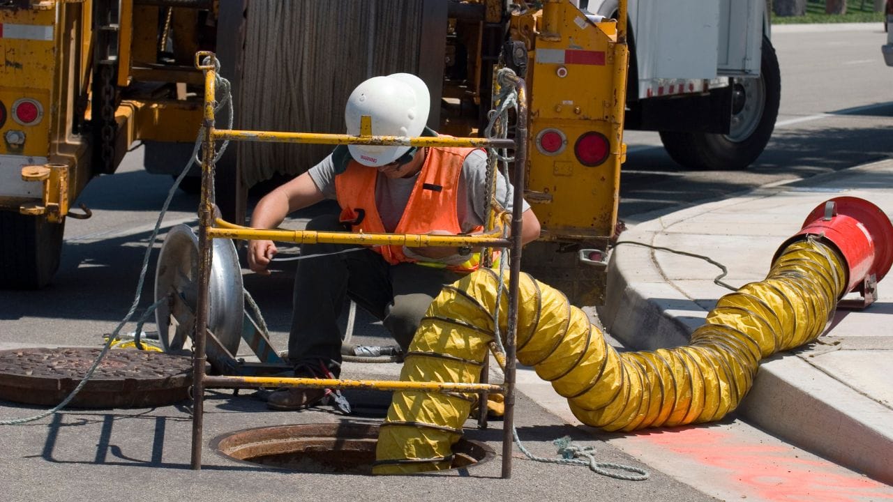
How does the utility locating process work in Riverside County?
The 811 system covers public infrastructure only—a critical distinction that trips up contractors daily. Call DigAlert and you’ll get marks for utilities in the public right-of-way up to the service connection. Everything beyond that point lives in a blind spot where 60% of America’s underground infrastructure hides. Understanding this divide prevents the strikes that 811 can’t prevent.
What utilities are covered by 811, and which private lines are not marked?
DigAlert locates public utilities to their service demarcation. Other companies mark gas mains, electric distribution and water mains. Sewer mains in public rights-of-way get marked by municipal systems. AT&T, Frontier and Spectrum mark telecom lines to the demarcation point.
Past those connection points, you’re operating blind. Customer-owned gas lines beyond meters, private fiber networks, site utilities—irrigation, landscape lighting, private electrical—never appear in 811 responses. HOA infrastructure, commercial property utilities, private sewer laterals, site drainage, and reclaimed water lines on private property require private locators. That’s 60% of U.S. utility infrastructure that 811 never touches.
How do professional private locators supplement 811 mark-outs on commercial or HOA properties?
Private utility locators find what 811 misses—10 to 50% more utilities than traditional record searches, according to FHWA studies. They deploy Ground Penetrating Radar to detect metallic and non-metallic lines, electromagnetic locators for metallic pipes, and tracer wire. Surface geophysics (Quality Level B) delivers ±6-12 inches horizontal accuracy and ±10% depth precision.
Cost scales with complexity: $2,000-$10,000 per acre, depending on utility density, $5,000-$30,000 for typical projects. That investment buys the complete subsurface picture—public infrastructure from 811 plus private utilities that only specialized equipment reveals. Commercial properties and HOAs need this coverage. 811 alone leaves dangerous gaps.
What information must be supplied on the 811 ticket to ensure accurate responses?
Incomplete tickets generate incomplete responses. Provide the jobsite address with cross streets and GPS coordinates if available. Describe the excavation area—which must already be delineated in white. Include dig depth, scope dimensions, and work type: trenching, boring, or potholing utilities. Specify your start date minimum two working days out, excluding the submission date itself.
Add contact information—name, phone, email—and company details. Confirm white-line delineation is complete before submission. Utility locating companies can’t mark what they can’t see. Missing any required field delays responses or triggers inaccurate marks that put your crew at risk.
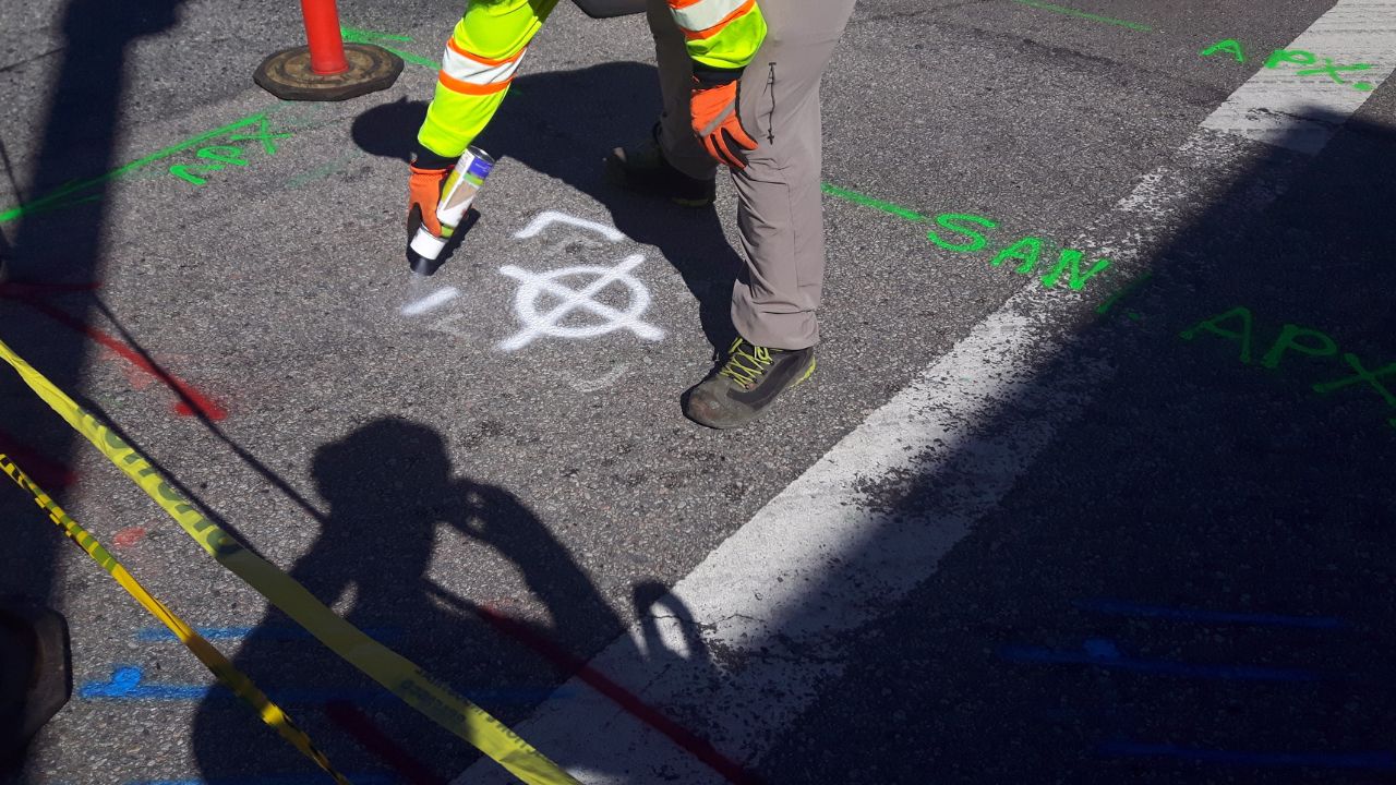
How should site sketches and white-lining be performed for compliant marking?
White-lining defines what gets marked. Use paint, flags, stakes, whiskers, or chalk to outline the entire dig area—not just centerlines but every zone where equipment operates. Add depth notations where excavation varies: “4 FT DEEP.” Show directional arrows for boring or trenching. Label the work type: “TRENCH,” “BORE,” “POTHOLE.”
Photograph your white-lining with timestamps before calling 811—documentation that proves compliant delineation if disputes arise. Marks must stay visible throughout the locate process. Weather and traffic destroy markings. Check visibility daily and refresh before tickets expire. Faded white-lines produce faded locate marks or no marks at all.
What are the major underground utilities you’re likely to encounter?
Riverside County’s subsurface follows predictable patterns—until it doesn’t. Water, sewer, gas, electric, and telecom each claim standard depth ranges and alignments, but age, soil conditions, and construction shortcuts create exceptions that kill assumptions. Knowing typical configurations helps. Verifying actual positions before digging keeps crews safe and projects on schedule.
Where are water, sewer, and reclaimed-water lines typically aligned in county rights-of-way?
Water mains run parallel to street centerlines in the roadway, 4-8 feet deep. Services branch perpendicular toward properties. Sewer mains follow street alignment on downhill gradients, 6-12 feet deep typically, deeper at downstream reaches where elevation drops. Reclaimed water—purple pipe—serves irrigation in medians and parks at 2-4 feet depth, always separated from potable systems.
Storm drains ignore street geometry and follow natural drainage patterns. They cross diagonally when topography demands, buried 4-10+ feet depending on the tributary area. Service laterals branch perpendicular from mains, crossing parkways to property lines—shallow near curbs at 3-4 feet, deeper where they connect to mains.
At what depths are gas, electric, and telecom conduits commonly buried in residential vs. industrial zones?
Residential utilities cluster shallow. Gas distribution sits at 18-36 inches. Underground electric runs 24-36 inches for secondary service, 36-48 inches for primary. Telecom and CATV occupy the shallowest zone at 12-24 inches—first strike risk on every job. Fiber optic installations overlay older utilities at 18-36 inches. Water services drop to 36-48 inches for frost protection.
Industrial and commercial zones push utilities deeper with heavier protection. High-pressure gas transmission (>60 PSI) drops to 48-72+ inches. Electric transmission duct banks match that depth, deeper for high-voltage runs. Telecom duct banks containing multiple conduits sit at 24-48 inches. Critical fiber backbone infrastructure goes 36-60 inches deep. Large water mains serving industrial demand reach 48-96 inches, depending on diameter and pressure ratings.
How can existing GIS or as-built maps help anticipate high-risk crossings before potholing?
Start with Riverside County’s GIS Portal (RCLIS)—free public access to property boundaries, streets, and selected utility layers. Request utility-specific GIS from owners: EMWD provides water/sewer mapping through customer service, Riverside Public Utilities shares electric/water data, and another company releases gas distribution maps via developer services. Caltrans District 8 maintains state highway utility mapping through its Utilities Office.
GIS reveals risk patterns that records miss. Pre-1960s development zones carry inaccurate documentation. Intersections concentrate multiple utility crossings. Arterial streets, commercial strips, and industrial corridors pack utilities tightly. Recent fiber buildouts overlay congested corridors. Cross-reference the National Pipeline Mapping System (NPMS) for high-pressure gas transmission near your project. Desktop review catches conflicts before design locks in—engineers route around confirmed utilities instead of discovering conflicts in the field when changes cost exponentially more.
What locating technologies deliver the best results for different soil and site conditions?
No single technology locates everything. Electromagnetic fails in dry desert soils. Ground-penetrating radar can’t identify pipe materials. Vacuum excavation costs too much for preliminary surveys. Smart contractors match technology to soil conditions, utility types, and project risk—using multiple methods to cover each technology’s blind spots.
How does electromagnetic locating perform in dry or mineralized ground?
Electromagnetic (EM) locators cost around $5,000 per unit—industry standard tools like the Vivax V-loc Pro 3. They detect metallic pipes, tracer wire, and active electrical lines by sensing electromagnetic fields. Performance peaks in moist soils with moderate mineralization, especially when connected directly to metallic utilities for active signal tracing.
Riverside’s extreme conditions kill EM effectiveness. Dry soils create high resistance that attenuates signals. Mineralized ground conducts signals away from the target. Detection range collapses in both scenarios. Desert areas and Rocky zones demand GPR backup. Never rely on EM alone in challenging soil—combine technologies for complete coverage.
When is ground-penetrating radar the superior option for non-metallic lines?
GPR costs $30,000-60,000 per unit but detects what EM misses: PVC, concrete, fiber optic, voids, abandoned utilities still physically present. Multiple antenna frequencies penetrate different depths and material types. Quality Level B accuracy delivers ±6-12 inches horizontal and ±10% depth—good enough for design but not construction.
Fiber optic cables—50% of all utility damages nationally—demand GPR. PVC water and sewer lines invisible to EM show clearly on GPR. The technology identifies 10-50% more utilities than records-only searches, according to FHWA studies. The limitation: GPR can’t determine pipe size, material composition, or condition. That requires physical exposure through vacuum excavation.
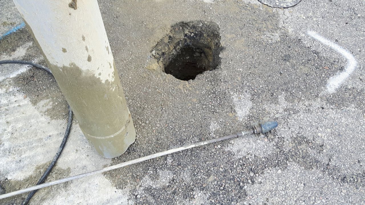
How does vacuum excavation confirm depth and alignment with zero-damage exposure?
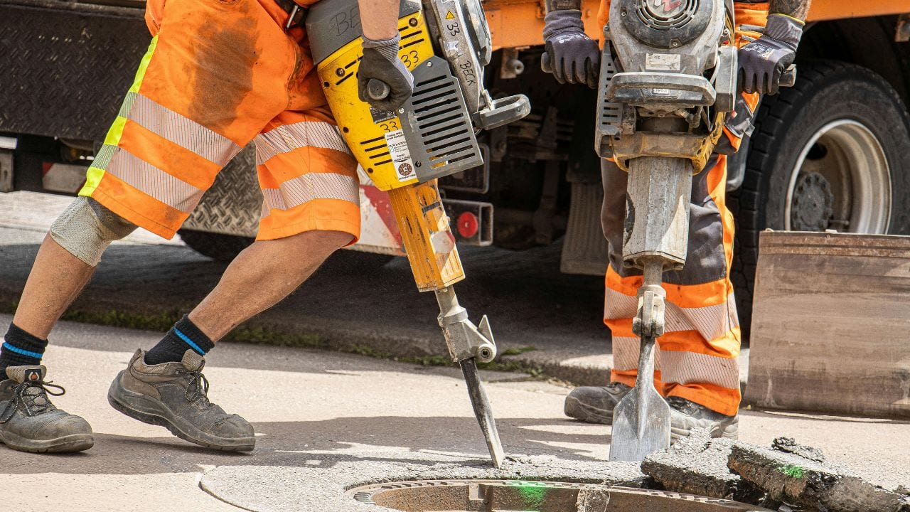
Vacuum excavation achieves Quality Level A accuracy: ±¼ inch horizontal to utility center, ±½ inch depth. Damage rates prove the method—0.2% for vacuum versus 53.9% mechanical excavation versus 20.5% hand tools per 2011 CGA data. Physical exposure reveals everything: precise X, Y, Z coordinates, depth to crown and invert, size, material, condition, including corrosion and cracks.
Productivity numbers justify the investment. Hydrovac completes 18 pits daily versus 4 with air-vac—450% increase. Peak performance hits 24 pits per day. It’s 10x faster than hand digging and 4x cheaper at $200-600 per standard 3’×3’×4′ test hole. Every critical utility crossing, structure foundation, and conflict point needs vacuum verification before construction equipment arrives.
How does GPS/GIS data capture improve record accuracy for future projects?
GPS-tagged locate data transforms temporary field marks into permanent infrastructure records. Digital line maps with coordinates, PDF field references with color-coded utility types, KMZ files for Google Earth—all generated from a single locate event. CAD formats (DWG/DXF) integrate directly into engineering software with survey-accurate positioning.
GIS shapefiles carry attribute data: utility type, owner, size, material, depth, quality level, and investigation date. Mark validation photos with embedded GPS and timestamps prove field conditions. Test hole logs in PDF and Excel/CSV formats document physical verification. Future projects start with accurate data instead of guesswork. The marginal cost of GPS capture during initial locating prevents expensive re-verification on every subsequent project in that corridor.
What steps make up a compliant pre-dig workflow in Riverside County?
Five steps separate compliant projects from utility strikes and legal violations. Each step builds on the previous—skip one and the entire sequence fails. This workflow applies to every excavation, from fence posts to freeway reconstruction. Master it once, apply it everywhere.
Step 1 — How should you gather record drawings and conduct site reconnaissance?
Start with records before fieldwork. Request as-builts from Riverside County Public Works, Caltrans District 8, and city engineering departments. Pull GIS data from RCLIS, EMWD, Riverside Public Utilities, and SoCalGas. Review prior project documentation, environmental reports, and geotechnical studies—somebody dug here before and documented what they found.
Flag high-risk zones during desktop review: dense utility corridors, pre-1960s development with poor records, intersections with multiple crossings, and gas transmission lines identified through NPMS. Budget Subsurface Utility Engineering at 0.5-1% of construction value per FHWA guidance. A $5 million project needs $25,000-$50,000 for SUE—insurance against conflicts that cost exponentially more to fix during construction.
Step 2 — When should you submit 811 requests and schedule private locators?
White-line first, ticket second. Delineate your entire dig area in white paint, flags, or stakes per Government Code 4216.2. Submit your DigAlert ticket at DigAlert.org or call 811 minimum two working days before the start—but seven to ten days prevents the 50% delayed-start rate that plagues projects using minimum notice. Check the Electronic Positive Response to confirm all utilities responded.
Hire private locators simultaneously with the 811 submission. Public utilities represent only 40% of underground infrastructure—private locators find the other 60%. They also provide in-depth information, GPS-accurate mapping, and quality verification that 811 marks don’t deliver. Coordinate water access for hydrovac operations now: hydrant permits and water truck logistics resolved in advance prevent delays when potholes need verification.
Step 3 — How do you interpret color codes and tolerance zones during field layout?
Color codes identify utility type: red for electric, yellow for gas (40% of damages), orange for telecom/fiber (50% of all damages), blue for water, green for sewer, purple for reclaimed water. Compare marks against as-builts and GIS data—discrepancies exceeding five feet trigger re-mark requests. Document every mark with GPS-tagged photos before equipment arrives.
Request remarks immediately when marks fade or appear questionable. Utilities have two working days to respond. Faded marks aren’t legal protection—visible, accurate marks are mandatory. Don’t gamble on interpretation. When doubt exists, stop and verify.
Step 4 — How and when should you pothole utilities to verify actual positions?
Pothole density scales with risk. High-density urban corridors need one pothole per 100-200 linear feet. Medium-density areas use one per 200-500 feet. Always pothole at structure foundations, known conflicts, crossing points, depths exceeding 10 feet, and high-risk utilities—gas transmission over 60 PSI, electric transmission, fiber backbone.
The math justifies every hole. One avoided strike saves $56,000 plus 2-3 months delay. That pays for 112-187 potholes at $500 each. Spend 0.1-0.3% of construction costs on potholing: a $5 million project allocating $5,000-$15,000 buys 10-30 verification potholes—cheap insurance against catastrophic utility damage.
Step 5 — How do you document findings, photograph marks, and store verification data?
Test hole logs capture everything: utility type, size, material, depth to crown and invert, and condition assessment. GPS-tagged photos with embedded coordinates provide georeferenced proof. Survey data in CAD format enables as-built integration showing actual versus design locations.
Document discrepancies immediately—utilities rarely sit where records claim. Retain 811 ticket numbers, EPR confirmations, and disposal receipts. Submit complete documentation to agencies and utility owners per permit conditions. This paper trail protects you during inspections, audits, and damage investigations. Projects without documentation face penalties even when no violations occurred—the burden of proof sits with the excavator.
Don’t let your next Riverside County project become a $56,000 lesson in utility avoidance
Riverside County’s jurisdictional maze, soil extremes, and 60% private utility density create strike conditions that standard protocols can’t prevent. One missed fiber line costs $56,000 plus three months of downtime. Ten test holes at $500 each deliver 112:1 return on investment when they prevent a single strike. 811 tickets cover only public utilities—private locators find the other 60% of underground infrastructure that public mark-outs miss. Desktop review identifies risks, but only physical verification through vacuum excavation confirms what’s actually underground versus what records claim.
Util-Locate brings three decades of Southern California subsurface experience to Riverside County projects. Ground-penetrating radar, electromagnetic locating, and vacuum excavation services deliver GPS-accurate mapping and CAD-format deliverables that integrate directly into your design documents. We identify the 10-50% more utilities that record misses and provide Quality Level A verification at critical conflict points.
Contact Util-Locate today for project-specific pricing and schedule coordination—our locating specialists understand Riverside County’s permit requirements, utility district boundaries, and soil conditions that impact technology selection. Don’t dig blindly. Verify first, excavate confidently.