Technological Advancements in Underground Utility Detection: From Ground Penetrating Radar to GIS Mapping

GPR scanning services

The landscape of utility locating and underground infrastructure mapping is undergoing a significant transformation, fueled by technological advancements. From the advent of Ground Penetrating Radar (GPR) to the sophistication of Geographic Information Systems (GIS), the construction industry is witnessing unprecedented improvements in detecting and mapping underground assets.

In this guide, we’ll explore these technological advancements in utility location and their impact on construction projects.

Revolutionizing Utility Locating with Ground Penetrating Radar (GPR)

GPR services have revolutionized the way construction firms and utility companies locate underground assets. This cutting-edge technology sends high-frequency radio waves into the ground, which bounce back to the surface upon hitting different materials, providing a detailed view of what lies beneath without any physical excavation.

GPR scanning services have become indispensable in detecting underground infrastructure such as water pipes, gas lines, and communication cables, significantly reducing human errors and the risk of accidental damage during construction activities.

The Role of Private Utility Locating

Private utility locating has emerged as a critical service, especially when public records are incomplete or outdated. Utilizing advanced technologies, private utility locating helps identify unrecorded or mislabeled underground utility assets, ensuring accurate location and mapping. This precision is crucial for avoiding accidental utility strikes that can lead to costly repairs and project delays.

Utility Mapping and GIS Integration

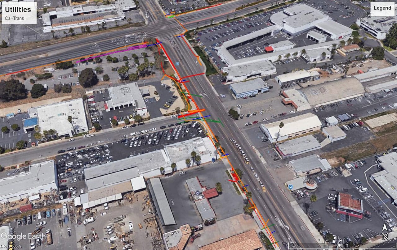
The integration of utility mapping services with Geographic Information Systems (GIS) represents a leap forward in urban and civil engineering projects. GIS provides a framework for gathering, managing, and analyzing spatial data, allowing construction contractors to visualize the location of utilities in relation to the overall construction site. The seamless integration of GIS with utility mapping results in more informed decision-making, enhancing Construction productivity and safety.

3D Modeling and Digital Technologies

The development of 3D models based on accurate utility mapping data is transforming construction plans and workflows. These models allow for the detailed visualization of underground assets in three dimensions, offering construction teams a clearer understanding of complex underground environments.

Coupled with other Digital Technologies such as AI and aerial photographs, 3D modeling contributes to more accurate measurement, planning, and execution of construction projects.

Cost Savings and Construction Efficiency

Advanced technologies in utility detection and mapping bring significant cost savings to construction companies. By reducing the likelihood of utility damages and improving the accuracy of construction plans, these innovations help streamline construction workflows, minimize damage during construction activities, and avoid costly service disruptions.

The precise location of utilities leads to more efficient project execution and reduced need for costly relocations and repairs.

Future Developments and Innovations in Utility Locating

The field of utility locating is on the cusp of a technological revolution, promising to transform traditional methods and introduce unprecedented efficiency and accuracy. The advancements in technology not only aim to mitigate the risks associated with accidental utility strikes but also streamline the entire construction workflow.

Here’s a look at the future developments and technologies shaping the landscape of utility locating:

1. Integration of Artificial Intelligence and Machine Learning

The future of utility locating is heavily leaning towards the incorporation of Artificial Intelligence (AI) and Machine Learning (ML). These technologies are set to redefine the detection capabilities by analyzing historical data, learning from past utility locating experiences, and predicting the likelihood of underground utility presence.

AI algorithms can process vast amounts of data from various sources, including GPR scanning services and previous excavation reports, to provide more accurate and reliable utility locating information.

2. Enhanced Ground Penetrating Radar (GPR) Technology

Ground Penetrating Radar technology is expected to see significant advancements in terms of depth penetration, resolution, and data processing speeds. Future GPR locating services may feature enhanced imaging capabilities, allowing for clearer and more detailed views of the underground infrastructure.

This will enable utility locators to identify and differentiate between various types of underground utilities with greater precision.

3. Adoption of 3D Modeling and Visualization

3D modeling and advanced visualization techniques are set to become integral components of utility locating services. By converting GPR data and other utility mapping information into three-dimensional models, construction teams can gain a comprehensive understanding of the subsurface environment. This will aid in planning and executing construction projects with minimal risk of disturbing existing underground utilities.

4. Development of Smart Sensors and IoT Devices

The use of smart sensors and Internet of Things (IoT) devices in utility locating is anticipated to grow. These devices could continuously monitor the underground conditions and provide real-time updates on the status and location of utilities.

By integrating these sensors with utility mapping services, city planners and construction firms can have ongoing access to dynamic, updated information about the underground infrastructure.

5. Enhanced Integration with Geographic Information Systems (GIS)

The integration between utility locating services and Geographic Information Systems (GIS) is expected to deepen. Future developments may allow for more seamless and automated data transfer between utility locating equipment and GIS platforms, enabling real-time updates and comprehensive spatial analyses. This integration will prove invaluable for urban planning, infrastructure maintenance, and emergency response strategies.

Technological advancements in underground utility detection are shaping the future of construction and city planning. By leveraging tools like GPR, GIS, and AI, construction firms can undertake projects with greater confidence, accuracy, and efficiency. The move towards more advanced detection capabilities and accurate mapping is not just a trend but a necessity for the modern construction industry.

Experience Cutting-Edge Utility Locating with Util-Locate

At Util-Locate, we pride ourselves on offering state-of-the-art utility locating services in Southern California. Our advanced technologies and expert team ensure that your construction projects proceed safely and efficiently.

Reach out to Util-Locate for comprehensive underground utility detection solutions, and step into the future of construction with confidence.

Economic Impact of Accurate Utility Mapping: Saving Costs and Time in Construction Projects

Expert utility locating services

The construction industry is increasingly recognizing the vital role of accurate utility mapping in ensuring project efficiency and public safety. Advanced technologies in utility locating services are revolutionizing how construction teams approach underground infrastructure, leading to significant cost savings and a reduction in project timelines.

In this guide, we’ll take a closer look at the key benefits that precise utility mapping brings to construction projects.

Are Expert Utility Locating Services Worth the Investment?

Expert utility locating services represent a critical investment in the construction and excavation industries, urban planning, and various infrastructure projects. Whether these services are worth the investment often depends on the specific needs and circumstances of a project, but generally, the benefits provided by expert utility locating services can significantly outweigh the costs, making them a wise investment for several reasons:

Safety Enhancement

One of the primary reasons professional utility locating services are worth the investment is the enhancement of safety they provide. Accurately identifying the location of underground utilities reduces the risk of accidentally hitting gas lines, electrical cables, water pipes, or other utility installations during excavation. This prevents potential injuries or fatalities among construction workers and the public, highlighting the invaluable nature of these services.

Cost Savings

While there is an upfront cost associated with hiring expert services for utility locating, the potential cost savings are substantial. Damaging underground utilities can lead to expensive repairs, legal fees, and fines. 

Moreover, utility strikes often result in significant project delays—increasing overall project costs and potentially damaging a company’s reputation. By investing in expert utility locating, companies can avoid these financial pitfalls, making it a cost-effective decision in the long run.

Efficiency and Time Management

Expert utility locating services contribute to better planning and execution of construction projects. Knowing the exact location of utilities allows project managers to design more efficient excavation plans, avoiding areas with dense underground infrastructure. This precision planning helps in maintaining project timelines, avoiding delays caused by unexpected utility encounters, and reducing the time spent on rework or alterations to project plans.

Compliance and Liability Reduction

There are regulatory requirements and standards in place that mandate the accurate detection and avoidance of underground utilities during construction activities. Expert utility locating services ensure compliance with these regulations, reducing the risk of legal issues and potential liabilities for utility damage. This compliance is essential not just for legal adherence but also for maintaining the integrity and reputation of the construction or planning entity involved.

Quality and Reliability

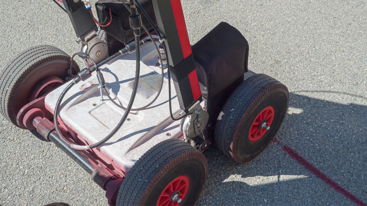
Expert utility locators use advanced technology such as Ground Penetrating Radar (GPR), electromagnetic induction, and other sophisticated equipment to provide accurate and reliable results. These technologies, combined with the expertise of seasoned professionals, ensure a higher quality of utility locating compared to basic or DIY approaches. The accuracy and reliability provided by these services are crucial for the successful completion of any project involving subsurface elements.

Risk Management

Utility strikes can lead to other indirect risks such as service disruptions, public outrage, and environmental damage. Professional utility locating services form an integral part of risk management strategies for construction projects, mitigating these risks by providing comprehensive information about the underground landscape. This allows for informed decision-making and proactive risk mitigation.

Understanding the Importance of Accurate Utility Locating

In today’s construction landscape, the importance of accurately locating and mapping underground utilities cannot be overstated. Services like private utility locating and Ground Penetrating Radar (GPR) have become indispensable tools in the arsenal of construction teams.

These advanced utility locating services play a vital role in identifying the exact location of underground utilities such as water pipes, gas lines, and telecommunication cables. The precision provided by these technologies is crucial for preventing damage during construction activities, which can lead to extensive costs, service disruptions, and severe public safety hazards, including dangerous gas leaks.

Utilizing advanced technologies for underground utility mapping enables construction teams to sidestep potential issues before they escalate into major problems. By clearly identifying the location of utilities, teams can avoid utility conflicts and the need for costly relocations, thus streamlining the construction process and enhancing overall efficiency.

Cost Savings Through Advanced Technologies

The integration of advanced technologies like subsurface utility engineering (SUE), GPR scanning services, and 3D modeling into the utility mapping process brings substantial cost savings to construction projects. These innovative technologies significantly mitigate the risk of injuries and property damage that can occur from accidental strikes to underground infrastructure.

This prevention translates to direct cost savings, as the expenses associated with utility repairs, legal liabilities, and project delays can be astronomical.

Moreover, accurate utility mapping provides more than just cost savings; it also contributes to the efficiency and safety of construction projects. By minimizing the need for utility relocations — which can be one of the most significant unexpected expenses in construction — projects can stay on schedule and within budget. This accuracy is particularly crucial in dense urban areas or complex infrastructure during construction where the margin for error is minimal.

The Benefits of Accurate Utility Mapping

Accurate utility mapping services yield numerous benefits for construction projects, impacting various aspects of the construction activity:

  • Prevention of Service Disruptions: Avoiding damage to essential services ensures that daily lives and business operations are not adversely affected by construction activity.
  • Public Safety: Accurately locating utilities reduces the risk of incidents like gas leaks, which can pose significant hazards to public safety and the construction teams themselves.
  • Streamlined Design Phases: Having detailed information on the underground infrastructure aids in the planning and design phases, allowing for more informed decision-making and innovative project approaches.
  • Reduced Environmental Impact: By avoiding unnecessary excavation and utility relocations, construction projects can minimize their environmental footprint, contributing to urban sustainability.
  • Enhanced Project Timelines: With fewer delays due to utility conflicts or accidental damages, construction projects can adhere to tighter schedules, ensuring timely completion and operational efficiency.

Partner with Util-Locate for Precision and Excellence

In Southern California, Util-Locate leads the way in providing top-tier utility locating and mapping services. Our use of state-of-the-art technology and adherence to the highest industry standards ensures that your construction projects are supported by accurate, reliable underground utility data.

Reach out to Util-Locate to leverage our expertise and technological solutions for your construction needs

The Future of Smart Cities: Integrating Underground Utility Mapping into Urban Development Plans

underground utility mapping

The vision of smart cities is rapidly becoming a reality, fundamentally altering how we think about urban planning and development. At the heart of this transformation is the integration of advanced technologies like underground utility mapping, which is setting a new standard for constructing sustainable, efficient, and people-friendly urban environments. This article delves into how these utility locating  innovations are shaping the cities of tomorrow.

Integrating Utility Locating and Mapping into Urban Planning

Utility locating and mapping are essential components of modern urban planning and the construction industry. By providing accurate information about the location of utilities, cities can avoid disruptions caused by construction and reduce the risk of damaging essential underground infrastructure.

Services such as GPR (Ground Penetrating Radar) scanning and private utility locating are indispensable tools for city planners and engineers, ensuring that urban development projects do not interfere with existing underground networks.

The Role of GPR Services in Smart City Initiatives

Ground Penetrating Radar (GPR) services have become a cornerstone in developing smart city initiatives. They offer a non-intrusive method for mapping the underground space, crucial for cities with limited space and dense urban infrastructures. By using advanced technology to create detailed maps of underground utilities, city authorities can plan more effectively and avoid potential conflicts with existing infrastructure systems.

The integration of GPR services, private utility locating, and utility mapping services into urban development is a hallmark of smart city planning. These technologies provide a comprehensive understanding of the urban subsurface, facilitating the design of infrastructure that is safe, efficient, and in harmony with existing utilities. Furthermore, they enable cities to plan for future growth and risk management strategies with a solid foundation based on accurate, reliable data.

Enhancing Urban Sustainability and Social Sustainability

The move towards data-driven smart cities is not just about improving urban infrastructures but also about enhancing urban and social sustainability. Accurate utility mapping contributes significantly to reducing energy consumption and improving air quality by minimizing unnecessary excavation and construction. Moreover, these data-driven technologies enable city planners to design cities that respond more effectively to natural disasters and the challenges of sustainability.

Innovative Solutions for Modern City Challenges

Smart cities leverage innovative solutions such as digital twins, mobile apps, and neural networks to manage their urban infrastructure more efficiently. These technologies rely heavily on accurate underground utility mapping to function correctly. For instance, digital twins – virtual replicas of physical cities – require precise data about the underground network to simulate and analyze various scenarios, from energy efficiency to emergency response strategies.

The Importance of Data-Driven Technologies in Urban Development

Data-driven technologies are transforming urban development into a more systematic, review-driven process. Previous studies have shown that cities have significantly benefited from adopting a data-driven approach, particularly regarding utility locating and mapping. By harnessing the power of data, city planners can make informed decisions that respect both the city’s historical legacy and its future needs.

Future Trends and Smart Solutions in Utility Locating

The field of utility locating is undergoing significant transformations, driven by technological advancements and a growing need for efficiency and safety in construction and urban development. As we move forward, several key trends and innovative solutions are set to redefine utility locating, making it more precise, efficient, and integrated. Here’s what the future holds for utility locating:

1. Advanced Geophysical Technologies

The future of utility locating will see broader adoption of advanced geophysical tools like Ground Penetrating Radar (GPR) and electromagnetic induction. These technologies allow for non-invasive subsurface exploration, providing clear, detailed images of underground utilities without the need for excavation.

As these tools become more sophisticated, we can expect higher resolution images, deeper penetration, and more accurate identification of different types of underground infrastructure.

2. Integration of GIS and BIM

Geographic Information Systems (GIS) and Building Information Modeling (BIM) are becoming increasingly integrated with utility locating services. This integration allows for the creation of comprehensive, three-dimensional maps that combine surface and subsurface data, offering a holistic view of the project site. This not only improves the accuracy of utility detection but also facilitates better planning and coordination among different stakeholders in construction projects.

3. Internet of Things (IoT) and Sensors

The Internet of Things (IoT) is set to play a crucial role in utility locating by embedding sensors in underground utilities. These sensors can transmit real-time data about the condition and exact location of pipes, cables, and other infrastructure.

This continuous stream of data can help utility owners and project managers monitor utilities more effectively, predict potential issues, and plan maintenance or construction activities with minimal risk of accidental damage.

4. Artificial Intelligence and Machine Learning

Artificial Intelligence (AI) and Machine Learning (ML) are being leveraged to analyze vast amounts of data collected from utility locating operations. By identifying patterns and learning from past projects, AI algorithms can predict the likelihood of utility presence in unexplored areas, optimize the utility locating process, and reduce the time and cost associated with utility detection.

5. Augmented Reality (AR)

Augmented reality is emerging as a powerful tool in utility locating, overlaying digital information, such as utility locations and specifications, onto the real-world view seen through AR glasses or devices. This can significantly enhance the accuracy and speed of utility locating on the construction site, allowing workers to “see” underground utilities before they dig.

As cities continue to grow and face new challenges, the integration of underground utility mapping into urban development plans will remain a key factor in building smart, sustainable cities. The ability to locate and map utilities accurately ensures that city infrastructures are developed with respect to existing underground services, enhancing the quality of life for all residents.

Partner with Util-Locate for Your Smart City Initiatives

Util-Locate is at the forefront of utility locating and mapping services in Southern California, providing the foundation for smart city development with our advanced technology and expert solutions. Our commitment to enhancing urban planning and contributing to the creation of sustainable smart cities positions us as a leader in the field.

Reach out to Util-Locate to ensure your urban development projects are built on accurate, reliable utility data, paving the way for a smarter, more sustainable future!

Risk Assessment in Utility Mapping: Evaluating Potential Hazards and Developing Mitigation Strategies

utility locating and mapping

Utility mapping plays a crucial role in the construction and maintenance of urban infrastructures. However, the process involves inherent risks that can significantly impact project outcomes and safety. A thorough risk assessment process is essential to identify these potential risks and develop effective mitigation strategies.

The Essentials of Risk Assessment in Utility Mapping

The application of advanced technology in utility locating and mapping is revolutionizing the construction industry’s approach to risk mitigation. Ground Penetrating Radar (GPR) locating services and private utility locating are at the forefront of this change, offering unparalleled accuracy and reliability.

By integrating these technologies into utility mapping processes, the risk of accidentally damaging underground utilities—a prevalent issue that leads to significant project delays and financial losses—is substantially reduced.

Identifying Potential Risks

The first step involves identifying potential hazards associated with utility locating and mapping, such as damaging underground utilities, encountering natural hazards, or operational risks. Utilizing tools like GPR services, utility locating services, and underground utility mapping helps pinpoint these risks early in the project.

Risk Analysis and Assessment Tools

Employing a systematic approach, such as risk assessment matrices and risk assessment models, allows project managers and risk assessors to evaluate the level of risk associated with identified hazards. This includes both qualitative risk analysis and, where applicable, quantitative measures to assign numerical risk scores to different scenarios.

Developing Risk Management Strategies

Based on the identified risks and their potential impacts, developing effective risk management strategies is crucial. This could involve employing advanced GPR scanning services, implementing internal controls, or revising operational procedures to mitigate identified risks.

Enhancements Brought by GPR and Private Utility Locating

  1. Improved Accuracy: Ground Penetrating Radar (GPR) services, through their advanced scanning capabilities, can detect a variety of subsurface structures, including non-metallic and metallic utilities, providing a comprehensive view of the underground infrastructure. This level of detail ensures that all potential hazards are identified before excavation begins, significantly reducing the likelihood of accidental damage.
  2. Time Efficiency: Private utility locating speeds up the pre-construction phase by quickly identifying the exact location of utilities. This expedites project timelines by eliminating lengthy trial-and-error excavation processes and preventing unforeseen delays caused by utility repairs.
  3. Safety Enhancement: The precise mapping afforded by these technologies mitigates safety hazards for construction workers and the general public. By accurately locating utilities, the risk of encountering dangerous lines such as gas or electric is minimized, fostering a safer work environment.

Utilizing the Risk Assessment Matrix and Establishing Risk Criteria

The risk assessment matrix is an essential tool in construction project planning and utility mapping. By categorizing risks based on their severity (the potential consequences) and likelihood (the probability of occurrence), project managers and risk assessors can make informed decisions about where to allocate resources and which mitigation strategies to implement.

Key Components of an Effective Risk Matrix

  1. Severity and Likelihood: The matrix allows for a visual representation of risks, making it easier to identify which ones require immediate attention and which are less critical.
  2. Risk Criteria Definition: Organizations must establish clear criteria for what levels of risk are acceptable. This involves considering the organization’s risk appetite, the potential impact on project outcomes, and legal or regulatory requirements.
  3. Prioritization of Risks: By sorting risks into categories, from high to low, teams can prioritize their risk management efforts, focusing on mitigating the highest-level risks first to ensure the most efficient use of resources.

Adopting a Systematic Approach to Risk Management

Effective risk management in utility locating and construction requires a holistic approach that spans the entire project lifecycle. This systematic approach not only identifies and assesses risks but also develops strategies to manage or eliminate them.

Steps in a Systematic Risk Management Process

  1. Hazard Identification: This initial phase involves using technologies like GPR scanning to identify potential underground hazards, setting the stage for a more informed risk assessment.
  2. Risk Assessment and Planning: Utilizing the risk assessment matrix, project teams evaluate identified hazards to understand their potential impact on the project and develop a risk assessment plan.
  3. Implementation of Risk Controls: Based on the risk assessment, appropriate controls are put in place to mitigate identified risks. This could involve adjusting construction plans, implementing safety measures, or employing alternative techniques to avoid sensitive areas.
  4. Monitoring and Review: Risk management is an ongoing process. As such, the implemented strategies and controls must be regularly reviewed and adjusted based on new information or changes in the project scope.

By integrating advanced utility mapping technologies and adopting a systematic risk management approach, construction projects can significantly reduce the potential for accidental utility damage, ensure the safety of workers, and maintain project timelines. This holistic approach ensures that potential issues are systematically identified, assessed, and managed, contributing to the overall success and sustainability of urban development projects.

Collaboration and Expertise

Collaboration between project managers, utility service providers, and subject-matter experts is essential for successful risk management in utility mapping. Brainstorming sessions and risk assessment meetings facilitate the sharing of knowledge and experiences, enhancing the overall risk assessment process and ensuring that all potential risks are adequately addressed.

Effective risk assessment in utility mapping is vital for safeguarding organizational objectives and ensuring the health and safety of all stakeholders involved. By adopting effective risk assessment techniques and leveraging the latest advancements in utility locating technology, projects can significantly reduce the potential consequences of unseen hazards.

Partner with Util-Locate for Comprehensive Risk Assessment and Utility Mapping Services

At Util-Locate, we specialize in providing state-of-the-art utility locating and mapping services, equipped with the latest technology and expert knowledge to identify and mitigate risks in your construction projects. Our experienced team is committed to ensuring the safety and success of your projects in Southern California.

Reach out to Util-Locate to integrate advanced risk assessment and utility mapping solutions into your project planning. Move forward with confidence, knowing your project is backed by expert analysis and support!