How to Detect Environmental Hazards With GPR

utility locating services

Key Takeaways:

  • Ground-penetrating radar (GPR) is a non-invasive tool for identifying and assessing environmental hazards like underground storage tanks, contaminated soil, and buried waste.
  • Applications of GPR in environmental projects locate underground storage tanks, detect contaminated soil, and help find buried waste.
  • Proper planning ensures a successful survey. During the survey, use a grid pattern, adjust settings, and monitor data quality. Analyze the data carefully for accurate hazard identification.
  • GPR is non-invasive, offers high-resolution images, is versatile for various environments, and is cost-effective compared to invasive methods.
  • Effectiveness is limited by depth and soil conditions. Data interpretation requires expertise and environmental regulations must be followed.

Environmental hazards pose significant risks to both the environment and human health. Effective detection and management of these hazards are crucial for maintaining safe and sustainable environments.

One of the most powerful tools in this field is ground-penetrating radar (GPR). In combination with utility locating services, GPR provides a comprehensive method for identifying and assessing environmental hazards.

This blog will explore how GPR works, its applications in detecting environmental hazards, and best practices for utilizing this technology.

Let’s Define Ground-Penetrating Radar

Ground-penetrating radar is a non-invasive geophysical method that uses radar pulses to image the subsurface.

It is widely used in various industries, including environmental science, construction, and archaeology. GPR is particularly valuable for detecting underground anomalies without the need for excavation.

How GPR Works

GPR operates by emitting radar waves into the ground. When these waves encounter different materials or objects, they reflect back to the surface and are detected by the GPR system.

The reflected signals are then processed to create a visual representation of the subsurface.

Applications of GPR in Detecting Environmental Hazards

Ground-penetrating radar is highly effective in identifying various types of environmental hazards. Below are some of the key applications of GPR in this field:

Detect Underground Storage Tanks (USTs)

Underground storage tanks (USTs) can pose significant environmental risks if they leak hazardous substances. GPR can locate these tanks and assess their condition.

  • Leak Detection: Identifies potential leaks in storage tanks.
  • Mapping Locations: Creates detailed maps of UST locations.
  • Assessing Integrity: Evaluates the structural integrity of USTs.

Locate Contaminated Soil

Contaminated soil is a major environmental hazard that can affect ecosystems and human health. GPR is effective in identifying areas of soil contamination.

  • Identifying Hotspots: Pinpoints areas with high levels of contamination.
  • Determining Extent: Assesses the extent and depth of contamination.
  • Monitoring Remediation: Tracks the progress of soil remediation efforts.

Detect Buried Waste

Illegal dumping and buried waste can lead to severe environmental damage. GPR helps in locating and assessing buried waste sites.

  • Identifying Dump Sites: Locates illegal dump sites.
  • Characterizing Waste: Determines the type and volume of buried waste.
  • Assessing Impact: Evaluates the environmental impact of buried waste.

Best Practices for Using GPR in Environmental Hazard Detection

To maximize the effectiveness of ground-penetrating radar in detecting environmental hazards, it is essential to follow best practices. Here are some guidelines to ensure accurate and reliable results:

Pre-Survey Planning

Before conducting a GPR survey, thorough planning is crucial.

  • Define Objectives: Clearly outline the goals of the survey.
  • Site Assessment: Conduct a preliminary assessment of the survey site.
  • Equipment Selection: Choose the appropriate GPR equipment for the task.

Conduct the Survey

During the survey, adherence to best practices ensures high-quality data collection.

  • Grid Pattern: Use a systematic grid pattern to cover the survey area comprehensively.
  • Adjust Settings: Fine-tune GPR settings based on soil conditions and target depth.
  • Monitor Data: Continuously monitor data quality during the survey.

Data Analysis and Interpretation

Accurate analysis and interpretation of GPR data are crucial for identifying environmental hazards.

  • Data Cleaning: Remove noise and irrelevant data points.
  • 3D Visualization: Create 3D models of the subsurface for better interpretation.
  • Expert Review: Have data reviewed by experienced GPR analysts.

Advantages of Using GPR for Environmental Hazard Detection

Ground-penetrating radar offers several advantages over traditional methods of environmental hazard detection:

  • Non-InvasiveGPR is a non-invasive technique, meaning it does not disturb the environment during surveys. This is especially important for sensitive or protected areas.
  • High Resolution – GPR provides high-resolution images of the subsurface, allowing for detailed and accurate identification of hazards.
  • Versatility – GPR can be used in various environments and conditions, making it a versatile tool for environmental hazard detection.
  • Cost-Effective – Compared to invasive methods, GPR is a cost-effective solution for identifying and assessing environmental hazards.

Challenges and Limitations

While ground-penetrating radar is a powerful tool, it does have some limitations:

Depth Penetration

The effectiveness of GPR decreases with depth. Penetration depth depends on the frequency of the radar waves and the conductivity of the ground material.

Soil Conditions

Soil conditions, such as moisture content and soil type, can affect the accuracy of GPR data. High moisture levels can reduce the effectiveness of GPR.

Data Interpretation

Interpreting GPR data requires expertise and experience. Misinterpretation of data can lead to incorrect conclusions about the presence or absence of hazards.

Environmental Regulations and Compliance

Adhering to environmental regulations is critical when using ground-penetrating radar for hazard detection.

Regulatory compliance ensures that surveys are conducted ethically and legally, protecting both the environment and the surveyors.

Key Regulatory Bodies

  • Environmental Protection Agency (EPA): Oversees environmental protection standards and regulations.
  • Occupational Safety and Health Administration (OSHA): Regulates safety practices during environmental surveys.
  • State and Local Agencies: Various state and local environmental agencies have their own regulations and guidelines.

Compliance Best Practices

  • Understand Regulations: Stay informed about relevant regulations and guidelines.
  • Document Procedures: Maintain detailed records of survey procedures and findings.
  • Follow Safety Protocols: Ensure all safety measures are in place to protect surveyors and the environment.

Future Trends in GPR for Environmental Hazard Detection

The future of ground-penetrating radar in environmental hazard detection looks promising, with ongoing research and development aimed at further enhancing its capabilities. Some emerging trends include:

Autonomous GPR Systems

Development of autonomous GPR systems that can operate without human intervention, increasing efficiency and safety.

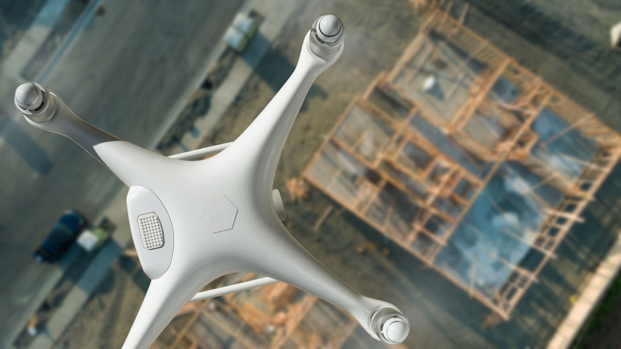
  • Drones and Robots: Autonomous vehicles equipped with GPR can survey hazardous or inaccessible areas.
  • Increased Efficiency: Reduces the need for manual labor and speeds up the survey process.

Machine Learning and AI

Integration of machine learning and artificial intelligence (AI) to improve data analysis and interpretation.

  • Enhanced Data Accuracy: AI algorithms can identify patterns and anomalies more accurately.
  • Predictive Analysis: Machine learning models can predict potential hazard zones based on historical data.

Environmental Monitoring Networks

Creating networks of GPR sensors for continuous environmental monitoring.

  • Real-Time Monitoring: Provides ongoing data about environmental conditions and potential hazards.
  • Early Warning Systems: Alerts stakeholders to emerging hazards before they become critical.

Stay Ahead with Cutting-Edge GPR Technology

Ensure the safety and sustainability of your projects with the latest in ground-penetrating radar technology. At Util-Locate, we offer comprehensive utility locating services that leverage advanced GPR capabilities to detect and manage environmental hazards.

Contact us today to learn how our expertise can benefit your environmental projects and keep you compliant with all regulations. Protect your site, your workers, and the environment with Util-Locate’s professional services.

How Drone Technology Enhances Ground-Penetrating Radar

Ground penetrating radar

Key Takeaways:

  • Combining drones with ground-penetrating radar (GPR) improves the efficiency, accuracy, and safety of utility locating services.
  • Enables faster data collection over large areas, improves accessibility to difficult locations, and ensures consistent data through automated flight paths.
  • Reduces the need for human workers in potentially hazardous environments with features like remote operation, obstacle avoidance, and minimized exposure.
  • Stable platforms, advanced sensors, and georeferencing capabilities provide more precise data collection for utility locating.
  • Useful in construction, environmental assessments, and archaeology (mapping utilities, contamination, and buried structures).

In recent years, the integration of drone technology with ground-penetrating radar (GPR) has revolutionized the field of utility locating services.

This combination has vastly improved the efficiency, accuracy, and safety of subsurface investigations.

In this blog, we will explore the various ways in which drone technology enhances GPR, and how these advancements benefit utility locating services.

The Basics of Ground-Penetrating Radar

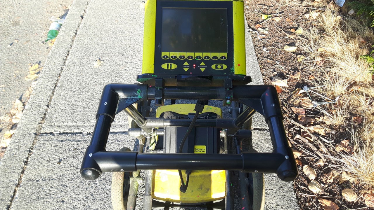
Ground penetrating radar is a non-invasive geophysical method that uses radar pulses to image the subsurface. It is widely used for detecting underground utilities, geological features, and other subsurface anomalies.

Key Benefits of GPR

  • High Resolution: Provides detailed images of the subsurface.
  • Versatility: Effective in a variety of soil conditions and environments.
  • Safety: Minimizes the risk of damaging underground utilities during excavation.

The Role of Drone Technology in GPR

Drone technology has significantly enhanced the capabilities of ground-penetrating radar in utility locating services. Drones offer several advantages that improve the efficiency and accuracy of GPR surveys.

Enhanced Data Collection

Drones equipped with GPR can cover large areas quickly and efficiently. This allows for more comprehensive data collection in less time compared to traditional ground-based methods.

  • Speed: Drones can survey large areas much faster than manual methods.
  • Accessibility: Drones can access areas that are difficult or dangerous for humans to reach.
  • Consistency: Automated flight paths ensure consistent data collection across the survey area.

Improved Safety

Using drones for GPR surveys enhances safety by reducing the need for human operators to work in potentially hazardous environments.

  • Remote Operation: Drones can be operated remotely, keeping personnel safe from physical hazards.
  • Obstacle Avoidance: Modern drones are equipped with obstacle detection and avoidance systems.
  • Minimized Exposure: Reduces the exposure of workers to harmful environments. This includes contaminated sites.

Higher Accuracy

The integration of drones with GPR improves the accuracy of utility locating services. This is done by providing more precise data collection.

  • Stable Platforms: Drones provide a stable platform for GPR equipment. They reduce data noise and improve accuracy.
  • Advanced Sensors: Equipped with advanced sensors, drones can capture high-resolution data.
  • Georeferencing: Drones can be equipped with GPS and other positioning systems. This will provide accurate georeferencing of GPR data.

Applications of Drone-GPR Integration in Utility Locating Services

The combination of drones and ground-penetrating radar has numerous applications. These include construction, infrastructure projects, environmental assessments, and archaeological investigations.

Utility Mapping

Drones equipped with GPR can efficiently map underground utilities. They provide valuable information for construction and excavation projects.

  • Comprehensive Surveys: Cover large areas quickly, identifying all underground utilities.
  • Detailed Mapping: Create detailed maps of utility locations and depths.
  • Risk Mitigation: Help avoid accidental utility damage during excavation.

Environmental Assessments

Drones with GPR are used in environmental assessments to detect subsurface contamination, buried waste, and other environmental hazards.

  • Non-Invasive: Conduct surveys without disturbing the ground.
  • Wide Coverage: Survey large areas efficiently.
  • Accurate Detection: Identify and map subsurface contamination and hazards.

Archaeological Investigations

In archaeology, drones equipped with GPR provide a non-invasive method for exploring. As well as mapping buried structures and artifacts.

  • Site Surveys: Quickly survey large archaeological sites.
  • Subsurface Imaging: Provide detailed images of buried structures and artifacts.
  • Preservation: Conduct investigations without disturbing the site.

Best Practices for Drone-GPR Surveys

To maximize the benefits of drone-GPR integration in utility locating services, it is important to follow best practices. Here are some key considerations:

Pre-Survey Planning

Proper planning is essential for a successful drone-GPR survey. This includes selecting the right equipment, planning flight paths, and obtaining necessary permits.

  • Equipment Selection: Choose the appropriate drone and GPR equipment for the survey.
  • Flight Path Planning: Plan flight paths to ensure comprehensive coverage and data consistency.
  • Permits and Approvals: Obtain any necessary permits and approvals for drone operations.

Data Processing and Analysis

Processing and analyzing the data collected by drone-GPR surveys is crucial for obtaining accurate and actionable results.

  • Data Processing: Use specialized software to process GPR data and create subsurface images.
  • Georeferencing: Ensure accurate georeferencing of GPR data for precise mapping.
  • Data Interpretation: Interpret the data to identify and map underground utilities and anomalies.

Future Prospects of Drone-GPR Integration

The integration of drones and ground-penetrating radar is still evolving. These include new advancements and emerging applications.

Future developments are likely to further enhance the capabilities. As well as the benefits of this technology in utility locating services.

Advanced Sensor Integration

Future drones may be equipped with more advanced sensors. This further improves the accuracy and resolution of GPR surveys.

  • Multi-Sensor Platforms: Integrate GPR with other sensors. These include LiDAR and thermal imaging, for comprehensive subsurface mapping.
  • Higher Resolution: Develop higher-resolution GPR sensors for more detailed subsurface imaging.

Autonomous Operation

Advancements in drone autonomy could enable fully autonomous GPR surveys. These reduce the need for human intervention and further improve efficiency.

  • Automated Flight Planning: Use AI and machine learning to automatically plan and optimize flight paths.
  • Real-Time Data Processing: Process and analyze GPR data in real-time during the survey.

The Evolution of Drone-GPR Integration

The combination of drones and ground-penetrating radar is a cutting-edge advancement in the field of subsurface exploration. This technology is continually evolving. It brings new opportunities and applications to utility locating services.

Historical Context

Traditionally, GPR surveys were conducted manually, requiring significant time and effort, especially over large or inaccessible areas. The advent of drone technology has dramatically changed this landscape.

By mounting GPR equipment on drones, the process has become more efficient and less labor-intensive.

Technological Advancements

Several key technological advancements have contributed to the successful integration of drones. As well as GPR in utility locating services:

  • Miniaturization of GPR Equipment: The development of smaller, lighter GPR units suitable for drone mounting.
  • Improved Drone Capabilities: Enhanced flight stability, longer battery life, and increased payload capacity of modern drones.
  • Advanced Data Processing Software: Tools that can handle the complex data sets generated by drone-GPR surveys. They provide clear and actionable insights.

Enhance Your Utility Locating Projects with Drone-GPR Technology

Leverage the power of drone-GPR integration for your next utility locating project in California. Util-Locate offers state-of-the-art utility locating services using advanced ground-penetrating radar technology, ensuring accurate and efficient results.

Contact us today to learn how our innovative solutions can benefit your projects and enhance safety and precision.

Tolerance Zone and Best Practices During Excavation

utility locating services

Key Takeaways:

  • It’s a safety buffer around marked utilities (typically 18-24 inches) to prevent damage during excavation. It’s crucial for safety, utility protection, regulation compliance, and cost-efficiency.
  • Utilize professional utility locating services (ground penetrating radar and electromagnetic locating) for accurate identification of underground utilities. Proper planning includes pre-excavation assessment, utility mapping, and risk mitigation.
  • Maintain clear communication among stakeholders (contractors, utility companies) and ensure proper marking of utilities. Use real-time monitoring tools and re-mark utilities throughout the project to avoid incidents.
  • Create a plan with utility maps and tolerance zones. Use hand digging within the tolerance zone to minimize the risk of damaging utilities with mechanical excavation tools.
  • Train workers on the importance of the tolerance zone and safe excavation practices.

When undertaking excavation projects, the importance of accurately identifying and respecting the tolerance zone cannot be overstated.

Adhering to best practices during excavation ensures the safety of workers, protects utilities from damage, and helps avoid costly repairs and project delays.

This blog will explore the concept of the tolerance zone. As well as the emphasis on the role of utility locating services and ground penetrating radar.

What is the Tolerance Zone?

The tolerance zone is a predefined area around a marked underground utility within which specific excavation precautions must be taken.

The size of this zone can vary based on local regulations but typically extends 18 inches to 24 inches on either side of the marked utility line.

Importance of the Tolerance Zone

  • Safety: Protects workers from potential hazards associated with hitting utility lines.
  • Utility Integrity: Prevents damage to critical infrastructure. These include water, gas, and electric lines.
  • Regulatory Compliance: Ensures adherence to local and national excavation regulations.
  • Cost Efficiency: Avoids costly repairs and project delays caused by utility damage.

Best Practices During Excavation

Adhering to best practices during excavation is crucial to maintaining the integrity of underground utilities. Here are some essential practices to follow:

Use of Utility Locating Services

Before any excavation work begins, it is essential to utilize professional utility locating services. These services use advanced techniques to identify the exact location of underground utilities.

  • Ground Penetrating Radar (GPR): This non-invasive technology provides detailed images of the subsurface. This makes it easier to locate utilities accurately. Ground penetrating radar is particularly effective in identifying non-metallic utilities like plastic pipes.
  • Electromagnetic Locating (EML): This method detects metallic utilities. It is done by inducing a signal into the utility line and measuring the response.

Pre-Excavation Planning

Proper planning is the cornerstone of any successful excavation project. This includes conducting a thorough site assessment and using utility locating services to map all underground utilities.

  • Site Assessment: Evaluate the site to identify potential hazards and determine the scope of the excavation.
  • Utility Mapping: Use tools like ground penetrating radar and EML to create accurate maps of underground utilities.
  • Risk Assessment: Identify and mitigate risks associated with excavation. These include potential utility damage and safety hazards.

Communication and Coordination

Effective communication and coordination among all stakeholders are crucial for the success of an excavation project.

  • Stakeholder Meetings: Hold regular meetings with all involved parties. These include contractors, utility companies, and local authorities.
  • Clear Markings: Ensure that all utilities are clearly marked. These markings are communicated to the excavation team.
  • Documentation: Keep detailed records of all utility locations, excavation plans, and any changes made during the project.

Utilize Technology for Continuous Monitoring

Continuous monitoring during the excavation process can help prevent accidental utility damage. This ensures compliance with safety protocols.

  • Real-Time Monitoring: Use real-time monitoring tools to track excavation progress. As well as to detect any potential issues immediately.
  • Re-Marking Utilities: Regularly check and re-mark utilities to ensure visibility. As well as the accuracy throughout the project.
  • Incident Reporting: Implement a system for reporting and addressing any incidents or near-misses during excavation.

Advantages of Using Utility Locating Services

  • Accurate Mapping: Provides precise location data for underground utilities.
  • Reduced Risk: Minimizes the risk of damaging utilities during excavation.
  • Time Efficiency: Speeds up the excavation process by avoiding unexpected utility encounters.

Creating a Detailed Excavation Plan

A well-thought-out excavation plan is critical to ensuring safety and efficiency. The plan should include detailed maps of the identified utilities and the tolerance zones.

  • Site Survey: Conduct a thorough site survey using utility locating services to mark all underground utilities.
  • Mapping: Create detailed maps that clearly indicate the location of utilities and their tolerance zones.
  • Communication: Ensure that all workers are briefed on the excavation plan and understand the significance of the marked zones.

Hand Digging Within the Tolerance Zone

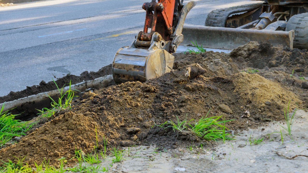
Mechanical excavation tools pose a high risk of damaging utilities within the tolerance zone. Instead, hand digging is recommended to safely expose utilities.

  • Hand Tools: Use shovels and other hand tools to carefully dig within the tolerance zone.
  • Controlled Excavation: Excavate slowly and methodically to avoid damaging utilities.

Monitoring and Re-Marking Utilities

Throughout the excavation process, it is important to regularly monitor and re-mark utilities as needed.

  • Regular Checks: Perform regular checks to ensure that markings remain visible and accurate.
  • Re-Marking: If markings become obscured or worn, re-mark the utilities to maintain clear visibility.

Training and Safety Protocols

Ensuring that all workers are properly trained and adhere to safety protocols is vital.

  • Training Programs: Implement training programs that educate workers on the importance of the tolerance zone and safe excavation practices.
  • Safety Gear: Ensure that all workers are equipped with appropriate safety gear.

Challenges in Utility Locating

Despite the advancements in technology, utility locating still faces several challenges that need to be addressed to ensure safety and efficiency.

Complex Underground Environments

Urban areas often have complex underground environments with multiple layers of utilities and infrastructure. This can make utility locating more challenging and increase the risk of accidental damage.

  • Layered Utilities: Multiple utilities may be buried at different depths and in close proximity to each other.
  • Historical Data: Incomplete or outdated records can complicate the locating7 process.

Varying Soil Conditions

Different soil conditions can affect the performance of utility locating equipment and techniques.

  • Soil Moisture: High moisture content can affect the accuracy of ground-penetrating radar.
  • Soil Composition: Different types of soil, such as clay, sand, and rock, can impact the detection capabilities of both GPR and EML.

Regulatory Compliance

Ensuring compliance with local, state, and federal regulations is essential to avoid legal and financial repercussions.

  • Permits and Approvals: Obtain all necessary permits and approvals before starting excavation.
  • Adherence to Standards: Follow industry standards and best practices for utility locating and excavation.

Ensure Safety and Precision in Your Next Excavation Project

Don’t take risks with your excavation projects. Ensure safety and precision by utilizing professional utility locating services in California. 

Our advanced ground-penetrating radar technology guarantees accurate utility mapping and safe excavation.

Protect your team, prevent utility damage, and stay compliant with all regulations. Contact Util-Locate today to schedule your utility locating service and excavate with confidence!

Utility Color Coding: What Do Utility Marking Colors Mean?

Utility locating services

Key Takeaways:

  • It’s a standardized system to mark different underground utilities (e.g., red for electric lines, and blue for water) for safety and avoiding damage during excavation.
  • Knowing the type of line reduces risks (like explosions from gas lines), prevents costly repairs, and ensures efficient excavation. It also helps comply with regulations.
  • These services use GPR (ground penetrating radar) to identify and mark utilities with color codes on the ground surface. The process involves planning, locating/marking, and verification.
  • GPR is a non-destructive method using radar pulses to image underground utilities (especially non-metallic ones). Electromagnetic locating (EML) detects metallic utilities with a signal.
  • Train workers on color codes, update utility maps and use advanced technology (like GPR) for accurate locating. Professionals offer expertise, safety, advanced equipment, and cost savings through avoiding damages.

When undertaking any excavation or construction project, it is crucial to know what lies beneath the ground to avoid hitting utility lines.

Utility locating plays a vital role in identifying these underground utilities. They use advanced technologies like ground penetrating radar (GPR). One key aspect of these services is utility color coding, which provides a visual guide to what type of utility lines are present.

Understanding these color codes can significantly enhance safety. As well as the efficiency in any subsurface work.

What is Utility Color Coding?

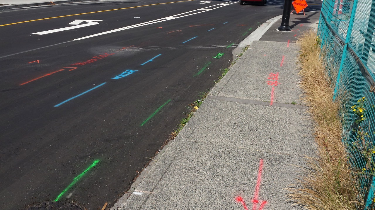
Utility color coding is a standardized system used to mark different types of underground utilities. Each color represents a specific type of utility. It makes it easier for workers to identify and avoid them during excavation or construction projects.

This system is universally recognized. It ensures that utility locating services can accurately map out underground utilities using ground-penetrating radar and other tools.

The Standard Utility Marking Colors

Here’s a breakdown of the standard utility marking colors and what they signify:

  • Red: Electric power lines, cables, conduit, and lighting cables.
  • Yellow: Gas, oil, steam, petroleum, and other gaseous materials.
  • Orange: Communication, alarm or signal lines, cables, or conduit.
  • Blue: Potable water.
  • Green: Sewers and drain lines.
  • Purple: Reclaimed water, irrigation, and slurry lines.
  • White: Proposed excavation sites.

Importance of Utility Color Coding

Understanding utility color coding is essential for several reasons:

  1. Safety: Knowing the type of utility line reduces the risk of accidents, such as hitting a gas line, which could lead to explosions or leaks.
  2. Damage Prevention: Avoiding damage to utility lines prevents costly repairs and service disruptions.
  3. Efficiency: Clear identification of utilities allows for more efficient excavation and construction processes.
  4. Regulatory Compliance: Adhering to color codes ensures compliance with local, state, and federal regulations.

How Utility Locating Services Use Color Coding

Utility locating services use advanced scanning equipment like ground penetrating radar to detect and map underground utilities.

Once these utilities are identified, they are marked with the appropriate color codes on the ground surface. This process involves several steps:

  • Pre-Survey Planning: Before any excavation begins, a detailed plan is created based on existing records and initial surveys.
  • Locating and Marking: Using tools like ground penetrating radar, the utility locating services team identifies the exact locations of underground utilities and marks them with the appropriate colors.
  • Verification: After marking, a verification process ensures that all utilities have been correctly identified and marked.

Advanced Techniques in Utility Locating

In addition to the color-coded marking system, advanced techniques are used to enhance the accuracy of utility locating services. These techniques include GPR scanning and electromagnetic locating.

Ground Penetrating Radar

Ground penetrating radar is a non-destructive method that uses radar pulses to image the subsurface. It is particularly effective for detecting non-metallic utilities such as plastic pipes.

Benefits of GPR

  • High Accuracy: Provides precise location and depth of utilities.
  • Versatility: Suitable for a wide range of soil conditions and materials.
  • Non-Destructive: Does not disturb the ground, making it safe for sensitive areas.

Electromagnetic Locating (EML)

Electromagnetic locating is used to detect metallic utilities by inducing a signal into the utility line and measuring the response.

Benefits of EML

  • Efficiency: Quickly locates metallic utilities.
  • Complementary: Works well with GPR for comprehensive utility mapping.

The Role of Ground-Penetrating Radar

Ground penetrating radar is a crucial technology in the utility locating industry. It uses electromagnetic waves to detect underground objects and structures.

Here are some key benefits of using GPR in utility locating:

  • Non-Invasive: GPR is a non-invasive method, meaning it does not disturb the ground surface.
  • Accurate: It provides highly accurate data on the location and depth of underground utilities.
  • Versatile: GPR can detect a wide range of materials, including metal, plastic, and concrete.
  • Efficient: It allows for quick and comprehensive surveys of large areas.

Best Practices for Using Utility Color Coding

When using utility color coding, it’s important to follow best practices to ensure accuracy and safety:

  • Training: Ensure all workers are trained in recognizing and understanding utility color codes.
  • Regular Updates: Update utility maps and color markings regularly. This is to reflect any changes or new installations.
  • Clear Communication: Maintain clear communication among all parties involved in the project to ensure everyone is aware of the marked utilities.
  • Use of Technology: Leverage advanced technologies like ground penetrating radar to enhance the accuracy of utility locating services.

Benefits of Professional Utility Locating Services

Hiring professional utility locating services offers numerous benefits:

  • Expertise: Professionals have the knowledge and experience to accurately locate and mark utilities.
  • Safety: They follow strict safety protocols to prevent accidents and damage.
  • Advanced Equipment: Professional services use advanced equipment. This includes ground-penetrating radar, to provide precise and reliable results.
  • Cost Savings: Avoiding utility damage can save significant costs associated with repairs and downtime.

Innovations in Utility Locating

The field of utility locating is continually evolving, with new technologies and methods being developed to improve accuracy and efficiency.

3D Utility Mapping

3D utility mapping creates detailed three-dimensional models of underground utilities. This provides a comprehensive view of the subsurface environment.

Benefits of 3D Mapping

  • Enhanced Visualization: Offers a clearer understanding of utility layouts.
  • Improved Planning: Facilitates better planning and decision-making.

AI and Machine Learning

Artificial intelligence (AI) and machine learning are being integrated into utility locating services. This is to analyze data and predict utility locations more accurately.

Benefits of AI Integration

  • Data Analysis: Processes large amounts of data quickly and accurately.
  • Predictive Modeling: Uses historical data to predict the location of hidden utilities.

Common Challenges in Utility Locating

Despite the effectiveness of utility color coding and ground penetrating radar, there are still challenges that utility locating services may face:

  • Old or Inaccurate Records: Inaccurate or outdated records can lead to missed utilities.
  • Complex Underground Networks: Dense and complex underground networks can make it difficult to identify and mark all utilities.
  • Environmental Conditions: Soil conditions and moisture levels can affect the accuracy of GPR.

Secure Your Project’s Success with Professional Utility Locating Services

Don’t take chances with hidden utilities on your next project. Contact Util-Locate today for expert utility locating services using the latest ground penetrating radar technology.

Our experienced team will provide accurate utility mapping, ensuring your project runs smoothly and safely. Reach out now to schedule your service and safeguard your construction site from potential hazards!