Utility Color Coding: What Do Utility Marking Colors Mean?

Utility locating services

Key Takeaways:

  • It’s a standardized system to mark different underground utilities (e.g., red for electric lines, and blue for water) for safety and avoiding damage during excavation.
  • Knowing the type of line reduces risks (like explosions from gas lines), prevents costly repairs, and ensures efficient excavation. It also helps comply with regulations.
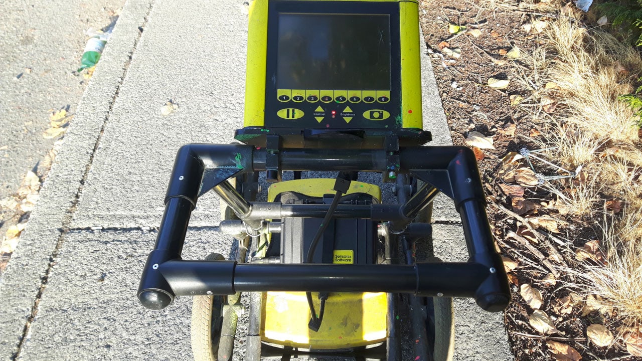
  • These services use GPR (ground penetrating radar) to identify and mark utilities with color codes on the ground surface. The process involves planning, locating/marking, and verification.
  • GPR is a non-destructive method using radar pulses to image underground utilities (especially non-metallic ones). Electromagnetic locating (EML) detects metallic utilities with a signal.
  • Train workers on color codes, update utility maps and use advanced technology (like GPR) for accurate locating. Professionals offer expertise, safety, advanced equipment, and cost savings through avoiding damages.

When undertaking any excavation or construction project, it is crucial to know what lies beneath the ground to avoid hitting utility lines.

Utility locating plays a vital role in identifying these underground utilities. They use advanced technologies like ground penetrating radar (GPR). One key aspect of these services is utility color coding, which provides a visual guide to what type of utility lines are present.

Understanding these color codes can significantly enhance safety. As well as the efficiency in any subsurface work.

What is Utility Color Coding?

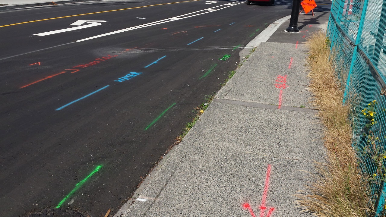
Utility color coding is a standardized system used to mark different types of underground utilities. Each color represents a specific type of utility. It makes it easier for workers to identify and avoid them during excavation or construction projects.

This system is universally recognized. It ensures that utility locating services can accurately map out underground utilities using ground-penetrating radar and other tools.

The Standard Utility Marking Colors

Here’s a breakdown of the standard utility marking colors and what they signify:

  • Red: Electric power lines, cables, conduit, and lighting cables.
  • Yellow: Gas, oil, steam, petroleum, and other gaseous materials.
  • Orange: Communication, alarm or signal lines, cables, or conduit.
  • Blue: Potable water.
  • Green: Sewers and drain lines.
  • Purple: Reclaimed water, irrigation, and slurry lines.
  • White: Proposed excavation sites.

Importance of Utility Color Coding

Understanding utility color coding is essential for several reasons:

  1. Safety: Knowing the type of utility line reduces the risk of accidents, such as hitting a gas line, which could lead to explosions or leaks.
  2. Damage Prevention: Avoiding damage to utility lines prevents costly repairs and service disruptions.
  3. Efficiency: Clear identification of utilities allows for more efficient excavation and construction processes.
  4. Regulatory Compliance: Adhering to color codes ensures compliance with local, state, and federal regulations.

How Utility Locating Services Use Color Coding

Utility locating services use advanced scanning equipment like ground penetrating radar to detect and map underground utilities.

Once these utilities are identified, they are marked with the appropriate color codes on the ground surface. This process involves several steps:

  • Pre-Survey Planning: Before any excavation begins, a detailed plan is created based on existing records and initial surveys.
  • Locating and Marking: Using tools like ground penetrating radar, the utility locating services team identifies the exact locations of underground utilities and marks them with the appropriate colors.
  • Verification: After marking, a verification process ensures that all utilities have been correctly identified and marked.

Advanced Techniques in Utility Locating

In addition to the color-coded marking system, advanced techniques are used to enhance the accuracy of utility locating services. These techniques include GPR scanning and electromagnetic locating.

Ground Penetrating Radar

Ground penetrating radar is a non-destructive method that uses radar pulses to image the subsurface. It is particularly effective for detecting non-metallic utilities such as plastic pipes.

Benefits of GPR

  • High Accuracy: Provides precise location and depth of utilities.
  • Versatility: Suitable for a wide range of soil conditions and materials.
  • Non-Destructive: Does not disturb the ground, making it safe for sensitive areas.

Electromagnetic Locating (EML)

Electromagnetic locating is used to detect metallic utilities by inducing a signal into the utility line and measuring the response.

Benefits of EML

  • Efficiency: Quickly locates metallic utilities.
  • Complementary: Works well with GPR for comprehensive utility mapping.

The Role of Ground-Penetrating Radar

Ground penetrating radar is a crucial technology in the utility locating industry. It uses electromagnetic waves to detect underground objects and structures.

Here are some key benefits of using GPR in utility locating:

  • Non-Invasive: GPR is a non-invasive method, meaning it does not disturb the ground surface.
  • Accurate: It provides highly accurate data on the location and depth of underground utilities.
  • Versatile: GPR can detect a wide range of materials, including metal, plastic, and concrete.
  • Efficient: It allows for quick and comprehensive surveys of large areas.

Best Practices for Using Utility Color Coding

When using utility color coding, it’s important to follow best practices to ensure accuracy and safety:

  • Training: Ensure all workers are trained in recognizing and understanding utility color codes.
  • Regular Updates: Update utility maps and color markings regularly. This is to reflect any changes or new installations.
  • Clear Communication: Maintain clear communication among all parties involved in the project to ensure everyone is aware of the marked utilities.
  • Use of Technology: Leverage advanced technologies like ground penetrating radar to enhance the accuracy of utility locating services.

Benefits of Professional Utility Locating Services

Hiring professional utility locating services offers numerous benefits:

  • Expertise: Professionals have the knowledge and experience to accurately locate and mark utilities.
  • Safety: They follow strict safety protocols to prevent accidents and damage.
  • Advanced Equipment: Professional services use advanced equipment. This includes ground-penetrating radar, to provide precise and reliable results.
  • Cost Savings: Avoiding utility damage can save significant costs associated with repairs and downtime.

Innovations in Utility Locating

The field of utility locating is continually evolving, with new technologies and methods being developed to improve accuracy and efficiency.

3D Utility Mapping

3D utility mapping creates detailed three-dimensional models of underground utilities. This provides a comprehensive view of the subsurface environment.

Benefits of 3D Mapping

  • Enhanced Visualization: Offers a clearer understanding of utility layouts.
  • Improved Planning: Facilitates better planning and decision-making.

AI and Machine Learning

Artificial intelligence (AI) and machine learning are being integrated into utility locating services. This is to analyze data and predict utility locations more accurately.

Benefits of AI Integration

  • Data Analysis: Processes large amounts of data quickly and accurately.
  • Predictive Modeling: Uses historical data to predict the location of hidden utilities.

Common Challenges in Utility Locating

Despite the effectiveness of utility color coding and ground penetrating radar, there are still challenges that utility locating services may face:

  • Old or Inaccurate Records: Inaccurate or outdated records can lead to missed utilities.
  • Complex Underground Networks: Dense and complex underground networks can make it difficult to identify and mark all utilities.
  • Environmental Conditions: Soil conditions and moisture levels can affect the accuracy of GPR.

Secure Your Project’s Success with Professional Utility Locating Services

Don’t take chances with hidden utilities on your next project. Contact Util-Locate today for expert utility locating services using the latest ground penetrating radar technology.

Our experienced team will provide accurate utility mapping, ensuring your project runs smoothly and safely. Reach out now to schedule your service and safeguard your construction site from potential hazards!

Utility Locating Guide: What To Do About An Exposed Power Line

utility locating services

Key Takeaways

  • Contact your utility company immediately if you find an exposed power line.
  • Use professional utility locating services to prevent accidental utility strikes.
  • Ground penetrating radar and metal detectors are essential tools for locating underground utilities.
  • Always mark utilities with white paint before any excavation.
  • Distinguish between public and private utilities to ensure proper maintenance and safety.

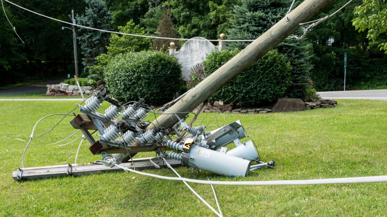
An exposed power line is a serious hazard that needs immediate attention. If you find an exposed power line on your property, it’s essential to stay away from it and contact your local utility company immediately. Proper utility locating services can help identify the exact location of other underground utilities to prevent further issues.

Discovering an exposed power line can be alarming, but knowing how to handle the situation is crucial for your safety and the safety of others. In this guide, we’ll cover the steps to take when encountering an exposed power line and the importance of using utility locating services to prevent such occurrences in the future.

Signs of a Utility Strike

A utility strike occurs when an underground utility line is accidentally hit during excavation or construction. Recognizing the signs of a utility strike is crucial for ensuring immediate and appropriate action. Here are some common indicators that a utility strike has occurred:

1. Hissing Sound

A hissing or whistling noise is a clear sign that a gas line has been punctured. This sound results from gas escaping under pressure and can signal a dangerous situation that requires immediate evacuation and emergency response.

2. Sudden Loss of Service

If you experience an unexpected loss of water, electricity, or internet service, it may indicate that a utility line has been damaged. For example, hitting an electrical line can result in power outages, while damaging a water line can cause a sudden drop in water pressure or complete loss of water supply.

3. Unusual Smells

A strong smell of gas or chemicals is a serious warning sign of a utility strike. Natural gas is often odorized with a sulfur-like scent to make leaks detectable. If you notice this smell, evacuate the area immediately and contact emergency services.

4. Visible Damage

Seeing exposed or damaged utility lines, such as cut wires or broken pipes, indicates a utility strike. It’s important to cease all work and secure the area to prevent further damage or injury.

5. Water or Soil Eruption

If water or mud starts erupting from the ground, it likely means a water or sewer line has been compromised. This can lead to flooding and contamination, necessitating prompt action to mitigate damage.

Immediate Steps to Take When You Find an Exposed Power Line

1. Stay Clear and Alert Others

The first and most important step is to stay at least 30 feet away from the exposed power line. Ensure that others are aware of the danger and keep them away as well. Do not attempt to touch or move the power line under any circumstances.

2. Contact Your Utility Company

Immediately contact your utility mapping company to report the exposed power line. They have the necessary resources and expertise to handle such emergencies. Providing them with the exact location of the exposed line will help them respond more efficiently.

3. Avoid Contact with Metallic Objects

Ensure that no one comes into contact with any metal objects near the exposed power line, as metal can conduct electricity. Keep pets and children inside until the area is deemed safe by professionals.

Understanding Utility Ownership

It’s important to distinguish between public and private utilities. Public utilities are typically maintained by the utility company, while private utilities are the responsibility of the property owners. Private utility locators can be hired to identify and mark private utility lines on private property.

Utility owners maintain records of their infrastructure, which can be useful in locating underground lines. Accessing utility owner records can provide additional information about the location and type of utility lines on your property.

Legal and Safety Considerations

Before starting any excavation project, it’s a legal requirement to notify the relevant authorities and utility operators. This notification must be made a few business days in advance to allow time for utilities to be marked.

Always follow safety protocols to avoid damage to utilities. This includes respecting the markers and avoiding any digging near underground water, gas, or electrical lines. Safety measures are crucial to preventing service disruptions and ensuring the safety of everyone involved.

Importance of Professional Utility Locating Services

Preventing utility strikes involves understanding the layout of underground utilities on your property. Professional utility locating services use advanced tools like ground penetrating radar and magnetic locators to identify the precise location of utility lines. This helps avoid accidental damage during digging or construction activities.

Ground penetrating radar (GPR) and metal detectors are commonly used to locate underground lines. GPR is particularly useful for identifying both metallic and non-metallic utilities, while metal detectors are effective for finding metal objects such as pipes and cables.

Hiring utility locating services like Util-Locate ensures that all underground utility lines are accurately located and marked. This prevents accidental strikes and ensures that digging projects can proceed safely. Util-Locate uses advanced technology such as ground penetrating radar to provide precise results.

Find Expert Utility Locating Services in California

Finding an exposed power line is a serious issue that requires immediate action. By contacting your utility company, avoiding contact with the line, and using professional utility locating services in California, you can ensure safety and prevent future problems. Understanding the layout of underground utilities and following safety protocols is essential for any property owner.

Ensure the safety of your property by engaging Util-Locate for professional utility locating services. Our experts use advanced tools like ground penetrating radar to precisely locate underground utility lines, preventing accidental damage and ensuring safe digging. Contact us today to safeguard your home and projects.

How To Find Underground Pipes and Water Lines in Your Backyard

Ground penetrating radar (GPR)

Key Takeaways

  • Ground penetrating radar (GPR) is highly effective for locating all types of underground pipes.
  • Metal detectors are useful for finding metallic pipes and lines with tracer wires.
  • Traditional divining rods can still be used to detect water pipes.
  • Professional utility locating services provide precise identification of all utility lines.
  • Contacting your utility company before digging helps prevent accidental damage to service lines.

Finding underground pipes and water lines in your backyard can seem daunting, but with the right techniques and tools, it becomes manageable. Whether you need to locate water pipes, electrical lines, or gas lines, knowing the location of these utility lines is crucial to avoid damaging them during digging or landscaping projects.

To find underground pipes and water lines in your backyard, you can use a variety of utility locating methods and tools such as ground penetrating radar, metal detectors, and even divining rods.

Common Tools for Locating Underground Pipes

  1. Ground Penetrating Radar – Effective for all types of underground utility lines.
  2. Metal Detectors – Ideal for metallic pipes and lines with tracer wires.
  3. Divining Rods – Traditional method for detecting water pipes.
  4. Metal Rods – Manual checking method.
  5. Acoustic Devices – Useful for sewer lines and other buried pipes.

Methods for Locating Underground Pipes and Water Lines

Ground Penetrating Radar (GPR)

Ground penetrating radar (GPR) is one of the most effective methods for locating underground utility lines. GPR uses electromagnetic waves to create images of the subsurface, allowing you to detect water pipes, sewer lines, and other types of utility lines without any digging.

This method is particularly useful for identifying plastic pipes like PVC pipes that may not be detectable with traditional metal detectors. GPR equipment can scan large areas quickly and provide detailed information on the depth and position of various lines.

Metal Detectors and Tracer Wires

For locating metallic pipes such as copper pipe, metal detectors are highly effective. Many utility lines are installed with tracer wires that can be detected using a metal detector, helping to pinpoint the location of underground water pipes and other service lines.

These tracer wires are often used in conjunction with non-metallic pipes to make them easier to locate. By following the signal from the tracer wire, you can trace the path of the buried lines accurately.

Electromagnetic and Acoustic Methods

The electromagnetic method is another way to locate underground utility lines. This method is especially useful for detecting electric lines and telephone lines. It involves using a transmitter to send an electromagnetic signal through the utility line, which can then be detected by a receiver above ground.

An acoustic method can also be used, where sound waves help identify the presence of sewer lines and irrigation lines. This involves inserting a sound source into the line and using microphones to detect changes in sound patterns that indicate the presence of a line or pipe.

Safety and Legal Considerations

Before starting any digging project, it’s essential to contact your local utility company to mark the location of underground utility lines. This helps prevent accidental damage to service lines, which can lead to serious hazards or service interruptions.

Most areas have a “Call Before You Dig” service that will notify utility companies to come and mark their lines for free. This step is not only a safety measure but also a legal requirement in many regions to prevent unintentional damage to critical infrastructure.

Detailed Guide to Using Locating Tools

Let’s take a closer look at the most common utility locating tools and devices.

Using Ground Penetrating Radar (GPR)

To use GPR, you need to operate the radar unit over the ground surface. The GPR unit sends electromagnetic waves into the ground and records the reflected signals. By analyzing these signals, you can create a detailed map of the subsurface, showing the location of different utility lines.

This method requires some training to interpret the radar images correctly, but it provides a non-invasive way to explore beneath the surface.

Operating Metal Detectors and Tracer Wires

When using a metal detector, walk slowly over the area where you suspect pipes might be located. The detector will emit a sound or signal when it passes over a metallic pipe or tracer wire.

By marking these spots and following the signal, you can trace the path of the underground lines. For tracer wires, connect a transmitter to the wire and use the detector to follow the signal along its length.

Applying Electromagnetic and Acoustic Methods

For the electromagnetic method, attach a transmitter to the utility line and turn it on. The receiver, carried along the ground surface, will pick up the electromagnetic signal, allowing you to trace the line’s path.

The acoustic method involves inserting a small speaker into the pipe and listening for sound variations with ground microphones. This method helps identify the location and condition of sewer lines and other buried utilities.

Practical Tips for Homeowners

By following these guidelines, you can ensure a safe and efficient way to locate underground utility lines and proceed with your backyard projects confidently.

  1. Plan Ahead: Before starting any project, plan the layout and determine where utilities are likely to be located.
  2. Use Multiple Methods: Combine different locating methods for the most accurate results.
  3. Mark and Record: Once identified, mark the locations of all utility lines and keep a record for future reference.
  4. Stay Safe: Always wear protective gear and follow safety guidelines when using locating tools and digging.
  5. Consult Professionals: When in doubt, contact a professional utility locating company to ensure accuracy and safety.

Utility Locating Company and Professional Services

For precise and safe identification of all types of underground lines, hiring utility locating services is recommended. These professionals use advanced tools like ground penetrating radar and electromagnetic methods to locate electric lines, gas lines, and sewer lines efficiently.

Professional locators have the expertise and equipment to detect both metallic and non-metallic pipes, ensuring comprehensive results. They can provide detailed maps and reports that outline the exact locations and depths of all detected lines.

Book Professional Util-Locate Utility Locating Services!

Ready to find all your underground utility lines safely and accurately? Contact Util-Locate today for professional utility locating services in California using the latest technology like ground penetrating radar and more. Protect your home and avoid costly mistakes with our expert services.


Advanced Utility Mapping: Locating Buried Utilities With Real-Time 3D Visualization

real-time 3D visualization

Key Takeaways

  • Advanced utility mapping provides precise detection of underground utilities using cutting-edge technologies.
  • Real-time 3D visualization enhances safety and prevents accidental damage during excavation.
  • Comprehensive 3D models enable efficient project planning and minimize risks.
  • GPR and GIS technologies are essential for creating accurate maps of underground infrastructure.
  • Utility companies, service providers, and city planners benefit from detailed and reliable underground utility mapping.

Advanced utility mapping with real-time 3D visualization offers unparalleled precision and safety in identifying underground utilities. By utilizing cutting-edge technologies, including ground penetrating radar and Geographic Information Systems (GIS), this method ensures accurate detection and mapping of underground assets, preventing accidental damage and enhancing the efficiency of construction projects.

Let’s explore how this innovative approach transforms utility mapping and utility locating services and contributes to safer and more efficient construction projects.

Accurate Detection and Mapping

Advanced utility mapping with real-time 3D visualization provides significant benefits for utility companies, city planners, and construction service providers. This technology offers a comprehensive view of the underground environment, helping to locate water pipes, electrical cables, and other critical infrastructure with remarkable accuracy.

Precision with Cutting-Edge Technologies

Advanced utility mapping employs ground penetrating radar (GPR) and Geographic Information Systems (GIS) to detect and visualize underground utility assets. GPR sends energy waves into the ground, which reflect off different materials such as pipes and cables. These reflections are captured and processed to create detailed 3D images of the underground infrastructure.

Comprehensive 3D Models

The use of real-time 3D visualization enables the creation of 3D models of subsurface utilities. These models provide an accurate and detailed representation of the underground environment, showing the exact location and orientation of utility lines. This information is crucial for avoiding utility strikes during excavation and ensuring that construction projects proceed without delays.

Handling Curved Utilities

One of the challenges in utility mapping is accurately detecting curved utilities such as bent pipes or cables. Advanced 3D visualization technology can capture the precise shape and path of these utilities, ensuring a comprehensive understanding of the underground utility infrastructure.

Enhancing Safety and Efficiency

Precise utility mapping significantly lowers the risk of striking underground utilities, enhancing worker and public safety.

Preventing Accidental Damage

Accidental damage to underground utilities during construction can lead to severe consequences, including service disruptions, financial losses, and safety hazards. By providing an accurate location of underground utility assets, advanced utility mapping helps prevent these incidents, ensuring a safer work environment and reducing project costs.

Efficient Project Planning

With detailed information on underground utilities, city planners and construction service providers can plan projects more efficiently. Knowing the exact locations of underground assets allows for better coordination and reduces the risk of unexpected delays, helping projects stay on schedule and within budget.

Minimizing Excavation Risks

The ability to visualize underground infrastructure in real time minimizes the risks associated with excavation. Workers can dig with confidence, knowing the precise location of utility lines, water pipes, and electrical cables, thereby avoiding potential hazards and ensuring a smoother construction process.

3 Advanced Technologies in Utility Mapping

  1. Ground Penetrating Radar: GPR is a key component of advanced utility mapping. It provides high-resolution images of the underground environment by sending energy waves into the ground and measuring their reflections. This technology is essential for detecting a wide range of underground utilities, from metal pipes to non-metallic conduits.
  2. Geographic Information Systems: GIS technology enhances the accuracy and usability of utility maps. By integrating data from GPR and other sources, GIS creates detailed and interactive maps that can be easily accessed and analyzed. This integration allows for more effective management of underground utility infrastructure and supports informed decision-making.
  3. Real-Time Data Visualization: Real-time 3D visualization provides immediate feedback on the location and condition of underground utilities. This capability is crucial for on-site decision-making and allows for quick adjustments to project plans if unexpected underground assets are detected.

Benefits of Comprehensive Utility Mapping for Various Stakeholders

By leveraging advanced utility mapping with real-time 3D visualization, stakeholders can achieve greater precision, safety, and efficiency in their projects. This innovative approach ensures that all parties have access to accurate and comprehensive information about underground utilities, leading to better decision-making and successful project outcomes.

  • Utility Companies: Advanced utility mapping helps utility companies maintain accurate records of their underground infrastructure. This information is vital for routine maintenance, emergency repairs, and future expansion projects.
  • Service Providers: Construction and excavation service providers benefit from the enhanced safety and efficiency offered by advanced utility mapping. By knowing the accurate location of underground utility assets, they can avoid costly damages and ensure that projects are completed on time.
  • City Planners: For city planners, advanced utility mapping provides a comprehensive understanding of the underground environment. This knowledge is essential for urban development projects, infrastructure upgrades, and planning new construction.

Frequently Asked Questions

1. What is advanced utility mapping, and how does it work?

Advanced utility mapping involves the use of cutting-edge technologies like ground penetrating radar (GPR) and Geographic Information Systems (GIS) to create detailed and accurate maps of underground utilities.

2. What types of underground utilities can be detected with advanced utility mapping?

Advanced utility mapping can detect a wide range of underground utilities, including water pipes, electrical cables, gas lines, sewer pipes, and telecommunications conduits.

3. How does advanced utility mapping enhance safety on construction sites?

By providing an accurate location of underground utility lines, advanced utility mapping helps prevent accidental damage during excavation. This minimizes the risk of service disruptions.

4. What are the benefits of using real-time 3D visualization in utility mapping?

Real-time 3D visualization offers immediate feedback on the location and condition of underground utilities, allowing for on-site decision-making and quick adjustments to project plans. This technology enables the creation of comprehensive 3D models of subsurface utilities.

5. Who can benefit from advanced utility mapping services?

Utility companies, city planners, construction service providers, and excavation professionals can all benefit from advanced utility mapping services. This technology helps utility companies maintain accurate records of their underground infrastructure.

Streamline Your Project With Expert Utility Locating Services Today!

Experience the benefits of advanced utility mapping with Util-Locate’s utility locating services in California. Our expert team uses the latest cutting-edge technologies to provide precise and reliable underground utility mapping. Ensure your construction projects are safe, efficient, and on schedule. Book a consultation now and let us help you locate underground utilities with unparalleled accuracy.

Benefits of 3D Scanning For Utility Mapping

underground utility locations

Key Takeaways

  • 3D scanning ensures accurate detection of underground utilities.
  • Enhances safety by providing exact locations of underground infrastructure.
  • Saves time and money by ensuring projects stay on schedule.
  • Collects comprehensive data on a wide range of underground utility lines.
  • Versatile technology is suitable for various types of subsurface utility investigations.

3D scanning for utility mapping offers numerous benefits, such as accurately identifying the precise location of underground utilities and enhancing the efficiency of construction projects. This advanced technology provides detailed and accurate views of underground utility locations, helping project managers and utility locators make informed decisions that keep projects on track and within budget.

The use of 3D scanning in utility mapping provides significant advantages by delivering a detailed and accurate view of underground utility locations. This technology aids in identifying subsurface utilities, mitigating safety risks, and ensuring that a construction project is completed on time and within budget.

Advantages of Using 3D Scanning to Locate Underground Utilities

3D scanning technology offers significant advantages for utility mapping, including enhanced accuracy, efficiency, cost savings, safety, and comprehensive documentation. Its versatility and ability to improve planning, design, and collaboration make it an indispensable tool in modern utility management.

Accurate Detection and Location

One of the primary benefits of 3D scanning is its ability to accurately detect and locate underground utilities. Traditional methods often rely on outdated maps and guesswork, which can lead to errors and accidents. In contrast, 3D scanning uses advanced ground penetrating radar (GPR) and remote sensing technologies to create precise maps of the subsurface utility environment.

Ground-penetrating radar emits energy waves that penetrate the ground and reflect off different materials, such as pipes and cables. These reflections are captured and processed to generate detailed images, showing the exact locations of underground pipes, cables, and other underground infrastructure. This accuracy is crucial for avoiding damage during excavation and ensuring that underground utility infrastructure remains intact.

Enhanced Safety

Safety is a paramount concern in any construction project, and 3D scanning significantly enhances safety by providing clear and accurate information about underground utilities. By knowing the exact locations of underground utility lines, workers can avoid accidental strikes, which can be dangerous and costly.

Accidental strikes on underground utility infrastructure can lead to severe consequences, including injuries, service disruptions, and financial losses. By using 3D scanning, project managers can minimize these risks and ensure a safer working environment for their teams. This proactive approach not only protects workers but also prevents costly delays and repairs.

Efficiency and Time-Saving

Time is money in the construction industry, and 3D scanning helps save both by providing real-time data that enables project managers to make informed decisions quickly. The detailed and accurate information obtained from 3D scans eliminates the guesswork and reduces the likelihood of encountering unexpected underground utility issues during excavation.

With 3D scanning, projects can proceed more smoothly and efficiently. The ability to identify underground utility locations accurately means that excavation and construction can be planned more effectively, reducing the time spent on site and minimizing disruptions. This efficiency is crucial for keeping projects on schedule and ensuring that they are completed on time.

Comprehensive Data Collection

3D scanning gathers extensive data on a wide range of underground utility locations. It utilizes remote sensing technologies to capture images and detect underground utility lines, providing a detailed map of the subsurface utility environment. This comprehensive data collection is invaluable for subsurface utility investigations and helps in creating accurate records of underground utilities.

The data collected by 3D scanners includes information on the type, size, and depth of underground utilities. This information is essential for planning and executing construction projects safely and efficiently. It also allows for better coordination between different stakeholders, such as utility companies, contractors, and project managers, ensuring that everyone has access to the same accurate information.

Versatility

3D scanning is a versatile technology that can be applied in various scenarios, including subsurface utility investigations and private utilities. It can accurately map a wide range of types of utilities, from water and gas lines to electrical conduits, aiding in comprehensive underground utility mapping. This versatility makes it an invaluable tool for different types of construction projects, whether they involve residential, commercial, or industrial sites.

The ability to map different types of underground utilities accurately is particularly important for projects that require excavation or drilling. By knowing the precise location of these utilities, project managers can avoid damaging them and ensure that the construction work proceeds smoothly. This versatility also makes 3D scanning an essential tool for utility companies and municipalities, which need to maintain accurate records of their underground utility networks.

By embracing 3D scanning for utility locating services, you can significantly improve the precision and safety of your construction projects, ensuring they are completed on time and within budget. This technology not only enhances efficiency but also provides peace of mind, knowing that your project is built on a solid foundation of accurate and comprehensive utility mapping.

Ground Penetrating Radar: How It Works

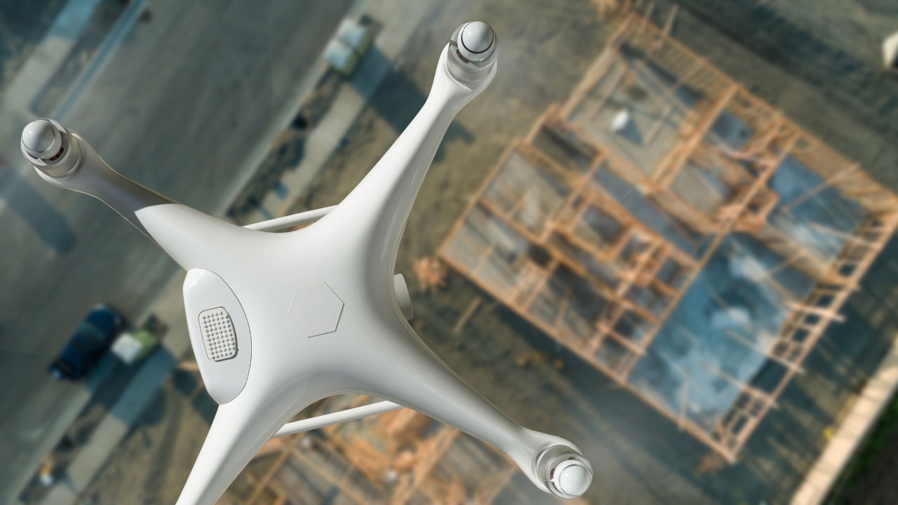
3D scanning employs ground-penetrating radar and other remote sensing technologies to emit energy waves that penetrate the ground. The reflections from these waves are then captured and processed to create detailed images of the underground utility infrastructure. This method is non-invasive and highly effective in locating underground utility lines without digging.

The process begins with the deployment of a 3D scanner over the area of interest. The scanner emits energy waves that travel through the ground and reflect off different materials, such as metal, plastic, and concrete. These reflections are captured by the scanner and processed to create a detailed 3D map of the underground utility environment.

The resulting images provide a clear and accurate representation of the underground utility network, showing the exact locations of underground pipes, cables, and other infrastructure. This information is then used by utility locators and project managers to plan and execute construction work safely and efficiently.

Find Expert Utility Locating Services Today!

Experience the benefits of cutting-edge 3D scanning technology with Util-Locate’s utility locating services. Our expert utility locators are equipped with the latest tools to provide precise underground utility detection and mapping.

Don’t wait until it’s too late – ensure your construction project runs smoothly and safely. Contact Util-Locate now and let us help you locate underground utilities with unmatched accuracy and efficiency.

What Happens If You Hit a Power Line While Digging: Emergency Response and Prevention Guide

utility locating is important

Key Takeaways

  • Hitting a power line while digging can cause electric shock, fire, and serious personal injury — every excavation needs marked utilities before any soil is disturbed.
  • The first response is to stay in equipment if you’re in contact with the line, clear bystanders to a safe perimeter, and call 911 plus the utility company.
  • Calling 811 Call Before You Dig and hiring a private utility locating service together provides the most reliable coverage of public and private underground utilities.
  • Ground Penetrating Radar, Electromagnetic Locating, and vacuum excavation give crews the tolerance zone confidence to dig safely around marked utilities.
  • Detailed documentation of every utility strike protects against liability claims and supports clean utility repair coordination with the affected utility company.

Power lines run beneath nearly every property in California and Arizona — underground cables for electricity, communication lines, gas pipes, and water mains all share the same buried space. What happens if you hit a power line while digging depends on how fast you respond, whether the lines are marked, and what equipment is in contact with the strike point. The hazards include electric shock, fire, extended power outages across a neighborhood, and substantial property damage liability.

What follows is a breakdown of the immediate risks, the response sequence that protects your crew, the documentation steps that protect your construction project against legal exposure, and the utility locating service habits that prevent the next strike entirely. Util-Locate has handled emergency calls and pre-construction prevention work across Southern California and Arizona since 2001, and the same patterns repeat: the strikes with the worst outcomes share two traits — incomplete utility marking and a slow response after impact.

What Happens If You Hit a Power Line While Digging: Immediate Risks and Hazards

A strike on an underground utility line creates a chain of hazards that develop in seconds. The first is electricity exposure. A damaged electric line can energize the excavator, the trench wall, and standing water nearby. Anyone in contact with the equipment, a metal tool handle, or even wet soil can take a serious electric shock or be electrocuted. The arc flash from a high-voltage strike can also ignite fuel vapors, dry vegetation, or PVC conduit, starting a fire before anyone realizes a line was hit.

Beyond electrical hazards, other buried hazards trigger their own response patterns. The table below summarizes the immediate concern for each utility type and the critical first action.

Utility Type Immediate Hazard Critical Response
Electric line / electric cables Electric shock, arc flash, fire Stay in equipment; evacuate everyone 35+ feet; call 911 and utility
Gas line / gas pipeline Gas leaks, explosion, asphyxiation Stop ignition sources; evacuate upwind; call fire department and gas company
Water line / water mains Flooding, trench wall washout, electrical contact risk Shut off water source if safe; call utility; clear trench
Sewer line Soil contamination, biological hazard Restrict access; call utility; arrange utility repair
Communication cables / fiber optics Service disruptions to 911, hospitals, banking Mark location; call telecom utility; high liability exposure

The longer-term consequences are equally serious. A single power outage from an excavator strike can interrupt service to thousands of households and businesses, with the construction project bearing the cost of restoration. Soil and water contamination from a ruptured gas pipeline or sewer line creates environmental damage that may require formal remediation. And contractor liability follows the project for years — civil claims for service disruptions, personal injury, and property damage can dwarf the original project budget. The cost profile of preventable utility strikes is one of the most underestimated risks in commercial construction.

What Happens If You Hit a Power Line While Digging Without Proper Preparation

The outcome of any utility strike correlates almost perfectly with the preparation that happened before the dig. When utilities are marked, crews are trained on safety protocols, and the right tools are on site, even an accidental impact often ends without injury or extended service disruption. When preparation is skipped, the same impact can trigger evacuations, hospital visits, and six-figure utility repair invoices.

The preparation gap usually comes down to one of three patterns:

  • Skipped 811 Call Before You Dig request. The public utility company never marked its lines, so the crew dug blind on lines that 811 would have flagged for free under state guidelines.
  • Skipped private utility locating. 811 only marks public utilities up to the meter. Private laterals — irrigation, site lighting, telecoms, and any utility cable on private property past the service point — stay invisible without a private utility locating detection contractor on site.
  • Skipped tolerance zone discipline. Even when lines are marked, crews sometimes use mechanical equipment inside the tolerance zone instead of hand tools or hydro excavation. California state guidelines and OSHA standards require a tolerance zone around every marked utility for exactly this reason.

A crew that fails on one of these steps is exposed. A crew that fails on all three is gambling with the safety of every construction worker on site.

Safety Precautions Before Breaking Ground

Effective planning is the difference between a routine excavation and a damage event. Every digging and excavation project should follow the same preparation sequence.

Plan with a utility map. Pull the most current utility map for the parcel from the property owner, the city, and the utility companies. Cross-reference each utility map against site walks — older records often show lines that have shifted, and new utilities may not be on the documents at all.

Place your 811 Call Before You Dig request 2–14 business days before digging. California requires a minimum of two working days; other states vary. Wait for line marking to be complete before any soil is disturbed. Line marking colors are standardized: red for electric, yellow for gas, orange for communication, blue for water, green for sewer. Util-Locate’s guide to utility marking colors covers the full system, including paint, flags, and marking tape conventions.

Hire a private utility locating service for everything past the meter. 811 stops at the public service point. Anything beyond — irrigation, site power, security conduit, private sewer laterals, telecoms — needs a private detection contractor with Ground Penetrating Radar, Electromagnetic Locating equipment, Cable Avoidance Tools, and Signal Generators to identify and mark.

Conduct safety training. Every crew member should know how to read line marking, respect the tolerance zone, recognize gas smells and signs of natural gas leaks, and execute the strike response sequence below. Refresher training should run twice a year and include any new safety precautions added since the last session.

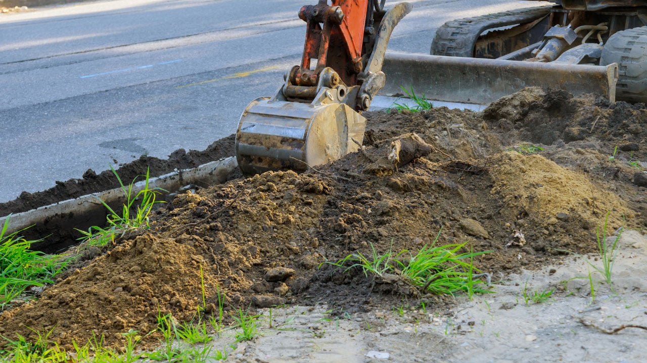
Use the right tools near marked utilities. Inside the tolerance zone (commonly 18–24 inches), switch from mechanical equipment to hand tools or non-destructive methods like vacuum excavation, hydro excavation, or potholing. These methods expose utilities without cutting them, and they’re the standard for working in dense urban corridors, near gas lines, or in confined space conditions.

Verify before you drill. For any work that breaks concrete or drills into walls, run Ground Penetrating Radar over the area first. Embedded conduit, post-tension cable, and rebar look identical from the surface — GPR is the only way to tell them apart.

Step-by-Step Response After Striking an Underground Utility

When an impact happens, the response sequence runs in a fixed order. Skipping steps or reversing them is what turns a utility damage event into a casualty event.

Immediate Actions in the First 60 Seconds

  1. Hold position and assess. If you’re in equipment and the line is energized, the safest place is inside the cab. Stepping out can complete the circuit through your body. Stay in the equipment, radio for help, and wait for the utility company to confirm the line is de-energized — unless fire forces evacuation. The same rule applies if you uncover exposed wires on foot: back away on a straight path, do not touch anything metal nearby.
  2. Clear the area of everyone on foot. Move workers, foot traffic, and bystanders to at least 35 feet from the strike point. For high-voltage lines, expand to 100 feet. Establish area security with cones, tape, or a spotter so no one drifts back into the danger zone.
  3. Identify the utility. Use the marking colors and the visible damage to identify whether the strike involved an electric line, gas line, water line, sewer line, or communication line. The identification drives the next call.
  4. Call 911 and the utility company. Report the damaged utility line and any injuries or fire. Provide the exact location, the type of utility, the size of the visible damage, and whether anyone is hurt. Stay on the line for instructions. Many states have a dedicated number for the utility company’s 24-hour emergency desk — keep those numbers on every job site.

Coordinating Repairs and Damage Assessment

After emergency services secure the site, the next phase is coordination with the utility owner and damage assessment for insurance and contractor liability purposes.

Communicate fully with the utility company. Provide them with everything — incident time, GPS coordinates, type of utility line, depth, photos, and witness statements. Utility contractors arrive faster when they know what tools and parts to bring.

Document the damage on site. Photograph the strike point from multiple angles, the exposed line, equipment position, marking flags or marking tape (or the absence of them), and any visible property damage. Note the time of every call placed and every responder who arrived. This documentation supports insurance claims, utility repair invoicing, and any later legal review.

Coordinate utility repair. The utility company handles the actual repair on their lines. Your role is to keep the site secure, hold the area open for their crew, and document the repair work for your project records.

Manage the cost conversation. Utility companies invoice for the repair plus service disruption damages — sometimes service interruption to hundreds or thousands of customers. Insurance may cover part of the damage and repair costs, but coverage depends on whether you complied with state guidelines and 811 Call Before You Dig requirements. A strike on unmarked lines may be covered; a strike on clearly marked utilities often is not.

Documenting an Underground Utility Strike for Insurance and Legal Claims

Good documentation is the difference between a contained incident and a years-long liability case. Every utility strike — even a minor one — should generate a written record that protects the contractor, the property owner, and any worker on site.

Capture these details immediately:

  • Exact date, time, and GPS coordinates of the strike
  • Type of utility line affected (electric, gas, water, sewer, telecom)
  • Depth of the strike and the equipment that made contact
  • Photos of the marking, the strike point, the exposed line, and the surrounding area
  • All emergency services and utility company contacts placed, with timestamps
  • Names and statements of every witness on site
  • Copy of the 811 ticket, any private utility locating report, and the utility map used

Organize the record in a single incident file and share it with your insurer, your project legal counsel, and the utility company. If disputes arise about responsibility — and they often do when service disruptions affect third parties — this file becomes the central evidence in the damage assessment.

Preventing Future Utility Strikes

Every strike is a learning event. After the immediate response is closed out, run a debrief that identifies the failure point — whether it was a missed 811 ticket, an unmarked private utility, a crew member working outside the safety protocols, or equipment used inside the tolerance zone. Then update the procedures so the same failure cannot repeat on the next site.

Ongoing prevention comes down to four habits:

Lock in safe digging practices. Every project starts with a utility map, an 811 ticket, and a private utility locating sweep for anything past the meter. No exceptions, even on routine work. California’s framework for safe excavation is summarized in our guide to calling before you dig in California.

Use the right tools. Match the method to the risk. Hand tools and vacuum excavation near marked utilities. GPR before drilling concrete. Video Pipe Inspections for confirming sewer line condition. Specialized equipment is not an upsell — it’s how crews dig safely around buried infrastructure.

Maintain safety training. Run refresher sessions twice a year. Cover line marking colors, tolerance zones, gas smells, response to exposed wires, and the strike response sequence. Pull in the local fire department for an annual joint drill if possible.

Educate the community. Homeowners account for a significant share of utility strikes — fence posts, mailbox installations, tree planting, and irrigation repair all happen without 811 tickets every weekend. Sharing 811 information and basic digging precautions with property owners before backyard work prevents many of these strikes before they start.

For complex sites, sites with confined space access, or sites with infrastructure development running alongside live operations, bring in a private locating partner before the design phase finalizes. Catching a utility conflict on paper is always cheaper than catching it with an excavator bucket.

Dig With Certainty — Schedule a Util-Locate Service Before You Break Ground

Two decades of utility locating across California and Arizona have taught us one thing: every avoidable strike was avoidable. The 811 call, the private locate, the GPR scan, the tolerance zone — each step is small, fast, and inexpensive compared to a single utility damage invoice.

Util-Locate is on call 24/7 for emergency response and pre-construction locating across Southern California, the San Francisco Bay Area, and Arizona. Our certified technicians work to ASCE-compliant standards, deliver real-time on-site data, and provide CAD, KML, and PDF documentation for every project.

Call 1-888-885-6228 to speak with a locating specialist, or request a quote for your next construction project. We answer the phone every day of the year — including the day you’re about to break ground.

Frequently Asked Questions

What should I do first if I hit a power line while digging?

Stay where you are if you’re inside equipment in contact with the line — stepping out can complete the circuit and cause electrocution. Radio for help, keep everyone else 35 feet back (100 feet for high-voltage), and call 911 immediately. The utility company should be called next so they can dispatch crews to de-energize the line and begin utility repair. Never touch the equipment, the line, or the soil around it until the utility company confirms power is off.

Can I be held liable if I hit a marked utility?

Yes — striking a marked utility almost always shifts liability to the excavator, since the marking was there to be respected. California state guidelines and OSHA standards require crews to maintain a tolerance zone around marked utilities and use hand tools or vacuum excavation inside that zone. If you cut a line that was clearly marked, you can be liable for the utility repair, all service disruptions, and any personal injury or property damage caused. Insurance coverage often excludes strikes on marked lines, which is why following safe digging practices matters even after the locate is done.

What’s the difference between 811 and a private utility locating service?

811 Call Before You Dig is a free public service that notifies your local utility companies to mark their lines up to the meter or service point. A private utility locating service — sometimes called a private detection contractor — marks everything past that point, including irrigation, site lighting, security conduit, private sewer laterals, and any utility cable on private property. 811 alone misses a significant share of buried utilities on a typical commercial site, which is why most contractors hire a private locator alongside their 811 request. Util-Locate works as the private side of that pairing across California and Arizona.

How deep are most underground utilities buried?

Depth varies by utility type and local code. Electric lines are typically 24–36 inches deep, gas pipes 18–24 inches, water mains 30–60 inches, and communication cables 18–24 inches. Depth is never guaranteed, though — older lines drift, fill changes elevation, and erosion exposes shallow utilities. That’s why depth assumptions are dangerous and why every dig should use line marking and tolerance zone discipline regardless of how deep a line is supposed to be.

What technology does Util-Locate use to find underground lines?

Util-Locate uses a stack of detection methods matched to the site. Electromagnetic Locating with Cable Avoidance Tools and Signal Generators finds active metallic lines like electric cables, water mains, and steel gas pipes. Ground Penetrating Radar finds non-metallic lines like PVC conduit, fiber optics, and sewer line, and it works for surface and concrete scanning before drilling. Vacuum excavation and hydro excavation expose utilities without cutting them, and Video Pipe Inspections verify the condition of sewer and storm drain lines from the inside. Every method we run produces ASCE-compliant deliverables you can use on the next construction project.