Key Takeaways
- California dig laws require one-call notification and safe excavation near utilities.
- Professional underground utility locator services improve locating accuracy and safety.
- Non-compliance can result in fines, delays, injuries, and property damage.
- Proper training and communication are essential for staying compliant.
- Util-Locate provides trusted utility locating services to help you meet all dig law requirements.
Digging underground in California is not just about breaking ground—it involves strict rules to protect public safety and infrastructure. California dig laws are designed to prevent accidents, costly damages, and service interruptions by regulating excavation practices near underground utilities.
For contractors, engineers, and property owners, understanding these laws is essential. In particular, professional underground utility locator services play a vital role in ensuring compliance and safety.
However, following are the key points on How to Stay Compliant with Underground Work:
- What Are California Dig Laws
- Key Requirements of California Dig Laws
- Why Compliance with California Dig Laws Matters
- How to Stay Compliant with California Dig Laws
This article provides a clear overview of California dig laws and practical tips on staying compliant. You’ll also discover why investing in trusted utility locating services is critical before any excavation.
What Are California Dig Laws?
California dig laws refer to the set of regulations that govern excavation and digging near underground utilities in the state. These laws are primarily enforced by the California Underground Service Alert (USA), which coordinates safe digging practices through a one-call notification system.
The main goals are to:
- Protect underground infrastructure such as gas, water, electric, and communication lines.
- Prevent personal injury and property damage.
- Promote safe excavation techniques.
- Ensure timely reporting of utility damages or emergencies.
Failing to follow these laws can result in hefty fines, project delays, legal liabilities, and serious safety hazards
Key Requirements of California Dig Laws
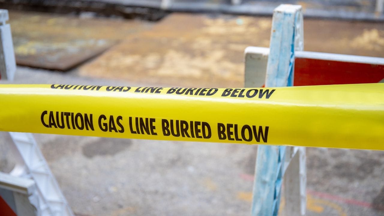
1. Call Before You Dig – The One-Call System
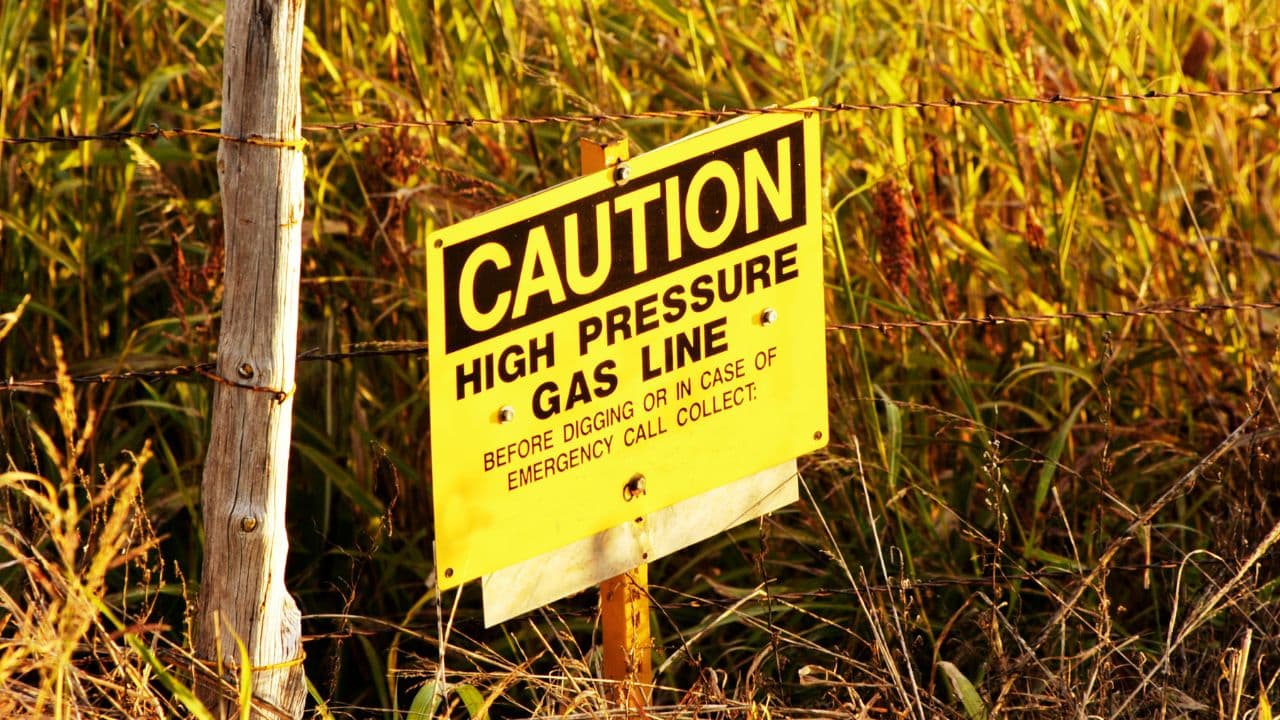
Before any excavation work, California law requires notifying the USA by calling 811 or submitting an online ticket. This initiates a process where utility owners mark their underground lines at the site.
- Notification must be made at least two business days before digging.
- Affected utility companies respond by marking their facilities with color-coded flags or paint.
- Excavators must respect these markings and dig carefully.
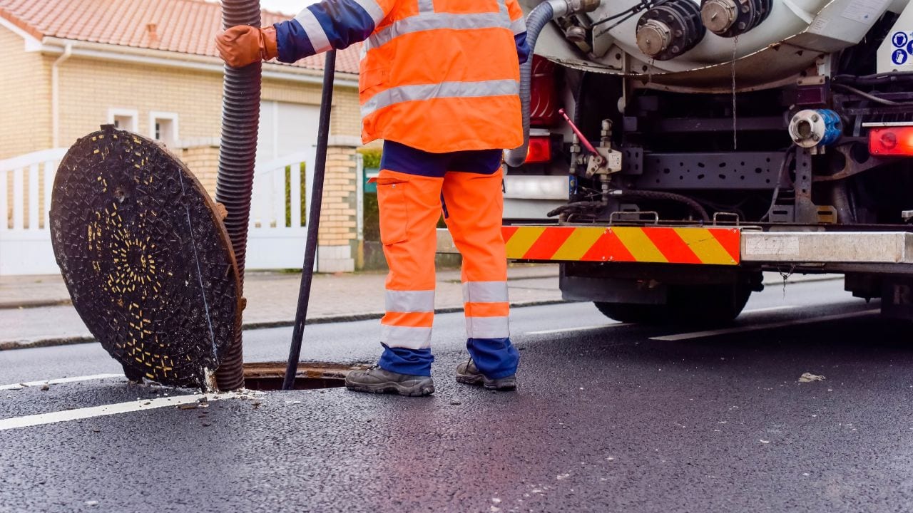
2. Use of Underground Utility Locator Services
Merely relying on utility markings is not enough. Contractors often engage professional underground utility locating services to perform thorough scans and verifications. These experts use advanced tools to:
- Identify unmarked or outdated utilities.
- Confirm the accuracy of utility owner markings.
- Provide detailed maps to assist safe excavation.
California dig laws encourage the use of such services to improve accuracy and reduce utility strikes.
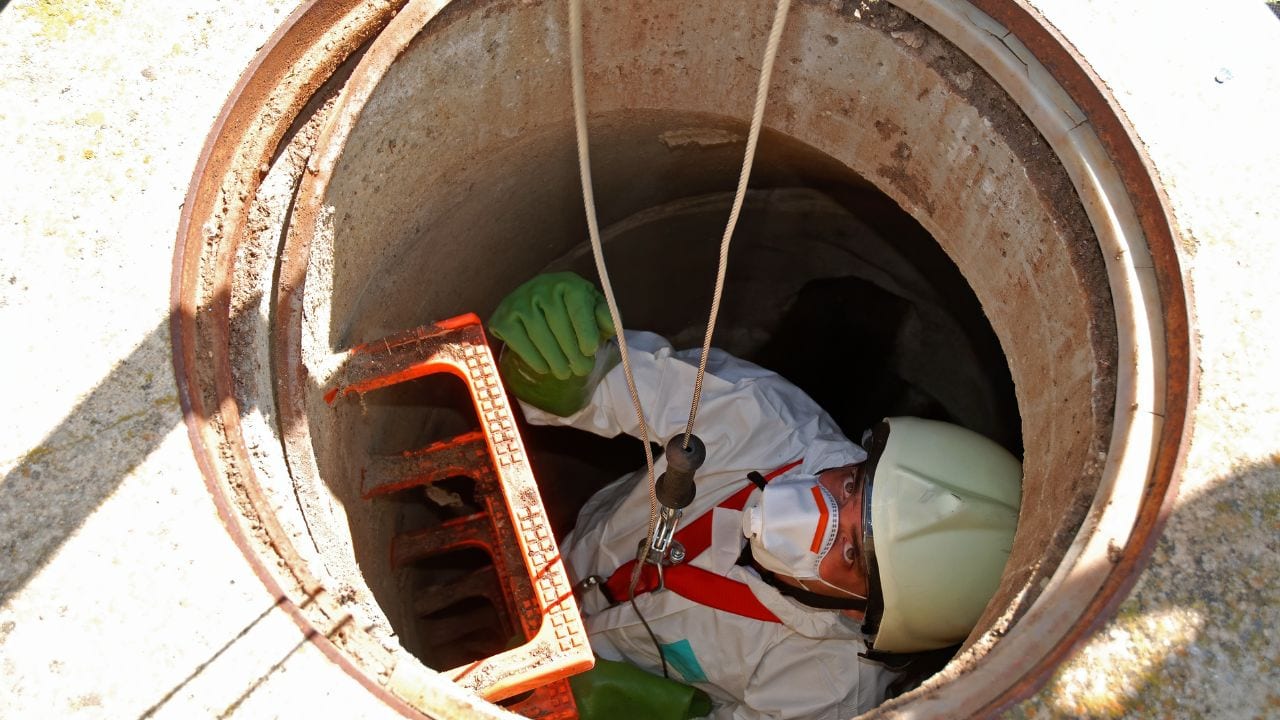
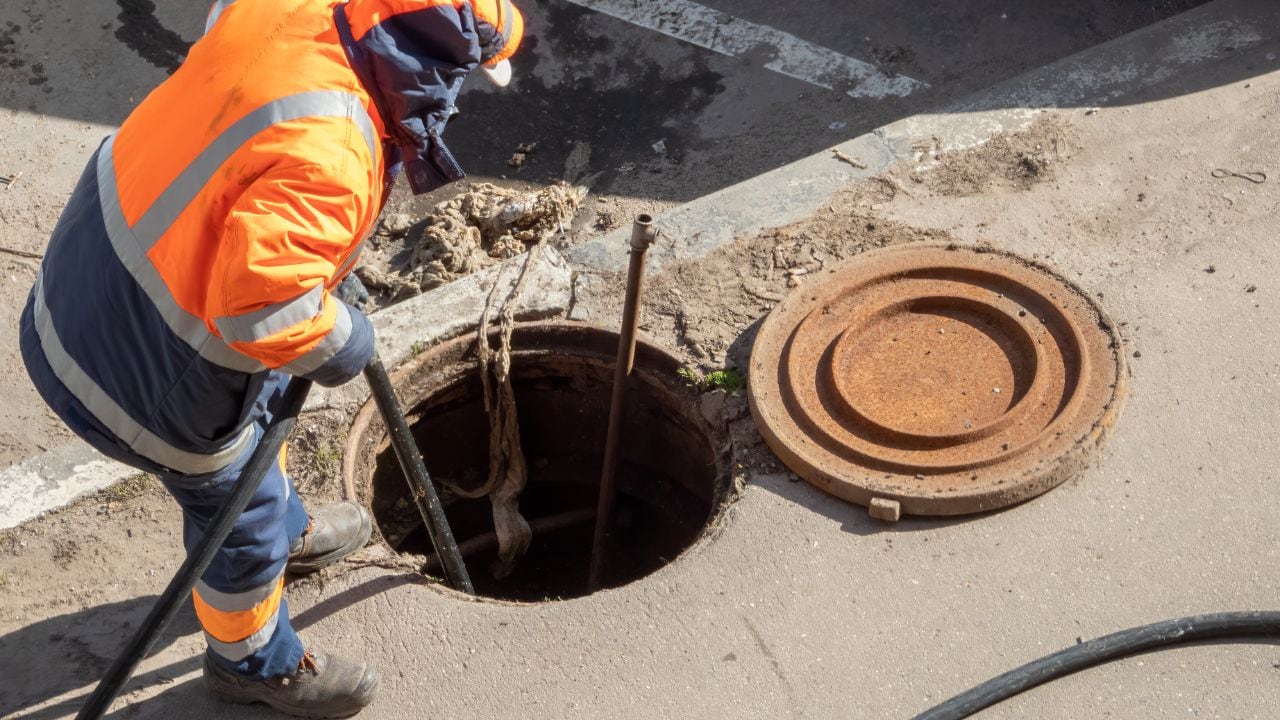
3. Safe Excavation Practices
Once utilities are marked, excavators must follow safe digging methods, including:
- Hand digging or soft excavation near marked utilities to avoid damage.
- Maintaining required clearance distances.
- Stopping work if unmarked or questionable utilities are encountered.
4. Reporting Utility Damages
If a utility is damaged during excavation, it must be reported immediately to the utility owner and the USA. Failure to do so can lead to penalties and increased liability.
Why Compliance with California Dig Laws Matters
Protecting Lives and Property
Underground utilities carry electricity, gas, water, and data essential to communities. Striking a utility line can cause:
- Explosions or fires.
- Electrocutions or injuries.
- Water contamination or flooding.
- Disruption of communication and power services.
Adhering to the dig laws helps prevent these dangerous events.
Avoiding Legal and Financial Consequences
Non-compliance can lead to:
- Significant fines from regulatory agencies.
- Costly repair bills for damaged utilities.
- Project shutdowns and delays.
- Lawsuits or criminal charges in severe cases.
Staying compliant protects your business and reputation.
Enhancing Project Efficiency
Following proper procedures ensures projects run smoothly without unexpected interruptions due to utility strikes or investigations.
How to Stay Compliant with California Dig Laws
1. Plan Ahead and Notify USA
- Always submit your one-call notification at least 48 hours before digging.
- Include precise site information and project details.
- Verify utility owners’ response and markings before starting work.
2. Engage Professional Utility Locating Services
- Hire certified underground utility locator companies to perform detailed utility locating.
- Use their reports and maps to inform your excavation plans.
- Their expertise reduces risk and ensures all utilities are identified.
3. Train Your Crew on Safe Digging Practices
- Educate workers on interpreting utility markings.
- Instruct on hand digging and other non-invasive techniques near utilities.
- Emphasize the importance of stopping work when unknown utilities are found.
4. Maintain Open Communication with Utility Owners
- Coordinate with utility companies for any questions or issues on-site.
- Report damages immediately if they occur.
- Keep documentation of notifications and correspondences.
5. Use Technology and Documentation
- Leverage GPS, GIS, and digital maps provided by utility locating services.
- Document your compliance efforts for inspections and audits.
The Vital Role of Underground Utility Locator Professionals
In California, the success of dig law compliance heavily depends on the accuracy of underground utility locating. Professional locators bring:
- State-of-the-art technology like ground-penetrating radar and electromagnetic locators.
- Expertise in detecting utilities in challenging soil or congested areas.
- Accurate marking and mapping that exceeds minimum legal requirements.
- Detailed reports that support safe excavation and project planning.
By partnering with trusted utility locating services, contractors significantly reduce the chance of accidents, fines, and delays.
Real-World Examples: What Can Go Wrong Without Compliance?
- A contractor accidentally ruptured a gas pipeline, causing a massive fire and evacuation.
- Unauthorized digging without a USA notification led to water main breaks, flooding a neighborhood.
- Poor utility locating resulted in electrical outages affecting thousands of customers.
These incidents highlight the importance of understanding and following California dig laws thoroughly.
Stay Safe and Compliant with Util-Locate
Navigating California’s dig laws might seem complex, but it doesn’t have to be. By understanding the regulations and working closely with professional underground utility locating teams, you can protect your workers, avoid penalties, and keep projects on track.
Util-Locate offers expert utility locating services tailored to California’s stringent requirements. Their skilled technicians use the latest technology to deliver precise, reliable utility locating that supports your compliance efforts.
Don’t risk costly mistakes—partner with Util-Locate today and dig with confidence and peace of mind.