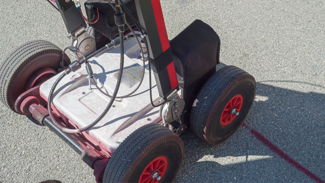
The landscape of utility locating and underground infrastructure mapping is undergoing a significant transformation, fueled by technological advancements. From the advent of Ground Penetrating Radar (GPR) to the sophistication of Geographic Information Systems (GIS), the construction industry is witnessing unprecedented improvements in detecting and mapping underground assets.
In this guide, we’ll explore these technological advancements in utility location and their impact on construction projects.
Revolutionizing Utility Locating with Ground Penetrating Radar (GPR)
GPR services have revolutionized the way construction firms and utility companies locate underground assets. This cutting-edge technology sends high-frequency radio waves into the ground, which bounce back to the surface upon hitting different materials, providing a detailed view of what lies beneath without any physical excavation.
GPR scanning services have become indispensable in detecting underground infrastructure such as water pipes, gas lines, and communication cables, significantly reducing human errors and the risk of accidental damage during construction activities.
The Role of Private Utility Locating
Private utility locating has emerged as a critical service, especially when public records are incomplete or outdated. Utilizing advanced technologies, private utility locating helps identify unrecorded or mislabeled underground utility assets, ensuring accurate location and mapping. This precision is crucial for avoiding accidental utility strikes that can lead to costly repairs and project delays.
Utility Mapping and GIS Integration
The integration of utility mapping services with Geographic Information Systems (GIS) represents a leap forward in urban and civil engineering projects. GIS provides a framework for gathering, managing, and analyzing spatial data, allowing construction contractors to visualize the location of utilities in relation to the overall construction site. The seamless integration of GIS with utility mapping results in more informed decision-making, enhancing Construction productivity and safety.
3D Modeling and Digital Technologies
The development of 3D models based on accurate utility mapping data is transforming construction plans and workflows. These models allow for the detailed visualization of underground assets in three dimensions, offering construction teams a clearer understanding of complex underground environments.
Coupled with other Digital Technologies such as AI and aerial photographs, 3D modeling contributes to more accurate measurement, planning, and execution of construction projects.
Cost Savings and Construction Efficiency
Advanced technologies in utility detection and mapping bring significant cost savings to construction companies. By reducing the likelihood of utility damages and improving the accuracy of construction plans, these innovations help streamline construction workflows, minimize damage during construction activities, and avoid costly service disruptions.
The precise location of utilities leads to more efficient project execution and reduced need for costly relocations and repairs.
Future Developments and Innovations in Utility Locating
The field of utility locating is on the cusp of a technological revolution, promising to transform traditional methods and introduce unprecedented efficiency and accuracy. The advancements in technology not only aim to mitigate the risks associated with accidental utility strikes but also streamline the entire construction workflow.
Here’s a look at the future developments and technologies shaping the landscape of utility locating:
1. Integration of Artificial Intelligence and Machine Learning
The future of utility locating is heavily leaning towards the incorporation of Artificial Intelligence (AI) and Machine Learning (ML). These technologies are set to redefine the detection capabilities by analyzing historical data, learning from past utility locating experiences, and predicting the likelihood of underground utility presence.
AI algorithms can process vast amounts of data from various sources, including GPR scanning services and previous excavation reports, to provide more accurate and reliable utility locating information.
2. Enhanced Ground Penetrating Radar (GPR) Technology
Ground Penetrating Radar technology is expected to see significant advancements in terms of depth penetration, resolution, and data processing speeds. Future GPR locating services may feature enhanced imaging capabilities, allowing for clearer and more detailed views of the underground infrastructure.
This will enable utility locators to identify and differentiate between various types of underground utilities with greater precision.
3. Adoption of 3D Modeling and Visualization
3D modeling and advanced visualization techniques are set to become integral components of utility locating services. By converting GPR data and other utility mapping information into three-dimensional models, construction teams can gain a comprehensive understanding of the subsurface environment. This will aid in planning and executing construction projects with minimal risk of disturbing existing underground utilities.
4. Development of Smart Sensors and IoT Devices
The use of smart sensors and Internet of Things (IoT) devices in utility locating is anticipated to grow. These devices could continuously monitor the underground conditions and provide real-time updates on the status and location of utilities.
By integrating these sensors with utility mapping services, city planners and construction firms can have ongoing access to dynamic, updated information about the underground infrastructure.
5. Enhanced Integration with Geographic Information Systems (GIS)
The integration between utility locating services and Geographic Information Systems (GIS) is expected to deepen. Future developments may allow for more seamless and automated data transfer between utility locating equipment and GIS platforms, enabling real-time updates and comprehensive spatial analyses. This integration will prove invaluable for urban planning, infrastructure maintenance, and emergency response strategies.
Technological advancements in underground utility detection are shaping the future of construction and city planning. By leveraging tools like GPR, GIS, and AI, construction firms can undertake projects with greater confidence, accuracy, and efficiency. The move towards more advanced detection capabilities and accurate mapping is not just a trend but a necessity for the modern construction industry.
Experience Cutting-Edge Utility Locating with Util-Locate
At Util-Locate, we pride ourselves on offering state-of-the-art utility locating services in Southern California. Our advanced technologies and expert team ensure that your construction projects proceed safely and efficiently.
Reach out to Util-Locate for comprehensive underground utility detection solutions, and step into the future of construction with confidence.

