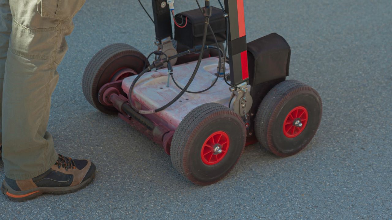
How Subsurface Utility Data Improves Building And Site Design In San Diego

how accurate utility information improves building and site design

San Diego’s construction landscape demands precision. Beneath the city’s streets lies a complex network of utilities, water mains, gas lines, electrical conduits, and telecommunications infrastructure, installed over decades without consistent documentation. This subsurface maze creates significant risks for developers, designers, and property owners. A single misplaced foundation or undetected utility conflict can derail projects, drain budgets, and endanger lives. As regulations tighten and technology advances, subsurface utility data San Diego has evolved from an optional investigation to an essential project requirement. 

This comprehensive guide explores how accurate utility information improves building and site design while delivering measurable economic and safety benefits.


Key Takeaways

  • Subsurface utility data prevents costly construction conflicts by identifying underground infrastructure before design decisions are finalized, saving 10-20% on project budgets
  • ASCE 38-02 quality levels provide standardized accuracy frameworks, with Quality Level A (vacuum excavation) offering the highest precision for critical projects
  • Advanced technologies like GPR, BIM integration, and machine learning transform utility detection, visualization, and predictive analysis capabilities
  • San Diego’s unique challenges, seismic risks, coastal soils, and dense urban development make comprehensive utility mapping essential for regulatory compliance and safety
  • Early stakeholder collaboration and cloud-based coordination platforms maximize the value of utility data throughout design, permitting, and construction phases


What Is Subsurface Utility Data, And Why Is It Important For Building And Site Design?

Subsurface utility data identifies and maps underground infrastructure before construction begins. This information prevents costly conflicts, protects workers, and streamlines design decisions. In San Diego’s dense urban environment, knowing what lies beneath saves time and money while reducing risk.

Types of Subsurface Utility Data

Data Type Description
Utility Locations Horizontal positioning of pipes, cables, and conduits (coordinates and offsets)
Depths Vertical measurements from surface to utilities (invert elevations and burial depths)
Conditions Material type, age, diameter, and structural integrity of utilities
Ownership Information Jurisdictional control, maintenance responsibility, and easement details

Key Challenges in San Diego

  • Seismic Activity: Rose Canyon and Elsinore fault zones require enhanced design considerations for utility protection
  • Urban Density: Congested underground infrastructure in downtown and coastal areas limits available space
  • Coastal Soil Conditions: Semi-consolidated sandstone and shale complicate excavation and utility placement
  • Environmental Compliance: Strict stormwater management regulations and coastal protection requirements
  • Historical Districts: Development restrictions in areas like Old Town and Gaslamp Quarter
  • Water Conservation Mandates: Permanent restrictions impact landscape irrigation and utility design

Comparison with Other Site Data

Data Type Primary Purpose Impact on Design Timing in Process
Subsurface Utility Data Identify underground infrastructure conflicts Prevents utility strikes and enables optimal building placement Preliminary design phase
Topographic Data Surface elevation and drainage analysis Determines grading, site access, and stormwater flow Site planning phase
Geotechnical Data Soil composition and bearing capacity Informs foundation design and excavation methods Design development
Planning Considerations Zoning, land use, and regulatory compliance Establishes permitted uses and development intensity Pre-design phase

How Does Subsurface Utility Data Improve Site Design And Prevent Common Pitfalls?

Accurate utility mapping transforms design efficiency by identifying conflicts before construction. Early detection allows designers to adjust building footprints, optimize foundation systems, and coordinate grading plans. This proactive approach eliminates expensive field changes and keeps projects on schedule.

Key Risks Prevented by Utility Data

  • Utility Strikes: Damage costs range from $75,000 to $500,000 per incident, plus potential injuries and service disruptions
  • Design Errors: Prevents placement of foundations, piles, or structural elements over active utilities
  • Construction Delays: Eliminates unexpected utility discoveries that halt work and require redesign
  • Cost Overruns: Avoids emergency relocations and change orders that run 3-5 times the cost of planned modifications
  • Safety Hazards: Protects workers from electrocution, gas leaks, and underground explosions
  • Legal Liability: Reduces exposure to damage claims, regulatory violations, and third-party lawsuits

Ways Utility Data Prevents Delays

  • Early Conflict Detection: Identifies utility conflicts during the design phase, saving 10-20% on overall project costs
  • Streamlined Permitting: Complete utility documentation accelerates city review and approval processes
  • Coordination Efficiency: Enables utility companies to plan relocations or shutdowns in advance
  • Accurate Cost Estimation: Provides contractors with reliable information for bidding and scheduling
  • Reduced Change Orders: Minimizes field surprises that trigger costly work stoppages
  • Smoother Utility Coordination: Facilitates communication between multiple utility providers and jurisdictions

Professional utility locating services ensure ASCE 38-02 compliance while delivering the accuracy needed for complex San Diego projects.

Benefits of Utility Mapping in Design

Benefit Category Specific Advantages
Decision-Making Speed Real-time clash detection in 3D models, immediate redesign options when conflicts arise
Stakeholder Collaboration Shared visualization for architects, engineers, and contractors; earlier input from utility companies
Technology Integration Direct import into CAD and BIM platforms, automated clash detection, GIS-based asset management
Cost Control Accurate quantity takeoffs, reliable contractor estimates, reduced contingency requirements
Risk Reduction Virtual conflict resolution before construction, documented conditions for future reference

Better site layouts emerge when designers have complete subsurface information from project inception, enabling optimal building orientation and infrastructure placement.

What Are The Main Challenges Of Using Subsurface Utility Data In San Diego?

San Diego’s infrastructure complexity creates unique data challenges. Legacy systems, incomplete records, and dense urban development make utility mapping difficult. Understanding these obstacles helps project teams plan appropriate investigation strategies.

Common Obstacles

  • Missing Historical Records: Many utilities installed decades ago lack accurate as-built documentation
  • Outdated Information: Existing maps may not reflect modifications, repairs, or abandoned infrastructure
  • Multiple Jurisdictions: Overlapping utility providers (SDG&E, City of San Diego, private companies) maintain separate records
  • Access Restrictions: Dense urban areas, active traffic corridors, and private property limit survey access
  • Conflicting Data Sources: Discrepancies between utility company records, city maps, and field conditions
  • Unknown Private Utilities: Older buildings may have undocumented private lines and service laterals

Solutions to Overcome Data Challenges

  • Advanced Surveying Technologies: Ground Penetrating Radar (GPR) and electromagnetic locators verify utility positions without excavation
  • ASCE 38-02 Quality Levels: Implement appropriate SUE levels (A through D) based on project risk and complexity
  • Utility Company Verification: Coordinate directly with providers to validate record accuracy and request field markings
  • Test Pit Investigations: Strategic excavations confirm depth, condition, and exact positioning of critical utilities
  • 3D BIM Integration: Combine multiple data sources into coordinated models for comprehensive visualization
  • Professional SUE Services: Engage qualified subsurface utility engineers for complex projects requiring Quality Level A or B data

Specialized San Diego County utility locator services provide local expertise and established relationships with regional utility providers.

Impacts of Poor Data Accuracy

Impact Category Consequences
Construction Costs Emergency utility relocations, extended equipment rental, overtime labor charges, contractor claims
Safety Hazards Worker injuries from utility strikes, public endangerment from gas or electrical damage, environmental contamination
Project Timelines Work stoppages during investigations, permit resubmissions, redesign delays, extended project duration
Legal Exposure Third-party damage claims, regulatory fines, contractor disputes, insurance premium increases
Property Value Development restrictions from undiscovered easements, reduced marketability, buyer skepticism

How Subsurface Utility Data Improves Compliance And Safety In San Diego’s Building Projects

Comprehensive utility documentation ensures regulatory compliance while protecting workers and the public. San Diego’s strict codes and environmental regulations make accurate subsurface data essential for project approval and safe construction.

Compliance Benefits

  • Zoning Conformance: Utility easements and setback requirements inform buildable area calculations and density limitations
  • Seismic Code Adherence: Proper utility protection details meet San Diego County’s earthquake safety standards
  • Stormwater Regulations: Accurate utility locations enable compliant BMP placement and drainage system design
  • Environmental Permits: Documented conditions support CEQA review and California Coastal Commission approvals
  • Historic Preservation: Utility data prevents damage to resources in protected districts during construction
  • ADA Compliance: Ensures accessible pathways avoid utility conflicts and maintain required grades

Understanding utility locating risk in San Diego helps project teams develop comprehensive risk mitigation strategies.

Safety Benefits of Utility Data

Safety Improvement Specific Outcome
Accident Prevention Eliminates 95% of utility-related construction incidents through pre-identification of hazards
Contractor Coordination Clear communication protocols between excavators and utility owners reduce emergency responses
Hazard Zone Identification Maps high-pressure gas lines, high-voltage electrical, and other critical infrastructure before work begins
Worker Protection Enables proper safety equipment, clearance distances, and protective measures during excavation
Public Safety Prevents service disruptions, gas releases, and electrical outages that endanger surrounding areas
Emergency Response Planning Provides first responders with utility locations for incident management and evacuation planning

What Tools And Technologies Are Used For Collecting And Analyzing Subsurface Utility Data?

Modern technology enables precise utility detection and documentation. Advanced surveying equipment, specialized software platforms, and emerging AI applications transform how engineers collect and analyze subsurface data. These tools deliver the accuracy levels required by ASCE 38-02 standards.

Most Common Data Collection Tools

Tool Category Technology Application Quality Level Achieved
Ground Penetrating Radar (GPR) High-frequency electromagnetic waves Detects non-metallic utilities, maps depth and size, identifies voids Quality Level B
Electromagnetic Locators Active/passive signal detection Traces metallic utilities, verifies horizontal positioning Quality Level B-C
Acoustic Methods Sound wave transmission Locates active water/sewer lines, detects leaks Quality Level C
Vacuum Excavation Hydro or air excavation Exposes utilities for visual verification and measurement Quality Level A
Utility Mapping Cameras CCTV and laser scanning Inspects pipe interiors, documents conditions Quality Level A-B
GPS/Total Station Precision positioning Records exact coordinates and elevations Supports all levels

Popular Software for Utility Data Visualization

Software Platform Primary Function Key Features Integration Capabilities
ArcGIS/QGIS GIS mapping and spatial analysis Asset management, network analysis, web-based sharing CAD import, database connectivity, cloud services
AutoCAD Civil 3D 2D/3D CAD design Utility corridor modeling, clash detection, alignment design GIS integration, data exchange formats
Revit Building Information Modeling 3D utility coordination, parametric modeling, documentation BIM 360, Navisworks, project collaboration
Navisworks BIM coordination and clash detection 4D simulation, multi-discipline coordination, constructability review Revit, AutoCAD, point cloud data
BIM 360 Cloud-based project management Real-time collaboration, mobile access, version control Autodesk products, third-party integrations
Bentley MicroStation Infrastructure design Subsurface utility engineering, reality modeling OpenBIM standards, GIS platforms

Professional utility mapping AutoCAD integration services ensure seamless data transfer between field survey equipment and design platforms.

Applications Of Machine Learning In Utility Data

  • Automated Data Cleaning: AI algorithms identify inconsistencies, remove duplicates, and standardize formats across multiple data sources
  • Predictive Utility Lifespan Analysis: Machine learning models forecast failure risks based on age, material, soil conditions, and maintenance history
  • Pattern Recognition: Neural networks detect utility installation patterns to predict locations where documentation is missing
  • Real-Time Data Processing: On-site systems process GPR scans instantly, highlighting anomalies for immediate investigation
  • Conflict Probability Mapping: Algorithms calculate the likelihood of utility conflicts based on historical project data and site characteristics
  • Automated Classification: Image recognition categorizes utility types, materials, and conditions from visual inspection data

What Are The Economic And Environmental Benefits Of Using Subsurface Utility Data In San Diego?

Investing in accurate utility data generates measurable returns through cost avoidance and environmental protection. Projects that implement comprehensive SUE programs consistently deliver better financial outcomes while reducing ecological impact. These benefits compound over a project’s lifecycle.

Ways Utility Data Saves Money

  • Eliminates Redesign Costs: Preventing mid-construction design changes saves 3-5 times the cost of initial planning modifications
  • Reduces Rework: Accurate placement eliminates excavation mistakes, trench relocations, and foundation adjustments
  • Minimizes Delay Costs: Avoiding utility conflicts saves 10-20% on overall project budgets through schedule maintenance
  • Lowers Contingency Requirements: Reliable data reduces risk reserves and improves project financing terms
  • Prevents Damage Claims: Avoiding utility strikes eliminates $75,000-$500,000 repair costs per incident
  • Streamlines Procurement: Accurate quantities reduce material waste and improve contractor bidding accuracy
  • Decreases Insurance Premiums: Documented risk mitigation lowers builder’s risk and liability insurance costs
  • Improves Property Values: Well-documented infrastructure enhances marketability and supports higher appraisals

Fewer RFIs and redesigns result from comprehensive utility documentation, reducing administrative burden and accelerating project timelines.

Environmental Benefits Of Utility Data

  • Reduces Land Disturbance: Precise excavation limits soil disruption, preserves vegetation, and protects sensitive habitats
  • Minimizes Construction Waste: Accurate planning reduces excess excavation, demolished materials, and landfill disposal
  • Lowers Carbon Footprint: Efficient construction sequencing decreases equipment runtime and fuel consumption
  • Protects Water Quality: Strategic utility placement prevents damage to stormwater BMPs and drainage systems
  • Prevents Contamination Events: Avoiding utility strikes eliminates soil and groundwater pollution from leaks or spills
  • Conserves Energy: Reduced rework and shorter project timelines lower overall energy consumption during construction
  • Supports Sustainable Development: Integration with green building practices enables LEED certification and sustainability goals
  • Preserves Urban Trees: Accurate utility mapping protects root systems and prevents unnecessary tree removal

What Are The Key Trends In Subsurface Utility Data For Building And Site Design In San Diego?

Technology advancement and smart city initiatives drive rapid evolution in utility data management. San Diego’s infrastructure modernization programs embrace these innovations to improve project outcomes and operational efficiency. Understanding emerging trends helps stakeholders prepare for future requirements.

Key Trends In Utility Data

  • IoT Sensor Networks: Real-time monitoring systems track utility conditions, detect leaks, and provide continuous location verification
  • Augmented Reality (AR) Visualization: Field crews view underground utilities through mobile devices overlaid on live camera feeds
  • Machine Learning Analytics: Predictive algorithms anticipate utility conflicts and recommend optimal design solutions
  • Digital Twin Technology: Virtual replicas of underground infrastructure enable scenario testing and lifecycle planning
  • Drone-Based Surveying: Aerial platforms integrate surface conditions with subsurface data for comprehensive site analysis
  • Blockchain Documentation: Distributed ledger systems create tamper-proof records of utility locations and modifications
  • 5G-Enabled Data Transfer: High-speed networks support instant field-to-office data transmission and real-time collaboration
  • Crowdsourced Verification: Construction teams contribute utility discoveries to centralized databases for continuous improvement

Future Developments

  • Smart City Integration: San Diego’s infrastructure initiatives will require standardized utility data formats and open-access platforms
  • Stricter Regulatory Requirements: California may mandate Quality Level B SUE for all public projects and high-risk private developments
  • Automated Utility Mapping: Self-driving survey vehicles equipped with GPR and LiDAR will accelerate data collection citywide
  • AI-Powered Design Optimization: Generative design algorithms will automatically route utilities and resolve conflicts in BIM models
  • Enhanced Collaboration Platforms: Cloud-based Common Data Environments will enable seamless multi-party access and version control
  • Advanced Material Tracking: RFID and GPS tags embedded in new utilities will eliminate future documentation gaps
  • Regional Data Repositories: County-wide utility databases will consolidate information from all providers into single-source systems
  • Climate Adaptation Planning: Utility data will integrate sea-level rise projections and flood risk mapping for resilient design

What Are The Best Practices For Integrating Subsurface Utility Data Into Building And Site Design?

Successful utility data integration requires systematic approaches and cross-disciplinary coordination. Following established protocols ensures data accuracy while maximizing value throughout the project lifecycle. These practices align with ASCE 38-02 standards and San Diego’s regulatory environment.

Best Practices For Data Accuracy

  • Cross-Reference Multiple Sources: Verify utility company records against city infrastructure maps, as-built drawings, and historical documentation
  • Employ Multiple Detection Methods: Combine GPR, electromagnetic location, and test pits to confirm findings and eliminate false positives
  • Engage Certified SUE Professionals: Use qualified engineers experienced with ASCE 38-02 protocols and local San Diego conditions
  • Conduct Regular Updates: Re-verify utility data if design changes occur or more than six months pass before construction
  • Document Field Conditions: Photograph and precisely measure all exposed utilities during test pit investigations
  • Validate with Utility Providers: Request field verification from SDG&E, City of San Diego, and private utility owners
  • Maintain Quality Control: Implement peer review processes and independent verification for critical utility conflicts
  • Archive Digital Records: Preserve native file formats, metadata, and survey notes for future reference and project handover

Steps For Efficient Integration

  • Initiate SUE During Pre-Design: Begin utility investigations before site planning to inform building placement and orientation decisions
  • Establish Data Standards Early: Define coordinate systems, file formats, and quality requirements in project kick-off meetings
  • Create Comprehensive 3D Models: Import utility data into BIM platforms alongside architectural, structural, and MEP systems
  • Conduct Iterative Clash Detection: Run automated conflict checks after each design iteration to catch issues immediately
  • Develop Coordination Drawings: Produce composite plans showing all utilities, proposed construction, and required clearances
  • Schedule Design Team Workshops: Hold regular coordination sessions where architects, engineers, and contractors review utility impacts
  • Implement Change Management Protocols: Track modifications to utility data and communicate updates to all team members
  • Prepare Construction Documentation: Include utility conflict matrices, protection details, and relocation sequences in bid packages

Improved coordination across disciplines reduces conflicts and streamlines the construction process when all stakeholders access current utility information.

Collaboration Strategies

  • Early Stakeholder Engagement: Invite utility companies, permit reviewers, and contractors to preliminary design meetings
  • Establish Communication Protocols: Define contact procedures, response timeframes, and escalation paths for utility-related questions
  • Use Cloud-Based Project Platforms: Deploy BIM 360, Procore, or similar tools for centralized document access and real-time updates
  • Conduct Pre-Construction Meetings: Review utility data, protection requirements, and emergency procedures with all field personnel
  • Assign Dedicated Coordinators: Designate specific team members responsible for utility liaison and conflict resolution
  • Create Shared Responsibility Matrices: Document which parties own data verification, design coordination, and construction protection tasks
  • Maintain Open Communication Channels: Establish project-specific communication channels for immediate utility-related issue resolution
  • Schedule Regular Coordination Reviews: Hold weekly or biweekly meetings during design and construction to address emerging utility challenges

The Importance Of Subsurface Utility Data For Building And Site Design In San Diego

Subsurface utility data transforms construction risk into manageable certainty. San Diego’s complex infrastructure, seismic requirements, and regulatory environment make accurate utility information essential for project success. Investment in comprehensive SUE programs delivers measurable returns while protecting workers, properties, and the public.

Long-Term Impacts

  • Streamlined Regulatory Processes: Standardized utility documentation will accelerate city review timelines and reduce permit resubmissions
  • Sustainable Building Practices: Precise utility mapping minimizes excavation waste, reduces carbon footprint, and supports LEED certification goals
  • Smart City Infrastructure: Real-time utility data feeds will integrate with San Diego’s digital infrastructure management systems
  • Enhanced Property Values: Well-documented subsurface conditions improve marketability, support higher appraisals, and reduce buyer due diligence concerns
  • Predictive Maintenance: Machine learning analytics will forecast utility failures and enable proactive infrastructure replacement
  • Climate Resilience: Utility data integration with sea-level rise and flood mapping will inform adaptive design strategies
  • Regional Data Consolidation: County-wide utility repositories will eliminate information gaps and improve multi-jurisdictional coordination
  • Technology Advancement: AR visualization, IoT sensors, and automated conflict detection will become standard practice in San Diego construction

Explore More About How Subsurface Utility Data Can Benefit Your Next Project

Protect your investment and streamline your next San Diego development with professional subsurface utility engineering services. Our experienced team delivers ASCE 38-02 compliant investigations using advanced GPR technology, electromagnetic detection, and vacuum excavation. We integrate seamlessly with your design team through BIM coordination, GIS mapping, and comprehensive documentation.

Ready to protect your next San Diego project with professional subsurface utility engineering? Contact us today for expert SUE services that reduce risk and streamline your design process.

Integrating Utility Locating Into Your San Diego Pre-Construction Process

pre-construction utility locating San Diego

San Diego construction projects face unique underground infrastructure challenges. With SDG&E reporting over 250 gas and electric line strikes annually, the consequences of inadequate utility locating extend far beyond budget overruns. A single strike averages $56,000 in direct costs, triggers 8-12 week delays, and exposes contractors to penalties reaching $100,000. California’s dense utility networks, where 60% of infrastructure exists beyond public meters, demand comprehensive pre-construction utility locating San Diego strategies.

This guide provides actionable frameworks for integrating utility locating into your pre-construction process, protecting both your project timeline and your bottom line.


Key Takeaways

  • Utility strikes cost $56,000+ and cause 8-12 week delays, private locating at $200-$800 delivers 100:1 ROI
  • 60% of utilities are private and require specialized locating beyond the free 811 service
  • California law mandates 2-day minimum notice, but complex projects need 7-10 days
  • Hand-digging within 24-inch tolerance zones is legally required regardless of technology
  • 28-day ticket validity demands active tracking and renewal before expiration

Why Is Utility Locating Critical in the San Diego Pre-Construction Process?

Utility locating prevents catastrophic project failures. San Diego contractors face $56,000 average strike costs, 8-12 week delays, and penalties up to $100,000. SDG&E documented over 250 gas and electric line strikes in a single year, each incident averaging $53,900 in emergency response alone. Beyond dollars, worker safety depends on accurate locating. Electrocution risks, gas explosions requiring site evacuations, and power outages affecting hundreds of customers result from skipped or inadequate utility detection.

Risks Of Not Locating Utilities Before Construction

  • Infrastructure Damage: A single utility strike costs $56,000 on average. Gas line strikes escalate to $73,900 plus $53,900 emergency response. SDG&E reported 250+ annual strikes causing measurable damage. One documented incident left 43 customers without power across 326 circuits.
  • Project Delays: Work stoppages average 8-12 weeks per strike. Nationally, these delays contribute $185 million annually in lost productivity. San Diego’s dense underground infrastructure compounds the risk.
  • Financial Penalties: California enforces strict liability. Negligent violations: $10,000. Knowing violations: $50,000. Hazardous material escapes: $100,000. Excavators pay all repair costs regardless of penalty tier.
  • Safety Hazards: Worker electrocution, gas leak evacuations, and 911 emergency responses create liability exposure. Documented SDG&E incidents demonstrate real-world consequences, lives endangered, communities disrupted.

How Utility Locating Prevents Delays And Mitigates Damage

Cost Prevention: 811/DigAlert is free for public utilities. Private locating costs $200-$800, 1% of average strike damage. GPR technology achieves 99.8%+ accuracy. Industry analysis shows comprehensive programs could save $40 billion annually.

Timeline Protection: California requires 2-day minimum notice; 7-10 days recommended for complex sites. Tickets remain valid 28 days, allowing scheduled work without rush decisions. Understanding when to locate utilities, ideally 30+ days before excavation, eliminates 8-12 week delay scenarios entirely.

What Are The Key Steps In The Utility Locating Process For Pre-Construction?

Success demands methodical execution across six phases. Start 30+ days before excavation with research and SDG&E coordination. Execute 811 calls 7-10 days out, not the 2-day minimum. Verify Electronic Positive Responses from all members. Engage private locators for beyond-meter infrastructure (60% of utilities). Document everything with timestamped photos and GPS coordinates. Renew tickets every 28 days without exception.

Key Steps To Begin Utility Locating In San Diego

  • Preliminary Research (30+ Days Before): Review geotechnical reports and utility maps. Contact SDG&E Design and Construction: 858-636-6805 (southern San Diego) or 760-480-7603 (northern). Identify all public and private utility responsibilities early.
  • Delineate Excavation Area: Pre-mark boundaries in white paint, flags, or stakes before calling 811. Accuracy here determines accuracy in responses.
  • Contact 811/DigAlert: Call minimum 2 working days before, 7-10 days recommended for complex projects. DigAlert processes 653 staff tickets plus 5,852 online requests daily. Your ticket remains valid for 28 calendar days.
  • Verify Responses: Confirm Electronic Positive Response (EPR) from every utility member. High-priority installations within 10 feet require onsite coordination meetings.
  • Engage Private Locators: Required for 60% of utilities, all beyond-meter lines. Budget $200-$800 per service. Public 811 doesn’t cover private infrastructure.
  • Document Everything: Photograph markings with timestamps and GPS coordinates. Stores locate ticket numbers and expiration dates. Learning how to use data in bids starts with comprehensive documentation that reduces contingencies and changes orders through accurate utility mapping. Renew every 28 days if work continues.

Tool Comparison

Tool Description Pros Cons
Ground-Penetrating Radar (GPR) Detects subsurface utilities via radar waves 99.8%+ accuracy, detects all utility types, determines depth Expensive ($400/month rental), requires training
Electromagnetic Locator Detects metallic utilities via signals Affordable, easy to use, portable Limited to metallic utilities, signal interference in urban areas
Vacuum Excavation (Potholing) Non-destructive exposure using air/water Visual confirmation, safe for all types $200-$600 per hole, slower process

Methods To Verify Utility Location Data Accuracy

  • Cross-Reference with Existing Maps: Compare 811 markings against utility company records. Review SDG&E underground construction standards and City water facility guidelines for discrepancies.
  • GPR Verification: Deploy for depth and precise location confirmation. Case documented: 30-inch SDG&E pipeline found 7.8 feet from mapped position, catastrophic if assumed accurate.
  • Potholing/Vacuum Excavation: Visual confirmation before mechanical excavation. California law requires hand-digging within 24-inch tolerance zones. Potholing provides certainty GPR cannot.
  • Electronic Positive Response (EPR): Verify all utility members responded to your ticket. Confirm either no utilities present or complete field markings. Missing responses = incomplete protection.

What Legal And Regulatory Requirements Must Be Considered For Utility Locating In San Diego?

California Government Code 4216 governs all excavation. Call 811 minimum 2 working days before, no exceptions. Delineate areas in white. Hand-dig within 24-inch tolerance zones. Maintain active 28-day tickets throughout projects. Cal-OSHA Title 8 Section 1541 requires qualified personnel and proper equipment. San Diego Municipal Code Chapter 6 adds excavation permits, markout removal protocols, and 3’×3′ exploratory limits. Electronic Positive Response became mandatory statewide; every utility must acknowledge every ticket.

Key Regulations

Regulation Description Requirements
California Government Code 4216 Statewide “Dig Safe” law Call 811 minimum 2 working days before excavation

Delineate area in white

Hand-dig within 24-inch tolerance zone

Maintain active 28-day tickets

California Code of Regulations Title 8, Section 1541 Cal-OSHA subsurface locating requirements Only qualified persons perform locating

Minimum single-frequency locating device required

San Diego Municipal Code Chapter 6, Article 2, Division 12 Public Right-of-Way excavations Excavation permits required

Markout removal with pavement restoration

Exploratory excavation limited to 3 ft × 3 ft

Electronic Positive Response (EPR) System Mandatory communication in California Utility members must respond to every ticket

Mark facilities or confirm absence

Penalties For Failing To Properly Locate Utilities

  • Civil Penalties: Negligent violations reach $10,000. Knowing or willful violations escalate to $50,000. Violations causing hazardous material escape hit $100,000 maximum.
  • Additional Liability: Excavators pay all repair costs and damages regardless of penalty assessment. Emergency response averages $53,900 for gas incidents. Project delays average 8-12 weeks, compounding financial exposure beyond statutory fines.

How Does Utility Locating Impact Project Cost And Timeline In San Diego?

Utility locating delivers 100:1 ROI minimum. Invest $200-$800 in private locating to avoid $56,000+ strike costs. Free 811 service covers public utilities, zero cost for baseline protection. Strategic timeline integration prevents the 8-12 week delays that destroy project schedules. Early assessment and proper ticket management eliminate costly surprises.

Cost Savings From Proper Utility Locating

Prevented Costs: Strike repairs average $56,000, escalating to $73,900 for gas lines. Work stoppages contribute $185 million annually nationwide. Legal penalties range $10,000-$100,000. Insurance claims reach $50,000-$500,000+ for severe incidents.

Investment vs. Risk: 811/DigAlert is free. Private locating costs $200-$800. GPR rental runs $400/month. Potholing costs $200-$600 per hole. Compare these figures against a $56,000 minimum strike exposure, the math is decisive. Subsurface utility engineering provides comprehensive data that supports accurate bidding and reduces project risk.

Cost Breakdown

Type Description Example
Direct Cost Pre-construction utility locating Private locating: $200-$800

Potholing: $200-$600/hole

Indirect Cost Consequences of utility strikes Strike repairs: $56,000+

Work delays: 8-12 weeks

Penalties: $10,000-$100,000

Timeline Integration Best Practices

  • Early Assessment: Start preliminary research 30+ days before excavation. Identify utility conflicts during the design phase, not field operations.
  • Advance Notice: Submit 811 requests 7-10 days out for complex projects. The 2-day minimum creates unnecessary risk.
  • Active Management: Track 28-day ticket validity religiously. Renew before expiration; expired tickets equal zero legal protection.
  • Coordination: Schedule onsite meetings for high-priority installations within 10 feet of work zones.
  • Buffer Planning: Build contingency time for re-marks and verification. Assume nothing; confirm everything.

Who Is Responsible For Utility Locating In The San Diego Pre-Construction Process?

Responsibility cascades across four key roles. General contractors initiate 811 calls and obtain permits. Subcontractors secure individual tickets and maintain insurance. Property owners locate private utilities, 60% of the total infrastructure. Civil engineers identify conflicts during design. Confusion about responsibility creates liability gaps. Clear role definition prevents costly mistakes.

Roles And Responsibilities

  • General Contractors: Initiate 811 calls minimum 2 working days before excavation. Pre-mark areas in white. Obtain City of San Diego excavation permits. Use hand tools within 24-inch tolerance zones. Report utility damage immediately to 811 and operators.
  • Subcontractors: Each excavator obtains their own DigAlert ticket, no exceptions. Maintain minimum $1 million General Liability Insurance. Follow identical 811 compliance requirements as general contractors.
  • Property Owners: Locate private utilities representing 60% of all underground infrastructure. Private lines include irrigation, landscape lighting, pool equipment, sewer laterals, septic systems. Engage private locators for beyond-meter lines. Verify contractor compliance.
  • Civil Engineers: Identify utility conflicts during design phase. Integrate utility data into project plans. Coordinate between contractors and utility companies before ground breaks.

Utility Locating Services – When And How To Subcontract

  • When to Use Private Locators: All utilities beyond public meters (60% of total). Complex sites requiring GPR or advanced technology. Sites with incomplete or outdated records. Private water, irrigation, lighting, pool, and sewer systems.
  • Choosing Reliable Subcontractors: Verify Cal-OSHA Title 8 Section 1541 compliance, qualified personnel only. Confirm minimum $1 million General Liability Insurance. Require advanced technology: GPR, EM locators, CCTV, vacuum excavation. Validate local San Diego experience and CSLB license. Target 99.8%+ documented accuracy rates.
  • Recommended Providers: GPRS: (619) 536-1219 – 99.8%+ accuracy. Util-Locate: (866) 421-5325 – Full service. AirX Utility Surveyors: (760) 480-2347.

How Can Technology Improve Utility Locating In Pre-Construction Projects In San Diego?

Technology transforms guesswork into precision. GPR achieves 99.8%+ accuracy detecting both metallic and non-metallic utilities. GIS integration provides real-time digital access, California mandates mapping for all new installations beginning January 2023. AI-powered signal processing differentiates utilities in complex environments. Investment in technology costs hundreds; mistakes cost tens of thousands.

Ground-Penetrating Radar (GPR) Benefits

  • Accuracy: 99.8%+ detection rate for subsurface utilities. 
  • Versatility: Detects metallic and non-metallic infrastructure, PVC, fiber optics, concrete. 
  • Depth Detection: Provides precise depth measurements for excavation planning. 
  • Case Example: Found SDG&E pipeline 7.8 feet from the mapped position, preventing a catastrophic strike.
  • Cost: $400/month rental versus $56,000+ strike exposure.

Geographic Information Systems (GIS) Improvements

  • California Requirement: New installations mapped in GIS since January 1, 2023.
  • Real-Time Access: Digital utility data available during planning phases.
  • Coordination: Integration with City of San Diego databases streamlines permitting.
  • Documentation: GPS-coordinated as-built records eliminate historical mapping errors.

AI And Machine Learning Enhancement

  • Signal Processing: Differentiates utilities in dense underground environments.
  • Predictive Analytics: Identifies probable utility locations based on infrastructure patterns. 
  • Pattern Recognition: Analyzes San Diego-specific utility configurations for improved accuracy.
  • Precision: Enhances detection beyond standard electromagnetic methods.

What Are The Common Challenges In Utility Locating During Pre-Construction?

Even professional locating faces obstacles. Signal bleed energizes adjacent conductors, flagging wrong utilities. Sixty percent of utilities are private, invisible to 811 systems. Documentation gaps plague older developments where as-built records don’t exist. Technology has limits: GPR costs $400/month and struggles in high-clay soils. EM locators miss non-metallic utilities entirely. Success demands multiple verification methods, not single-source reliance.

Common Errors And Impact

Misidentified Utilities: Signal bleed energizes nearby conductors. Cross-utility interference occurs in dense urban areas. Impact: Wrong utility flagged, potential damage to actual target.

Missed Utilities: 60% of utilities are private, uncovered by 811. Undocumented lines common in older developments. Impact: Direct strikes, safety hazards, 8-12 week delays. Case: SDG&E pipeline found 7.8 feet from map position.

Documentation Issues: Inaccurate or outdated maps don’t reflect current conditions. Markings fade during 28-day ticket validity periods. Impact: Confusion during excavation, potential code violations.

Technology Limitations

  • Ground-Penetrating Radar: High cost, $400/month rental to $14,000-$100,000 purchase. Requires certified operator training. Performance degrades in high-clay soils common in San Diego.
  • Electromagnetic Locators: Cannot detect non-metallic utilities like PVC pipes or fiber optics. Signal interference prevalent in urban environments. Depth accuracy decreases for utilities beyond 8 feet.
  • General Limitations: Exact depth is difficult without physical verification. The 24-inch tolerance zone legally requires hand-digging confirmation regardless of technology used.

Addressing Misidentified Utilities

  • Re-Surveys: Request free re-marks from 811/DigAlert if markings appear unclear or contradictory.
  • Multiple Technologies: Combine GPR, EM locators, and potholing for cross-verification. Single-method reliance creates blind spots.
  • Utility Company Contact: Direct communication with SDG&E at 1-800-411-7343 for clarification on specific installations.
  • Physical Verification: Vacuum excavation at $200-$600 per hole provides visual confirmation before mechanical excavation begins.

What Are The Best Practices For Effective Utility Locating In San Diego’s Pre-Construction Process?

Comprehensive surveys demand layered verification. Start 30+ days before excavation, not the 2-day legal minimum. Use both free 811 service and paid private locators covering 60% of infrastructure. Deploy multiple technologies: GPR for comprehensive coverage at 99.8%+ accuracy, potholing for depth confirmation at $200-$600 per hole. Photograph everything with GPS coordinates. Track 28-day ticket validity obsessively. When conflicts emerge between data and plans, stop work immediately and re-verify before proceeding.

Best Practices For Comprehensive Surveys

  • Early Assessment: Begin 30+ days before excavation versus 2-day legal minimum. Early detection prevents late-stage conflicts.
  • Dual-Service Approach: Free 811/DigAlert covers public utilities. Private locators ($200-$800) handle beyond-meter lines representing 60% of total utilities.
  • Multiple Verification Methods: GPR provides 99.8%+ accuracy for comprehensive coverage. Potholing confirms depth at $200-$600 per hole. Photographic documentation with GPS coordinates creates permanent records.
  • Active Ticket Management: Track 28-day validity periods. Renew before expiration, no exceptions. Expired tickets offer zero legal protection.

Essential Tools

Tool Function Recommended Use
Ground-Penetrating Radar (GPR) Detects all subsurface utilities, determines depth Deep utilities, complex sites, verification (~$400/month rental)
Electromagnetic Locator Detects metallic utilities via signals Shallow metallic utilities, quick scans
Vacuum Excavation Non-destructive utility exposure Depth verification, tolerance zone exposure ($200-$600/hole)

Resolving Conflicts Between Data And Plans

  • Stop Work: Immediately halt when conflicts are identified. Proceeding creates liability exposure.
  • Re-Verify Location: Request 811 re-mark. Deploy GPR for independent verification. Use potholing for visual confirmation.
  • Update Plans: Work with civil engineers to revise drawings reflecting actual conditions.
  • Coordinate Stakeholders: Contact SDG&E, City Engineer, contractors. Unified communication prevents duplicate efforts.
  • Document Changes: Update GIS records, required since January 1, 2023 for all new installations.

How Do You Choose The Right Utility Locating Service Provider In San Diego?

Provider selection determines project success. Verify Cal-OSHA Title 8 Section 1541 compliance and minimum $1 million General Liability Insurance. Require GPR capability, EM locators, and vacuum excavation equipment. Demand San Diego-specific experience, knowledge of SDG&E configurations and City systems matters. Request client references and verify accuracy rates targeting 99.8%+. Standard pricing ranges $200-$800 per service; beware outliers on either extreme.

Key Qualifications

  • Certifications: Cal-OSHA Title 8 Section 1541 compliance with qualified personnel. NASSCO certification for video pipe inspection. California contractor license verified through CSLB. Minimum $1 million General Liability Insurance.
  • Technology: Ground-Penetrating Radar (GPR) capability. Electromagnetic (EM) locators. Vacuum excavation equipment. GPS mapping and GIS integration.
  • San Diego Experience: Knowledge of SDG&E configurations. City water/sewer system familiarity. Local soil conditions understanding. Municipal permitting process expertise.

Evaluating Reputation

  • Verification Methods: Request San Diego County client references. Review case studies and documented project outcomes. Confirm accuracy rates, target 99.8%+ like industry leaders. Verify response time guarantees.
  • Pricing Transparency: Standard range $200-$800 per service. Potholing costs $200-$600 per hole. Written proposals with a detailed scope. Clear payment terms and warranties.
  • Recommended Providers: GPRS: (619) 536-1219 – 99.8%+ accuracy. Util-Locate: (866) 421-5325 – Full service. AirX Utility Surveyors: (760) 480-2347.

How Does Effective Utility Locating Enhance Your Pre-Construction Process In San Diego?

Effective utility locating transforms risk into certainty. Invest $200-$800 to avoid $56,000+ strike costs, a 100:1 ROI minimum. Prevent 8-12 week delays destroying project schedules. Eliminate penalties ranging from $10,000 to $100,000. Protect workers from documented electrocution and explosion hazards. Understanding utility locating risk in San Diego enables contractors to build accurate bids while reducing contingencies and changing orders through comprehensive pre-construction planning. The industry could save $40 billion annually through comprehensive programs.

Minimizing Risks And Costs

  • Risk Prevention: Avoids utility strikes costing $56,000+ per incident. Prevents 8-12 week work stoppages. Eliminates penalties of $10,000-$100,000. Protects workers from safety hazards, including documented SDG&E electrocution incidents.
  • Cost Savings: Investment of $200-$800 private locating versus $56,000+ strike costs. ROI approximately 20:1 to 100:1 depending on project complexity. Industry potential of $40 billion annual savings from comprehensive programs.

Final Integration Steps

  • Schedule Final Survey (2-7 Days Before Excavation): Submit 811/DigAlert request valid 28 days. Engage private locators for utilities beyond meters. Verify Electronic Positive Response from all utility members.
  • Document Findings: Photograph all markings with timestamps and GPS coordinates. Maintain 811 tickets and positive response records. Prepare GIS mapping for as-builts, required since January 1, 2023.
  • Conduct Pre-Construction Meeting: Review markings with contractors and City Resident Engineer (858-627-3200). Confirm hand-digging procedures within 24-inch tolerance zone. Establish emergency response protocols: 911 for hazmat, SDG&E 1-800-411-7343.
  • Monitor Throughout Project: Renew 28-day tickets before expiration. Request re-marks if visibility compromised. Maintain active communication with utility companies.

Final Checklist

  • 811/DigAlert notification (minimum 2 days, recommended 7-10 for complex projects)
  • Private locating for utilities beyond meters (60% of total)
  • Electronic Positive Response verified from all members
  • Excavation permits obtained from City of San Diego
  • Hand-digging tools ready for 24-inch tolerance zone
  • Emergency contacts distributed: 911, 811, SDG&E (1-800-411-7343)
  • 28-day ticket tracking system established
  • $1 million liability insurance confirmed

Ready to protect your San Diego project from costly utility strikes? Contact Util-Locate’s certified experts today for comprehensive utility locating services delivering 99.8%+ accuracy.

Why Missing Depth Information Is A Major Utility Locating Risk

utility locating

Key Takeaways

  • Depth Uncertainty Drives 67% of Utility Strikes; Nearly two-thirds of the 400,000-700,000 annual utility strikes occur because utilities are located 2+ feet from marked positions, far exceeding the 18-24 inch tolerance zone.
  • Missing Depth Data Costs $30 Billion Annually; The economic impact reflects a 29:1 ratio of indirect to direct costs. For every $1 spent repairing damaged utilities, $29 is lost to project delays, legal liability, and emergency response.
  • Quality Level A (QL-A) Provides ±1 Inch Accuracy; ASCE standards establish that physical exposure through potholing delivers ±15mm vertical accuracy, compared to ±20-30% estimates from geophysical methods or complete unreliability from records alone.
  • 94% of Damage Root Causes Stem From Incomplete Data; Common Ground Alliance reporting confirms that locator error (67%), missing markings (14%), and incorrect maps (10%) account for nearly all depth-related strikes.
  • High-Pressure Gas and High-Voltage Electric Are Most Dangerous; When depth is unknown, utilities carrying explosive or lethal energy become unpredictable hazards. Gas line strikes cost $5,000-$50,000+ in direct repairs but create mass casualty risk.


Every excavation project begins with a simple question: “Where are the utilities?” But knowing where a utility runs horizontally is only half the answer. The question that determines whether your crew goes home safely is “How deep?” With over 500,000 utility strikes occurring annually in the United States, causing 400+ deaths and $30 billion in economic losses since 2000, the construction industry faces a persistent crisis rooted in missing or inaccurate depth information. While 811 call-before-you-dig systems have reduced strikes from failure to notify, the majority of incidents now occur because utilities are found far from marked locations or at unexpected depths. 

This guide examines why depth matters for safety, why knowing depth is the critical missing link in utility locating, and how standards-based workflows can prevent catastrophic failures.

What Is “Depth Information” In Utility Locating?

Depth is the vertical distance from a reference surface to the top of a buried utility. It differs from “cover” (soil thickness above the utility) and “elevation” (absolute height relative to a survey datum). A usable depth attribute requires a known measurement point, a defined tolerance, and a quality level designation.

ASCE 38-02/38-22 defines Quality Level A (QL-A) vertical accuracy as typically ±15mm (0.05 ft) when obtained by physical exposure. The UK’s PAS 128 mandates ±25mm tolerance for QL-A verification. These precision thresholds exist because the industry’s Tolerance Zone, 18 to 24 inches on either side of a marked line, represents the maximum safe margin for manual excavation. Professional utility locating services rely on these standards to ensure excavation safety.

Depth vs. Cover vs. Elevation

Term What it measures Reference point Common failure mode How crews misinterpret it
Depth Distance from surface to top of utility Current ground surface Surface changes invalidate measurement Assumes depth is constant along entire run
Cover Thickness of soil above utility Top of utility itself Settling, erosion, overlay add-ons Confuses “cover” with “depth to invert”
Elevation Absolute height above datum Survey benchmark (NAVD88) Datum shift, benchmark loss Doesn’t translate elevation to digging depth

What Makes Depth Data Actionable?

  • Reference datum/benchmark: Known starting point (current surface, survey marker, or adjacent feature)
  • Measurement method: Physical exposure (QL-A), geophysics (QL-B), or records (QL-C/D)
  • Confidence/quality level: ASCE QL designation or PAS 128 category
  • Timestamp: When the measurement was taken (ground conditions change)
  • Units and tolerance: Imperial/metric with accuracy range (±X inches/mm)

Why Does Missing Depth Information Create Disproportionate Risk?

Without depth, excavators cannot anticipate when they’ll encounter a utility, turning every bucket of soil into potential catastrophe. Two-thirds of strikes occur when utilities are located 2+ feet from marked locations, but depth uncertainty compounds this horizontal error. These excavation and foundation risks multiply when projects involve deep footings or grade changes.

The United States experiences 400,000 to 700,000 underground utility strikes annually, approximately one every 60 to 90 seconds. The Tolerance Zone (18-24 inches on either side of marks) establishes safe excavation margins, but without vertical context, crews cannot determine if they’re safely above or dangerously close to the utility. Electromagnetic (EM) locators achieve ±5% of depth accuracy under ideal conditions, but accuracy degrades to 33% at 90° bends and approaches 100% error when parallel utilities exist closer than 10 times their depth. 

Understanding the utility locating risk in San Diego and other urban areas requires accounting for these depth uncertainties.

How A “Correct Mark-Out” Still Leads To A Strike

  • Crossing geometry: Utility crosses at an angle, marked centerline doesn’t indicate depth variation across excavation width
  • Depth variability along run: Sags, peaks, and tie-ins create vertical deviations not reflected in surface marks
  • Tool selection mismatch: Operator selects excavation method based on assumed depth, not verified depth
  • Tolerance zone misunderstandings: Crew believes being outside the tolerance zone horizontally means they’re safe vertically

Error Stacking Without Depth

Error source Typical magnitude Resulting uncertainty Strike scenario
Horizontal mark error ±12-24 inches Full 3D position unknown Excavator assumes safe distance, strikes shallow crossing
EM signal distortion Up to 100% at close spacing Cannot distinguish utilities Locator marks dominant signal; second utility at different depth hit first
Ground surface changes +6 to +18 inches (overlays) Original depth now invalid Crew relies on design depth, excavates aggressively, immediate strike
GPR velocity error ±20% depth error Depth estimate off by 1+ feet GPR shows utility at 4 ft; actually at 2.5 ft, bucket catches it

What Do Standards And Regulations Require When Depth Is Uncertain?

OSHA mandates physical verification of “exact location” when excavation approaches marked utilities (29 CFR 1926.651(b)), effectively requiring depth confirmation by non-mechanical means. This federal requirement forces excavators to pothole or hand-dig within the Tolerance Zone.

ASCE 38-02/38-22 codifies four Quality Levels: QL-D (records only, no depth accuracy), QL-C (visible features, no depth specification), QL-B (geophysics, project-defined depth tolerance), and QL-A (physical exposure, ±15mm vertical accuracy). The UK’s PAS 128 mandates stricter thresholds: QL-A verification requires ±25mm accuracy, while QL-B1 detection allows ±150mm or ±15% of depth.

Field-Facing Requirements Before/During Excavation

  • Pre-excavation planning: Identify all utilities, assess Quality Levels, and determine where QL-A potholing is required
  • Verify marks: Confirm locator marks are visible, recent (typically <14 days), and match the 811 ticket scope
  • Maintain tolerance zone: No mechanical excavation within 18-24 inches of the marked centerline
  • Stop-work triggers: Unknown utility encountered, mark discrepancy >2 feet, depth significantly shallower than expected

Approximate vs. Exact Location (In Practice)

Concept What you get What it’s safe for What it’s not safe for Verification step needed
811 mark-out Horizontal ±12-24″, no depth Route planning, avoiding conflicts Excavation method selection, depth control Pothole at crossings
GPR scan (QL-B) Depth ±20-30%, horizontal ±6″ Preliminary design, congestion zones Final engineering, construction control Physical exposure (QL-A) at conflicts
As-built plans Design intent, ±1-2 feet actual Desktop review, cost estimates Directing excavation equipment Field verification via QL-B + selective QL-A
Pothole (QL-A) Actual depth ±1″, 3D coordinates All construction, final design N/A, this is verification standard None, QL-A is definitive

Why Is Depth Commonly Missing In The First Place?

Ninety-four percent of utility locating damage root causes stem from incomplete or inaccurate subsurface data. The Common Ground Alliance’s 2022 DIRT Report reveals that locator error (67%), missing/incomplete markings (14%), and incorrect maps (10%) collectively account for nearly all depth-related strikes. Utility owners provide horizontal location through 811 systems, but depth data remains optional in most jurisdictions. This challenge affects projects nationwide, including utility depth locating San Diego projects, where complex urban infrastructure compounds the problem.

The problem compounds over time: design depths don’t reflect field installation variances, surface changes (resurfacing adds 6-18 inches) invalidate original measurements, and utility relocations go unrecorded. Electromagnetic locators can’t measure depth without known signal strength, GPR requires soil-specific calibration, and acoustic methods provide tracing without vertical positioning.

Why Records And As-Builts Fail To Provide Usable Depth

  • Design vs. installed variance: Actual installation depth varies due to field conditions, rock encountered, or contractor deviation
  • Missing datum: Depth recorded without reference point (current surface? original grade? survey benchmark?)
  • Field changes not captured: Utility lowered or raised during construction; as-builts never updated
  • Legacy paper conversion issues: Hand-drawn depths scanned to PDF; precision lost, units unclear

Why Ground Reality Invalidates ‘Original Depth’ Assumptions

  • Resurfacing/overlays: Pavement overlays add 2-6 inches per cycle; 30-year-old utility now 12-18 inches shallower than plans
  • Settlement/heave: Soil consolidation lowers utilities; frost heave or expansive soils raise them seasonally
  • Trench backfill consolidation: Consolidation over the years reduces cover by 6-12 inches
  • Utility relocations: Partial relocation moves the segment to a different depth; records show the original depth for the entire run

Which Utility Types Become Most Dangerous When Depth Is Unknown?

High-pressure gas lines and high-voltage electric cables become lethal weapons when struck at unexpected depths. Depth uncertainty prevents crews from selecting appropriate excavation methods and eliminates the graduated caution that protects workers. A fiber-optic line hit at 18 inches costs thousands; a gas main struck at the same depth can kill.

Average Direct Repair Costs by Utility Type

Utility Type Direct Repair Cost Range Primary Risk
Gas Lines $5,000 – $50,000+ Explosion, fire, public safety risk
Electric Lines (Low-Voltage) $4,000 – $15,000 Electrocution, localized power outage
Water Lines $3,000 – $25,000 Flooding, service interruption, property damage
Fiber-Optic/Telecom $4,000 – $100,000+ Service disruption (high indirect cost), repair complexity

Fiber-optic service interruption costs reach $10,000 to $100,000 per hour for large enterprises. PHMSA data shows approximately 15% of hazardous liquid pipeline incidents (2002-2003) resulted from excavation damage.

Risk Emphasis By Utility Type

Utility Primary hazard Why depth uncertainty escalates it Typical verification approach
High-pressure gas (>60 psi) Explosion, fire, mass casualty Cannot assess rupture risk without depth Mandatory QL-A potholing within 10 ft of crossing
High-voltage electric (>600V) Electrocution, arc flash Depth determines safe approach distance QL-A verification + utility owner standby
Water transmission (>12″) Catastrophic flooding, sinkholes Depth determines failure propagation path QL-B minimum; QL-A at crossings
Sanitary sewer Contamination, environmental violation Shallow sewers create trench cave-in risk QL-B + bypass plan; QL-A if depth <3 ft

When planning excavation near sewer lines, professional depth verification becomes essential to prevent contamination events.

How Does Missing Depth Turn Into Measurable Project Losses?

Depth uncertainty multiplies every downstream consequence. The $30 billion annual U.S. cost of utility strikes reflects a 29:1 ratio of indirect to direct costs: every $1 spent repairing damaged utilities generates $29 in project delays, legal liability, emergency response, and lost productivity. Average direct repair costs of $4,000 per incident mask the true economic damage, particularly when trenching and grading conflicts escalate into major disruptions.

Understanding the full cost of not hiring gas line locating services becomes critical when a single gas line strike can trigger million-dollar liability claims and catastrophic safety incidents.

Human costs compound financial losses: 400+ deaths and 2,000+ injuries since 2000 trace directly to location and depth failures. The CGA Index rose from 94.0 (2023) to 96.7 (2024), signaling that damage prevention efforts cannot keep pace with excavation volume. Crew downtime alone costs $96 per hour; large infrastructure projects lose tens of thousands daily in liquidated damages when strikes halt work.

Cost And Schedule Multipliers From Unknown Depth

Impact category What triggers it Prevention lever
Emergency response Gas release, electrical contact, water main break QL-A potholing prevents incident entirely
Service interruption Strike on an active utility requiring repair Depth verification enables isolation/bypass planning
Work stoppage Unplanned strike forces safety stand-down SUE investigation front-loads delay into the planning phase
Legal liability Injury/fatality, property damage, regulatory violation Documented depth verification establishes standard of care
Schedule delay Critical path activity stopped QL-A data allows schedule contingency for high-risk crossings

What Does “Better Utility Quality” Look Like For Depth?

Quality Levels define the hierarchy from guesswork to ground truth. ASCE 38-02/38-22 establishes four tiers: QL-D (records only), QL-C (visible features), QL-B (geophysics, estimated depth), and QL-A (physical exposure, ±15mm vertical accuracy). The UK’s PAS 128 mandates QL-A verification at ±25mm accuracy, while QL-B1 detection allows ±150mm or ±15% of depth.

Utility Quality Levels and Depth Confidence

Quality level How data is obtained Depth statement Typical use case Residual risk
QL-A Physical exposure + surveying “Utility confirmed at X.XX ft ±1 inch at Station Y” Construction, final design, permanent records Minimal, actual measurement
QL-B GPR, EM, acoustic + surveying “Utility estimated at ~X ft ±6-12 inches” Preliminary design, bid documents Moderate, soil/equipment limits
QL-C Surface features + plans “Utility inferred at X ft per plans; not verified” Desktop studies, cost estimates High, actual depth may vary significantly
QL-D Existing records, no verification “Utility shown on plans; reliability unknown” Initial scoping only Very high, data may be completely inaccurate

811 Mark-Out vs. SUE Designation/Verification

Output Typical accuracy Depth included? When appropriate Typical next step
811 mark-out Horizontal: ±18-24″ No, horizontal only Route planning, avoiding conflicts QL-B designation or QL-A potholing
QL-B designation Horizontal: ±6″; Vertical: ±20-30% Yes, estimated Preliminary design, bid documents QL-A verification at critical crossings
QL-A verification Horizontal & Vertical: ±1″ Yes, measured ±15-25mm All construction, final design Proceed with excavation

How Should You Manage Excavation When Depth Information Is Missing?

Treat every excavation with unknown depth as high-risk until proven otherwise. With 400,000 to 700,000 strikes occurring annually and 67% happening when utilities are 2+ feet from marked locations, assuming safety based on horizontal marks alone is organizational negligence. Missing depth demands a structured risk classification and mandatory verification workflow.

Minimum Safe Workflow When Depth Is Unknown

  1. Pre-research: Review all available utility records, as-builts, and previous SUE investigations
  2. Locate request: Submit 811 ticket; engage private locators for utilities not covered by one-call
  3. Field walkdown: Physically inspect marks, assess site conditions, and identify conflicts
  4. Risk classify: Categorize each utility crossing by consequence (utility type, depth uncertainty, excavation method)
  5. Choose verification: Select the appropriate Quality Level based on risk tier
  6. Perform controlled exposure: Execute non-destructive verification at critical points
  7. Document: Survey exposed utilities, record depths, photograph conditions, update drawings
  8. Proceed: Excavate using an appropriate method with verified depth as control parameter

Risk Classification When Depth Is Missing

Risk tier Indicators What’s prohibited Required verification
Critical High-pressure gas, high-voltage electric, fiber trunk lines Mechanical excavation, directional boring, blasting QL-A mandatory at all crossings
High Medium-pressure gas, primary electric, shallow utilities (<3 ft suspected) Mechanical excavation within 5 ft without exposure QL-A at crossings; QL-B minimum
Moderate Low-pressure gas, secondary electric, deep utilities (>5 ft suspected) Mechanical excavation within tolerance zone QL-B designation; QL-A if congested
Low Storm drain, abandoned utilities (confirmed), deep bedrock utilities (>10 ft) Disregarding marks entirely QL-C acceptable; upgrade if uncertainty increases

Verification Method Selection By Risk Tier

Method What it confirms When to use
QL-A potholing (vacuum excavation) Exact 3D location, depth ±1 inch, material, condition Critical/high-risk utilities; design conflicts; directional bore crossings
QL-B GPR + EM scan Estimated depth ±6-12 inches, horizontal ±6 inches Moderate-risk utilities; preliminary design; route selection
QL-C records research + survey Plan depth (unverified), horizontal inference Low-risk utilities; initial scoping; identifying where higher QL needed
Hand-digging (manual potholing) Exact depth at excavation point Within tolerance zone when vacuum excavation unavailable

Don’t Dig Blind: Why Depth Verification Is Non-Negotiable

Missing depth information is not just a data gap; it’s a life-threatening deficiency that transforms every excavation into a game of chance. While horizontal utility marks satisfy legal notification requirements, only verified depth data enables safe excavation method selection, appropriate equipment deployment, and worker protection. The industry standards are clear: OSHA mandates physical verification of exact location when excavation approaches marked utilities, ASCE 38-02/38-22 defines Quality Level A as the only defensible depth standard, and the $30 billion annual cost of strikes proves that reactive repair far exceeds proactive verification investment. 

Whether your project involves shallow residential services or deep infrastructure crossings, the question is no longer “Can we afford depth verification?” but rather “Can we afford the consequences of proceeding without it?”

Request A Utility Locating Quote

Don’t let missing depth data turn your next excavation into a statistic. Contact our utility locating experts today to discuss how QL-A verification and comprehensive subsurface utility engineering can protect your project, your crew, and your bottom line.

GPR, EM, Or Both? Choosing The Right Utility Locating Technology In San Diego

Utility locating

Key Takeaways

  • .No single technology is sufficient: San Diego’s coastal clay soils (GPR rated 2/5), extensive PVC infrastructure (EM rated 30% accuracy), and urban congestion (EM rated 2/5) require a combined approach as industry standard
  • Soil conditions determine technology effectiveness: East County’s dry, sandy soils favor GPR (rated 5/5); coastal areas favor EM (rated 4/5) for metallic utilities; downtown concrete-heavy zones require GPR for scanning but EM for deep metallic tracing
  • Detection accuracy varies by utility type and depth: GPR achieves 98% PVC accuracy but drops to 40% at 15-20 feet depth; EM achieves 98% metallic accuracy and maintains 85% at 15-20 feet but only 30% PVC accuracy
  • Combined approach costs 20-30% more but eliminates blind spots: A single utility strike costs $50,000 to over $1 million, far exceeding the premium for dual-technology services that provide comprehensive detection
  • Local market confirms combined standard: San Diego contractors (GPRS, Util-Locate, CPL Detection, ART Locating) all offer both technologies; SDG&E requires EM-detectable markers on PVC conduits because EM alone is insufficient

San Diego’s utility infrastructure presents a unique challenge: coastal clay soils that limit Ground Penetrating Radar effectiveness, extensive PVC conduit networks invisible to Electromagnetic locators, and dense urban congestion where signal interference creates blind spots. The question isn’t whether GPR or EM is “better”, it’s which technology fits your specific site conditions, and when you need both to eliminate strike risk.

This guide provides the technical specifications, cost analysis, and soil-specific performance data you need to make informed decisions for San Diego County projects. Whether you’re planning downtown excavation, East County development, or coastal infrastructure work, understanding how these technologies perform in local conditions determines whether you detect every utility or face a costly strike.

What Does “Utility Locating” Actually Mean On A San Diego Jobsite?

Utility locating identifies the position and depth of underground infrastructure before excavation. In San Diego, this process is critical due to the region’s dense urban utility networks, mix of legacy and modern infrastructure, and variable soil conditions from coast to inland. The stakes are high: utility strikes cost $50,000 to over $1 million, depending on the type of utility damaged and the project disruption.

The two primary technologies are Electromagnetic (EM) locator and Ground Penetrating Radar (GPR). Each technology detects different utility types with varying accuracy depending on material, depth, and soil conditions.

What Utilities You Should Expect in San Diego and How They’re Typically Detected

Utility Type Common Material Detectable by EM? Detectable by GPR? Detection Accuracy
Metal pipes/cables Steel, copper, cast iron Yes (98% accuracy) Yes (95% accuracy) Excellent for both
PVC pipes PVC, HDPE Only with tracer wire (30% accuracy) Yes (98% accuracy) GPR required
Fiber optic cables Glass fiber, non-metallic Only with tracer wire (25% accuracy) Yes (95% accuracy) GPR required
Concrete-embedded utilities Varies Limited (40% accuracy) Yes (90% accuracy, penetrates up to 18″) GPR superior
Mixed/congested areas Multiple materials Moderate (60% accuracy, signal bleed-over) Good (85% accuracy) Combined approach best

Note: San Diego Gas & Electric (SDG&E) requires EM-detectable marker balls on non-metallic PVC conduits as a workaround, confirming that EM alone cannot detect these utilities.

Why Records And Surface Clues Can Still Be Wrong

Case Example: 1401 Imperial Avenue, Downtown San Diego During a Phase II Environmental Site Assessment at this downtown redevelopment site, EM successfully identified eight metallic anomalies but could not determine their nature or depth. GPR was then deployed, providing critical depth data (approximately 4 feet) and imaging that identified one anomaly as a probable Underground Storage Tank (UST). This demonstrates the standard workflow: EM for broad metallic screening, GPR for detailed characterization and non-metallic detection.

Common reasons utility records fail:

  • As-built drift – Construction deviates from design drawings
  • Undocumented repairs – Emergency fixes bypass formal documentation
  • Abandoned lines – Old utilities left in place without record updates
  • Missing tracer wire – Non-metallic lines installed without detectable markers
  • Utility congestion – Overlapping infrastructure creates confusion and increases the risk of false positives and missed utilities

What Is EM (Electromagnetic) Locating, And What Is It Best At?

EM locating excels at tracing metallic utilities quickly and cost-effectively, particularly at significant depths. It’s the go-to technology for known metal pipes and cables where depth capability matters more than precision.

How EM Locating Works In Plain Language

EM locators detect magnetic fields generated by alternating current (AC) flowing through conductive utilities. This current can be passive (naturally present in live electrical cables) or actively induced by a transmitter, either directly connected to the utility or inductively applied from the surface.

The technology requires a conductive path, making it primarily effective for metallic pipes and cables. Non-metallic lines can only be traced if they have tracer wire installed or if a detectable sonde is pushed through them. EM’s major advantage is depth capability: it can detect utilities up to 50 feet deep with a magnetometer and maintains 85% accuracy at 15-20 feet depth.

EM Strengths And Limitations

Strength Limitation
98% accuracy on metal utilities Cannot detect non-metallic without tracer wire (30% PVC, 25% fiber optic)
Excellent depth capability (up to 50 ft, maintains 85% accuracy at 15-20 ft) Signal bleed-over in congested urban areas (rated 2/5)
Cost-effective equipment (<$10,000) Depth measurements are estimates (rated 3/5 vs GPR’s 5/5)
Easier operation and training (rated 4/5, ~$500 certification) Ineffective for concrete scanning (rated 2/5)
Less affected by soil moisture (rated 4/5 for clay, 4/5 for coastal conditions) Poor performance in mixed/congested areas (60% accuracy)

What Is GPR (Ground Penetrating Radar) Locating, And What Is It Best At?

GPR utility locating San Diego projects is essential for detecting non-metallic utilities and scanning concrete structures. It provides superior depth accuracy and performs best in dry, sandy, or rocky soils, making it ideal for San Diego’s inland and East County areas.

How GPR “Sees” Subsurface Targets

GPR transmits high-frequency radio waves into the ground and analyzes the reflected signals. Reflections occur when the radio waves encounter changes in dielectric properties between subsurface materials, allowing GPR to detect both metallic and non-metallic objects, soil layers, and voids.

The technology involves a critical trade-off: lower frequencies penetrate deeper but offer lower resolution, while higher frequencies provide high-resolution detail at shallower depths. GPR’s depth accuracy is often within inches (rated 5/5) compared to EM’s estimates (rated 3/5). However, GPR does not inherently identify utility type without additional context or confirmation.

GPR Strengths and Limitations

Strength Limitation
98% PVC accuracy, 95% fiber optic accuracy, 90% concrete-embedded accuracy Severely limited in coastal clay soils (rated 2/5)
Superior depth accuracy (rated 5/5, often within inches) Poor coastal/high-moisture performance (rated 2/5)
Excellent in dry/sandy/rocky soils (rated 5/5 for sandy soil) Depth penetration is limited to “as little as a few feet” in high-conductivity clay
Concrete penetration up to 18 inches (rated 5/5) Accuracy drops significantly at depth (70% at 8-15 ft, 40% at 15-20 ft)
Better urban congestion handling (rated 4/5) Higher equipment cost ($14,000-$100,000+)
Detects non-metallic utilities invisible to EM Requires skilled interpretation (training $795-$1,295)

How Do San Diego Ground Conditions Change GPR vs EM Outcomes?

San Diego County’s diverse geology creates distinct performance zones for utility locating technologies. Soil and site condition considerations are paramount: coastal areas with high-conductivity clay soils severely limit GPR effectiveness, while dry inland areas provide ideal conditions. Urban congestion and concrete-heavy environments add further complexity.

The USDA Ground-Penetrating Radar Soil Suitability Map of California shows that the urbanized coastal strip of San Diego has low to moderate GPR potential due to high-conductivity clay and moisture content. These conditions cause rapid signal attenuation, limiting GPR depth penetration to just a few feet. Conversely, EM performance remains relatively stable across soil types, though it faces challenges in very dry, non-conductive soils and can experience accuracy distortion in heterogeneous ground.

Technology Effectiveness Across San Diego Soil Zones

Zone GPR Effectiveness EM Effectiveness Recommendation
Coastal (High Moisture Clay) 2/5 4/5 EM Primary + GPR for non-metallic

High-conductivity clay severely limits GPR depth penetration per USDA Soil Suitability Map

Downtown Urban (Concrete Heavy) 4/5 3/5 Combined GPR + EM

GPR superior for concrete scanning; EM experiences signal interference from congestion

Central Valley (Mixed Soil) 3/5 4/5 EM Primary + GPR as needed

Balanced soil conditions; EM cost-effective for initial screening

East County (Dry Sandy) 5/5 3/5 GPR Primary

Ideal conditions for GPR; EM signal weakens in dry, non-conductive soils

North County (Rocky Terrain) 4/5 2/5 GPR Primary

GPR works well in rocky conditions; EM challenged by geological heterogeneity

How Do You Choose GPR, EM, Or Both For A San Diego Project?

Technology selection depends on utility type, soil conditions, project depth, and site congestion. The decision tree is straightforward: if you know the utility material and soil type, you can select the optimal technology. If either is unknown, default to a combined approach.

Technology Selection By Scenario

Scenario Recommended Technology Detection Accuracy Why
Metal utilities in dry/sandy soil EM Only 98% Cost-effective with excellent depth capability
PVC/fiber optic utilities GPR Required 98% PVC, 95% fiber EM achieves only 30% PVC and 25% fiber optic accuracy
Coastal/high-moisture areas EM Primary + GPR for non-metallic EM 4/5 in clay, GPR 2/5 GPR severely limited in high-conductivity coastal clay
Downtown/congested zones Combined GPR + EM GPR 85%, EM 60% in congestion GPR handles congestion better; EM needed for deep metallic utilities
Concrete scanning/coring GPR Only 90% concrete-embedded Penetrates up to 18 inches; EM ineffective in concrete
Unknown/mixed utilities Combined GPR + EM Comprehensive detection Industry best practice per local San Diego market
Deep utilities (>15 ft) EM Primary 85% at 15-20 ft GPR achieves only 40% accuracy at very deep range

When Combining Both Is The Default Best Practice

The San Diego utility locating market has converged on a combined dual-technology approach as the industry standard. Local contractors, including GPRS, Util-Locate, CPL Detection, and ART Locating all offer both technologies, reflecting market recognition that neither alone is sufficient. The multi-method approach benefits are clear when analyzing real-world project outcomes.

Why is combined standard:

  • Cost-benefit analysis: The initial premium of 20-30% for combined services is minimal compared to single utility strike costs of $50,000 to over $1 million
  • San Diego-specific challenges: Coastal clay soils with low GPR potential, urban congestion affecting EM accuracy, and SDG&E’s PVC infrastructure requiring GPR detection
  • Proven workflow: The 1401 Imperial Avenue case demonstrates the standard approach, EM for broad metallic screening, then GPR for depth characterization and non-metallic detection
  • High-risk scenarios: Utility crossings, mixed materials, tight clearances, directional drilling, and unknown utility configurations all require comprehensive detection

What Are The Cost Differences Between GPR And EM In San Diego?

GPR represents a significantly higher capital investment but provides capabilities that EM cannot match. EM is more cost-effective for known metallic utilities at depth. The decision between purchasing, renting, or outsourcing depends on project volume and frequency.

Equipment And Service Cost Comparison

Cost Category GPR EM Combined
Equipment Purchase $14,000–$100,000+ <$10,000 Both technologies required
Daily Rental $190 $50 N/A
Training per Operator $795–$1,295 ~$500 N/A
San Diego Service Rates (per hour) $250–$285/hr Lower rates Premium 20-30% over single technology
Small Project (1-2 hours) $500 $285 $650
Full Day (8 hours) $2,500 $1,200 $3,200
Cost per Linear Foot (2000 ft project) $2.20 $0.90 $2.80
ROI Timeline 2-3 years for high-volume users 2-3 years for high-volume users N/A

Equipment purchase is cost-effective when: Projects require frequent utility locating (2-3+ times per month). For occasional users, rental or third-party services remain more economical.

What Are The Most Common Mistakes When Choosing GPR vs EM?

The three most costly mistakes are: (1) using EM alone for non-metallic infrastructure, (2) using GPR alone in coastal areas or at depth, and (3) assuming a “clean scan” means zero risk. Each mistake significantly increases strike probability. Recognizing these red flags in utility locating helps avoid costly errors.

EM-Only Mistakes That Increase Strike Risk

Using EM alone misses the majority of non-metallic utilities and creates dangerous blind spots in San Diego’s infrastructure:

  • Cannot detect non-metallic utilities: Only 30% PVC accuracy and 25% fiber optic accuracy without tracer wire
  • Missing SDG&E infrastructure: PVC conduits and polymer concrete handholes are invisible to EM without marker balls
  • Signal bleed-over in congestion: Rated 2/5 for urban congestion handling where EM signals inductively couple to adjacent lines
  • Poor mixed-area performance: Only 60% accuracy in mixed/congested areas compared to GPR’s 85%

GPR-Only Mistakes That Increase Strike Risk

Using GPR alone creates blind spots in coastal areas and at significant depths:

  • Severely limited in coastal clay: Rated 2/5 effectiveness with penetration limited to “as little as a few feet” in high-conductivity soils
  • Missing deep utilities: Only 40% accuracy at 15-20 feet compared to EM’s 85%
  • No continuous route tracing: GPR provides cross-sectional views but cannot continuously trace metallic utility routes like EM
  • 1401 Imperial Avenue example: GPR alone could not have detected all eight metallic anomalies that EM found during initial screening

“Clean Scan” Mistakes

A “clean scan” report does not eliminate utility strike risk:

  • Overconfidence without verification: No technology is 100% accurate; critical points require redundant verification
  • Skipping 811/private coordination: Public utility locates (811) and private locating services complement each other, but don’t overlap completely
  • Not verifying critical conflict zones: Crossings, tie-ins, and known congestion areas require focused attention and often multiple passes
  • Cost of single strike: $50,000 to over $1 million,depending on utility type and project disruption, far exceeding the cost of thorough verification

What Are The Most Common San Diego Questions About GPR And EM?

Can GPR Locate Plastic Gas Lines And Conduits?

Yes—GPR can detect PVC at ~98% accuracy (vs. ~30% for EM without tracer wire). For non-invasive gas line detection, the limiting factor is soil: East County dry soils (5/5) are ideal, while coastal clay (2/5) can restrict penetration to only a few feet.
Recommendation: Use GPR inland/East County; in coastal zones, combine GPR + EM (and EM markers where present, like SDG&E marker balls) to avoid blind spots.

Can EM locate a utility with no tracer wire?

Only if it’s metallic. EM is ~98% accurate on conductive utilities, but drops to ~30% for PVC and ~25% for fiber without tracer wire/markers. SDG&E’s use of EM-detectable markers on PVC is a workaround for this limitation.
Alternative: In favorable soils, GPR can locate untraced non-metallic lines (PVC/fiber) reliably.

How accurate is depth?

GPR provides the most precise depth readings (often within inches) but loses accuracy at depth (~70% at 8–15 ft; ~40% at 15–20 ft) and performs poorly in coastal clay. EM depth is more “estimated” but holds up better deeper (~85% at 15–20 ft).

Recommendation: Verify depth at critical points (crossings, drill entry/exit, minimum cover). Use GPR for shallow-to-mid depth precision, EM for deep metallic tracing.

What Should You Do Next To Reduce Utility Strike Risk?

Good results start with good inputs. Before you book a locate, gather the basics so the provider can match the right technology to your site.

What to gather before requesting services

Site conditions

  • Soil zone: coastal clay (GPR limited), downtown concrete/congestion, central valley mixed soils, East County dry sand (best for GPR), North County rocky.
  • Likely utility materials: SDG&E PVC/non-metallic (plan on GPR) vs mostly metallic (EM may be sufficient).
  • Depth needs: GPR is best ~0–8 ft; EM performs better deeper, staying strong at 15–20 ft.

Project details

  • Records/as-builts (assume drift and missing updates)
  • A scope map with excavation limits and conflict areas
  • Excavation method (trenching, coring, directional drilling)
  • List of high-consequence utilities (gas, high-voltage, major fiber)

When to default to combined GPR + EM (and extra verification)

Use both when any of the following apply:

  • High consequences: one strike can cost $50,000 to $1M+
  • Coastal clay: GPR limited, EM needed for metallic + GPR for non-metallic where possible
  • Downtown congestion: EM interference risk; GPR helps, but EM still needed for deep metallic tracing
  • Mixed/unknown utilities: PVC + metallic lines in the same corridor
  • Complex work: crossings/tie-ins, directional drilling entry/exit zones, poor documentation

San Diego providers offering both: GPRS Southern California, Util-Locate, CPL Detection, ART Locating, Sentry Mapping.

Making The Right Choice For San Diego Utility Locating

San Diego’s mix of coastal clay, widespread PVC infrastructure, and dense urban corridors means no single locating method covers everything. GPR is essential for non-metallic lines and concrete scanning, but it loses performance in coastal clay and at deeper depths. EM excels at tracing metallic utilities—especially deep—but can’t reliably find PVC without tracer wire/markers and can struggle in congested areas.

That’s why most San Diego projects are best served by a combined GPR + EM approach: it closes the blind spots for a 20–30% premium that’s small compared to the $50,000 to $1M+ cost of a single strike. Use single-method locating only when conditions clearly support it (e.g., GPR in dry East County soils or EM for deep metallic utilities). When utilities are mixed, unknown, or the consequences are high, dual-technology locating is the safest standard.

Request A Utility Locating Quote

Ready to eliminate utility strike risk on your San Diego project? Contact Util-Locate for expert combined GPR and EM services tailored to your site conditions.

Surface Markings vs. Utility Mapping: Why San Diego Commercial Projects Need More

Subsurface Utility Engineering (SUE) mapping

Key Takeaways

  • 811 markings comply with the law but don’t prevent strikes: Markings show approximate horizontal location only, no depth, no private utilities, 20+ foot deviations common. 94% of strikes result from incomplete data, not excavator error.
  • SUE Quality Levels match accuracy to decisions: QL-D records ($0-$500) for feasibility, QL-B mapping ($1,000-$8,000) for design at ±1 ft, QL-A verification ($700-$1,100/hole) for ±0.04 ft precision. Wrong choice means 10-30x cost increases.
  • ROI is immediate: $15,000 investment prevents $56,000 in strikes, $39,500 net savings with $4.62-$22.21 return per dollar. Pure Water saved $76M; Orion paid $1.26M for bad data.
  • San Diego’s subsurface exceeds map complexity: UUD conversions, ownership changes, and abandoned infrastructure make 811-only insufficient. Accurate data becomes a permanent asset for future development.
  • Systematic verification works: SDG&E cut dig-ins 54.9% despite 50% more activity. The same approach prevents conflicts, eliminates claims, and protects schedules.

The difference between a smooth commercial build and a seven-figure dispute often comes down to one choice: how well you verify what’s underground before you dig. In San Diego, some teams prove what’s possible, SDG&E cut gas dig-ins by roughly 55%, and Pure Water avoided $76M by resolving conflicts in design. Others pay for “paint-only certainty,” like the Mission Beach Orion project: a $1.26M settlement, 159 working days lost, and major productivity hits.

That gap isn’t luck. It’s data quality. 811 markings meet the legal requirement, but they provide approximate horizontal location only, no depth, no private utilities, and deviations that can be 20+ feet. For commercial work involving foundations, deep excavation, shoring, or tie-ins, that’s not enough.

This guide explains when 811 markings are sufficient, when Subsurface Utility Engineering (SUE) mapping is the smarter requirement, and how matching SUE quality levels to project decisions prevents avoidable strikes, claims, and schedule blowups.

What Problem Are We Solving When We Talk About “Surface Markings vs. Utility Mapping” On San Diego Commercial Sites?

Utility strikes cost the U.S. construction industry $30-62 billion annually, with the average incident carrying a $56,000 price tag. The root cause isn’t careless excavation, 94% of strikes result from incomplete or inaccurate subsurface data. San Diego commercial projects face this risk daily, which is why understanding utility locating risk in San Diego is critical for project success.

The Orion Construction case in Mission Beach illustrates the scale of the problem. The City provided maps showing 160 underground utilities. The contractor encountered 324, more than double the expected number. The result: a $1.26 million settlement and 159 working days of delay. This wasn’t an excavation error. It was a data failure.

Standard 811 surface markings provide only an approximate horizontal location. They don’t reveal depth, material, condition, or the private utilities that exist on nearly every commercial site. For projects involving trenching, pile driving, or underground tie-ins, approximation isn’t good enough. 

The gap between what 811 provides and what construction needs creates predictable, expensive failures. Professional utility mapping services close that gap with engineered, surveyed data.

What Do Surface Utility Markings Actually Mean, And Not Mean?

California Government Code 4216 requires excavators to contact DigAlert/811 at least two working days before digging. Failure carries penalties up to $10,000 per violation. As of January 1, 2025, strengthened “positive response” requirements mean you cannot proceed until operators confirm their facility status. But compliance with 811 law doesn’t eliminate risk, it establishes a legal baseline, not engineering certainty. Surface markings show approximate horizontal location only. 

They provide no depth data, no verification of accuracy, and no coverage of private utilities. The limitations of paint-only locates become especially problematic on complex commercial sites where precision matters.

What markings provide What they DON’T provide Risk created What you need instead
Approximate horizontal location Depth information Deep excavation strikes QL-A potholing for depth
Utility-owner facilities only Private utilities (fire, irrigation, site lighting) Striking unmarked site utilities Private as-built research + QL-B
Location within ±24″ tolerance zone Precise position for design Conflicts discovered during construction QL-B for design accuracy (±1 ft)
Snapshot valid ~28 days Updates as site changes Working with outdated marks Re-ticket each phase

Key stat: Over 20% of utilities marked via 811 systems deviate by more than 20 feet from their actual location.

What Is Utility Mapping (SUE), And What Do The Quality Levels Mean?

The American Society of Civil Engineers standard ASCE 38-02 defines four Quality Levels (QL-D through QL-A) for Subsurface Utility Engineering. Each level provides different accuracy and serves different project needs. QL-D relies on existing records, the same data that led to Orion Construction encountering double the expected utilities. QL-C adds surveys of visible features like manholes. QL-B uses geophysical methods (Ground Penetrating Radar, electromagnetic location) to map utilities horizontally and vertically with ±1 foot accuracy. QL-A physically exposes utilities through vacuum excavation, providing ±0.04 feet (roughly half-inch) precision.

The quality level determines what decisions you can confidently make. QL-D supports feasibility studies. QL-B enables design and conflict identification. QL-A verifies critical crossings and provides tie-in data. Choosing the wrong level means either spending money you don’t need to spend, or, more commonly, discovering expensive conflicts during construction when fixes cost 10-30 times more. 

This is why documentation matters for remodels and renovations, having surveyed utility data eliminates guesswork when modifying existing buildings.

Quality Level What it provides Accuracy When to use Cost range
QL-D Desktop records review Unknown (often ±20+ ft) Concept/feasibility only $0-$500
QL-C Records + surveyed surface features Varies Site planning Minimal add to QL-D
QL-B Geophysics (GPR, EM location) ±1 foot horizontal/vertical Design phase; conflict ID $1,000-$8,000
QL-A Physical exposure (vacuum excavation) ±0.04 feet (½ inch) Critical crossings; tie-ins; deep excavation $700-$1,100 per hole

Why Are Surface Markings Alone Not Enough For San Diego Commercial Projects?

A utility mark can be “correct” under 811 standards and still destroy your schedule. The tolerance zone (typically 24 inches on either side of the mark) is wide enough to hide major conflicts. The marks don’t account for depth; a line marked at grade could be 2 feet deep or 12 feet deep. And private utilities, irrigation, site lighting, fire systems, telecommunications equipment, won’t be marked at all because they’re not in public operator databases.

San Diego adds specific complications. Municipal Code §51.312 mandates utility undergrounding in Underground Utility Districts (UUDs), creating conversion zones where overhead and underground systems overlap. Decades of property ownership changes mean incomplete record handoffs. The result is a subsurface environment more complex than maps suggest. 

This complexity underscores the long-term value for property owners who invest in comprehensive utility mapping; accurate subsurface data becomes a valuable asset for future improvements, tenant modifications, and property transactions.

Why San Diego commercial sites have high unknown-utility rates:

  • Underground Utility District (UUD) conversions add complexity with overhead-to-underground transitions
  • Multiple decades of property ownership changes = incomplete record handoffs
  • Private utilities (parking lot lighting, irrigation, fire systems) not in public records
  • Abandoned legacy lines left in place during upgrades
  • Repeated trenching over decades creates unmarked crossings

What Are The Real Consequences Of Relying On Markings-Only?

The difference between adequate utility data and inadequate data is measured in millions of dollars and months of schedule. Two San Diego projects illustrate the extremes. One relied on city-provided maps and paid a seven-figure settlement. The other invested in design-phase conflict avoidance and saved $76 million. Understanding how utility mapping prevents construction delays is essential for every project stakeholder.

Orion Construction (Mission Beach) – The Cost Of Inaccuracy

City maps showed 160 utilities. The contractor encountered 324, more than double the expected number. Productivity collapsed from 75 feet of pipe installed per day to 20-50 feet per day when crews hit unmapped conflicts. The planned 320 working days stretched to 479 days, a 159-day overrun. The financial result: a $1.26 million settlement paid by the City of San Diego to cover delay costs and extra work. This wasn’t a construction failure. It was a data failure with a seven-figure price tag.

Pure Water San Diego – The Value Of Proactive Mapping

The multi-billion-dollar Pure Water Program took the opposite approach. Construction management staff and designers partnered to realign pipelines during the design phase, deliberately routing them away from existing SDG&E infrastructure. This proactive conflict avoidance reduced estimated utility relocation costs from $120 million to $44 million, a $76 million cost avoidance. 

The strategy worked because the team had accurate subsurface data before committing to a design. They engineered solutions to avoid conflicts rather than discovering them with a backhoe.

Cost category Example from San Diego Typical range How QL-B/QL-A prevents it
Claims/settlements Orion: $1.26M $50K-$2M+ Accurate data eliminates differing conditions claims
Project delays Orion: 159 days Weeks to months Conflict resolution in design phase
Emergency repairs Utility strike restoration $4K-$15K per incident QL-A verification prevents strikes
Redesign mid-construction Pure Water alternative: $76M avoided $15K-$50K+ QL-B identifies conflicts before bidding
Productivity loss Orion: 67% drop in install rate $2K+ per hour of standby Known conflicts = maintained productivity

How Do Markings And Mapping Compare Across Project Phases?

The value of surface markings versus utility mapping changes dramatically depending on the project phase. During design, 811 markings provide zero value; they’re not surveyable data and can’t inform engineering decisions. During excavation, they’re legally required but insufficient without verification. The optimal approach layers methods based on the decision being made.

SDG&E’s gas utility program demonstrates what systematic verification achieves. From 2019 to 2023, the dig-in rate dropped 54.9%, from 2.46 to 1.11 incidents per 1,000 tickets, despite a 50% increase in excavation activity. This wasn’t luck. It was the result of proactive damage prevention programs that went beyond basic 811 compliance.

Project phase Surface markings value Mapping (SUE) value Recommended approach
Design (SD/DD) None – too inaccurate QL-B identifies conflicts for design solutions QL-B comprehensive
Permitting/bidding None – not surveyable data QL-B data supports permit drawings & accurate bids QL-B deliverables in bid package
Pre-construction Reference only QL-A at known conflicts before mobilization Update QL-B + targeted QL-A
Foundation/shoring Required by law (811) QL-A mandatory at each conflict Both: 811 + QL-A verification
Utility tie-ins Required by law (811) QL-A mandatory at connection points Both: 811 + QL-A before cutting

Success metric: SDG&E achieved 54.9% reduction in gas dig-in rate (2.46 to 1.11 per 1,000 tickets) from 2019-2023, despite 50% increase in excavation activity, proof that proactive programs work.

What Does “More Than Markings” Look Like In Practice?

“More than markings” is a layered approach: start with broad, low-cost research and add precision only where the consequences justify it. QL-D establishes the baseline, QL-B maps utilities accurately enough for design, and QL-A confirms critical conflicts where there’s no room for error.

The deliverable should be surveyed, CAD/BIM-ready utility data, not just field paint, with metadata (quality level, method, date, and required verification points) so designers and field crews know what’s confirmed and what still needs potholing before excavation.

What’s The ROI, And When Does It Pay For Itself?

Utility mapping usually pays for itself by preventing the first conflict. On a typical $10M San Diego commercial project, a full SUE approach (QL-B plus targeted QL-A) costs about $15,000 versus an average $56,000 utility strike, roughly $39,500 in net savings if it prevents one incident.

Industry ROI ranges of $4.62–$22.21 returned per $1 invested align with local results like Pure Water San Diego’s $76M in avoided costs by identifying and resolving conflicts during design. The tradeoff is simple: pay a predictable upfront cost or absorb unpredictable mid-construction costs and delays.

When Is Markings-Only Acceptable vs. When Do You Need Mapping?

Markings-only can be sufficient for shallow, low-consequence work where hand-digging is practical and an unexpected utility won’t materially impact safety, schedule, or cost. The moment excavation becomes deeper, structural, or requires tie-ins, surface markings stop being decision-grade information.

In San Diego’s dense commercial corridors, especially downtown, redevelopments, and Underground Utility District areas, utility congestion, legacy lines, and incomplete records make mapping a risk-control step, not an optional upgrade, particularly for schedule-sensitive sites like hospitals, data centers, and occupied buildings.

How Do You Select A Mapping Partner And Scope Deliverables?

Not all utility locating services are equal. Traditional “locating” marks the ground with paint and provides no engineered deliverable. Subsurface Utility Engineering (SUE) produces surveyed, CAD-integrated data with quality levels, metadata, and limitations clearly documented. The procurement language matters, vague specifications produce vague results. Define exactly what you’re buying: ASCE 38-02 compliance, specific file formats, coordinate systems tied to project control, and metadata that includes verification method, date, and confidence rating for each feature.

Red flags indicate you’re buying basic locating dressed up as engineering. If the proposal doesn’t reference ASCE 38-02 quality levels, doesn’t include a CAD deliverable, or makes overconfident accuracy claims without physical verification (QL-A), you’re not getting utility mapping, you’re getting expensive paint on the ground. Why documentation matters for remodels becomes clear when you compare a paint-only locate that washes away in the first rain to a permanent CAD file that serves the property for decades.

Procurement language to include:

  • Explicit ASCE 38-02 compliance for quality levels
  • Specific deliverables: CAD format, layer structure, coordinate system
  • Metadata requirements: method, date, confidence rating, depth accuracy per feature
  • Limitations disclosure required (what was NOT surveyed and why)
  • QA/QC process defined (peer review, spot verification)

Red flags you’re buying locating (not mapping):

  • No quality levels or ASCE standards mentioned
  • No CAD/GIS deliverable, just field paint/flags
  • No metadata or limitations section
  • Overconfident depth claims without QL-A verification (“accurate to 2 inches from GPR”)
  • No survey control or tie-in to project benchmarks

What Should San Diego Commercial Teams Do Next?

The path forward is straightforward: standardize utility mapping in project specifications, budget appropriately, and integrate the data into field operations. Add QL-B as the minimum requirement for design phases and QL-A verification at known conflicts before excavation. For most San Diego commercial sites, comprehensive SUE costs $8,000-$15,000, a fraction of the cost of a single utility strike or one week of schedule delay.

Verify Underground Utility District status early. San Diego Municipal Code §51.312 imposes mandatory undergrounding requirements that affect project scope and cost. Establish triggers for re-verification: when phasing changes, when schedule delays exceed 90 days, or when site conditions change. Most importantly, brief field crews daily on SUE findings. Accurate data only prevents strikes if the crew operating the excavator knows where the conflicts are and where hand-digging is mandatory. Contact a qualified utility locating provider to start the process.

Immediate action steps:

  • Add SUE to standard specs: Require QL-B minimum for design; QL-A at critical conflicts
  • Budget appropriately: $8K-$15K for comprehensive SUE on typical commercial site
  • Verify UUD status early: Check San Diego Municipal Code §51.312 for undergrounding requirements
  • Standardize deliverables: Define CAD format, metadata, quality level requirements in RFP
  • Establish refresh triggers: Re-verify when phasing changes or after 90+ day delays
  • Brief the field: Integrate SUE findings into daily crew briefings; mark hand-dig zones

Key takeaway: San Diego has proven proactive damage prevention works (SDG&E’s 55% strike reduction). The question is not whether you can afford to invest in mapping, it’s whether you can afford another Orion Construction scenario ($1.26M settlement, 159-day delay) when a $15K SUE investment could have prevented it.

The Cost Of Knowing vs. The Cost Of Guessing

The evidence is unambiguous: utility mapping isn’t an expense, it’s insurance with a guaranteed positive return. San Diego has proven the model works. SDG&E’s 55% strike reduction and Pure Water’s $76 million in avoided costs demonstrate what systematic subsurface verification achieves. The Orion Construction case demonstrates the alternative: $1.26 million settlements and 159-day delays when you guess instead of know.

Every San Diego commercial developer now faces a binary choice. Invest $8,000-$15,000 in QL-B and QL-A verification during design and pre-construction, or accept the statistical probability of a $56,000 utility strike with cascading schedule and cost impacts. The limitations of paint-only locates are well-documented. The long-term value for property owners who invest in comprehensive utility mapping extends beyond the immediate project; accurate CAD deliverables become permanent assets for future tenant improvements, expansions, and property transactions.

The question isn’t whether you can afford utility mapping. The question is whether you can afford to proceed without it when the data proves that inadequate subsurface information is the root cause of 94% of utility strikes. Start with three actions: add QL-B to design-phase specifications, budget appropriately for comprehensive SUE, and verify UUD status before finalizing project scope. The cost of accurate data is a fraction of the cost of discovering you didn’t have it.

Request A Utility Locating Quote

Ready to protect your next San Diego commercial project from utility conflicts? Contact Util-Locate for ASCE 38-02 compliant subsurface utility engineering that delivers the data your project needs before the first shovel hits the ground.

What Should Be Included In A Professional Utility Locating Quote?

professional utility locating in San Diego


Key Takeaways

  • Quality Level Is Non-Negotiable: Demand ASCE 38-22 QL-B minimum (±1.5 ft accuracy) for standard projects and QL-A (±6 in accuracy) for work within California’s 24-inch tolerance zone. Vague quotes without Quality Level specifications cannot be properly evaluated.
  • 811 Only Covers 40% of Utilities: The free DigAlert service marks public utilities but leaves you liable for the 60% that are private, including sewer laterals, irrigation, pool lines, and service connections that cause most residential strikes.
  • San Diego Geology Demands Specialized Approach: Coastal clay (>15% content), inland caliche hardpan, and hillside rock terrain require multi-frequency GPR and site-specific methodology; generic approaches fail in these challenging conditions.
  • Insurance Protects Against $56,000 Average Strikes: Verify $1-2M General Liability AND $1-2M Professional Liability (E&O) coverage, the $300-500 quote savings from uninsured contractors exposes you to catastrophic financial risk.
  • ROI Justifies Professional Service: Industry data shows $4.62-$22.21 saved for every $1.00 invested in professional locating, choosing the lowest quote to save $200-300 risks $1,500-$100,000+ in strike repair costs and project delays.

A professional utility locating quote is a risk management document that protects both parties and defines project expectations. It must follow ASCE 38-22 Standard guidelines, specify quality levels, detail methodologies, and transparently break down costs. The investment delivers measurable returns: studies show $4.62 saved for every $1.00 spent on proper utility locating, while typical utility locating risk in San Diego results in residential strike repairs costing $1,500-$2,300.

San Diego presents unique challenges requiring specialized approaches. The region’s diverse geology, from coastal clay to inland caliche to hillside rock, affects equipment performance and pricing. Local regulations include California’s Dig Safe Act, City and County permitting requirements, SDG&E underground construction standards, and Coastal Development Permit compliance for properties near the ocean. Quotes for professional utility locating in San Diego must address these region-specific factors while maintaining transparency and industry standards.

What Must The Scope Of Work Define To Prevent Pricing Ambiguity?

A clear scope of work prevents disputes and ensures accurate pricing. The quote must specify exactly what’s included, what methods will be used, and what the client will receive. Vague scopes lead to change orders, project delays, and cost overruns.

Essential Scope Elements

Element What Must Be Specified San Diego-Specific Considerations
Work Area Address, boundaries, square footage or linear feet City vs County jurisdiction affects permitting requirements
Utilities Included Public (SDG&E, City Water, SDCWA) vs Private (irrigation, pool lines, laterals) 60% of utilities are private, not covered by 811
Quality Level ASCE 38-22 QL-A, QL-B, QL-C, or QL-D with accuracy standards QL-B (±1.5 ft) standard; QL-A (±6 in) for tolerance zone work
Methods GPR frequency, EM capabilities, vacuum excavation scope Multi-frequency GPR needed for clay/caliche soils
Deliverables Field marking, CAD/GIS formats, reports, photos, coordinate system State Plane Zone 6 (NAD83) standard for San Diego
Timeline Field days, deliverable turnaround, 811 coordination 2 working days minimum for DigAlert (811)

California law requires DigAlert (811) contact at least 2 working days before excavation, but this free service only covers public utilities. Sixty percent of utility lines are private, beyond the meter and not marked by 811. These include sewer laterals, irrigation systems, pool equipment lines, and private electric services. The deliverables checklist should clearly specify formats and coordinate systems to ensure compatibility with your project plans.

California’s legal tolerance zone is 24 inches on either side of any utility; only QL-A verification provides the ±6 inch precision required for safe work within this zone.

San Diego Geological Challenges Affecting Methods And Pricing

San Diego’s diverse geology directly impacts locating effectiveness and cost. Quotes must address site-specific soil conditions:

  • Coastal clay soils: Reduce GPR effectiveness when clay content exceeds 15%; wet winter conditions reduce GPR depth 50-70% vs. dry summer
  • Caliche layers (inland): Hardpan at 6-10 inches depth causes signal scattering; potholing requires a jackhammer (+10-20% cost)
  • Hillside terrain (>25% slope): Hand-carried equipment, safety measures required (+25-50% premium per Steep Hillside Guidelines)
  • Seasonal moisture: Water dielectric constant ~81 vs. 3-5 for dry soil; optimal season June-October, challenging December-March

What Quality Level Is Being Priced And What Does It Mean?

Quality Level determines accuracy, methodology, and cost. ASCE 38-22 defines four levels from basic records review to precise physical verification. The quote must explicitly state which level is being provided; without this, comparison is impossible. Understanding accuracy expectations helps you select the appropriate level for your project risk tolerance.

ASCE 38-22 Quality Levels And Costs

Quality Level Method Accuracy When Used San Diego Cost Range
QL-D Records review only Not verified Preliminary planning only $200-$500
QL-C Records + visible features survey Variable Early design phase $300-$800
QL-B GPR + EM surface geophysics ±1.5 ft horizontal Most projects, standard Residential: $300-$1,500

Commercial: $1,000-$5,000+

QL-A Vacuum excavation verification ±6 in horizontal, ±1 ft vertical Within tolerance zone, critical conflicts +$150-$400 per pothole

QL-B is the most common quality level for construction projects, providing horizontal position within ±1.5 feet through non-destructive surface geophysics. QL-A is the only method providing the ±6 inch precision required for California’s 24-inch tolerance zone. The San Diego County Water Authority explicitly states that utility locations on plans are “approximate,” making professional field verification essential.

The benefits of Subsurface Utility Engineering include avoiding costly strikes through precise location data. Typical pothole counts: ADU projects 2-4, pool installations 3-6, commercial developments 10-30.

How Should Pricing Be Structured And What Factors Influence Cost?

Transparent pricing requires itemization by project scope, quality level, and site complexity. San Diego’s 2024 construction boom, with 3,991 ADU units permitted (27% of all housing), has standardized pricing for common project types.

San Diego Project Types And Typical Costs

Project Type Typical Cost Range Key Factors Common Add-Ons
ADU Construction $400-$800 (QL-B)

$900-$2,000 (+ QL-A)

Private utilities, separate electric meter (24″ depth requirement) Potholing at service entry points
Pool Installation $300-$700 (QL-B)

$750-$1,900 (+ QL-A)

Deep excavation (6-10 ft), private gas/electric lines 3-6 potholes for conflict verification
Hillside Grading $800-$1,600 (QL-B)

$1,400-$3,600 (+ QL-A)

Rocky terrain, access limits, geotechnical report requirements Hand-carried equipment, extended time
Commercial Urban $2,500-$7,000 (QL-B)

$5,500-$15,000 (+ QL-A)

High utility density, abandoned lines, traffic control Comprehensive SUE, engineering report
Coastal Property $1,000-$2,000 (QL-B)

$1,600-$4,000 (+ QL-A)

Coastal Development Permit documentation, sandy/clay soils Enhanced reporting for CDP application

Most new ADUs require separate SDG&E electric meters with 24-inch minimum trench depth, driving the need for comprehensive utility locating services. Repair costs justify the investment: residential utility strikes cost $1,500-$2,300, while fiber optic strikes range from $10,000-$100,000+.

Pricing Factors and Premiums

  • Location premiums: Urban core +20-40%, hillside/steep slope +25-50%, coastal zone +10-25% (CDP documentation)
  • Service level: Expedited (2-3 days) +25-50%, emergency (24-48 hours) +50-100%
  • Soil challenges: Clay/caliche/rock conditions +10-25% due to reduced GPR effectiveness
  • Minimums: $300-500 project minimum, $200-400 re-mark minimum
  • Unit rates: $0.10-$0.50 per sq ft for large areas; benchmark GPR rate $250/hour
  • Vacuum excavation: $150-$300 per pothole (soft soil), $250-$400 (caliche/rock)

What Are The Critical Red Flags vs. Quality Indicators In Quotes?

Distinguishing professional service providers from inadequate ones requires systematic evaluation. Red flags indicate potential liability exposure, incomplete work, or hidden costs. Quality indicators demonstrate professional standards, transparency, and risk mitigation. 

Red Flags vs. Quality Indicators

Category RED FLAGS (Avoid) QUALITY INDICATORS (Seek)
Standards No ASCE 38-22 or QL mentioned Explicit QL specification with accuracy standards
Insurance No insurance mentioned or <$1M coverage $1-2M General Liability + $1-2M E&O + Workers Comp
Pricing Vague lump sum, no itemization Itemized breakdown: mobilization, labor, equipment, deliverables
Technology “Utility locating” with no method details Specific: “400 MHz GPR + multi-frequency EM + potholing at conflicts”
Certifications No professional credentials NULCA certified, ASCE membership, equipment certifications
Experience No San Diego references or portfolio Local project references, understanding of SDG&E/SDCWA requirements
Limitations Implies 100% accuracy guarantee Honest disclosure: non-metallic challenges, soil constraints, depth limitations
Timeline Same-day service for complex sites Realistic: 5-10 days + 2-day 811 wait; expedited available at premium

Industry standard: No method can guarantee 100% accuracy. Professional contractors acknowledge limitations, this honesty protects both parties. NULCA (National Utility Locating Contractors Association) certification indicates professional training and adherence to competency standards established since 1996. The technology used should be explicitly detailed in the quote, including GPR antenna frequencies and EM locator capabilities.

Detection Limitations That Must Be Disclosed

Professional quotes must honestly address technology limitations:

  • Non-metallic utilities: PVC water/sewer requires GPR; fiber optic without tracer wire may be undetectable
  • Soil constraints: Clay >15% attenuates GPR signals; wet winter reduces depth 50-70%; caliche causes scattering
  • Interference: Power lines, rebar in concrete (>6″ thick prevents GPR penetration), dense duct banks
  • Depth uncertainty: QL-B depths are estimates (±2-3 ft); only QL-A potholing provides verified depth (±1 ft)

Reinforced concrete exceeding 6 inches thick and asphalt exceeding 8 inches thick significantly reduce GPR penetration, requiring alternative methods or access points.

How Do 811 and Private Locating Differ In San Diego?

The free 811 service (DigAlert) marks public utilities but leaves property owners responsible for private lines, 60% of all utilities. Professional private locating fills this critical gap with verified accuracy and comprehensive documentation.

811 vs. Private Locating

Aspect 811 (DigAlert) Professional Private Locating
What’s Covered Public utilities: SDG&E, City/SDCWA water, public sewer, Cox in ROW Private laterals, irrigation, pool/spa lines, owner infrastructure
Cost Free (ratepayer funded) $300-$5,000+ depending on scope
Wait Time 2 working days minimum 3-10 days typical (plus 811 wait if needed)
Deliverables Paint/flag marking only, 28-day validity Marking + CAD/GIS + reports + verification as specified
Accuracy Approximate location ASCE 38-22 QL-B (±1.5 ft) or QL-A (±6 in) as specified
Liability Excavator liable for strikes within tolerance zone Professional locator carries $1-2M E&O insurance

San Diego County Department of Public Works requires the DigAlert ID number cited before excavation permits are valid, making 811 compliance mandatory. However, 811 marking doesn’t eliminate the need for private locating; it’s the starting point, not the complete solution.

What Questions Should You Ask And How Do You Evaluate Competing Quotes?

Thorough intake prevents scope gaps and ensures comparable quotes. Ask detailed questions before requesting quotes to receive accurate, apples-to-apples proposals. Comparing quotes requires weighted criteria beyond price alone.

Pre-Quote Intake Checklist

  • Scope: Exact address, boundaries (map/dimensions), City vs County jurisdiction
  • Utilities: Which types (electric, gas, water, sewer, telecom, irrigation)? Public vs private?
  • Site conditions: Surface type (pavement/dirt/slab), terrain (flat/hillside/coastal), soil type if known
  • Access: Badging, escorts, traffic control needs, working hours (day/night/weekend)
  • Deliverables: Mark-only or mapping (CAD/GIS)? Coordinate system requirements?
  • Timeline: Target field date, deliverable deadline, rush needs, 811 coordination

Quote Comparison Framework

Evaluation Criteria Weight What to Assess
Price 20% Within market range? Too low = red flag
Quality Level 20% QL specified? Accuracy standards match project needs?
Insurance 15% $1-2M GL + $1-2M E&O minimum? COI offered?
Experience 15% San Diego projects? Similar scope? Local geology knowledge?
Technology 10% Multi-frequency GPR? EM capabilities? Potholing for QL-A?
Deliverables 10% Format matches needs? Turnaround realistic?
Communication 10% Responsive? Professional? Detailed answers?

ROI Calculation: $4.62 to $22.21 saved per $1.00 spent on locating. Choosing the lowest quote to save $200-300 risks $1,500-$100,000+ strike costs. Utility strikes cost the U.S. approximately $30 billion annually. The Common Ground Alliance reported 213,792 damages in 2022, with 67% attributed to locator error and 14% to missing or incomplete markings, emphasizing the critical importance of selecting a quality provider over the cheapest option.

What Legal And Safety Terms Must Be Included?

Legal and safety provisions protect both parties and establish clear accountability. These terms define liability limits, insurance requirements, and regulatory compliance obligations that govern the relationship. Clear documentation and liability provisions prevent disputes while setting realistic expectations.

Required Legal and Safety Elements

  • Insurance: GL $1-2M, E&O $1-2M, Workers Comp (CA statutory), COI within 3 days of award
  • Safety: PPE compliance, site induction attendance, traffic safety (MUTCD standards if in ROW)
  • Limitations: Non-metallic detection challenges, soil/interference constraints, no 100% guarantee
  • Liability: Limited to fees paid or cost of re-survey (industry standard); client responsible for hand-digging within tolerance zone
  • Coordination: SDG&E Underground Construction Standards compliance, SDCWA coordination if near water infrastructure

Professional liability insurance is essential because utility strike costs average $4,000 but can reach $56,000 per incident when including repair, project delays, and business interruption. The limitation of liability clause, standard in the industry, reflects the reality that subsurface conditions contain inherent uncertainties that no technology can completely eliminate.

What Should Happen After Quote Acceptance?

Pre-mobilization coordination ensures efficient field work and prevents delays. Both parties must complete specific tasks before the locator arrives on site.

Pre-Mobilization Requirements

  • Access confirmed: Site accessible on scheduled dates, escorts arranged, badging processed (2+ weeks for secured sites)
  • 811 coordination: DigAlert ticket obtained 2+ working days before field work, ticket number provided
  • Records provided: As-builts, prior surveys, utility owner contacts shared with contractor
  • Safety cleared: Induction scheduled (if required), site-specific PPE requirements confirmed
  • Approvals in place: Traffic control coordinated (if needed), shutdown windows confirmed

The optimal locating season in San Diego is June-October, when dry soil conditions maximize GPR effectiveness. Wet winter months (December-March) reduce GPR effectiveness 50-70%, potentially requiring alternative methods or project rescheduling for best results.

The Non-Negotiables In A San Diego Utility Locating Quote

Must-Have Elements:

  • ASCE 38-22 Quality Level (QL-B minimum, QL-A for critical work)
  • Insurance: $1-2M GL + $1-2M E&O + Workers Comp
  • Itemized pricing with clear scope (area, utilities, methods, deliverables)
  • Technology specifications (GPR frequency, EM capabilities, potholing approach)
  • San Diego factors addressed (geology, SDG&E/SDCWA coordination, City/County jurisdiction)
  • Honest limitations disclosure (no 100% guarantee, soil constraints)
  • Realistic timeline (5-10 days + 2-day 811 minimum)

At $4.62+ saved per $1.00 spent, professional utility locating is the highest-ROI investment in any excavation project. Don’t choose on price alone; evaluate on quality, insurance, experience, and value. A $500 savings on a low-quality quote can cost $2,000-$100,000+ in strikes and delays.

Request quotes meeting these standards. Verify NULCA/ASCE credentials, adequate insurance, and San Diego-specific experience. Remember: in utility locating, the cheapest option is almost never the best value.

Request A Utility Locating Service Quote

Ready to protect your San Diego project with professional utility locating? Contact Util-Locate today for a comprehensive locating quote that meets ASCE 38-22 standards and addresses your site-specific challenges.