
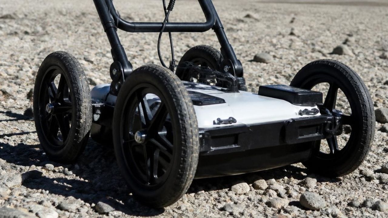
Government agencies executing infrastructure projects face a persistent challenge: subsurface utilities remain hidden beneath construction sites where incomplete records, private ownership gaps, and multi-era installations create risk at every excavation. Ground penetrating radar utility mapping addresses this by providing verified subsurface data that supports planning and design across transportation corridors, airport facilities, and educational campuses where traditional locating methods fall short.
Here’s what we break down: how GPR technology works, why 811 leaves private utilities unmarked, the financial case for subsurface utility engineering, and how transportation, airport, and school projects put this data to use. Public construction spending reached $541.2 billion in May 2026, a surge that raises the stakes of inaccurate utility information and makes GPR utility mapping an operational necessity for agencies managing aging infrastructure.
Key Takeaways
- GPR utility mapping delivers QL-B subsurface data that fills the 811 coverage gap for private utilities on government-owned property.
- Public construction spending reached $541.2 billion in May 2026, driving unprecedented demand for accurate utility location services.
- Utility strikes cost $30 billion annually in societal impacts, with projects using subsurface utility engineering saving $4.62 per dollar spent.
- Airport and transportation projects require specialized utility mapping due to fuel hydrant systems, airfield lighting circuits, and FAA compliance requirements.
- Educational campuses face layered infrastructure complexity, with 60% of underground lines classified as private and unmarked by 811.
GPR Utility Mapping Identifies Subsurface Utilities Through Non-Destructive Scanning
GPR utility mapping identifies subsurface utilities through non-destructive electromagnetic waves that penetrate soil and reflect signals from buried objects, delivering horizontal location data classified as Quality Level B under ASCE 38-22. GPR detects metallic and non-metallic lines, including PVC water pipes, concrete storm drains, and fiber optic conduits, that electromagnetic locating alone cannot reliably identify. The resulting field-verified maps replace unreliable record drawings and protect crews from striking lines that 811 does not mark.
GPR Complements Traditional Electromagnetic Locating Methods
GPR complements electromagnetic locating by detecting non-conductive utilities and verifying the position of lines found through traditional methods, since electromagnetic equipment traces current-carrying conductors and metallic pipes while GPR identifies PVC, concrete, and abandoned conduits that carry no signal. Combined, the two methods reduce blind spots inherent in single-technology investigations.
Field crews pair GPR and electromagnetic data with survey-grade GPS using RTK positioning to establish accurate coordinates. Processors convert field data into utility maps delivered in digital formats that integrate with agency GIS or CAD systems, creating a permanent asset for capital planning and emergency response.
811 Call-Before-You-Dig Services Leave a Private Utility Gap
811 call-before-you-dig services mark only public utility company lines, typically stopping at the meter, service connection, or property boundary. Everything on the campus side is private infrastructure outside 811 scope, leaving government facilities, military installations, and schools with substantial unmarked networks; private lines represent more than 60% of all underground infrastructure nationwide.
Calling 811 remains required but insufficient to prevent strikes on government-owned property. Airport facilities, municipal campuses, and military installations operate outside One-Call coverage, requiring specialized subsurface utility engineering before excavation begins.
ASCE 38-22 Defines Four Utility Data Quality Levels
ASCE 38-22 establishes the Subsurface Utility Engineering framework with four Quality Levels that communicate how utility data was collected and how reliable it is. Agencies specifying the required Quality Level in procurement documents establish the mechanism to manage subsurface risk.
| Quality Level | Data Collection Method | Reliability / Accuracy |
| QL-D | Existing records, oral recollections, or One-Call markings | Unreliable; highest risk |
| QL-C | QL-D data correlated with surveyed above-ground features | Adds professional judgment; limited verification |
| QL-B | Non-destructive surface geophysical methods (GPR, electromagnetic) | Field-verified horizontal location |
| QL-A | Physical exposure via non-destructive excavation | Highest accuracy: 0.1 ft vertical / 0.2 ft horizontal |
GPR Utility Mapping Protects Public Infrastructure Investments
GPR utility mapping protects public infrastructure investments by identifying subsurface conflicts during planning and design, when changes cost far less than field modifications. Projects without proper utility investigation experience 29-40% higher costs and 9% longer schedules than those using systematic verification, and strikes create disruptions beyond direct repair costs, including service interruptions and regulatory violations for agencies already facing scrutiny over budget and safety performance.
Public Works and Education Spending Drives Utility Mapping Demand
Public construction spending reached $541.2 billion (seasonally adjusted annual rate) in May 2026, up from $503.6 billion in December 2024, with highway and street construction accounting for $150.6 billion and educational construction reaching $113.4 billion. The Infrastructure Investment and Jobs Act provides roughly $350 billion for federal highway programs through fiscal year 2026, doubling pre-IIJA investment and concentrating excavation on rights-of-way with decades of layered installations.
Underground Utility Strikes Carry Significant Societal and Financial Costs
Underground utility strikes generate $30 billion per year in total societal costs nationwide. A single strike costs $4,000 to $56,000 in direct repairs, but indirect and social costs multiply by 29:1 once traffic delays, business interruptions, and emergency response are factored in. The Common Ground Alliance logged 196,977 unique damage reports in 2024, with its damage index rising from 94.0 in 2023 to 96.7.
An estimated 400,000 to 800,000 strikes occur annually, with telecommunications facilities representing 46% of damaged assets and natural gas 24%. More than 60-75% of incidents trace back to weak planning or poor field procedures, including failed verification of subsurface conditions. Projects using subsurface utility engineering save $4.62 for every dollar spent.
Private Utilities on Campus Properties Require Specialized Locating
Private utility lines concentrate on government campuses where building-to-building systems, including campus electrical distribution, internal water and sewer, fire suppression, irrigation, and inter-building communications cabling, operate entirely outside 811 coverage. Municipal campuses such as city halls, public works yards, and water treatment plants contain mixed-era buildings with private distribution systems shaped by decades of modifications never registered with 811.
GPR Utility Mapping Supports Transportation and Airport Projects
GPR utility mapping supports transportation and airport projects by identifying high-consequence utility systems before excavation begins in operational environments where interruptions create safety hazards. Airport subsurface environments contain fuel hydrant systems, airfield lighting circuits, FAA communications networks, and emergency power distribution concentrated in corridors where construction must proceed without disrupting flight operations, and federal IIJA and FAA funding has doubled airport infrastructure investment during the authorization period.
Airport Subsurface Environments Carry Unique Complexity and Risk
Airport subsurface environments concentrate multiple high-consequence systems within constrained corridors where operations continue during construction. Striking a fuel hydrant line creates fire, explosion, and contamination risk along with immediate airfield closure, and damage to airfield lighting disrupts flight operations and triggers FAA compliance failures. At Memphis International Airport, Concourse B modernization revealed inaccurately documented sewer lines, forcing an accelerated seven-day schedule to resolve conflicts with fuel lines.
Federal Funding Through FAA and IIJA Drives Airport Projects
The Airport Infrastructure Grant program provided $14.5 billion over FY2022-2026, and the Airport Terminal Program added $5 billion, for combined federal airport investment averaging roughly $6.5 billion annually. This funding drives simultaneous expansion programs at major hubs, including LAX, JFK, and O’Hare, with AIP funding covering 90% of eligible costs.
Subsurface Utility Engineering Delivers Measurable Transportation ROI
The FHWA-Purdue University study of 71 transportation projects documented $4.62 saved for every $1.00 spent on subsurface utility engineering, with SUE costs under 0.5% of total construction costs producing 1.9% in savings. One North Carolina DOT project achieved a $206-to-$1 return, with only 3 of 71 projects showing negative returns, and Florida DOT reported a benefit ratio of roughly 3:1 across its program.
GPR Utility Mapping Addresses Educational Campus Infrastructure Complexity
GPR utility mapping addresses subsurface complexity on educational campuses, where layered infrastructure reflects decades of renovations performed without updating master utility records. The average U.S. school building is now a half-century old, with 70% of California classrooms exceeding 25 years and incomplete as-built documentation. Educational construction reached $113.4 billion in May 2026, the second-largest category of public construction spending.
Schools and Universities Face Layered Subsurface Infrastructure Challenges
As-built records are incomplete, inaccurate, or nonexistent for many buildings from mid-century expansion periods, and utility repairs are often performed without updating master maps. The Department of Energy estimates that 36,000 schools, roughly one-third of the nation’s K-12 buildings, need HVAC replacement, work that requires new underground mechanical piping and electrical upgrades intersecting existing buried utilities.
Regulatory and Liability Factors Drive Utility Locating in Schools
Gas line strikes during school construction can trigger evacuations, closures, and community alarm. Water main strikes disrupt operations for thousands of students and staff, and electrical cable strikes near occupied buildings create immediate life-safety hazards. A strike resulting in a gas leak, water main break, or electrical contact creates liability exposure reaching the district’s board, administration, and contractors.
OSHA’s excavation standard 29 CFR 1926 Subpart P requires employers to determine the estimated location of utility installations before opening an excavation, applying to school construction projects regardless of size.
GPR Supports Campus Facility Management and Capital Planning
Higher education construction accounted for $30.74 billion in 2024, while K-12 construction reached an estimated $89 billion in 2025-2026, a market projected to grow from $61.80 billion to $102.60 billion by 2034. This sustained investment creates ongoing demand for accurate subsurface data supporting pre-design investigation, GIS integration, and emergency response, letting campus teams respond to leaks and outages faster.
Sound Practices Integrate GPR Utility Mapping With Asset Management and GIS
Sound practices for integrating GPR utility mapping with asset management systems start with georeferenced field data collection protocols that align with existing GIS datum and coordinate systems. Providers deliver data in formats compatible with municipal GIS platforms, including CAD files, KML for Google Earth, and GIS-compatible shapefiles that import directly into ArcGIS, turning field-verified positions into permanent assets within the agency’s infrastructure database.
GPR Data Deliverables Match Municipal GIS and CAD Formats
Deliverables are formatted to match the recipient agency’s existing CAD and GIS infrastructure, typically including DWG files with utilities separated by type on discrete layers. KML files support Google Earth visualization for field crews on mobile devices, while shapefiles support direct import into GIS platforms that manage municipal infrastructure assets. Survey-grade GPS coordinates establish accurate georeferencing aligned with surface features and design elements.
Deliverable specifications should document the coordinate system, datum, and accuracy standard applied during collection, along with metadata on collection date, equipment specifications, and quality level classification.
Three-Dimensional Utility Modeling Supports Public Works Planning
Three-dimensional utility modeling supports clash detection during design by establishing volumetric representations of existing infrastructure that designers compare against proposed improvements. ASCE 38-22 now includes guidance on collecting depth measurements that enable 3D utility models, moving beyond horizontal location to capture vertical positioning that integrates with BIM workflows.
Municipalities maintaining 3D utility models gain the ability to analyze subsurface capacity in congested corridors where additional installations must fit within limited space.
Accurate Subsurface Mapping Supports Maintenance and Emergency Response
Accurate subsurface mapping lets maintenance teams respond to failures without redundant investigation or exploratory excavation that extends outage duration, and lets capital planning teams prioritize replacement projects based on condition, remaining service life, and proximity to other assets needing near-term intervention.
GPR Utility Mapping Reduces Risk and Improves Project Outcomes
GPR utility mapping reduces risk by identifying subsurface conflicts during planning and design, when modifications cost far less than field changes. Teams working with verified utility positions avoid delays from unexpected conflicts, reduce claims tied to differing site conditions, and maintain schedule performance without accelerated work. Financial benefits extend beyond direct cost avoidance to lower insurance premiums, stronger contractor bidding confidence, and protected agency reputation.
GPR and SUE Lower Construction Costs and Schedule Delays
Using GPR and subsurface utility engineering lowers construction costs by eliminating unplanned utility relocations that require design revisions, added materials, and extended mobilization. FHWA has cited total returns in the $4-$20 range when risk-reduction benefits are included, and Florida DOT reported a benefit ratio of roughly 3:1, with individual projects showing returns exceeding 200:1 when avoided catastrophic strikes are factored in.
Utility conflicts remain the primary cause of highway construction delays despite decades of damage prevention effort. Teams forced to resolve conflicts after ground disturbance begins often shift to accelerated seven-day schedules that raise labor costs.
Agencies Specify Utility Quality Levels in Procurement to Manage Risk
Agencies specify utility quality levels in procurement documents by referencing ASCE 38-22 and defining the minimum acceptable Quality Level for each project phase. Design-phase investigations typically require QL-B through surface geophysical methods, while construction-phase verification may require QL-A through non-destructive excavation at critical conflict points.
FAA Advisory Circular AC 150/5370-2G requires Construction Safety and Phasing Plans to include procedures for locating and protecting existing underground utilities.
Common Utility Strike Causes and How GPR Helps Prevent Them
Telecommunications facilities are damaged most often, at 46%, followed by natural gas at 24%, per Common Ground Alliance reporting, with backhoes and trenchers involved in 33% of incidents and hand tools in 26%. More than 60-75% of incidents trace back to weak planning, including missing 811 tickets, outdated maps, and missed markings.
GPR helps prevent these strikes by providing field-verified positions that replace unreliable records, identifying lines electromagnetic locating cannot detect, and establishing horizontal locations that let crews maintain safe clearance from buried assets.
Procuring GPR Utility Mapping Services Involves Key Considerations
Procuring GPR utility mapping services involves evaluating vendor qualifications, defining deliverable specifications that align with agency GIS systems, and establishing quality control procedures that verify field accuracy. Agencies must balance cost against the risk exposure created by inadequate subsurface investigation. Procurement documents should specify required Quality Level, coordinate system compatibility, deliverable formats, and turnaround expectations.
Addressing the 811 Coverage Gap in Project Planning and Contracts
Addressing the 811 coverage gap means stating explicitly in project specifications that contractors must perform private utility locating beyond 811 markings on government-owned property. Contract language should clarify that 811 marks only public utility lines to the meter or service connection, leaving private campus infrastructure outside coverage.
Pre-construction meetings should require contractors to demonstrate engagement of qualified private locators using GPR and electromagnetic methods before mobilization. Planning timelines should allow several weeks for private utility investigation, depending on site size and complexity.
Choosing Between GPR, Electromagnetic Locating, and Vacuum Excavation
The choice between GPR, electromagnetic locating, and vacuum excavation depends on required Quality Level, utility material, and project risk tolerance.
| Method | What It Detects | Data Quality Level | Ideal Use |
| Electromagnetic Locating | Conductive utilities: metallic water lines, gas pipes, active electrical cable | Varies by verification method | Fast tracing of conductive lines |
| GPR | Non-metallic utilities: PVC, concrete, fiber optic, abandoned conduits | QL-B horizontal location | Filling gaps electromagnetic signals miss |
| Vacuum Excavation (Potholing) | Physical exposure confirming material, size, and depth | QL-A: 0.1 ft vertical / 0.2 ft horizontal | Verifying critical conflict points |
Evaluating Vendor Qualifications, Standards Compliance, and Deliverables
Public agencies should evaluate vendor qualifications by verifying technician certifications, equipment calibration records, and a project portfolio showing experience with similar facility types, and confirm familiarity with ASCE 38-22 through sample deliverables. Standards compliance review should confirm vendors use survey-grade GPS for georeferencing and maintain quality control procedures, with deliverable specifications requiring formats compatible with agency GIS platforms.
GPR Utility Mapping for Government and Public Works Projects as a Strategic Infrastructure Asset
GPR utility mapping functions as a strategic infrastructure asset extending value beyond individual project support to long-term capital planning, emergency response coordination, and institutional knowledge preservation. Agencies investing in systematic subsurface mapping programs accumulate verified utility data, reducing investigation costs on future projects and protecting against documentation losses when experienced facilities staff retire.
The convergence of historic infrastructure investment, aging facility portfolios, and rising utility strike consequences makes accurate subsurface data essential for agencies managing public works, transportation corridors, and educational campuses. Organizations that integrate GPR utility mapping into standard practice protect budgets, maintain schedules, and demonstrate the stewardship stakeholders expect.
Schedule GPR Utility Mapping With Util-Locate
Since 2001, Util-Locate has delivered ASCE-compliant subsurface utility data to government agencies, school districts, transportation authorities, and airport operators across California and Arizona. Our certified technicians combine GPR, electromagnetic locating, and vacuum excavation to give your team QL-B and QL-A data for safe, on-schedule excavation, backed by a 97% accuracy rate and 24/7 emergency response.
Call Util-Locate at 1-888-885-6228 or request a quote online to schedule GPR utility mapping for your next public works, transportation, or campus project.
