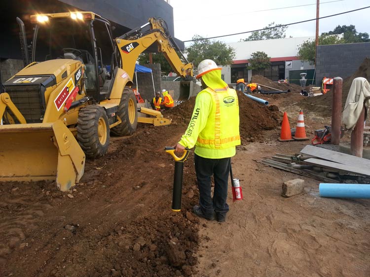
What Exactly is GPR and Why Do I Need It?

What Exactly is GPR and Why Do I Need It?

Digging up the ground is so much work and takes so much time. Locating where utilities and structures are underground before digging would make the excavation so much easier.

This is why utility locators, construction companies, and archeologists use Ground Penetrating Radar technology.

Ground penetrating radar technology, commonly known as GPR, is a method of capturing images underneath the ground through the use of electromagnetic energy. As such, GPR technology makes subsurface mapping and locating objects so much easier.

These services have many advantages, from reducing time and effort in locating any object underground to minimizing possible accidents from damaged utility lines.

How Does GPR Work?

A ground penetrating radar uses a transmitter to send signals in the form of radio waves in the 1 to 1000 MHz frequency range into the soil, concrete, or another material.

When these signals hit any object in the soil or concrete, they bounce back, reflecting, refracting, and scattering. It uses an antenna to receive and record these reflected signals, and from there the device calculates the depth and position of an object under the ground.

Aside from measuring depth and location, a ground penetrating radar GPR can also detect material property, size, and shape. This makes generating 2D or even 3D images of objects possible.

Advantages of Ground Penetrating Radar Technologies

As mentioned earlier on in the article, such imaging technologies can detect a wide range of materials buried beneath the surface without damaging the surface.

Compared to calling 811 or using old utility maps, this type of radar can help determine where utility lines are right when you need to know it. It therefore helps eliminate the need for additional allowances in distance due to human error or movement in utility positions due to temperature changes.

Unlike other methods of subsurface mapping, GPR can characterize subsurface properties and identify what kinds of compounds are underground in any given infrastructure. It does so by gathering a wide set of data which makes subsurface geo-referencing possible.

What’s more, GPR’s real-time data features means it’s useful for detecting forgotten or undiscovered items, underground facilities, and other types of surveys.

Utility Mapping Applications

This imaging method can find variances in the return signals caused by different electric charges depending on the substance detected. These services are especially useful for mapping structures since excavators can accurately plan around whatever is underneath the ground.

Such data is then used by excavators to avoid digging accidents, or even by archaeologists to dig up promising artifacts.

GPR, detects metal and nonmetal materials such as plastic, concrete, wood, stone, etc. This makes it useful for detecting electric wires and cables, gas and water pipes, as well as tree roots, stone slabs, and man-made underground fixtures or architecture.

How to Make GPR Data as Accurate as Possible

While there are tons of advantages to using a ground penetrating radar, such services work best under certain environmental factors. To get the most accurate, real-time data from ground penetrating radar services, make sure that these factors are in place.

Soil Properties

One of the conditions needed for GPR to work well is for the surface to be relatively flat; this is necessary to ensure optimum penetration of electromagnetic energy which also results in the most accurate subsurface detection. This means GPR works really well on concrete as opposed to uneven terrain.

Because GPR relies on materials reflecting or refracting signal, anything different from the scanned material can obstruct the reading of the device and limit its extensive scanning capacity.

Depth

Another factor to consider when using GPR is the depth of the object or utility you’re trying to locate. Soil is naturally resistant to electricity; this makes scanning objects more and more difficult the deeper it goes into the ground. Depending on the capacity of the device, one may or may not penetrate as deep as 30 meters or 100 feet deep into the ground.

Water Content

The presence of water in the soil or any material found by GPR will also affect how well electromagnetic energy penetrates it because of dielectric permittivity. Dielectric permittivity refers to how conductive the soil or any surface is, which impacts how a GPR device receives the reflected or refracted signal it sends out.

What Is the Difference Between GPR and Seismic Reflection?

Though GPR and Seismic reflection both try to understand subsurface structures or characteristics, GPR uses electromagnetic energy in the form of radio waves whereas seismic reflection uses acoustic energy in the form of seismic waves.

GPR sends out high-frequency radio waves to detect changes in the electrical properties of a surface. Such changes exist when there’s an object made of a different substance than soil or concrete, as scanning can usually detect the varying electrical properties.

Meanwhile, seismic reflections rely on seismic waves hitting things or surfaces and reflecting back. A seismic device then records the surface’s elastic properties and density, both of which impact the signal reflected back.

Because they scan subsurface characteristics differently, GPR is best used for detecting things like artifacts and utilities whereas seismic reflection is best used to map flat surfaces.

Hiring a Professional Team

Ground penetrating radar equipment can cost anywhere from $15,000 to $50,000. This is a hefty investment for a homeowner in need of some utility mapping for a digging project. While you can rent a device for around $1,000 to $2,000 a day, that’s still impractical especially when you are not used to using it and interpreting the data it gives.

The accuracy of any GPR process relies heavily on who uses it. Using GPR incorrectly can lead to a false interpretation which undermines the purpose of utility mapping to begin with.

If your infrastructure project needs scanning and locating expertise, contact Util-Locate! Our team is made up of trained professionals who use GPR to expose all underground utilities for the most efficient utility locating and mapping services. For any questions about utility surveys or penetration projects, call us today!

12 Best Safety Practices During Utility Location

12 Best Safety Practices During Utility Location

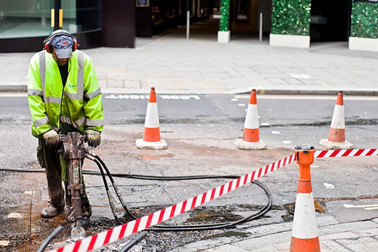
Working outdoors is prone to many safety hazards. This holds especially true for projects like excavation work or utility locating. Digging up the ground where underground lines, cables, and pipes present many dangers, both natural and man-made.

As such, it’s absolutely important to observe the utmost precaution to ensure everyone’s safety and the success of any project. Effective planning involves thorough utility locating, utility infrastructure investigations, damage prevention as well as mitigation measures for issues identified during preliminary surveillance.

Plan Effectively

Every project is unique and will have its own schedule, budget, location, and scope. Depending on these factors, contractors will have to come up with a plan that will please the client while also ensuring the safety and wellbeing of the workers.

But utility locating happens outside where safety hazards abound and circumstances are unpredictable. Therefore, one must prepare contingencies for all possible scenarios that might take place.

Call Before You Dig

An easily avoidable common mistake is accidentally hitting or damaging a utility line. To do so, always call 811 before you dig. This holds true even for utilities projects that may seem simple and straightforward.

811 is the national call number for preventing the unintentional striking of underground utility lines. Pre excavation, call 811 to request help flagging the approximate locations of buried utilities in the area where you plan to excavate.

Create A Utility Map

While you should call 811 before excavation, it’s also good practice to devise a utility map before starting any utility service project. After all, there may be some private utility cables or unknown underground utility lines that 811 is not aware of or their information may be not updated.

To build a utility map, you can use old utility maps as a reference but never use them to guide your excavation. Utility maps need to be updated and creating one right before a new project is the best way to avoid accidents.

Homeowners near your excavation site usually know where their private utility lines are. One can also look for tanks and meters around a property to locate water pipes and electrical or gas lines.

Prevent Cave-Ins

One of the most common accidents experienced by utility locators when doing excavation work or working with underground utilities is collapsed tunnels or cave-ins.

To prevent this, utilities contractors must test the soil composition, as well as design and build structures that will function as support and provide shielding. Testing the soil ahead of time allows them to assess the likelihood of a cave-in whereas support beams can prevent tunnel collapse and shields can protect workers in the event of a cave-in.

Design Walkways and Barriers

No matter how careful excavators are, human error is still a huge risk. Though dropping an object or slipping and falling at home may not result in life-threatening consequences, doing so in a dig site can.

As such, any utility locator or excavator should first set up smooth and non-slippery walkways for workers to securely move about. They must also erect sturdy barriers around the area to prevent people from falling into pits.

Use the Proper Equipment

Excavation projects are no joke. Even with the most experienced utilities workers, most projects can’t be accomplished without the necessary tools.

If you’re a homeowner digging for a one-time project, investing in expensive equipment can be wasteful. Instead, hiring an experienced utility locator who already has such equipment and is experienced in using them to render services is going to be safer and more cost-effective.

These excavators are trained to use equipment such as a ground penetrating radar to ensure survey markings are all recorded accurately.

Prepare Respirators

Dust and dirt are constantly in the air during excavations, which can in turn be hazardous to people’s health. Depending on the utility request, some teams even dig deep enough into the ground that oxygen levels begin to drop. Such lack of oxygen can cause lightheadedness, fatigue, and even fainting.

Before any light digging, workers must wear proper masks. If the project requires excavators to dig deep, workers need respirators or similar devices to help them breathe properly while working. This prevents them from collapsing or feeling sick; it will also help them avoid developing respiratory diseases due to work.

Bring Ear Plugs or Ear Muffs

During excavations, workers are surrounded by noisy equipment. Though this is part of the job, anyone exposed to high levels of noise for prolonged periods can risk ear damage and hearing loss.

Before starting any project, always conduct a noise assessment. If noise levels reach 85 dBA as an 8-hour TWA or more, workers must wear protective PPE like ear plugs or ear muffs.

Educate Workers

When digging, workers use heavy-duty dangerous equipment. Such devices need proper handling; otherwise, they can cause severe injuries while on the job. This is why educating workers is incredibly important. Moreover, workers must also be educated on how to properly use protective gear to ensure their safeties.

As a homeowner or excavation or construction company, it pays to train workers or work with contractors with proper training.

Supervise At All Times

An excavation project can’t just be done willy-nilly. There must be an experienced worksite supervisor who can govern the workers and make sure they all abide by safety protocols and follow the proper operational procedures.

Any compromises in this regard can easily lead to accidents and disaster so insisting on having someone capable at the helm of a project is a non-negotiable.

Put Signs, Reminders, and Warnings

Anyone is bound to forget a thing or two after they’ve been working for hours and days. This is why putting up a sufficient number of signs around the digging area can make a huge difference in disaster prevention.

Though it’s advised to stay at least 18 inches away from a marked underground utility, it’s highly encouraged to dig as far as you can because the mapping is not always accurate. For example, pipes can move due to changes in ground temperature over time.

To account for this reach, make sure to set up the appropriate reminders or warnings before you dig. Doing so in danger zones can boost alertness and vigilance minimizing the chances of accidents. This is also helpful for bystanders and utility owners who may want to help direct the flow of traffic around the utilities site.

Hire Professional Utility Locators

Whether you’re digging to install new underground utilities or doing some landscaping, you always want to observe the safety measures listed above to help protect yourself and everyone else around your worksite.

Accidentally hitting underground utilities can not only cause inconveniences such as water shortage or power interruption, it can also cause fire, serious injury, and possibly even death to the workers involved.

If you’re a property owner and have no experience with utility locating or digging in a utility site, you may not know what to do if you accidentally hit a gas line or a water pipe. Therefore, it’s highly advisable that you leave the job to utility companies or hire professionals who render utility locating services.

Our team is made up of professionals who have been in the utilities industry for years, and we meet all our requests with the utmost care. You can leave your private utility locating and mapping needs to us, so call Util-Locate, your trusted utility locator partner!

5 Reasons to Use a Ground Penetrating Radar (GPR) for Construction Projects

Utility locating services are a necessary step when preparing for any construction project, because they make construction safer and more efficient. Ground penetrating radar is a highly effective method that lets you know about any features below ground, from utility lines to septic tanks. It's always better to learn about your building site before getting a project started, to prevent any potential issues. With the help of ground penetrating radar, construction teams can prepare for underground obstacles and avoid costly mistakes. What Is GPR? Ground penetrating radar is a non-destructive method for getting images of anything beneath the ground, including voids. It uses radio waves to indicate the locations of objects below the surface. It has a wide variety of applications, including scientific studies, archaeology, and of course, construction. GPR technology functions by sending radar signals in the direction of a target area, which tells you if there's anything present there. A GRP system will interpret the reflected signals and assemble the data into an image of the object. When a survey is complete, you'll learn the exact locations of the utility lines and be made aware of any other subsurface features. How Does GPR Work? GPR works by using radio waves to locate objects underground. It transmits pulses of energy with a frequency range up to 1000 MHz. When those energy pulses are directed into the ground, objects below the surface reflect that energy and show up on the radar. All GPR systems are equipped with a receiver antenna, to record the reflected waves. Software assembles those reflected GPR signals into a visual, and the results show the size and shape of any object below ground. Each energy pulse returns more data to the receiver about the location and material properties of any items below. GPR equipment uses different frequencies to collect information about various depths and provide different resolution levels. With the help of GPR data, you can learn which areas contain utility lines or other potential obstacles. This method of data collection can detect all kinds of materials, including metal, rock, and PVC. Utility locating experts often start in areas marked for utility lines, but sometimes utility lines aren't where they should be. Other areas of interest include those with distinguishing features like valves. Once surveyors locate an object, they'll cover the area with the GPR cart or radar antenna more than once to get more details on the dimensions and depth of the item. GPR is a cost-effective way to survey an area before building on it, and it will keep you alert to any potential surprises, ranging from unauthorized utility lines to changes in soil composition. Advantages of a Ground Penetrating Radar GPRs provide plenty of advantages, and it's very useful as a non-destructive method of surveying an area before any excavation or building starts. A professional survey from a GPR device arms you with the information you need to make good decisions for your construction site. Here are some of the ways you can benefit from using a GPR on construction projects. 1. Provide a Starting Point The best time to get a GPR survey done is before you even start your project. If you ascertain the locations of underground utilities before you start to build, the process can go much more smoothly. Once you know where important utility lines are located, it's easier to build the rest of the structure around them. In some cases, utility lines may need to be moved before you can complete a construction project. 2. Keep Your Team Members Safe Underground utilities like pipes and wires are potentially dangerous. Cut power lines can electrocute people, and gas lines can cause explosions. The GPR results for your construction site will let you know the exact location of utility lines so you can avoid any unfortunate surprises. You can prioritize safety for your team members by getting professional utility locating services. 3. Avoid Costly Damage Not only are utility lines dangerous, they can also cause significant damage to your site or building materials. Explosions, fires, and floods from cut utility lines can result in a lot of damage to building materials and equipment. Damage prevention is always cheaper than repairs or replacements, so invest in a GPR survey before construction begins. 4. Get More Accurate Results Utility mark outs are made with the best of intentions, but they aren't always accurate. Sometimes they're made using old, out of date records. Instead of relying on provided records, play it safe and get professional utility locating. GPR lets you find the location of any utilities easily and with a 97% accuracy rate up to a depth of 13 feet. This survey method tells you the specific locations of important utility lines. It can even detect a wide range of materials, not just conductive metals. Professional utility locators can also adjust the antenna frequency to detect items at different depths. High frequency radio waves provide higher resolution, giving you the most accurate reading of subterranean obstacles. 5. Discover Potential Obstacles During utility location, people normally have an idea of what to expect and what to look for, like gas and power lines. However, some obstacles might not show up on records, either because they're naturally occurring or they were done unofficially. Without GPR survey, concrete structures and abandoned lines could take you by surprise. Items like tree roots or buried objects can get in the way of your building project, but a GPR technician will alert you to these obstacles before they become a serious problem. GPR systems even let you know about the soil conditions of the building site! How Effective Is GPR? GPR is a useful tool in an arsenal dedicated to figuring out subterranean conditions and obstacles. It's an important part of any construction site preparation. This survey method has an incredible 97% accuracy rate with a penetration depth of 13 feet. What's more, GPR procedures are low-cost, work quickly, and are great for locating important structures below ground without disturbing the soil. It's the best technology available for surveying a site, and it can save you a lot of money by preventing expensive problems. Before you start a project that involves digging into the ground, get professional utility locating services first. Util-Locate uses cutting-edge technology to provide fast and accurate readings for utility line locations. Contact us today to learn more about our services or to schedule an appointment.

Utility locating services is a necessary step when preparing for any construction project because they make construction safer and more efficient. Ground penetrating radar is a highly effective method that lets you know about any features below ground, from utility lines to septic tanks.

It’s always better to learn about your building site before getting a project started, to prevent any potential issues. With the help of ground-penetrating radar, construction teams can prepare for underground obstacles and avoid costly mistakes.

What Is GPR?

Ground penetrating radar is a non-destructive method for getting images of anything beneath the ground, including voids. It uses radio waves to indicate the locations of objects below the surface. It has a wide variety of applications, including scientific studies, archaeology, and of course, construction.

GPR technology functions by sending radar signals in the direction of a target area, which tells you if there’s anything present there. A GRP system will interpret the reflected signals and assemble the data into an image of the object.

When a survey is complete, you’ll learn the exact locations of the utility lines and be made aware of any other subsurface features.

How Does GPR Work?

GPR works by using radio waves to locate objects underground. It transmits pulses of energy with a frequency range up to 1000 MHz. When those energy pulses are directed into the ground, objects below the surface reflect that energy and show up on the radar. All GPR systems are equipped with a receiver antenna, to record the reflected waves.

Software assembles those reflected GPR signals into a visual, and the results show the size and shape of any object below ground. Each energy pulse returns more data to the receiver about the location and material properties of any items below. GPR equipment uses different frequencies to collect information about various depths and provide different resolution levels.

With the help of GPR data, you can learn which areas contain utility lines or other potential obstacles. This method of data collection can detect all kinds of materials, including metal, rock, and PVC.

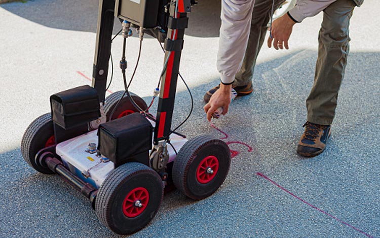
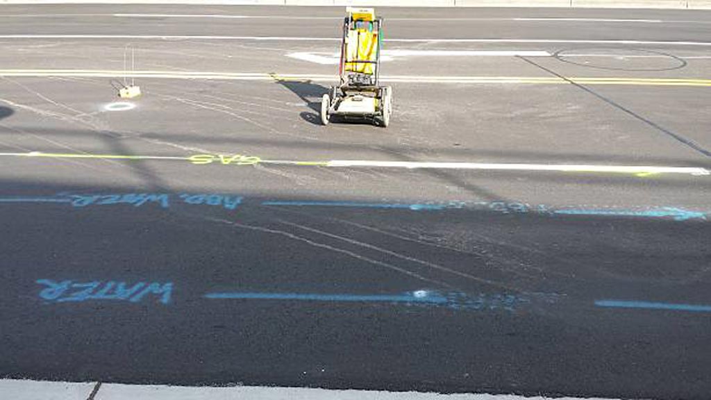
Utility locating experts often start in areas marked for utility lines, but sometimes utility lines aren’t where they should be. Other areas of interest include those with distinguishing features like valves. Once surveyors locate an object, they’ll cover the area with the GPR cart or radar antenna more than once to get more details on the dimensions and depth of the item.

GPR is a cost-effective way to survey an area before building on it, and it will keep you alert to any potential surprises, ranging from unauthorized utility lines to changes in soil composition.

Advantages of a Ground Penetrating Radar

GPRs provides plenty of advantages, and it’s very useful as a non-destructive method of surveying an area before any excavation or building starts. A professional survey from a GPR device arms you with the information you need to make good decisions for your construction site.

Here are some of the ways you can benefit from using a GPR on construction projects.

1. Provide a Starting Point

The best time to get a GPR survey done is before you even start your project. If you ascertain the locations of underground utilities before you start to build, the process can go much more smoothly.

Once you know where important utility lines are located, it’s easier to build the rest of the structure around them. In some cases, utility lines may need to be moved before you can complete a construction project.

2. Keep Your Team Members Safe

Underground utilities like pipes and wires are potentially dangerous. Cut power lines can electrocute people, and gas lines can cause explosions. The GPR results for your construction site will let you know the exact location of utility lines so you can avoid any unfortunate surprises.

You can prioritize safety for your team members by getting professional utility locating services.

3. Avoid Costly Damage

Not only are utility lines dangerous, they can also cause significant damage to your site or building materials. Explosions, fires, and floods from cut utility lines can result in a lot of damage to building materials and equipment.

Damage prevention is always cheaper than repairs or replacements, so invest in a GPR survey before construction begins.

4. Get More Accurate Results

Utility mark outs are made with the best of intentions, but they aren’t always accurate. Sometimes they’re made using old, out-of-date records. Instead of relying on provided records, play it safe and get professional utility locating.

GPR lets you find the location of any utilities easily and with a 97% accuracy rate up to a depth of 13 feet. This survey method tells you the specific locations of important utility lines. It can even detect a wide range of materials, not just conductive metals.

Professional utility locators can also adjust the antenna frequency to detect items at different depths. High-frequency radio waves provide higher resolution, giving you the most accurate reading of subterranean obstacles.

5. Discover Potential Obstacles

During utility location, people normally have an idea of what to expect and what to look for, like gas and power lines. However, some obstacles might not show up on records, either because they’re naturally occurring or they were done unofficially. Without a GPR survey, concrete structures and abandoned lines could take you by surprise.

Items like tree roots or buried objects can get in the way of your building project, but a GPR technician will alert you to these obstacles before they become a serious problem. GPR systems even let you know about the soil conditions of the building site!

How Effective Is GPR?

GPR is a useful tool in an arsenal dedicated to figuring out subterranean conditions and obstacles. It’s an important part of any construction site preparation. This survey method has an incredible 97% accuracy rate with a penetration depth of 13 feet.

What’s more, GPR procedures are low-cost, work quickly, and are great for locating important structures below ground without disturbing the soil. It’s the best technology available for surveying a site, and it can save you a lot of money by preventing expensive problems.

Before you start a project that involves digging into the ground, get professional utility locating services first. Util-Locate uses cutting-edge technology to provide fast and accurate readings for utility line locations.

Contact us today to learn more about our services or to schedule an appointment.

Underground Locating: 9 Common Misconceptions Every Excavator Should Know

Trusted Utility Locating Services

Key Takeaways

  • Underground locating mark outs are not always accurate — even with modern detection technologies, marks can be off by inches or miss lines entirely.
  • Skipping a private locate, relying on old utility maps, or assuming utility depth are three of the most common — and costly — misconceptions about underground utility detection.
  • Ground Penetrating Radar is a powerful tool but not a universal solution; soil conditions, depth limits, and operator interpretation all affect what GPR can find.
  • Abandoned lines, unmarked private utilities, and seemingly empty lots all carry hidden risk — every excavation should start with a fresh, professionally performed locate.
  • The excavator carries ultimate liability for utility strikes regardless of whether 811 was called; verification is the contractor’s responsibility, not the utility company’s.

Underground locating is one of the most misunderstood safety disciplines in construction. Property owners and inexperienced contractors regularly act on incorrect assumptions — that mark outs are always accurate, that 811 alone is sufficient, that GPR catches everything, that abandoned lines are safe — and each assumption sets up a possible utility strike. Every year, the U.S. construction industry absorbs billions of dollars in damages from strikes that better understanding of locating fundamentals would have prevented.

Here’s what we break down: nine common misconceptions about underground locating that lead directly to expensive strikes, plus the safe digging practices that actually work. Util-Locate has performed utility locating services across California and Arizona since 2001, and the same myths come up on site after site — usually with the same outcomes when they go unaddressed.

Underground Locating Myths About Marks, Maps, and Depth

Most of the costliest misconceptions involve what crews believe about the marks themselves, the maps they trust, and the depth at which utilities are assumed to sit. Each of the following beliefs leads to confident digging — and to strikes.

Myth 1: All utility mark outs are accurate

Mark outs are often inaccurate. Whenever excavation work is happening, every crew should proceed with caution around marked lines. Marks may be based purely on outdated records, and even marks placed with modern locating technologies have known limitations. Instrument readings shift with soil conditions, depth, and the operator’s interpretation of signal patterns.

The practical approach is to treat marked lines as approximate guides, not exact boundaries. Stay five to ten feet away from any marked line when committing to a drilling or trenching location, and remember that a single mark may represent one cable or a bundle of pipes and cables running together.

Myth 2: Utility depths can be assumed or estimated

Depth assumptions are dangerous. Lines shift and settle over time, and any surface mark generally indicates horizontal position only — not vertical depth. Vacuum excavation or hydro excavation, which physically exposes the utility, is the only way to confirm exact depth before equipment makes contact. Test holes dug ahead of major excavation give crews a verified depth reading at the points that matter most.

Myth 3: Utility mapping only needs to be done once

Underground utility detection should happen before every excavation, not just the first one. Lines shift over time, depths change with settling soil, and new utilities are added to a site constantly. Skipping a locate because the property was mapped years ago is a textbook way to strike a recently installed gas line or fiber duct. Locating is a recurring step, not a one-time check.

Myth 4: An old map is good enough

Underground utility mapping is a continuous process, and maps go out of date quickly. If a map is more than five years old, it should be treated as a starting reference, not as ground truth. A current location survey before any utility services project is the standard of care for responsible excavation. Mergers and acquisitions between utility companies, infrastructure upgrades, and routine repair and service work all introduce changes that older maps will not reflect.

Underground Locating Myths About Risk and Responsibility

The second category of myths is about who bears the risk of a strike and what level of protection various services actually provide.

Myth 5: I can dig in a spot without hiring utility locators

The absence of visible utility marks does not mean the area is free of buried lines — it usually just means the area has never been located. Every lot, especially older or previously developed parcels, can contain unmapped infrastructure. Before digging, a property owner or contractor should ask neighbors about utility history, inspect the area for signs of underground activity (repaired pavement, disturbed soil, utility boxes, exposed wires or pipes, electric power poles nearby), and ideally bring in a professional locating service to confirm what’s beneath the surface.

Myth 6: Utility strikes won’t happen to me

The costliest myth is exemption. Just because a contractor or homeowner has never struck a line before does not mean it cannot happen. The Common Ground Alliance’s annual Damage Information Reporting Tool (DIRT) data shows hundreds of thousands of preventable utility strikes in the U.S. every year, with most occurring on projects where the operator believed their site was low-risk. Statistical exemption is not a real concept; preparation is the only protection.

Myth 7: 811 is liable for accidents

Calling 811 does not transfer liability. The 811 hotline is a one-call service that coordinates with local public utility companies and dispatches their 811 marks, but the excavator remains responsible for verifying every mark before digging. When a strike happens, the cost falls on the operator who damaged the line — not on 811, not on the utility company that placed the mark. The Enhanced Positive Response process gives excavators confirmation that public utilities have responded to a locate request, but it does not shift legal responsibility for the strike itself.

Underground Locating Misconceptions About Technology and Abandoned Lines

The final two myths involve how excavators think about the equipment used to find utilities and about lines that appear to be out of service.

Myth 8: Ground Penetrating Radar finds every underground utility

Ground Penetrating Radar (GPR) is a powerful detection tool, but it is not a universal solution. GPR sends geophysical radar pulses into the ground and reads the reflections that bounce back from subsurface features. The technology works extraordinarily well in dry, sandy soils where signal penetration is strong, but it loses depth in wet or clay-heavy ground, and any reading requires skilled interpretation. Our Ground Penetrating Radar service pairs GPR with electromagnetic profiling locators, radio frequency pipe locators, Magnetic Resonators, locate wands, and vacuum excavation to fill the gaps that GPR alone cannot cover. No single piece of locating equipment finds every underground utility.

Myth 9: Abandoned lines don’t need to be considered

Never assume an abandoned line is safe. Lines that appear dormant can still be live at one end, can carry residual fuel or fluid, and can mask the position of newer active lines running parallel. Abandoned lines have been the source of explosions, contamination, and major project shutdowns when excavation crews treated them as harmless. The right approach is to mark every line found during a locate — active or apparently abandoned — and verify status through utility records and physical inspection before any digging.

Safe Digging Practices to Avoid Underground Strikes

Beyond debunking myths, professional excavation depends on a consistent set of safety practices on every job. The Common Ground Alliance and OSHA standards both reinforce these procedures.

Call 811 at least three business days before digging. The 811 hotline is the federally assigned one-call service that notifies local public utility systems of an upcoming dig. Member utilities then dispatch crews to mark their public lines up to the meter or service point. The call is free and required by state law in most jurisdictions.

Pair the 811 call with a private utility locate. 811 marks public utilities only. Private lines — irrigation, landscape lighting, septic systems, garden sprinkler systems, self-installed home filtration systems, propane lines, sewer lines, security wiring — are the property owner’s responsibility to identify. A professional private locator handles those.

Respect tolerance zones. Even with all marks in place, mechanical excavation inside the tolerance zone (commonly 18 to 24 inches on either side of a mark) should be replaced with hand digging, hydro excavation, or vacuum excavation. The tolerance zone is the practical buffer that absorbs locating-tool margin of error.

Follow standard utility marking colors. Red for electric, yellow for gas, orange for telecom, blue for water, green for sewer, with additional colors for private utilities. Every excavation crew member should be trained to read these colors and pipeline markers correctly.

Document everything. Photograph the marks, save the locate ticket, record the date and time of the call, and keep utility records on file for the duration of the project. Documentation supports compliance audits, insurance claims, and any post-strike legal review.

Use modern detection technology. GPR scanning, electromagnetic profiling locators, radio frequency pipe locators, Cable Avoidance Tools, locate wands, field mapping instruments, GIS mapping services, and digital X-Ray Imaging all play a role on modern sites. The right tool depends on the line type and conditions; a professional locator brings the full stack.

Hiring a Professional Underground Locating Service

For very small, low-risk digging projects on simple properties, a careful homeowner with an 811 call and a clear understanding of marking conventions may be able to proceed safely. For anything beyond that — a fence installation, a sprinkler system overhaul, a pool excavation, concrete inspection on a slab, or a fence post in a corner where utility history is unclear — hiring a professional locating service is the responsible choice.

A professional crew brings calibrated equipment that consumer locators cannot match, trained interpretation of complex signal environments, full documentation of findings (including facility documentation, path marking capabilities, and GPS utility mapping deliverables), and liability protection that DIY locating cannot replicate. The cost of locating is a fraction of the cost of even a small strike, and the documentation produced supports the project through completion.

Util-Locate runs a private locating workflow on every job, with documentation delivered in PDF, CAD, and KML formats. Our certified technicians work to ASCE-compliant standards and have served Southern California, the San Francisco Bay Area, and Arizona for more than two decades. Emerging tools like Digital twins of underground infrastructure are starting to extend what a locating deliverable can support across the full project lifecycle.

Schedule a Util-Locate Service Before You Dig

Every project on private property has lines that an old map or an 811 mark alone will miss. The only reliable way to dig safely is to combine the 811 call with a professional private locate that verifies every utility on site. Util-Locate has served homeowners, contractors, and commercial property owners across Los Angeles, San Diego, Orange County, Riverside, San Bernardino, Ventura County, and the San Francisco Bay Area since 2001.

Call 1-888-885-6228 to speak with a locating specialist, or request a quote for your next project. We respond 24/7 for both routine and emergency locates, and every job comes with the documentation you need to protect yourself from utility damage liability.

Frequently Asked Questions

Are 811 marks always accurate?

No. 811 marks indicate the approximate position of public utilities up to the meter or service point, but they’re not guaranteed to be precise. Marks can be off by inches, can drift if applied to soft surfaces, and can be incomplete if utility records are outdated. Treat every mark as an approximate guide, respect the tolerance zone, and verify critical line positions through vacuum excavation when project depth or proximity to lines demands certainty.

Does an old utility map work for a new project?

If a utility map is more than five years old, treat it as a reference, not as authoritative documentation. Underground infrastructure changes constantly — new utilities get installed, existing lines settle, and recorded depths drift. A fresh underground locating sweep before each project is the standard of care, even on properties that were mapped recently. Mergers and acquisitions among utility companies and routine repair and service work also introduce changes that older maps will not reflect.

Can Ground Penetrating Radar find every underground utility?

GPR is a strong detection tool but has real limits. Wet or clay-heavy soil attenuates the signal and reduces effective depth. Some non-conductive lines blend into background noise without clean reflection signatures. GPR is most effective when paired with EM locating, magnetic locators, and vacuum excavation verification on critical lines. No single technology can locate every utility on every site.

Is the excavator liable for a utility strike if 811 was called?

Yes. The 811 hotline is a notification service, not a guarantee. Once the 811 marks are placed, the excavator is responsible for verifying them and respecting the tolerance zone during digging. If a marked line is struck, the cost of repair and any third-party damages typically falls on the excavator who caused the strike — not on 811 or the public utility company that placed the mark.

What’s the difference between 811 and a private utility locator?

811 is a free public notification service that coordinates with public utility companies to mark only their own lines, up to the meter or service point. A private utility locator is a paid professional service that maps everything past that point — irrigation, landscape lighting, septic systems, propane gas lines, sewer lines, communication lines, and any other private utility on the property. Most projects need both: 811 for public coverage, plus a private locate for everything else.

Utility Potholing for Small Projects: Better Safe Than Sorry

why utility potholing is essential

Thanks to modern excavating tools and methods, i.e., air and hydro vacuuming excavation, utility potholing became the new and safer strategy prior to the start of home and other construction projects.

Digging used to be the standard when checking underground utility lines and performing directional drilling work, but it had many disadvantages. It is prone to damages—of the actual lines, other pipes, bedding, and anything else that a shovel or backhoe will hit.

Keep reading below to find out more about what utility potholing is and why it’s a safer option for small projects.

The Importance of Utility Potholing in Home and Building Projects

What Does Potholing Mean?

Potholing uses vacuum excavators, which are portable pressurized units that use water or air to help locate subsurface lines and obstructions in and around a bore path. It was originally used to clean septic tanks and car wash pits and remove slurry from drilling projects.

Throughout the years, contraction services have used it as a non-destructive and visual confirmation technique in checking and exposing underground utility lines prior to proceeding with building projects.

What Is Utility Potholing?

Utility potholing is a method used to gather ocular information on an infrastructure project’s underground using vacuum excavators with pressurized air or water. It involves digging a 6-12 inches deep hole to determine:

  • The presence and position of buried utility lines (underground utility locating)
  • The type/s of underground utilities
  • Correct drilling and sewer depth
  • Signs of damage to existing utilities (electrical or water)

What Are the Benefits of Utility Potholing?

Excavation potholing, as the practice is sometimes  called, is a time-saving and economical practice that aids in locating significant underground beds or sewer in directional drilling, horizontal directional drilling, and utility engineering. It also prevents blind digging and, later on:

  • Damage to underground utility lines
  • Life-threatening accidents
  • Electrical service interruptions and outages
  • Building project delays
  • Equipment damages
  • Spending on unnecessary repair services
  • Contractor fines and liability issues

Utility potholing ensures overall construction site safety. Rather than relying solely on utility locating maps and charts, which can be outdated, contractors are able to get to see first hand the situation underneath with the use of this self contained practice.

How Does Utility Potholing Work?

Both air and water can be used in utility potholing. They are pressurized to move ground contents quickly for a better view of buried utilities.

So, do you use air or water?

The answer depends on the nature of the construction project you’re dealing with. But, hydro vacuum excavation is more frequently recommended because air excavation doesn’t get rid of spoil, which ends up demanding more time and money to clean up at the end of the day.

How Does Hydro Excavation Work?

To give you an overview of the utility locating process, here is a general step-by-step process of hydrovac excavation:

  1. A piece of hydro excavation equipment or truck is used to put high pressure on its water content to break through the soil, cement, clay, grass, or compound surface and expose existing utilities underneath. Note: Safety practices encourage a test hydro excavation run first using a low pressure on a shallow depth. This is an add-on safety measure to prevent damage to underground utilities.
  2. Then, the slurry or hydrovac waste containing the broken-down soil is lifted up using a vacuum and transferred to and stored in a holding tank. Now, there are two types of vacuum that can be used for hydro excavation. One is a fan blower and the other is a positive displacement blower. The former is more commonly used in construction and line installation services because it is cheaper and can vacuum up soil in large amounts.
  3. The entire process is a utility locator that, once done, gives a good view of the buried pipes and tubes. What follows depends on the nature of the project, e.g., new line installation, pipe repair, pole setting, etc. Whether the removed slurry is returned and spread back on the dig site, incorporated as fill material, or disposed of at a liquid waste facility depends on local government guidelines and the contractor you’re working with.

What Are the Benefits of Hydro Excavation?

The hydro vacuum excavation process ultimately minimizes damages and potential disruptions to existing infrastructure and utilities.

Its other benefits include:

  • Providing a safer and less manual method for utility workers during excavations and construction
  • Minimizing the need for additional equipment, e.g., more shovels, backhoes, or water to remove soil or cement
  • Preventing damage to existing establishments and electrical lines through a controlled way of excavating
  • Limiting congestion in the construction work area as the truck can be situated at a distance and perform its function via a hose line

Are There Other Applications of Hydro Vacuum Excavation in Construction?

Apart from potholing, the hydrovac process can also be used when:

  • Removing debris from drainages and manholes
  • Excavating narrow streets, narrow trenches, planting strips, and limited-space yards
  • The weather is freezing
  • Pole drilling and setting
  • Locating community or household sewer
  • Installing a new line (electricity, water, telecommunication, etc) to a residential or business area

Contact Us for Utility Locating Services in Southern California

Utility potholing comes with advantages that go beyond giving a look into a project’s underground utilities situation. It’s a method that helps ensure workplace safety, a smooth flow of repair services, prevents ground damage, and allows for proper installation of line poles.

Opting to do it prior to the start of a construction or line project, big or small, won’t ever go wrong and will leave you with no regrets later on.

If you have a building or line project on hand and are looking for reliable services, Util-Locate specializes in mapping, CCTV, ground-penetrating radar, and underground utility locating services. Our company has been around since 2001 providing cost-effective solutions on residential and commercial utilities to both professional clients and homeowners.

Contact us today at (714) 492-1380 or leave us a message to place your inquiries about our services or schedule line installation work with our crew at Util-Locate.

Why You Should Still Call a Utility Locator When Revisiting a Project

Utility Locating

Underground utility locating is an extremely important and necessary step for any construction project. Excavations that do not safely locate utilities run the risk of a utility strike, which can result in serious damage and disruption to the local area. Indeed, professional utility locating services can mean the difference between a safe construction site, or a dangerous one. 

When revisiting a project, it may seem unnecessary to hire a utility locating team — but having sub-surface level utilities expertly located near any new excavation is crucial. To learn more about why you should still call a utility locator when revisiting a project and the benefits that come with hydro vacuum excavation, keep reading.

Safety is Assured

The first priority on any construction site is the safety of the crew and the public. This is why all necessary precautions should be taken to create a safe working environment with a crew that is regularly educated about on-site safety measures.

Excavating a construction site can be a dangerous process if it is not carried out with care and modern techniques, such as hydro vacuum excavation. With our underground utility locating services, your construction site will remain a safe and secure place with a minimized risk of accident or injury.

When you’re revisiting a construction project, it’s important to be certain of the locations of the utility lines and other sub-surface level structures that may be under your site. While you may have verified the locations previously, markers left behind could have been affected over time and may no longer have the same accuracy. 

Instead of risking an expensive and dangerous utility strike, you should have a professional team of vacuum excavators return to the site to carry out further excavation. This will provide you with visual verification of the utility line locations and give peace of mind before moving forward to work on the site.

Hiring a professional utility locator also prevents dangerous gas lines from being struck, which have been known to cause explosions and fires. These are incredibly dangerous for anyone in the nearby vicinity, including members of the public, and can cause serious delays to your project. 

On the other hand, while electricity lines are less dangerous when struck, they can still cause major implications for the surrounding community. For instance, if the power at a local hospital is cut, it can cause debilitating problems for doctors and patients. This can, in turn, result in large fines and even community ire while the line is repaired.

Lower Overall Costs

Another reason to locate utilities at a site you are revisiting is to reduce costs. While this may seem counterintuitive given professional fees or already having located utility lines in the past, choosing to call utility locator to the site is bound to save you on money and time, and can serve as a good way to give you peace of mind. 

As mentioned above, a utility strike is a very costly accident that can simply be avoided. While in recent years repairing damaged utility lines have become less expensive, fines imposed by local government councils have risen steeply. Not to mention, if a utility strike affects the local community, you may also have to deal with time-consuming civil lawsuit actions. 

To avoid these unnecessary costs, use utility locating services that will safely and efficiently identify the exact locations of all utility lines or underground structures, such as pipes or other objects that are often not found on utility maps.

It is also much easier to budget for excavation services than for unforeseen and high fines or repair costs. By preparing your budget ahead of time to include hydro vacuum excavation, your project will be able to proceed smoothly and on time without any delay.

Benefits of Choosing Hydro Vacuum Excavation

When it comes to choosing the right utility locating services, it’s important to choose a method that is safe, cost-efficient, and friendly for the environment. Hydro vacuum excavation utilizes low flow and high water pressure to accomplish the dislodging, and is an ideal method for areas with slippery or slick surfaces, or places suffering from soil erosion or instability. 

Aside from this, however, the hydro vacuum excavation method also presents a number of other benefits, such as: 

  1. Minimal Surface Disruption: For any project, excavation can be a time-consuming and disruptive activity to other work taking place on the construction site. Hydro vacuum excavation is the least invasive method and will only minimally affect your construction site. This is especially helpful for anyone who is on a tight deadline or wants to carry out other work on the site while the excavation work is being carried out.
  2. Modern Technology: Alongside our vacuum excavation equipment, our team can utilize RADAR technology, which will make for a more efficient excavation process. Using both utility line maps and Ground Penetrating RADAR, our team can get a better idea of the location of utility lines, how many holes need to be dug, and how deep those holes will be. This information will also provide your project with an accurate price estimation before the actual excavation project begins.
  3. Visual Verification: Perhaps the best advantage of choosing hydro vacuum excavation is how incredibly accurate it is. By visually identifying the locations of all utility lines and other sub-surface level structures, you can rest assured that utility lines will not be struck, and your site will remain a safe environment.

Overall, it is important to use a utility locating service even when you are revisiting a construction project to ensure that locations of lines, pipes, and other underground structures are accurately identified and recorded. The right method is also just as crucial, and the hydro vacuum excavation will help you save time and money while maintaining the highest of safety standards. 

Get Utility Locating Services with Util-Locate

Util-Locate is the #1 utility locating service and underground locator of choice for industry professionals in Southern California. With our professional underground utilities locator, you can be sure that we’ll use state-of-the-art technology that’s the best in the industry. 

If you decide you want to acquire underground utility locating services for your recent project, call Util-Locate at (885) 885-6228 today.