
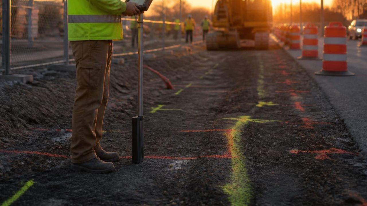
Solar and renewable energy construction involves trenching for collection lines, installing foundations and equipment pads, building access roads, and connecting to existing electrical infrastructure. Every one of those activities intersects with buried utilities. Non-destructive digging methods, including vacuum excavation, private utility locating, ground-penetrating radar, and utility potholing, give project teams physical confirmation of subsurface conditions before mechanical excavation begins. The cost of striking an unknown water line, gas pipe, fiber-optic cable, or electrical conduit reaches well past the repair invoice, since project delays, safety incidents, regulatory penalties, and strained utility-owner relationships all follow.
Below, you will find how each method works, the risks specific to solar and battery storage sites, when vacuum excavation earns its cost, how utility mapping supports construction and long-term operations, and what to look for in a provider. We also break down the damage prevention sequence, from record review and 811 notification through private locating, targeted potholing, and final documentation.
Key Takeaways
- Non-destructive digging confirms utility location and depth before high-risk excavation, reducing reliance on incomplete site records
- Solar and renewable sites often contain public, private, abandoned, or poorly mapped utilities that 811 services may not fully cover
- A layered workflow combines 811 calls, private utility locating, GPR scanning, vacuum excavation, and utility mapping
- Controlled physical exposure and documentation reduce safety incidents, schedule delays, repair costs, and project redesigns
- Providers should be evaluated on service integration, field documentation quality, limitation transparency, and renewable-site coordination experience
Non-Destructive Digging Methods Used on Renewable Energy Sites
Defining Non-Destructive Digging Techniques
Non-destructive digging covers methods that expose or identify underground utilities without mechanical damage. Vacuum excavation, also called utility potholing, uses high-pressure air or water with suction to remove soil and verify the depth, size, and material of a buried line before heavy equipment enters the work zone.
Ground-penetrating radar scans subsurface layers with electromagnetic pulses to identify non-metallic pipe, fiber, rebar, post-tension cable, and voids without breaking the surface. Calling 811 triggers the free national before-you-dig service, which has public utility owners mark registered infrastructure. Private locating covers facility-owned lines, abandoned utilities, and anything missing from public databases.
| Method | What It Detects | Typical Renewable Site Use | Known Limitation |
|---|---|---|---|
| Electromagnetic locating | Metallic pipe, steel gas line, copper communications, energized conduit | Initial sweep of trench routes, pads, and tie-ins | Needs a conductive path and signal access |
| Ground-penetrating radar | PVC and HDPE pipe, fiber, vaults, rebar, post-tension cable, voids | Suspected corridors and pads before cutting or coring | Varies with soil moisture, clay, and depth |
| Vacuum excavation | Exact depth, diameter, material, and alignment | Crossings where trenches meet duct banks or mains | Confirms only the points that are dug |
| Utility mapping | Permanent record of location, depth, type, and owner | As-built documentation for turnover and O&M | Reflects conditions at time of survey |
Key Benefits for Solar and Renewable Construction
Buried-utility damages cost the United States roughly $30 billion each year, which frames the exposure renewable projects carry when excavation planning rests on incomplete information. At the end of 2024, more than 280,000 U.S. employees spent most of their time on solar projects or manufacturing work, with another 90,000 spending less than half their time on solar work.
Another 79,000 jobs supported battery energy storage systems in 2024, a 4 percent increase year over year. That workforce operates where trenching, boring, foundation work, and pad construction create daily chances for utility conflict, which puts damage prevention at the center of planning for EPCs, developers, civil contractors, and facility managers.
Differences Between Non-Destructive and Traditional Excavation
Vacuum excavation confirms utilities at specific conflict points, while mechanical digging proceeds without visual verification. Non-destructive digging is a targeted method, not a replacement for every excavation task across a solar array or wind farm.
While vacuum excavation costs more upfront than mechanical digging, it lowers total project risk by removing unverified excavation near suspected corridors and the later costs of repairs, rework, outages, and change orders. Open excavation also complicates spoil handling and increases liability when a utility is struck.
Non-Destructive Digging Addresses Underground Risks on Solar Sites
Hidden Public and Private Utility Conflicts
Solar and renewable sites routinely contain electrical lines, communications cable, water mains, gas pipe, irrigation systems, fiber, and conduit from earlier construction. Former farmland retains irrigation lines and drainage tile, while industrial, municipal, and campus parcels hold power distribution, storm drains, sewers, and abandoned utilities that were never formally decommissioned.
Private utilities owned by the facility operator, developer, or previous landowner sit outside public records and go unmarked during a standard 811 request. Private locating is what identifies those facility-owned and unrecorded lines, which professional potholing services then confirm before excavation proceeds. Prior land use is the fastest predictor of what a crew will hit.
| Prior Site Use | Commonly Buried Infrastructure | Verification Priority |
|---|---|---|
| Agricultural land | Irrigation mains, drainage tile, well lines, farm power drops | GPR sweep, pothole at crossings |
| Former industrial site | Process piping, power distribution, tanks, storm drains | Full private locate before trenching |
| Campus or municipal | Duct banks, steam and chilled water, sewers, fiber | Pothole every tie-in point |
| Commercial parking lot | Lighting circuits, storm lines, fire service, conduit runs | Concrete scan, pothole at pads |
| Undeveloped parcel | Transmission crossings, pipeline easements, unrecorded services | Record review, 811, GPR on roads |
Safety, Schedule, and Financial Implications of Utility Strikes
That $30 billion estimate covers more than repair invoices. It carries emergency shutdowns, rework of finished trenching, redesign of collection routes, and timelines that trigger liquidated damages or push interconnection milestones. More than 350,000 service interruptions occur each year from utility strikes across all construction sectors, each carrying potential for worker injury, public safety hazards, and enforcement action when high-pressure gas or energized lines are involved.
Striking a utility during array trenching can halt an entire site while repairs run, leaving crews idle and pushing commissioning into a later interconnection queue window. Redesign and change orders after a conflict multiply costs well beyond the repair, especially when pads, inverter locations, or collection routes have to move.
Challenges of Stale As-Builts and Unrecorded Infrastructure
Stale as-builts create wrong assumptions about depth, alignment, and abandoned lines that were never documented at decommissioning. Incomplete maps, common on repurposed industrial sites, former campuses, and farmland, offer little guidance when ground-penetrating radar uncovers subsurface features that appear on no available drawing.
Old drawings omit temporary utilities that became permanent, miss field changes, or show planned routes instead of installed ones. Skipping the 811 call remains the single largest driver of damage to buried utilities, and even with 811 filed, unrecorded infrastructure still carries risk.
Utility Locating and GPR Support Safe Renewable Excavation
The Role of Electromagnetic Utility Locating
Electromagnetic locating detects conductive utilities such as metallic water pipe, copper communication cable, steel gas line, and energized conduit by tracing signals they carry or that a transmitter induces. It needs a conductive path and an accessible signal point, which makes utility locating services effective for mapped utilities with known access points and less reliable for abandoned lines or non-metallic infrastructure.
Util-Locate reports up to 97 percent accuracy for electromagnetic locating and capability up to 13 feet deep under favorable conditions. These figures are client-provided performance data, and field results depend on soil conductivity, utility material, signal interference, and operator experience.
Ground Penetrating Radar Identifies Non-Metallic Utilities and Voids
GPR complements electromagnetic locating by finding features that carry no current: PVC water and sewer pipe, HDPE conduit, fiber without trace wire, concrete vaults, voids from settlement or erosion, and steel or post-tension cable inside slabs and pads.
GPR performance shifts with soil moisture, clay content, depth, and the material contrast of the target, so results need professional interpretation. A GPR scanning service delivers real-time subsurface imaging that helps renewable project teams decide where physical confirmation through vacuum excavation belongs.
Limitations and Field Guidelines for Combining Locating Methods
Utility locating identifies probable paths and produces field markings that guide planning. High-risk crossings still need physical confirmation, such as where a collection trench meets a duct bank or where a storage pad will be poured over suspected infrastructure.
Private locating does not replace the legal requirement to contact 811 where state or local rules mandate notification. A sound field approach combines 811 compliance, private electromagnetic and GPR locating where facility-owned or unrecorded utilities are suspected, and targeted vacuum excavation at critical conflict zones.
Vacuum Excavation and Utility Potholing Confirm Buried Utilities
Situations That Require Physical Utility Confirmation
Vacuum excavation and potholing belong on the schedule when plans show construction crossing existing utility corridors, when as-builts are incomplete, and when locating or GPR reveals anomalies that need physical exposure.
Collection routes that cross access roads, duct banks, or irrigation mains need verification before trenchers work those zones. Storage pads, transformer foundations, switchgear, and interconnection equipment sit in congested space near existing tie-ins, where accurate depth and clearance come only from controlled exposure.
Advantages of Vacuum Excavation Over Mechanical Digging
Vacuum excavation removes soil with suction rather than mechanical force, so operators expose utilities without cutting, crushing, or abrading pipe walls, cable jackets, or conduit. Controlled exposure allows inspection of depth, diameter, material condition, and alignment before bulk earthmoving starts nearby.
Targeted potholing costs more per linear foot than continuous trenching, and it prevents the far higher costs of repairs, outages, route redesign, and third-party damage claims when excavation hazards and utility strikes follow unverified digging.
Typical Renewable Project Touchpoints for Potholing
Collection lines connecting inverter strings to the substation run thousands of linear feet, where a single low-probability conflict causes real delay. Commercial, municipal, healthcare, school, airport, and industrial campuses adding arrays, EV charging, or microgrid infrastructure sit over utility networks built across decades, which makes utility potholing highly recommended for construction projects in those settings. The table below maps common work areas to the verification each one calls for.
| Project Area | Excavation Activity | Recommended Verification |
|---|---|---|
| Collection line trenching | Open trench and plowing across long runs | Locate the route, pothole crossings |
| Storage and transformer pads | Mass excavation and foundation work | Locate, GPR, pothole the footprint |
| Access roads and drainage | Grading, culverts, stormwater structures | Locate before grading, pothole culverts |
| Substation tie-in | Excavation near energized duct banks | Pothole every crossing before digging |
| O&M and repowering | Trenching beside operating arrays | Use existing maps, re-verify changes |
Utility Mapping Strengthens Renewable Site Planning and O&M
Creating Actionable Utility Maps from Field Data
Utility mapping converts temporary paint marks and handheld GPS points into permanent CAD drawings, GIS datasets, and georeferenced site plans that serve the build and later maintenance, expansion, or repair.
A utility map identifies buried pipes, lines, and cables, and typically includes depth, type, material, owner, and alignment against site benchmarks. Survey-grade GPS and robotic total stations support engineering design, construction layout, and as-built documentation.
Documentation Benefits for Construction and Future Asset Management
Field markings fade, get covered by traffic, or become illegible across a multi-month build. Mapping creates the record that outlasts them and reduces the chance that O&M crews strike a utility during inverter replacement, tracker repair, drainage upgrades, or expansion, protecting the asset value owners expect from a 25- to 35-year operating life. Comprehensive utility mapping also supports turnover by giving incoming O&M providers verified information instead of repeating locating and potholing every time excavation comes up.
Integrating Utility Maps into Project Turnover and Repairs
Turnover packages increasingly include utility maps in final as-built submittals, so operators, maintenance contractors, and future engineering teams work from the same information that guided construction. When repowering replaces aging inverters or electrical gear a decade later, those maps help new contractors avoid lines installed, relocated, or abandoned in earlier phases.
Repairs driven by equipment failure, weather damage, or component replacement benefit from documented locations, which let crews excavate with confidence and cut repeat locating costs.
Damage Prevention Workflow for Renewable Construction Sites
Starting with Records, 811, and Site Review
The workflow starts with a review of site plans, as-builts, one-call responses, survey data, and any utility information held by the site owner or prior contractors. Contacting the state 811 center a few business days before digging prompts member utilities to mark registered infrastructure. Teams supply the property address, county, nearest cross street, project type, and exact excavation area so locators reach the correct work zone.
Combining Locating, GPR, Potholing, and Mapping Steps
After 811 marks are placed, private locating and GPR scanning cover areas where facility-owned, unrecorded, or abandoned utilities may exist. Locators mark probable alignments with paint, flags, or stakes. Vacuum excavation then verifies critical utilities at crossings and excavation limits, and field findings become maps and as-built documentation used through the project life cycle.
| Step | Action | Output |
|---|---|---|
| 1. Records review | Collect plans, as-builts, survey and utility records | Suspected utility inventory |
| 2. 811 notification | File the ticket days before digging | Public utilities marked |
| 3. Private locating and GPR | Sweep facility-owned or unrecorded areas | Marked alignments, flagged anomalies |
| 4. Vacuum excavation | Expose utilities at crossings and corridors | Verified depth, size, material |
| 5. Mapping | Convert field data to CAD, GIS, as-builts | Permanent record for O&M |
Prioritizing High-Risk Points and Coordinating with Construction
Effective utility damage prevention concentrates physical confirmation at high-risk points, such as where trenches cross duct banks, where pads sit near known corridors, or where boring pits meet congested zones, rather than potholing every foot of a multi-mile collection system.
Coordination keeps locating, GPR, and potholing ahead of equipment mobilization, so crews hold verified information before digging starts and can adjust routes when a conflict surfaces. Tailgate meetings, marked excavation limits, and direct communication between locators and crews reduce the chance that operators work outside verified zones or read missing surface markings as proof that nothing is buried.
Provider Selection Criteria for Non-Destructive Digging Services
Evaluating Technology and Field Expertise
Project teams should check whether a provider offers integrated subsurface services, meaning locating, GPR, vacuum excavation, and mapping under one contract, or whether several vendors must be coordinated. Providers with renewable field experience know what trenching through former farmland involves, how to work on active commercial campuses, and how to coordinate with utility owners during interconnection.
Util-Locate was founded in 2001 and performs more than 11,000 locates a year for universities, healthcare systems, airports, and utility companies across Southern California and Arizona, which reflects the capacity large renewable projects require.
Clear Communication About Limitations and Risks
Providers should state the limits of each method instead of claiming universal accuracy. Electromagnetic locating depends on conductive utilities and accessible signal sources, GPR performance varies with soil type, moisture, and depth, and vacuum excavation confirms only the points that are dug.
Open discussion of those constraints lets teams put verification budgets where it matters, concentrating confirmation on high-risk zones while accepting reasonable uncertainty where excavation can proceed with caution.
Detailed Documentation and Coordination Experience
Renewable projects benefit from providers who deliver CAD drawings, GPS coordinates, depth measurements, photographs, and written reports that construction managers can fold into project records. Coordination matters most when civil, electrical, and mechanical work runs at once and each subcontractor needs verified information at a different phase.
Providers familiar with renewable schedules know locating and potholing happen in stages as site access opens and work zones shift, which calls for flexible mobilization and communication that matches EPC processes.
Non-Destructive Digging Protects Solar Projects from Utility Risk
Non-destructive digging brings vacuum excavation, utility locating, GPR, and mapping into one damage prevention workflow that cuts the safety, schedule, and financial risk renewable projects face from buried utility conflicts. As solar and battery storage expand onto sites with complicated utility histories, verifying conditions before excavation protects worker safety and holds the schedule certainty interconnection agreements and financing covenants depend on.
Teams that use layered verification, combining 811 compliance, private locating, GPR scanning, targeted potholing, and mapping, hold far more control over what happens once the excavator arrives.
Schedule Non-Destructive Digging with Util-Locate
Util-Locate has provided underground utility locating, GPR scanning, vacuum excavation, and utility mapping across Southern California and Arizona since 2001. Our certified technicians deliver real-time field data and ASCE-compliant documentation in PDF, CAD, and KML formats, so your civil, electrical, and O&M teams work from the same verified picture of the site.
Call 1-888-88-LOCATE (562283) or 1-866-421-5325 to talk through your project scope, or request a quote online and a specialist will follow up with scheduling options. Emergency locating is available 24/7 when something unexpected turns up mid-build.
Frequently Asked Questions About Non-Destructive Digging
Q1. What does non-destructive digging cost on a solar project?
Pricing depends on site size, soil conditions, the number of potholes required, and how much of the site needs private locating or GPR coverage. Vacuum excavation costs more per linear foot than trenching, so most teams pothole selectively at crossings rather than along an entire route. A provider needs the site address, scope, drawings, and target excavation areas to quote accurately.
Q2. Does calling 811 replace private utility locating on a renewable site?
No. The 811 service arranges marking of public utilities registered with member companies and remains a legal requirement in most states. Private lines owned by the facility, developer, or a previous landowner fall outside that system and stay unmarked. Solar sites on former farmland, industrial parcels, or active campuses almost always hold private or abandoned infrastructure, so private locating fills the gap.
Q3. How deep can utility locating detect buried lines?
Util-Locate reports capability up to 13 feet deep under favorable conditions using electromagnetic methods, with accuracy up to 97 percent. Depth performance varies with soil conductivity, utility material, signal interference, and metallic content. GPR depth is limited more by soil moisture and clay than by the target itself. Vacuum excavation is the only method that confirms exact depth by exposing the line.
Q4. When should potholing happen in the construction schedule?
Potholing should happen after 811 marks and private locating are complete and before excavation equipment mobilizes. Early confirmation gives engineering time to shift a trench route, relocate a pad, or change a method without a change order. On phased builds, locating and potholing run in stages that track site access and grading. Crews that pothole after mobilization lose the flexibility that made verification worth doing.
Q5. What documentation should a locating provider deliver?
Expect field markings, photographs, depth and material notes for each pothole, GPS coordinates, and a written report at minimum. Projects needing a permanent record should also receive CAD drawings and KML files tied to site benchmarks. That package supports coordination during the build and gives O&M crews verified information for later repairs and expansion.
