
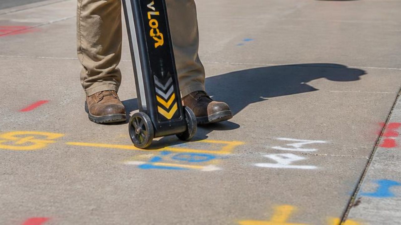
Ground Penetrating Radar services deliver non-destructive subsurface utility mapping for airports, highways, and public infrastructure where excavation errors create catastrophic consequences. GPR technology identifies underground utilities including fuel hydrant systems, electrical distribution, telecommunications cables, water mains, and storm drainage before ground disturbance. Federal highway programs, airport modernization initiatives, and educational facility construction drive demand for accurate subsurface data that prevents strikes, reduces delays, and satisfies regulatory compliance.
Airport expansion programs exceeding $50 billion across major U.S. hubs require subsurface verification where fuel lines, airfield lighting circuits, and FAA communications systems concentrate within constrained corridors. Highway construction funded through the Infrastructure Investment and Jobs Act brings approximately $350 billion in federal investment requiring utility conflict resolution. Educational campuses managing decades of layered renovations face incomplete records and private utility networks outside 811 coverage.
Key Takeaways
- GPR and electromagnetic locating identify underground utilities before excavation begins on airport and transportation projects
- ASCE 38-22 establishes four Quality Levels that define utility data reliability from existing records to physical exposure
- Airport fuel hydrant systems, airfield lighting circuits, and communications networks create high-consequence excavation environments
- Federal highway studies document $4.62 saved for every $1.00 spent on Subsurface Utility Engineering
- The 811 system covers only public utility lines, leaving private infrastructure on campuses and government property unmapped
What Is Ground Penetrating Radar (GPR) Utility Mapping?
Ground Penetrating Radar utility mapping uses electromagnetic pulses to detect subsurface objects and identify underground infrastructure before excavation. GPR equipment transmits high-frequency radio waves into the ground, and 5 reasons to use a ground penetrating radar for construction projects include detecting utilities, voids, and buried objects without surface disruption. Reflected signals return when waves encounter buried pipes, cables, or soil density changes.
GPR data collection integrates with electromagnetic locating and survey-grade positioning systems to produce georeferenced utility maps. EM locating traces conductive utilities by applying electrical signals and tracking the electromagnetic field. GPR and EM data is georeferenced using RTK positioning, which provides real-time kinematic survey-grade GPS accuracy.
How Does GPR Identify Subsurface Utilities?
GPR identifies subsurface utilities by measuring time delays between transmitted pulses and reflected signals from buried objects. Detection depth reaches 13 feet or more depending on soil conditions, utility composition, and equipment frequency. Metallic utilities including steel pipes and electrical conduits produce strong reflections, while non-metallic materials such as PVC and fiber optic cables require specialized antenna frequencies.
Advanced advancements in ground penetrating radar and GIS mapping enable three-dimensional subsurface visualization and clash detection during design phases. RTK positioning achieves centimeter-level horizontal accuracy by correcting satellite signals using fixed base station data. Field crews collect coordinates at each utility marking, ensuring georeferenced data integrates with engineering drawings and GIS platforms.
What Are the Key Quality Standards for Utility Data?
ASCE 38-22 establishes Quality Levels for utility data reliability, defining how information was collected and its associated accuracy. The standard replaces ASCE 38-02 and provides four distinct classifications that communicate subsurface investigation methodology to project stakeholders.
QL-D represents existing records, combining utility information from archived drawings, oral recollections, or One-Call markings without field verification. QL-C adds surface feature survey, correlating QL-D information with professionally surveyed above-ground features including manholes, valve boxes, and meter pits. QL-B determines horizontal location through non-destructive surface geophysical methods, primarily GPR and electromagnetic locating. QL-A requires utilities physically exposed through non-destructive excavation with 0.1 ft vertical and 0.2 ft horizontal accuracy tied to project survey control.
| Quality Level | Data Source | What It Confirms |
|---|---|---|
| QL-D | Archived drawings, oral recollections, One-Call markings | No field verification |
| QL-C | QL-D records correlated with surveyed above-ground features (manholes, valve boxes, meter pits) | Surface feature confirmation |
| QL-B | GPR and electromagnetic locating | Horizontal location, non-destructive |
| QL-A | Physical exposure through non-destructive excavation | Vertical accuracy to 0.1 ft, horizontal accuracy to 0.2 ft |
Why Is GPR Critical for Airport Infrastructure Projects?
GPR is critical for airport infrastructure because subsurface utility strikes create fire risk, operational shutdowns, and multi-million dollar liability exposure. Airports concentrate high-consequence utility systems including pressurized fuel hydrant networks, airfield lighting circuits, and FAA communications infrastructure within active operational zones. Federal Aviation Administration advisory circulars require Construction Safety and Phasing Plans to include procedures for locating and protecting underground utilities during airport construction.
Major airport expansion programs executing $50 billion in combined terminal modernization, runway reconstruction, and concourse development drive subsurface verification demand. Projects at Los Angeles International, New York JFK, and Chicago O’Hare require utility mapping that identifies fuel distribution systems, storm drainage networks, and electrical distribution before design completion. The FAA Airport Improvement Program allocated $3.575 billion in fiscal year 2025, supplementing Infrastructure Investment and Jobs Act funding that added $14.5 billion for airport infrastructure through 2026.
What Are the Unique Subsurface Utility Risks at Airports?
Striking a fuel hydrant line creates fire, explosion, environmental contamination, and immediate airfield closure risks that distinguish airports from other construction environments. Airport fuel hydrant systems distribute pressurized jet fuel from centralized tank farms through underground piping networks directly to aircraft parking positions. Environmental cleanup costs and operational losses from airfield closures multiply direct repair expenses by factors exceeding typical utility strike consequences.
Damage to airfield lighting disrupts flight operations and creates FAA compliance failures that prevent nighttime landings and instrument approaches. Disruptions to telecommunications or electrical power cause air traffic delays, increased controller workload, and safety concerns across the national airspace system. Multi-million dollar lawsuits following airport utility strikes reflect liability exposure including airline delay costs, passenger claims, and regulatory penalties beyond construction contract values.
Memphis International Airport Concourse B modernization revealed inaccurately documented utilities including sanitary and sewer lines, requiring accelerated seven-day work schedules to resolve conflicts. Fuel line, sanitary line, and sewer line conflicts required immediate resolution to maintain airport operations.
How Do Major Airport Expansion Programs Drive GPR Demand?
LAX modernization encompasses $14 to $30 billion in terminal reconstruction, automated people mover installation, and consolidated rental car facilities preparing for 2028 Olympics demand. New York JFK executed a $19 billion multi-terminal overhaul that opened 14 widebody gates in Phase A for 2026 FIFA World Cup arrivals. Chicago O’Hare advances an $8.7 billion Global Terminal program including new concourses, expanded runways, and utility corridor reconstruction beneath active airfield pavements.
Austin-Bergstrom constructs New Concourse B with 18 Southwest gates, 5 United gates, 3 common use gates, subgrade tunnel connections, and in-pavement hydrant fueling requiring comprehensive subsurface utility engineering before foundation excavation. Pittsburgh International Airport opened a new 700,000 square foot landside terminal in November 2025 following a $1.57 billion construction program.
| Airport | Program Scope | Investment |
|---|---|---|
| Los Angeles International (LAX) | Terminal reconstruction, automated people mover, consolidated rental car facilities ahead of the 2028 Olympics | $14 to $30 billion |
| New York JFK | Multi-terminal overhaul; 14 widebody gates opened in Phase A for the 2026 FIFA World Cup | $19 billion |
| Chicago O’Hare | Global Terminal program: new concourses, expanded runways, utility corridor reconstruction | $8.7 billion |
| Austin-Bergstrom | New Concourse B: 18 Southwest gates, 5 United gates, 3 common-use gates, subgrade tunnel connections | Included in broader program |
| Pittsburgh International | New 700,000 sq ft landside terminal, opened November 2025 | $1.57 billion |
What Regulations Govern Utility Locating on Airports?
FAA Advisory Circular AC 150/5370-2G requires Construction Safety and Phasing Plans to include procedures for locating and protecting underground utilities in excavation areas. Construction Safety and Phasing Plans must address utility protection protocols, emergency response procedures, and coordination with airport operations before ground disturbance authorization. The advisory notes that One Call or Miss Utility services do not cover all airport utilities, particularly those owned by FAA Technical Operations.
AIP is the FAA’s Airport Improvement Program, providing federal grants for airport capital development and infrastructure modernization projects nationwide. FAA AIP FY2024 allocated $3.35 billion, increasing to $3.575 billion in FY2025 and continuing escalation through FY2028 under the FAA Reauthorization Act. The Airport Infrastructure Grant program provides $14.5 billion over FY2022-2026 through Infrastructure Investment and Jobs Act supplemental funding.
How Does GPR Support Highway and Transportation Construction?
GPR supports highway and transportation construction by identifying underground utilities before excavation, preventing strikes that cause project delays and cost overruns. Highway widening, bridge replacement, and interchange reconstruction projects funded through federal and state transportation programs require subsurface verification where utilities concentrate along existing rights-of-way. Ground Penetrating Radar produces Quality Level B utility data supporting engineering design, reducing change orders, and enabling accurate construction cost estimation.
The Infrastructure Investment and Jobs Act provides approximately $350 billion for federal highway programs over fiscal years 2022 through 2026, creating the largest dedicated surface transportation investment since the Interstate Highway System. This spending surge drives subsurface verification demand across thousands of federally funded projects where 811 is not enough and contractors need private utility locators to address gaps in One Call coverage.
What Are the Return on Investment Benefits of GPR in Transportation?
Studies document $4.62 saved for every $1.00 spent on Subsurface Utility Engineering based on Federal Highway Administration research analyzing 71 projects across four states. The FHWA/Purdue University study examined projects with combined construction value exceeding $1 billion, quantifying savings from avoided utility conflicts, reduced change orders, and prevented construction delays. SUE costs less than 0.5% of total construction costs while producing 1.9% construction savings. Only 3 of 71 FHWA-studied projects had negative return on investment.
One North Carolina Department of Transportation project achieved $206 to $1 return on investment through comprehensive subsurface investigation. Florida DOT independently reported benefit ratios of approximately 3:1, while FHWA analyses document returns ranging from $4 to $20 per dollar invested. Systematic SUE use is projected to produce minimum $1 billion per year national savings based on highway construction spending and conflict avoidance rates.
| Study or Agency | Documented Return on Investment |
|---|---|
| FHWA / Purdue University (71 projects, 4 states) | $4.62 saved per $1.00 spent on SUE |
| North Carolina DOT | $206 saved per $1.00 spent |
| Florida DOT | Approximately 3:1 benefit ratio |
| FHWA analyses (range across studies) | $4 to $20 saved per $1.00 spent |
| National projection | Minimum $1 billion in savings per year |
How Has IIJA Funding Influenced Utility Mapping Needs?
IIJA refers to the Infrastructure Investment and Jobs Act, also called the Bipartisan Infrastructure Law, providing historic federal investment in surface transportation and infrastructure modernization. IIJA provides approximately $350 billion for federal highway programs over FY2022-2026, distributed to states through formula apportionment and competitive grant programs. This concentrated investment creates simultaneous subsurface verification demand across thousands of projects where utility conflicts threaten schedules, budgets, and federal funding compliance.
Highway and street construction reached a $150.6 billion seasonally adjusted annual rate in May 2026. U.S. public construction spending reached a $541.2 billion seasonally adjusted annual rate in May 2026, up from $503.6 billion in December 2024 as IIJA funds accelerated project delivery.
What Challenges Make Educational Campuses Complex for GPR Surveys?
Educational campuses present complex GPR survey challenges because decades of layered renovations created incomplete subsurface records and mixed utility ownership across aging building stock. The average school building in America is now 50 years old, with California reporting 70% of classrooms exceeding 25 years in age. These facilities underwent multiple renovation cycles that added, rerouted, or abandoned utility lines without updating master infrastructure drawings.
Public educational construction reached a $113.4 billion seasonally adjusted annual rate in May 2026, representing the second-largest category of public construction spending behind highway development. California voters approved Proposition 2 in November 2024, authorizing $10 billion in school construction bonds with $8.5 billion allocated to K-12 facilities and $1.5 billion to community colleges. Educational campus construction requires why use GPR for utility locating verification that addresses private utility networks, abandoned infrastructure, and documentation gaps from deferred maintenance programs.
How Do Private Utility Networks Affect 811 Locating Coverage?
811 does not cover utilities on the campus side of the meter or connection point, creating significant coverage gaps for educational facilities with extensive private distribution systems. Private utility lines include electrical distribution on campus, internal water/sewer/fire suppression, site lighting, irrigation, communications cabling between buildings, private gas distribution, and abandoned infrastructure. The 811 system marks only public utility company lines, typically stopping at the meter, service connection, or property boundary.
Private utility lines represent more than 60% of all underground infrastructure in the U.S. Original as-built records for many campus buildings are incomplete, inaccurate, or nonexistent following decades of modifications, emergency repairs, and undocumented infrastructure additions. 811 Call Before You Dig does not locate privately owned utilities, requiring property owners to engage specialized services for campus infrastructure mapping.
What Drives Compliance and Risk Management in School Construction?
Gas line strikes during school construction can trigger evacuations, school closures, and community alarm that extends liability beyond typical construction project consequences. Water main strikes disrupt operations for thousands of students and staff. Electrical cable strikes near occupied buildings create immediate life-safety hazards where energized conductors contact construction equipment.
OSHA excavation standard 29 CFR 1926 Subpart P requires determining the estimated location of utilities before excavation begins. School district insurance carriers increasingly require documentation of utility locating procedures as a condition of construction project coverage where risk assessment in utility mapping hazards and mitigation determines premium rates and policy terms.
How Is GPR Utility Data Integrated with Asset Management Systems?
GPR utility data integrates with asset management systems through standardized digital formats supporting GIS platforms, CAD software, and three-dimensional modeling environments. Data is processed into utility maps following field collection, with deliverables provided in CAD (DWG), KML (Google Earth), and GIS-compatible shapefiles. ASCE 75-22 standardizes utility data exchange between CAD and GIS systems, ensuring georeferenced subsurface information transfers across platforms without accuracy loss.
Municipalities managing water, sewer, storm, gas, electric, and communications systems use GPR data as permanent, reusable assets for deferred maintenance planning and capital improvement programming. Three-dimensional utility modeling supported by ASCE 38-22 guidance allows agencies to maintain volumetric subsurface records that prevent conflicts during successive construction projects.
What Formats and Technologies Enable GIS and 3D Utility Modeling?
Data is processed into utility maps combining field-collected GPR readings, electromagnetic locating results, and survey control points into georeferenced spatial datasets. Deliverables provided in CAD (DWG), KML (Google Earth), and GIS-compatible shapefiles enable immediate integration with municipal asset management platforms and engineering design software.
Data imported directly into ArcGIS or similar systems becomes queryable spatial data supporting infrastructure analysis, maintenance routing, and capital planning applications. ASCE 75-22 standardizes utility data exchange between CAD and GIS systems, defining attribute schemas, coordinate systems, and data quality parameters.
How Does GPR Inform Maintenance and Emergency Response Planning?
GPR informs maintenance and emergency response planning by providing accurate subsurface utility locations that enable rapid response to failures, leaks, and service interruptions. Schools, universities, and public facilities use verified utility data to plan maintenance access routes, identify shutoff valve locations, and coordinate emergency repairs without exploratory excavation.
Emergency response teams access georeferenced utility maps through mobile devices and GIS platforms displaying subsurface infrastructure relative to current GPS position. Maintenance departments use historical GPR data to verify utility depth and routing before scheduling valve replacements, service upgrades, and infrastructure condition assessments.
What Best Practices Ensure Effective Preconstruction Utility Mapping?
Effective preconstruction utility mapping begins with Subsurface Utility Engineering investigation at appropriate Quality Levels before design completion and excavation authorization. SUE stands for Subsurface Utility Engineering, the systematic process of accurately identifying underground utility location, type, size, and condition during design and construction phases. Specifying required Quality Level in project procurement documents communicates subsurface data expectations and allocates risk between owner, designer, and contractor.
Field procedures preventing utility strikes include verifying 811 ticket coverage, engaging private locators for infrastructure outside One Call scope, and conducting test excavations at conflict points. 60-75% of incidents trace back to weak planning or poor field procedures, including failure to call 811, digging errors, outdated maps, missed markings, or inadequate verification. Systematic SUE use is projected to produce minimum $1 billion per year national savings.
Why Is Subsurface Utility Engineering (SUE) Essential Before Excavation?
SUE establishes engineering standards for investigating and documenting existing underground utilities during project development. 60-75% of incidents trace back to weak planning or poor field procedures that fail to verify utility locations before ground disturbance. Systematic SUE use is projected to produce a minimum $1 billion per year national savings through avoided utility strikes, prevented construction delays, and reduced change order costs.
The Memphis project required a seven-day accelerated work schedule to resolve fuel line, sanitary line, and sewer line conflicts discovered when inaccurate documentation contradicted field conditions. Projects incorporating SUE at Quality Level B or Level A during design development avoid these conflicts through field-verified utility data.
How Do Field Procedures Prevent Utility Strikes?
$30 billion per year in total societal costs from utility strikes across the U.S. reflects direct repair expenses, indirect operational losses, and social costs including traffic delays and environmental contamination. 400,000 to 800,000 utility strikes occur annually in the U.S. A single utility strike costs $4,000 to $56,000 in direct repair costs, excluding consequential damages. Indirect and social costs multiply by a factor of 29:1 for every $1 in direct damage according to Common Ground Alliance analysis.
Backhoes and trenchers are involved in 33% of incidents, while hand tools account for 26% of utility damages. Field procedures preventing strikes include calling 811 before excavation, waiting for utility marking completion, using hand tools within designated tolerance zones, and verifying markings against project drawings. Telecommunications facilities are most frequently damaged at 46% of reported incidents, followed by natural gas at 24%.
How Do GPR Services Address the 811 Coverage Gap?
GPR services address the 811 coverage gap by locating privately owned utilities that fall outside One Call system responsibility and regulatory scope. The 811 system marks only public utility company lines, typically stopping at the meter, service connection, or property boundary. This limitation creates significant exposure on government property, educational campuses, military installations, and commercial sites with extensive private utility networks distributing water, power, gas, and communications between buildings.
Private utility lines represent more than 60% of all underground infrastructure in the U.S., concentrated on properties with internal distribution systems serving multiple buildings. Calling 811 is the first step but insufficient for private property where owners maintain electrical distribution, water/sewer systems, site lighting, irrigation, communications cabling, and abandoned infrastructure.
Which Private Utility Types Require Specialized Locating?
Private utility lines include electrical distribution on campus, internal water/sewer/fire suppression, site lighting, irrigation, communications cabling between buildings, private gas distribution, and abandoned infrastructure unmapped in facility records. 811 system marks only public utility company lines, typically stopping at the meter, service connection, or property boundary. Electrical distribution beyond the service entrance, including transformers, secondary circuits, and building feeders, requires private locating.
Telecommunications facilities are most frequently damaged at 46% of all reported utility strikes nationwide, followed by natural gas damage accounting for 24% of incidents. Campus telecommunications networks include fiber optic cables, copper data circuits, building-to-building connections, and wireless equipment feeds that public carriers do not mark. Abandoned infrastructure from previous construction creates subsurface hazards that utility locating and San Diego pre-construction process standards address through comprehensive field verification.
What Is the Role of Private Locating Services in Public Agency Projects?
Calling 811 is the required first step but insufficient for private property where extensive infrastructure exists beyond public utility company responsibility boundaries. A separate private utility locating engagement is required for infrastructure 811 will not mark, including campus distribution systems, internal building services, and facility-owned networks. Public agencies managing municipal complexes, water treatment plants, transportation facilities, and educational campuses maintain buried infrastructure on their own property outside One Call system scope.
One Call or Miss Utility services do not cover all airport utilities, particularly those owned by FAA Technical Operations. Private locating services integrate with public agency asset management systems through standardized deliverable formats supporting GIS platforms, CAD workflows, and long-term infrastructure documentation.
GPR Services for Airports and Transportation Projects: A Comprehensive Risk Management Solution
Ground Penetrating Radar services provide comprehensive risk management for airports, transportation infrastructure, and public facility construction where subsurface utility strikes create catastrophic consequences and project-ending liability exposure. Federal investment through the Infrastructure Investment and Jobs Act, FAA Airport Improvement Program, and state transportation funding drives unprecedented construction activity requiring systematic subsurface verification.
Util-Locate delivers survey-grade GPR services supporting airports, highway programs, educational facilities, and municipal infrastructure projects across Southern California and Arizona with 20 years of continuous operation. The combination of field-verified utility data, ASCE-compliant deliverables, and integration with GIS platforms enables agencies to manage subsurface risk systematically across multi-year capital programs. Safety compliance, accurate cost estimation, and operational continuity depend on comprehensive subsurface documentation that identifies fuel systems, electrical distribution, communications networks, and water infrastructure before ground disturbance begins.
Construction projects managing utility locating requirements achieve predictable execution through early-phase subsurface investigation and coordinated field verification protocols. Preventing utility strikes protects workers, reduces liability exposure, and maintains project schedules where excavation delays cascade across dependent activities.
Protect Your Airport or Transportation Project with Util-Locate
Airport, highway, and public infrastructure projects carry consequences that few other construction environments share, and subsurface uncertainty is not a risk worth carrying into a ground-breaking day.
Util-Locate has delivered ASCE-compliant GPR and electromagnetic utility locating across Southern California and Arizona since 2001, supporting agencies and contractors on airport modernization, highway, and educational campus programs where precision matters most. Our certified technicians combine GPR, electromagnetic locating, and RTK-verified mapping to identify fuel lines, communications networks, and private infrastructure outside 811 coverage before excavation begins, backed by a 97% accuracy rate and 24/7 emergency response. Call Util-Locate at 1-888-885-6228 or request a quote to schedule GPR utility mapping for your next airport, highway, or public infrastructure project.
