Key Takeaways
- Depth Uncertainty Drives 67% of Utility Strikes; Nearly two-thirds of the 400,000-700,000 annual utility strikes occur because utilities are located 2+ feet from marked positions, far exceeding the 18-24 inch tolerance zone.
- Missing Depth Data Costs $30 Billion Annually; The economic impact reflects a 29:1 ratio of indirect to direct costs. For every $1 spent repairing damaged utilities, $29 is lost to project delays, legal liability, and emergency response.
- Quality Level A (QL-A) Provides ±1 Inch Accuracy; ASCE standards establish that physical exposure through potholing delivers ±15mm vertical accuracy, compared to ±20-30% estimates from geophysical methods or complete unreliability from records alone.
- 94% of Damage Root Causes Stem From Incomplete Data; Common Ground Alliance reporting confirms that locator error (67%), missing markings (14%), and incorrect maps (10%) account for nearly all depth-related strikes.
- High-Pressure Gas and High-Voltage Electric Are Most Dangerous; When depth is unknown, utilities carrying explosive or lethal energy become unpredictable hazards. Gas line strikes cost $5,000-$50,000+ in direct repairs but create mass casualty risk.
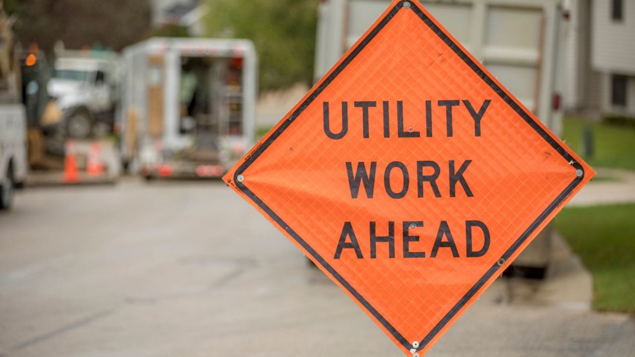
Every excavation project begins with a simple question: “Where are the utilities?” But knowing where a utility runs horizontally is only half the answer. The question that determines whether your crew goes home safely is “How deep?” With over 500,000 utility strikes occurring annually in the United States, causing 400+ deaths and $30 billion in economic losses since 2000, the construction industry faces a persistent crisis rooted in missing or inaccurate depth information. While 811 call-before-you-dig systems have reduced strikes from failure to notify, the majority of incidents now occur because utilities are found far from marked locations or at unexpected depths.
This guide examines why depth matters for safety, why knowing depth is the critical missing link in utility locating, and how standards-based workflows can prevent catastrophic failures.
What Is “Depth Information” In Utility Locating?
Depth is the vertical distance from a reference surface to the top of a buried utility. It differs from “cover” (soil thickness above the utility) and “elevation” (absolute height relative to a survey datum). A usable depth attribute requires a known measurement point, a defined tolerance, and a quality level designation.
ASCE 38-02/38-22 defines Quality Level A (QL-A) vertical accuracy as typically ±15mm (0.05 ft) when obtained by physical exposure. The UK’s PAS 128 mandates ±25mm tolerance for QL-A verification. These precision thresholds exist because the industry’s Tolerance Zone, 18 to 24 inches on either side of a marked line, represents the maximum safe margin for manual excavation. Professional utility locating services rely on these standards to ensure excavation safety.
Depth vs. Cover vs. Elevation
| Term | What it measures | Reference point | Common failure mode | How crews misinterpret it |
| Depth | Distance from surface to top of utility | Current ground surface | Surface changes invalidate measurement | Assumes depth is constant along entire run |
| Cover | Thickness of soil above utility | Top of utility itself | Settling, erosion, overlay add-ons | Confuses “cover” with “depth to invert” |
| Elevation | Absolute height above datum | Survey benchmark (NAVD88) | Datum shift, benchmark loss | Doesn’t translate elevation to digging depth |
What Makes Depth Data Actionable?
- Reference datum/benchmark: Known starting point (current surface, survey marker, or adjacent feature)
- Measurement method: Physical exposure (QL-A), geophysics (QL-B), or records (QL-C/D)
- Confidence/quality level: ASCE QL designation or PAS 128 category
- Timestamp: When the measurement was taken (ground conditions change)
- Units and tolerance: Imperial/metric with accuracy range (±X inches/mm)
Why Does Missing Depth Information Create Disproportionate Risk?
Without depth, excavators cannot anticipate when they’ll encounter a utility, turning every bucket of soil into potential catastrophe. Two-thirds of strikes occur when utilities are located 2+ feet from marked locations, but depth uncertainty compounds this horizontal error. These excavation and foundation risks multiply when projects involve deep footings or grade changes.
The United States experiences 400,000 to 700,000 underground utility strikes annually, approximately one every 60 to 90 seconds. The Tolerance Zone (18-24 inches on either side of marks) establishes safe excavation margins, but without vertical context, crews cannot determine if they’re safely above or dangerously close to the utility. Electromagnetic (EM) locators achieve ±5% of depth accuracy under ideal conditions, but accuracy degrades to 33% at 90° bends and approaches 100% error when parallel utilities exist closer than 10 times their depth.
Understanding the utility locating risk in San Diego and other urban areas requires accounting for these depth uncertainties.
How A “Correct Mark-Out” Still Leads To A Strike
- Crossing geometry: Utility crosses at an angle, marked centerline doesn’t indicate depth variation across excavation width
- Depth variability along run: Sags, peaks, and tie-ins create vertical deviations not reflected in surface marks
- Tool selection mismatch: Operator selects excavation method based on assumed depth, not verified depth
- Tolerance zone misunderstandings: Crew believes being outside the tolerance zone horizontally means they’re safe vertically
Error Stacking Without Depth
| Error source | Typical magnitude | Resulting uncertainty | Strike scenario |
| Horizontal mark error | ±12-24 inches | Full 3D position unknown | Excavator assumes safe distance, strikes shallow crossing |
| EM signal distortion | Up to 100% at close spacing | Cannot distinguish utilities | Locator marks dominant signal; second utility at different depth hit first |
| Ground surface changes | +6 to +18 inches (overlays) | Original depth now invalid | Crew relies on design depth, excavates aggressively, immediate strike |
| GPR velocity error | ±20% depth error | Depth estimate off by 1+ feet | GPR shows utility at 4 ft; actually at 2.5 ft, bucket catches it |
What Do Standards And Regulations Require When Depth Is Uncertain?
OSHA mandates physical verification of “exact location” when excavation approaches marked utilities (29 CFR 1926.651(b)), effectively requiring depth confirmation by non-mechanical means. This federal requirement forces excavators to pothole or hand-dig within the Tolerance Zone.
ASCE 38-02/38-22 codifies four Quality Levels: QL-D (records only, no depth accuracy), QL-C (visible features, no depth specification), QL-B (geophysics, project-defined depth tolerance), and QL-A (physical exposure, ±15mm vertical accuracy). The UK’s PAS 128 mandates stricter thresholds: QL-A verification requires ±25mm accuracy, while QL-B1 detection allows ±150mm or ±15% of depth.
Field-Facing Requirements Before/During Excavation
- Pre-excavation planning: Identify all utilities, assess Quality Levels, and determine where QL-A potholing is required
- Verify marks: Confirm locator marks are visible, recent (typically <14 days), and match the 811 ticket scope
- Maintain tolerance zone: No mechanical excavation within 18-24 inches of the marked centerline
- Stop-work triggers: Unknown utility encountered, mark discrepancy >2 feet, depth significantly shallower than expected
Approximate vs. Exact Location (In Practice)
| Concept | What you get | What it’s safe for | What it’s not safe for | Verification step needed |
| 811 mark-out | Horizontal ±12-24″, no depth | Route planning, avoiding conflicts | Excavation method selection, depth control | Pothole at crossings |
| GPR scan (QL-B) | Depth ±20-30%, horizontal ±6″ | Preliminary design, congestion zones | Final engineering, construction control | Physical exposure (QL-A) at conflicts |
| As-built plans | Design intent, ±1-2 feet actual | Desktop review, cost estimates | Directing excavation equipment | Field verification via QL-B + selective QL-A |
| Pothole (QL-A) | Actual depth ±1″, 3D coordinates | All construction, final design | N/A, this is verification standard | None, QL-A is definitive |
Why Is Depth Commonly Missing In The First Place?
Ninety-four percent of utility locating damage root causes stem from incomplete or inaccurate subsurface data. The Common Ground Alliance’s 2022 DIRT Report reveals that locator error (67%), missing/incomplete markings (14%), and incorrect maps (10%) collectively account for nearly all depth-related strikes. Utility owners provide horizontal location through 811 systems, but depth data remains optional in most jurisdictions. This challenge affects projects nationwide, including utility depth locating San Diego projects, where complex urban infrastructure compounds the problem.
The problem compounds over time: design depths don’t reflect field installation variances, surface changes (resurfacing adds 6-18 inches) invalidate original measurements, and utility relocations go unrecorded. Electromagnetic locators can’t measure depth without known signal strength, GPR requires soil-specific calibration, and acoustic methods provide tracing without vertical positioning.
Why Records And As-Builts Fail To Provide Usable Depth
- Design vs. installed variance: Actual installation depth varies due to field conditions, rock encountered, or contractor deviation
- Missing datum: Depth recorded without reference point (current surface? original grade? survey benchmark?)
- Field changes not captured: Utility lowered or raised during construction; as-builts never updated
- Legacy paper conversion issues: Hand-drawn depths scanned to PDF; precision lost, units unclear
Why Ground Reality Invalidates ‘Original Depth’ Assumptions
- Resurfacing/overlays: Pavement overlays add 2-6 inches per cycle; 30-year-old utility now 12-18 inches shallower than plans
- Settlement/heave: Soil consolidation lowers utilities; frost heave or expansive soils raise them seasonally
- Trench backfill consolidation: Consolidation over the years reduces cover by 6-12 inches
- Utility relocations: Partial relocation moves the segment to a different depth; records show the original depth for the entire run
Which Utility Types Become Most Dangerous When Depth Is Unknown?
High-pressure gas lines and high-voltage electric cables become lethal weapons when struck at unexpected depths. Depth uncertainty prevents crews from selecting appropriate excavation methods and eliminates the graduated caution that protects workers. A fiber-optic line hit at 18 inches costs thousands; a gas main struck at the same depth can kill.
Average Direct Repair Costs by Utility Type
| Utility Type | Direct Repair Cost Range | Primary Risk |
| Gas Lines | $5,000 – $50,000+ | Explosion, fire, public safety risk |
| Electric Lines (Low-Voltage) | $4,000 – $15,000 | Electrocution, localized power outage |
| Water Lines | $3,000 – $25,000 | Flooding, service interruption, property damage |
| Fiber-Optic/Telecom | $4,000 – $100,000+ | Service disruption (high indirect cost), repair complexity |
Fiber-optic service interruption costs reach $10,000 to $100,000 per hour for large enterprises. PHMSA data shows approximately 15% of hazardous liquid pipeline incidents (2002-2003) resulted from excavation damage.
Risk Emphasis By Utility Type
| Utility | Primary hazard | Why depth uncertainty escalates it | Typical verification approach |
| High-pressure gas (>60 psi) | Explosion, fire, mass casualty | Cannot assess rupture risk without depth | Mandatory QL-A potholing within 10 ft of crossing |
| High-voltage electric (>600V) | Electrocution, arc flash | Depth determines safe approach distance | QL-A verification + utility owner standby |
| Water transmission (>12″) | Catastrophic flooding, sinkholes | Depth determines failure propagation path | QL-B minimum; QL-A at crossings |
| Sanitary sewer | Contamination, environmental violation | Shallow sewers create trench cave-in risk | QL-B + bypass plan; QL-A if depth <3 ft |
When planning excavation near sewer lines, professional depth verification becomes essential to prevent contamination events.
How Does Missing Depth Turn Into Measurable Project Losses?
Depth uncertainty multiplies every downstream consequence. The $30 billion annual U.S. cost of utility strikes reflects a 29:1 ratio of indirect to direct costs: every $1 spent repairing damaged utilities generates $29 in project delays, legal liability, emergency response, and lost productivity. Average direct repair costs of $4,000 per incident mask the true economic damage, particularly when trenching and grading conflicts escalate into major disruptions.
Understanding the full cost of not hiring gas line locating services becomes critical when a single gas line strike can trigger million-dollar liability claims and catastrophic safety incidents.
Human costs compound financial losses: 400+ deaths and 2,000+ injuries since 2000 trace directly to location and depth failures. The CGA Index rose from 94.0 (2023) to 96.7 (2024), signaling that damage prevention efforts cannot keep pace with excavation volume. Crew downtime alone costs $96 per hour; large infrastructure projects lose tens of thousands daily in liquidated damages when strikes halt work.
Cost And Schedule Multipliers From Unknown Depth
| Impact category | What triggers it | Prevention lever |
| Emergency response | Gas release, electrical contact, water main break | QL-A potholing prevents incident entirely |
| Service interruption | Strike on an active utility requiring repair | Depth verification enables isolation/bypass planning |
| Work stoppage | Unplanned strike forces safety stand-down | SUE investigation front-loads delay into the planning phase |
| Legal liability | Injury/fatality, property damage, regulatory violation | Documented depth verification establishes standard of care |
| Schedule delay | Critical path activity stopped | QL-A data allows schedule contingency for high-risk crossings |
What Does “Better Utility Quality” Look Like For Depth?
Quality Levels define the hierarchy from guesswork to ground truth. ASCE 38-02/38-22 establishes four tiers: QL-D (records only), QL-C (visible features), QL-B (geophysics, estimated depth), and QL-A (physical exposure, ±15mm vertical accuracy). The UK’s PAS 128 mandates QL-A verification at ±25mm accuracy, while QL-B1 detection allows ±150mm or ±15% of depth.
Utility Quality Levels and Depth Confidence
| Quality level | How data is obtained | Depth statement | Typical use case | Residual risk |
| QL-A | Physical exposure + surveying | “Utility confirmed at X.XX ft ±1 inch at Station Y” | Construction, final design, permanent records | Minimal, actual measurement |
| QL-B | GPR, EM, acoustic + surveying | “Utility estimated at ~X ft ±6-12 inches” | Preliminary design, bid documents | Moderate, soil/equipment limits |
| QL-C | Surface features + plans | “Utility inferred at X ft per plans; not verified” | Desktop studies, cost estimates | High, actual depth may vary significantly |
| QL-D | Existing records, no verification | “Utility shown on plans; reliability unknown” | Initial scoping only | Very high, data may be completely inaccurate |
811 Mark-Out vs. SUE Designation/Verification
| Output | Typical accuracy | Depth included? | When appropriate | Typical next step |
| 811 mark-out | Horizontal: ±18-24″ | No, horizontal only | Route planning, avoiding conflicts | QL-B designation or QL-A potholing |
| QL-B designation | Horizontal: ±6″; Vertical: ±20-30% | Yes, estimated | Preliminary design, bid documents | QL-A verification at critical crossings |
| QL-A verification | Horizontal & Vertical: ±1″ | Yes, measured ±15-25mm | All construction, final design | Proceed with excavation |
How Should You Manage Excavation When Depth Information Is Missing?
Treat every excavation with unknown depth as high-risk until proven otherwise. With 400,000 to 700,000 strikes occurring annually and 67% happening when utilities are 2+ feet from marked locations, assuming safety based on horizontal marks alone is organizational negligence. Missing depth demands a structured risk classification and mandatory verification workflow.
Minimum Safe Workflow When Depth Is Unknown
- Pre-research: Review all available utility records, as-builts, and previous SUE investigations
- Locate request: Submit 811 ticket; engage private locators for utilities not covered by one-call
- Field walkdown: Physically inspect marks, assess site conditions, and identify conflicts
- Risk classify: Categorize each utility crossing by consequence (utility type, depth uncertainty, excavation method)
- Choose verification: Select the appropriate Quality Level based on risk tier
- Perform controlled exposure: Execute non-destructive verification at critical points
- Document: Survey exposed utilities, record depths, photograph conditions, update drawings
- Proceed: Excavate using an appropriate method with verified depth as control parameter
Risk Classification When Depth Is Missing
| Risk tier | Indicators | What’s prohibited | Required verification |
| Critical | High-pressure gas, high-voltage electric, fiber trunk lines | Mechanical excavation, directional boring, blasting | QL-A mandatory at all crossings |
| High | Medium-pressure gas, primary electric, shallow utilities (<3 ft suspected) | Mechanical excavation within 5 ft without exposure | QL-A at crossings; QL-B minimum |
| Moderate | Low-pressure gas, secondary electric, deep utilities (>5 ft suspected) | Mechanical excavation within tolerance zone | QL-B designation; QL-A if congested |
| Low | Storm drain, abandoned utilities (confirmed), deep bedrock utilities (>10 ft) | Disregarding marks entirely | QL-C acceptable; upgrade if uncertainty increases |
Verification Method Selection By Risk Tier
| Method | What it confirms | When to use |
| QL-A potholing (vacuum excavation) | Exact 3D location, depth ±1 inch, material, condition | Critical/high-risk utilities; design conflicts; directional bore crossings |
| QL-B GPR + EM scan | Estimated depth ±6-12 inches, horizontal ±6 inches | Moderate-risk utilities; preliminary design; route selection |
| QL-C records research + survey | Plan depth (unverified), horizontal inference | Low-risk utilities; initial scoping; identifying where higher QL needed |
| Hand-digging (manual potholing) | Exact depth at excavation point | Within tolerance zone when vacuum excavation unavailable |
Don’t Dig Blind: Why Depth Verification Is Non-Negotiable
Missing depth information is not just a data gap; it’s a life-threatening deficiency that transforms every excavation into a game of chance. While horizontal utility marks satisfy legal notification requirements, only verified depth data enables safe excavation method selection, appropriate equipment deployment, and worker protection. The industry standards are clear: OSHA mandates physical verification of exact location when excavation approaches marked utilities, ASCE 38-02/38-22 defines Quality Level A as the only defensible depth standard, and the $30 billion annual cost of strikes proves that reactive repair far exceeds proactive verification investment.
Whether your project involves shallow residential services or deep infrastructure crossings, the question is no longer “Can we afford depth verification?” but rather “Can we afford the consequences of proceeding without it?”
Request A Utility Locating Quote
Don’t let missing depth data turn your next excavation into a statistic. Contact our utility locating experts today to discuss how QL-A verification and comprehensive subsurface utility engineering can protect your project, your crew, and your bottom line.