Key Takeaways
- Using underground utility locating services ensures fast and accurate identification of critical infrastructure, reducing the risk of utility strikes.
- Utility mapping technologies like LiDAR, satellite imagery, and remote sensing provide detailed, real-time data for effective site planning.
- Integrating geospatial data into site selection helps optimize infrastructure management and reduce costly construction delays.
- Incorporating predictive analytics and AI-driven insights aids in anticipating potential issues and streamlining the development process.
- Accurate utility mapping is key for future-proofing infrastructure and supporting economic development and community engagement.
Planning a construction site or selecting a location for a retail store requires precision. When it comes to underground utilities, errors in judgment can lead to costly accidents and delays. Fortunately, advances in technology have made it easier than ever to map out the critical underground infrastructure that lies beneath the surface.
By utilizing underground utility locating services, businesses can mitigate risks associated with utility strikes and ensure a smoother, more efficient planning process. This article will explore how utility mapping data can enhance site planning and streamline the decision-making process.
Why Utility Mapping Is Crucial for Site Planning
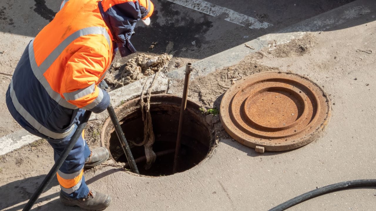
Effective site planning requires the integration of multiple data sets, such as geospatial data and infrastructure maps, to ensure accuracy. One crucial piece of this puzzle is understanding where the underground utilities are located. These include fiber-optic cables, water lines, gas pipes, and electrical wiring, all of which are vital for any construction or development project. When these utilities aren’t accurately identified and mapped, the risk of damage increases. This can lead to disruptions, delays, and unforeseen costs that could have been avoided with private underground utility locating services.
The Role of Private Utility Locating Services
Using a private utility locating service offers fast and accurate locating of underground utilities, ensuring that construction projects avoid costly utility strikes. These services leverage advanced technologies, including satellite imagery, LiDAR data, and remote sensing, to pinpoint the exact location of critical infrastructure.
Utility locating services provide precise and real-time data, allowing for accurate asset identification and asset tracking throughout the project. By having access to this essential data, construction teams can adjust their excavation plans to avoid damaging underground systems, thus reducing the likelihood of delays and safety hazards.
The Power of Geospatial Data in Site Planning
Integrating geospatial data into site selection and property development allows for more informed decisions. Utility mapping provides a detailed overview of underground infrastructure, making it easier to navigate and plan for future developments.
With spatial records and real-time data, planners can visualize underground assets and anticipate any challenges that may arise. By using location intelligence software and AI-driven analytics, planners can optimize their site selection analysis and make decisions based on accurate, up-to-date information.
Incorporating these tools ensures that the site development process is streamlined and reduces the need for reactive maintenance. Additionally, it helps in infrastructure management by offering detailed records of all underground utilities, which are crucial for asset management over time.
How Utility Mapping Improves Customer Experience
For retail businesses, proper site selection analysis can significantly impact foot traffic and overall customer experience. Utility mapping can help identify locations with the best infrastructure, ensuring a smooth customer experience from the moment they step onto the site. It can also help identify locations that align with a company’s market entry strategy, offering real estate data, retail expansion planning software, and a foot traffic analytics platform to assist businesses in making informed decisions. Knowing where utilities are located ensures that store openings are smooth and free of construction-related delays.
By incorporating accurate infrastructure maps into planning, businesses can also assess the economic development potential of a location. Whether it’s for retail store development or community engagement, proper utility mapping provides a clearer picture of what to expect in terms of construction timelines and costs.
Utility Mapping for Future-Proof Infrastructure
Planning for the future is essential, especially in areas that may see future developments. Whether it’s for broadband infrastructure or fiber network installation, accurate utility data helps guide expansion plans. By mapping utilities, planners can identify areas that may need updates or improvements in the future, ensuring that new systems, such as broadband deployment, are integrated smoothly into the existing infrastructure. Reality capture and deep learning models can assist in mapping infrastructure that needs upgrading, making future upgrades easier and more cost-effective.
Additionally, understanding land boundaries and land-use data is crucial for city planning and site selection. With precise utility maps, planners can ensure that infrastructure development fits within the land’s designated use, saving time and money during the development phase.
Integrating Technology for Better Planning
The combination of satellite imagery, street view imagery, and LiDAR data makes utility mapping even more efficient. By using advanced reality capture techniques and Blyncsy analytics, teams can collect high-quality field data that can be processed and used to plan the layout of a project. Whether the goal is pavement management or asset inventory, leveraging these technologies helps ensure that the infrastructure is mapped with the highest degree of accuracy, thus reducing the chance of errors during construction.
Furthermore, predictive analytics can be used to forecast potential risks associated with utility strikes or infrastructure damage. By analyzing the spatial records and leveraging AI-driven analytics, planners can predict where issues may arise in the future, allowing them to make adjustments ahead of time and avoid costly disruptions.
Take Control of Your Site Planning Today!
Site planning doesn’t have to be a guessing game. With underground utility locating services, you can make more informed decisions, avoid costly utility strikes, and create a safer, more efficient construction process. By incorporating utility mapping and leveraging advanced technologies, you ensure that your projects are built on a solid foundation, both literally and figuratively. At Util-Locate, we provide private underground utility locating services designed to give you fast, accurate, and reliable data to make your next project a success.
Contact us today at California (714) 492-1380 or Arizona (480) 535-0230 to learn more about how our utility locating services can benefit your next project. Let’s work together to make your construction process safer, smoother, and more efficient.