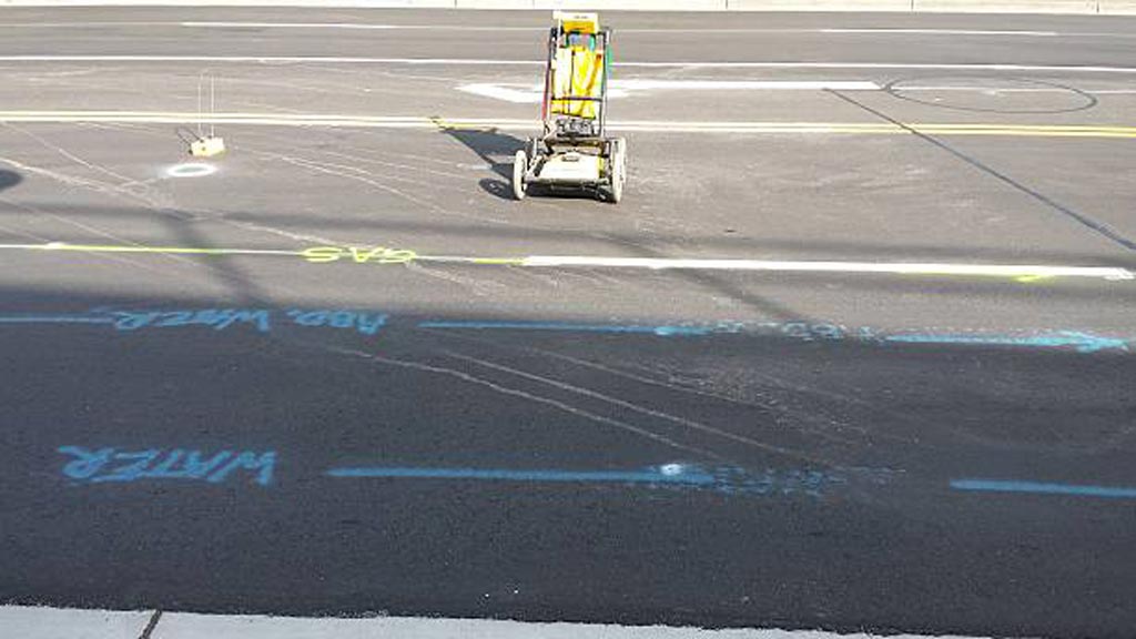
Digging up the ground is so much work and takes so much time. Locating where utilities and structures are underground before digging would make the excavation so much easier.
This is why utility locators, construction companies, and archeologists use Ground Penetrating Radar technology.
Ground penetrating radar technology, commonly known as GPR, is a method of capturing images underneath the ground through the use of electromagnetic energy. As such, GPR technology makes subsurface mapping and locating objects so much easier.
These services have many advantages, from reducing time and effort in locating any object underground to minimizing possible accidents from damaged utility lines.
How Does GPR Work?
A ground penetrating radar uses a transmitter to send signals in the form of radio waves in the 1 to 1000 MHz frequency range into the soil, concrete, or another material.
When these signals hit any object in the soil or concrete, they bounce back, reflecting, refracting, and scattering. It uses an antenna to receive and record these reflected signals, and from there the device calculates the depth and position of an object under the ground.
Aside from measuring depth and location, a ground penetrating radar GPR can also detect material property, size, and shape. This makes generating 2D or even 3D images of objects possible.
Advantages of Ground Penetrating Radar Technologies
As mentioned earlier on in the article, such imaging technologies can detect a wide range of materials buried beneath the surface without damaging the surface.
Compared to calling 811 or using old utility maps, this type of radar can help determine where utility lines are right when you need to know it. It therefore helps eliminate the need for additional allowances in distance due to human error or movement in utility positions due to temperature changes.
Unlike other methods of subsurface mapping, GPR can characterize subsurface properties and identify what kinds of compounds are underground in any given infrastructure. It does so by gathering a wide set of data which makes subsurface geo-referencing possible.
What’s more, GPR’s real-time data features means it’s useful for detecting forgotten or undiscovered items, underground facilities, and other types of surveys.
Utility Mapping Applications
This imaging method can find variances in the return signals caused by different electric charges depending on the substance detected. These services are especially useful for mapping structures since excavators can accurately plan around whatever is underneath the ground.
Such data is then used by excavators to avoid digging accidents, or even by archaeologists to dig up promising artifacts.
GPR, detects metal and nonmetal materials such as plastic, concrete, wood, stone, etc. This makes it useful for detecting electric wires and cables, gas and water pipes, as well as tree roots, stone slabs, and man-made underground fixtures or architecture.
How to Make GPR Data as Accurate as Possible
While there are tons of advantages to using a ground penetrating radar, such services work best under certain environmental factors. To get the most accurate, real-time data from ground penetrating radar services, make sure that these factors are in place.
Soil Properties
One of the conditions needed for GPR to work well is for the surface to be relatively flat; this is necessary to ensure optimum penetration of electromagnetic energy which also results in the most accurate subsurface detection. This means GPR works really well on concrete as opposed to uneven terrain.
Because GPR relies on materials reflecting or refracting signal, anything different from the scanned material can obstruct the reading of the device and limit its extensive scanning capacity.
Depth
Another factor to consider when using GPR is the depth of the object or utility you’re trying to locate. Soil is naturally resistant to electricity; this makes scanning objects more and more difficult the deeper it goes into the ground. Depending on the capacity of the device, one may or may not penetrate as deep as 30 meters or 100 feet deep into the ground.
Water Content
The presence of water in the soil or any material found by GPR will also affect how well electromagnetic energy penetrates it because of dielectric permittivity. Dielectric permittivity refers to how conductive the soil or any surface is, which impacts how a GPR device receives the reflected or refracted signal it sends out.
What Is the Difference Between GPR and Seismic Reflection?
Though GPR and Seismic reflection both try to understand subsurface structures or characteristics, GPR uses electromagnetic energy in the form of radio waves whereas seismic reflection uses acoustic energy in the form of seismic waves.
GPR sends out high-frequency radio waves to detect changes in the electrical properties of a surface. Such changes exist when there’s an object made of a different substance than soil or concrete, as scanning can usually detect the varying electrical properties.
Meanwhile, seismic reflections rely on seismic waves hitting things or surfaces and reflecting back. A seismic device then records the surface’s elastic properties and density, both of which impact the signal reflected back.
Because they scan subsurface characteristics differently, GPR is best used for detecting things like artifacts and utilities whereas seismic reflection is best used to map flat surfaces.
Hiring a Professional Team
Ground penetrating radar equipment can cost anywhere from $15,000 to $50,000. This is a hefty investment for a homeowner in need of some utility mapping for a digging project. While you can rent a device for around $1,000 to $2,000 a day, that’s still impractical especially when you are not used to using it and interpreting the data it gives.
The accuracy of any GPR process relies heavily on who uses it. Using GPR incorrectly can lead to a false interpretation which undermines the purpose of utility mapping to begin with.
If your infrastructure project needs scanning and locating expertise, contact Util-Locate! Our team is made up of trained professionals who use GPR to expose all underground utilities for the most efficient utility locating and mapping services. For any questions about utility surveys or penetration projects, call us today!

