Orange County is home to some of the city's most affluent and densely populated communities. The area also houses one of the nation's largest and underappreciated high-tech businesses.
It became one of the most expensive real estate markets globally due to the region's proximity to beaches, skiing, and world-famous attractions such as Disneyland after the postwar expansion of the aerospace and shipping industries.
Underground Utility Locating Using GPR
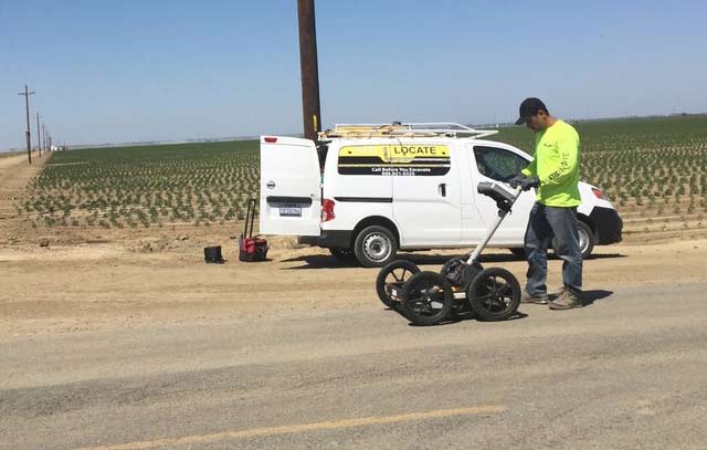
Util-Locate makes use of cutting-edge technology and equipment. With over 13 years of experience, Util-Locate demonstrates its skill in providing cost-effective, timely, and accurate GPR survey solutions.

We can establish the most appropriate survey approach based on the client's specifications and are glad to give real-time data on-site.
What is GPR?
If you are in Orange County, Ground Penetrating Radar (GPR) is for you. It is a non-invasive surveying technique used to find underground utilities, conduits, rebar, voids, and other characteristics.
GPR images the subsurface using energy pulses. A built-in computer keeps track of the strength and time necessary to return reflected signals and stores this information on digital media. Natural and man-made materials such as geological features, pipes, and wires exhibit differences.
It can also be used on a range of surfaces, including soil, ice, rock, freshwater, pavements, and concrete buildings, as a non-destructive and dynamic survey tool.
Benefits of Ground Penetrating Radar
GPR is capable of detecting metallic and non-metallic services like polyethylene water and gas pipes and utilities such as fiber-optic cables that are generally undetectable by other means.
While GPR alone cannot ensure the detection or identification of all underground services, when combined with electromagnetic detection, the most full and thorough answer is generated. Here are its benefits:
- A safer and non-intrusive way to map
- It last throughout the duration of a project
- Ensures that sensitive sites are not disturbed by digging
- It offers cost and time savings as well as scheduling and safety improvements over techniques such as x-rays
- Identify early warning signs
- Diagnose problems quickly and accurately
Its applications:
- Detection and mapping of utilities
- Determine the physical dimensions and arrangement of a structure
- Analyze natural obstacles and identify risks
- Clearance for Directional Drilling
- Unmarked cemetery and grave location
- Inspect the pavement for cracks and asphalt thickness
- Geology and geophysics
- Environmental surveys
- Studies on trenchless technology and directional drilling
