GPR vs. Concrete Xray for Utility Location

utility locating services

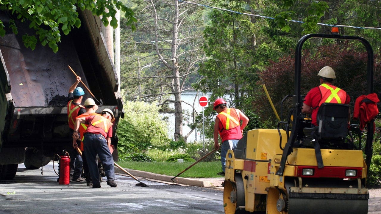
When it comes to utility locating services, two commonly used methods are ground-penetrating radar (GPR) and concrete X-ray scanning. Both methods offer effective solutions for locating underground utilities, each with its own unique benefits and considerations.

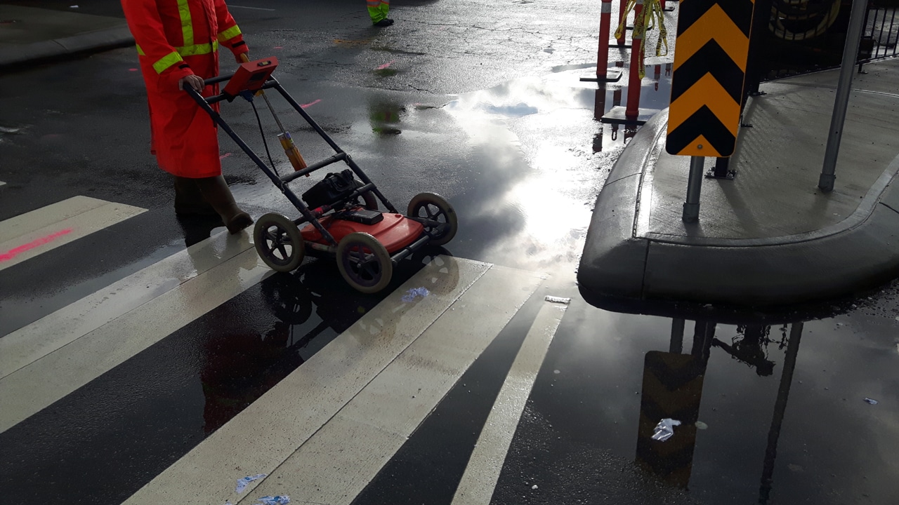
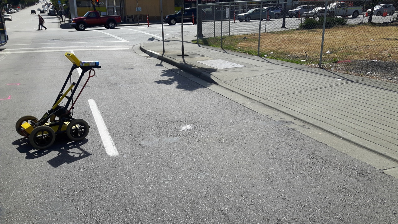
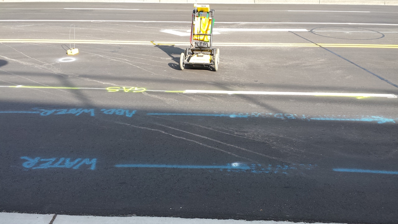
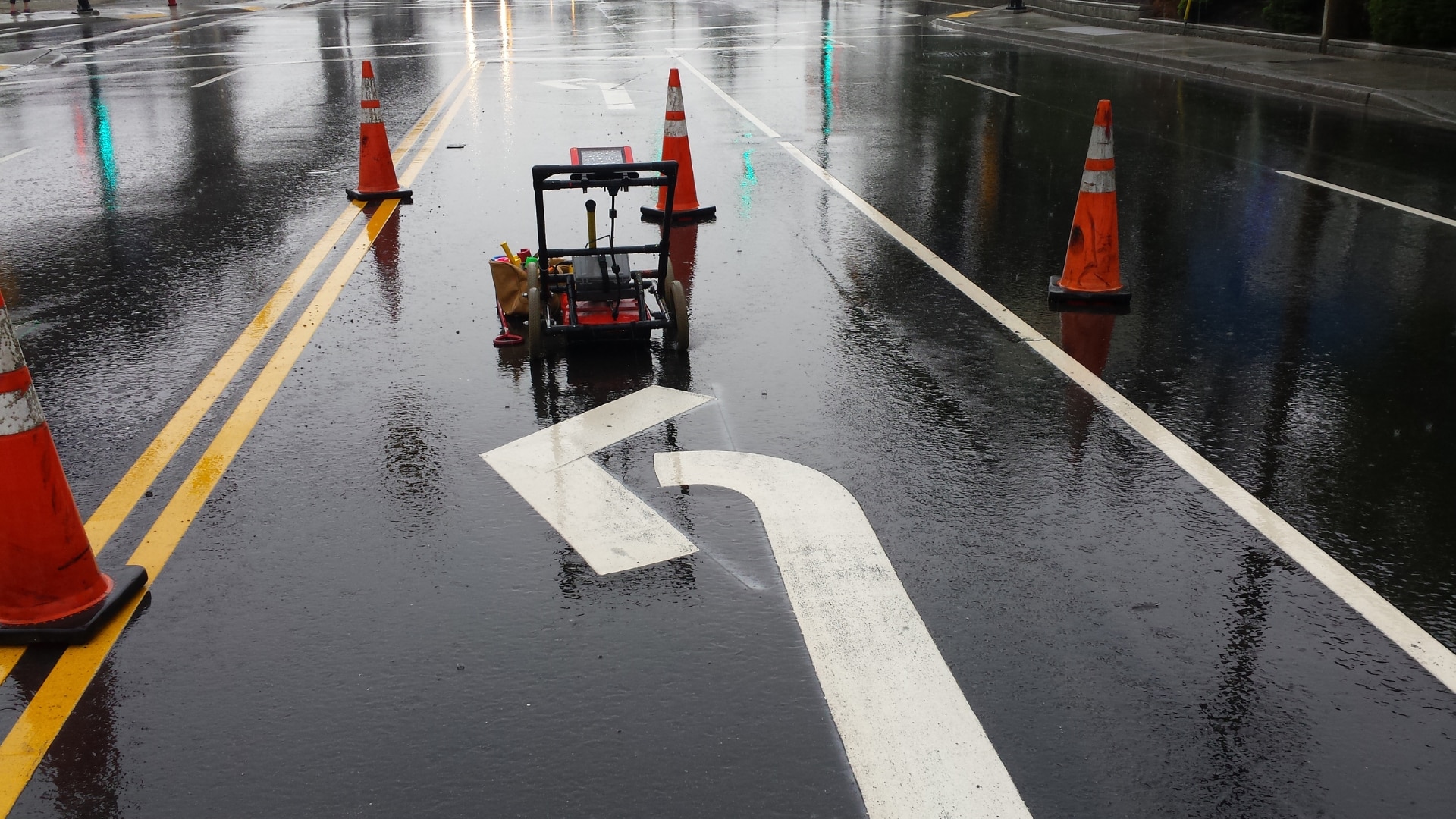
GPR utilizes advanced ground-penetrating radar technology to detect subsurface utilities by emitting and analyzing electromagnetic waves. It provides a non-intrusive and efficient way to map out utility lines and identify their approximate locations.

On the other hand, concrete X-ray scanning, also known as concrete imaging or concrete radiography, employs specialized equipment to capture detailed images of objects within concrete structures, including utilities. It allows for the precise identification and mapping of utilities embedded within concrete slabs or walls.

Understanding the differences and benefits of these methods is crucial for utility companies, property owners, and construction project managers to choose the most suitable approach based on project requirements, material types, and accuracy needs.

An Insight Into GPR and Concrete X-ray for Utility Location

GPR and concrete X-ray scanning are two commonly used methods for underground utility locating services, differing in their principles and technologies.

Ground-Penetrating Radar (GPR)

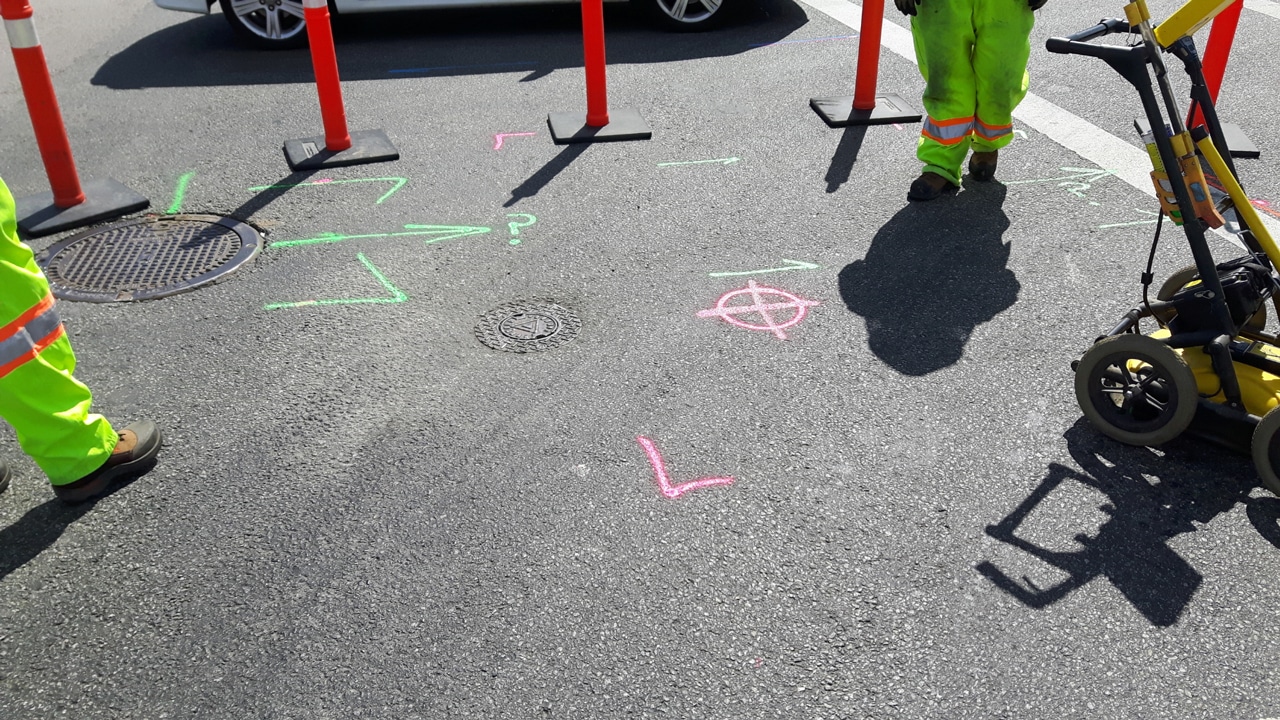
GPR utilizes radar technology and electromagnetic waves to detect subsurface variations. It maps utility locations without invasive measures, identifying various utility types, including non-metallic pipes and cables.

GPR provides real-time data, immediate analysis, and detailed reports, enhancing understanding of subsurface conditions.

Concrete X-Ray Scanning

Concrete scanning employs specialized equipment and X-ray technology to capture detailed images of utilities within concrete structures. It offers precise identification and mapping of utilities hidden in concrete slabs or walls. High-resolution images enable accurate planning and decision-making.

These methods aid utility companies, property owners, and construction project managers in making informed choices based on project needs, material types, and requirements. They contribute to accurate utility identification and mapping for efficient and safe excavation practices.

Principles and Technology Behind GPR and Concrete X-Ray

  • Ground-Penetrating Radar – GPR utilizes electromagnetic waves to penetrate the ground and detect variations in subsurface materials. It relies on the principles of radar technology and the analysis of reflected signals to map out utility locations.
  • Concrete X-ray – Concrete X-ray, also known as concrete imaging or concrete radiography, involves using specialized equipment to capture images of objects embedded within concrete structures. It employs X-ray technology to create detailed images of utilities hidden within concrete slabs or walls.

Pros and Cons of Ground Penetrating Radar for Utility Location

Pros

  • A non-destructive method that does not require drilling or cutting into concrete
  • Can detect a wide range of utility types, including non-metallic pipes and cables
  • Provides real-time data and immediate on-site analysis
  • Offers the ability to map out utility locations and create detailed reports
  • Effective for large-area scanning and mapping

Cons

  • Limited penetration depth in certain soil conditions or dense materials
  • Interpretation of data requires expertise and experience
  • Can be affected by environmental factors such as moisture or electrical interference
  • May have limitations in identifying smaller or deeply buried utilities
  • Requires clear access to the scanning area for optimal results

4 Applications and Use Cases of GPR in Utility Location

Ground-penetrating radar (GPR) has a wide range of applications in utility locator services. Its non-destructive nature and versatility make it suitable for various scenarios, including:

  1. Mapping Utility Lines – GPR is effective in mapping utility lines, including gas lines, water pipes, electrical cables, and communication lines. It allows for the identification and mapping of both metallic and non-metallic utilities.
  2. Subsurface Imaging – GPR can create detailed subsurface images, revealing the presence of underground structures, voids, or buried objects that may impact utility location.
  3. Environmental Assessment – GPR helps assess the environmental conditions and subsurface geology of a site, identifying potential hazards or areas prone to subsidence.
  4. Archaeological Surveys – GPR aids in archaeological investigations by detecting buried artifacts, structures, or ancient remains without excavation.

Applications and Use Cases of Concrete X-Rays in Utility Location:

Concrete X-ray scanning is particularly valuable in utility location scenarios involving concrete structures. Some key applications include:

  1. Locating Embedded Utilities: Concrete X-ray enables the identification and mapping of utilities, such as conduits, rebar, post-tension cables, and ductwork embedded within concrete slabs or walls.
  2. Structural Assessments: They help evaluate the integrity of concrete structures, identifying cracks, voids, or other defects that may affect utility installation or maintenance.
  3. Renovation and Retrofitting: Concrete X-ray assists in planning renovation projects by locating existing utilities and determining the best strategies for integrating new systems.
  4. Quality Control: It allows for quality control inspections during construction to ensure proper installation and positioning of utilities within concrete structures.

Factors to Consider When Choosing Between GPR and Concrete X-Ray:

When deciding between GPR and concrete X-ray for utility location services in Orange County and anywhere in Southern California, several factors should be considered:

  • Material Type – GPR is suitable for a wide range of materials, while concrete X-ray is specifically designed for concrete structures.
  • Depth of Penetration – GPR provides greater depth penetration in most soil conditions, whereas concrete X-ray is limited to the thickness of the concrete being scanned.
  • Accuracy Requirements – Consider the level of accuracy needed for utility location, as well as the desired resolution and level of detail.
  • Project Constraints – Evaluate factors such as project timeline, site accessibility, and potential interference from other nearby utilities or structures.

By carefully assessing these factors, utility companies, property owners, and construction project managers can determine the most suitable method, whether it’s GPR or concrete X-ray, for their specific utility location needs.

Trust Util-Locate for Excellent Concrete X-Ray and Utility Locating Services!

Util-Locate is your trusted partner when it comes to accurate and dependable X-ray utility location services. With years of experience and a team of highly skilled professionals, we specialize in providing exceptional results for utility mapping and identification.

Our advanced X-ray equipment and cutting-edge imaging techniques ensure the precise location and identification of utilities embedded within concrete structures.

Trust Util-Locate for all your X-ray scanning, GPR, and private utility locating needs. Contact us today at 888-885-6228 to discuss your specific requirements and experience the reliability and excellence of our services.

How to Photo Document Underground Utility Locating

private utility locating

When it comes to underground utility locating, photo documentation plays a crucial role in capturing and preserving valuable information. It goes beyond traditional field markings, providing visual evidence that enhances precision and understanding.

This blog explores the art and significance of photographing underground utility locations. From private utilities to public safety considerations, we delve into the various aspects where photo documentation proves indispensable.

Discover how it revolutionizes the industry, enables accurate location identification, and aids in future development planning. By unraveling the hidden infrastructure through images, we unlock a new level of insight and efficiency in the construction industry.

Below, we’ll discuss the power of capturing the unseen and gathering visual evidence for underground private utility locating.

The Art of Underground Utility Photo Documentation

Photo documentation plays a crucial role in underground utility locating, offering a visual record that enhances accuracy and documentation. By capturing detailed images of underground facilities, private utility locators and construction companies can effectively document the location and condition of utilities.

This art of underground utility photo documentation involves using specialized equipment and techniques to capture clear and comprehensive images of buried infrastructure. These images serve as valuable references for future projects, helping to minimize the risks associated with utility damage and ensuring precise utility location identification.

With the advancement of technology, photo documentation has become an indispensable tool in the field, allowing professionals to unveil and understand the intricate network of underground utilities.

Enhanced Precision in Photo Documentation in Private Utility Locating

In private utility locating, precision is of utmost importance. Photo documentation plays a key role in enhancing the accuracy and precision of locating underground utilities. By capturing high-quality images of utility lines, private utility locators can document their exact locations, depths, and orientations.

This level of detail enables precise mapping of underground facilities, reducing the risks of excavation-related incidents and costly damages. Advanced imaging techniques, such as geotagging and augmented reality, further enhance the precision of photo documentation by providing precise spatial references for utility locations.

With enhanced precision in photo documentation, private utility locators can confidently provide accurate utility information to construction companies, utility companies, and other stakeholders involved in excavation projects.

How Photo Documentation Revolutionizes Utility Locating

Photo documentation has revolutionized the way underground utility locating is conducted. It offers a visual representation of underground facilities, providing a comprehensive understanding of the intricate network of utilities.

By capturing images of utility lines, photo documentation enables professionals to better analyze, plan, and execute construction projects. It helps in identifying potential conflicts, determining the best excavation methods, and ensuring compliance with safety regulations.

Furthermore, photo documentation serves as a valuable reference for future maintenance and repair work, allowing for efficient and precise utility management.

Detect Underground Utilities through Photo Documentation by Util-Locate!

Capture the power of photo documentation to detect underground utilities with Util-Locate! As a trusted provider of underground utility locating services, we leverage advanced techniques and cutting-edge equipment to deliver accurate and comprehensive photo documentation.

Our skilled team utilizes specialized imaging tools to capture detailed images of buried infrastructure, enabling precise mapping and identification of underground utilities. With our expertise and state-of-the-art technology, we revolutionize utility location through photo documentation.

Choose Util-Locate as your partner for efficient and reliable private utility locating services. Contact us today at 888-885-6228 to experience the benefits of our photo documentation solutions and ensure the success of your construction projects while mitigating the risks associated with underground utilities.

Effectiveness of GPR for Locating Underground Utilities

Ground penetrating radar

As construction projects become increasingly complex, accurate and reliable utility locating is more critical than ever. Ground penetrating radar (GPR) is a non-destructive method used to detect and locate subsurface utilities with high accuracy.

GPR utilizes high-frequency radio waves to penetrate the ground and produce images of subsurface objects. The method can locate both metallic and non-metallic utilities, including plastic pipes, concrete pipes, and optic cables.

This is a cost-effective and safe method of utility locating that reduces the risk of damage to underground utilities, saving thousands of dollars in repair costs and preventing service disruptions for customers. In this blog, we will explore the effectiveness of GPR for locating underground utilities and its benefits in construction projects.

We will also discuss the range of applications, equipment, and factors that impact GPR performance.

What You Need to Know About Ground Penetrating Radar for Utility Locating

Ground penetrating radar is a geophysical method that uses high-frequency radio waves to image subsurface features. It is an effective technique for locating underground utilities, such as water pipes, gas lines, and communication cables, without damaging them.

GPR works by transmitting a pulse of electromagnetic energy into the ground and recording the reflections from subsurface objects. The reflections are then analyzed to determine the location, depth, and size of the utilities.

GPR technology has revolutionized utility locating and is now widely used in construction, engineering, and environmental applications. With GPR, utility locating is faster, more accurate, and less disruptive compared to traditional methods.

Underground Utilities and the Challenges in Locating Them

Locating underground utilities can be challenging due to various factors such as the type of soil, the depth of the utilities, and the presence of other subsurface objects. In urban areas, utilities are often buried beneath a maze of other infrastructure, including sewer lines, storm drains, and electrical conduits, making it difficult to differentiate them.

The use of GPR technology helps to overcome these challenges by providing a non-destructive way of imaging subsurface features. However, there are still limitations to GPR’s effectiveness, such as its inability to penetrate through certain types of soil or detect utilities made of non-conductive materials such as plastic pipes.

Utility locating companies often use a combination of GPR, electromagnetic pipe and cable locators, and other subsurface utility engineering techniques to provide accurate and comprehensive utility location services.

How GPR Locates Underground Utilities: Principle of Radio Waves and Energy Waves

GPR works by sending a series of high-frequency radio waves into the ground and measuring the time it takes for the waves to reflect back to the receiver antenna. The reflected waves are then analyzed to determine the location and depth of the subsurface objects.

Different types of subsurface materials reflect radio waves differently due to differences in their electrical conductivity and dielectric constant. For example, metallic utilities reflect more radio waves compared to non-metallic utilities, making them easier to detect.

GPR can also be used to detect subsurface objects based on differences in energy waves, such as acoustic energy or electrical current. By analyzing the reflected waves, GPR can provide a subsurface image of the utilities, allowing for accurate location and mapping of underground utilities.

Different Types of Underground Utilities that GPR Can Detect

 The GPR technology can detect a wide range of underground utilities in construction projects, including metallic and non-metallic utilities. Some of the most common underground utilities that GPR can detect include water lines, sewer lines, gas lines, electrical lines, fiber optic cables, and communication lines.

GPR is particularly useful in detecting non-metallic utilities such as plastic pipes, which cannot be detected by traditional cable locators. GPR can also detect the location of underground storage tanks, buried manholes, and valve boxes.

By providing a detailed subsurface image of the utility lines, GPR can help project managers to locate and map out the exact locations of the underground utilities before starting any excavation work. This can save time, reduce the risk of damaging utilities during construction, and ultimately save thousands of dollars in repair costs.

Benefits of GPR in Locating Underground Utilities: Accuracy and Cost-Effectiveness

Ground Penetrating Radar (GPR) offers several benefits in locating underground utilities. The first and most significant benefit is accuracy. GPR technology can accurately locate underground utilities, including metallic and non-metallic pipes, cables, and other subsurface objects.

The data produced by GPR surveys can provide detailed information about the location and depth of underground utilities, allowing for more accurate planning and excavation.

Another benefit of using GPR is cost-effectiveness. By using GPR technology, construction companies can avoid costly mistakes such as damaging underground utilities during excavation, which can cause delays, safety hazards, and costly repairs. In contrast, the cost of GPR surveys is relatively low, especially when compared to the potential costs associated with damaging underground utilities.

GPR is also a non-destructive method of utility locating, which means that the process does not cause any damage to the subsurface utilities or the surrounding areas. This allows construction companies to reduce the disruption to the surrounding environment, which is particularly important in urban areas.

Overall, the benefits of GPR in locating underground utilities make it an essential tool for construction projects, ensuring accuracy, cost-effectiveness, and safety.

Factors Affecting GPR Performance in Locating Underground Utilities

Several factors can affect the performance of GPR in locating underground utilities.

  • Conductive Material – The type of material present in the subsurface can affect the performance of GPR. Metallic utilities are easier to detect compared to non-metallic utilities like plastic pipes or concrete structures.
  • Soil Conditions – The type of soil present in the subsurface can also affect the performance of GPR. Wet soil and highly conductive soils can reduce the penetration depth of GPR signals.
  • Ground Disturbances – The presence of ground disturbances like rocks, tree roots, or other buried objects can also affect the performance of GPR. These objects can reflect or absorb the GPR signals, leading to false readings or incomplete data.
  • Frequency Range – The frequency range of GPR used can also affect its performance. Higher frequencies can provide more accurate data but have a shallower penetration depth. Lower frequencies can penetrate deeper but may provide less detail.
  • Equipment Quality – The quality of the GPR equipment used can also affect performance. Low-quality equipment may provide inaccurate data or break down, leading to delays and additional costs.

By taking these factors into account and selecting appropriate equipment and techniques, the performance of GPR can be optimized for utility locating.

Why Util-Locate is the Top Choice for GPR Utility Locating Services

Looking for accurate and reliable GPR utility locating services for your construction project? Choose Util-Locate, the top choice for utility locating services. With years of experience and state-of-the-art equipment, our team of experts can locate underground utilities quickly and accurately.

We use the latest technology and equipment to provide the most accurate subsurface imaging for utility lines, whether they are metallic or non-metallic. Our services are cost-effective and can save you thousands of dollars in potential damages caused by hitting an underground utility line during your construction project.

Don’t risk disrupting your project timeline or causing disruptions for customers due to inaccurate utility locating. Trust our team for all your ground-penetrating radar utility locating needs. To learn more about our range of services and how we can help ensure the success of your construction project, contact us at 888-885-6228 at Util-Locate today!

Common Underground Utility Locating Tools and Devices

underground private utility locating

When it comes to construction and excavation projects, the accurate location of underground utilities is crucial to ensuring safety and preventing costly damages. This blog explores the common tools and devices used for underground private utility locating.

From private utility locators to underground wire locators, these tools play a vital role in identifying gas lines, water pipes, electric cables, and other crucial underground infrastructure.

We’ll delve into the importance of precise location techniques, such as using electromagnetic locators and metal detectors, and discuss the advancements in underground utility survey equipment.

By understanding these tools and their functions, professionals in the construction industry can enhance their utility locating practices and minimize risks.

An Insight Into Underground Utility Locating Tools and Instruments

Underground utility locating tools and instruments are essential for construction and excavation projects to identify and avoid potential hazards.

One commonly used tool is the underground utility locator, which utilizes electromagnetic signals to detect underground utilities such as gas lines, water pipes, and electric cables.

These locators employ various technologies, including radio waves and electromagnetic frequencies, to accurately pinpoint the location of buried utilities. Additionally, metal detectors are employed to detect metallic objects like pipes and cables

By using these advanced tools, construction professionals can enhance their ability to locate underground utilities accurately, ensuring the safety and efficiency of their projects.

The Role of Underground Wire Locators in Utility Location

Underground wire locators play a crucial role in utility location, specifically in identifying and tracing underground electrical cables and power lines. These specialized instruments use electromagnetic signals to locate and trace the path of electric currents flowing through underground cables.

By emitting signals and measuring the response, underground wire locators can determine the precise location and direction of buried electric lines, allowing construction crews to work safely and avoid damaging vital infrastructure.

These locators are equipped with features like adjustable frequencies and signal filters to adapt to different soil conditions and environmental factors, enabling accurate and efficient utility location.

Essential Equipment for Locating Metal Pipes and Water Pipes

Locating metal pipes and water pipes underground requires specific tools and equipment. Among the essential instruments used is the pipe locator, which utilizes electromagnetic signals to detect metallic pipes buried beneath the ground.

These locators can differentiate between different types of pipes, such as steel, copper, or PVC, based on their conductive properties. In addition, ground penetrating radar (GPR) systems are employed to create subsurface images and identify the presence and location of various underground features, including water pipes.

By utilizing essential equipment and techniques, construction professionals can precisely locate and avoid damaging metal and water pipes during excavation projects, minimizing disruptions and potential hazards.

Trust Util-Locate to Provide You with Reliable Underground Utility Locating Tools!

When it comes to underground private utility locating, you need tools you can rely on. At Util-Locate, we specialize in providing high-quality and reliable underground utility locating tools and instruments. With our extensive range of equipment, including underground utility locators, wire locators, and pipe locators, we ensure that you have the right tools to accurately detect and locate underground utilities.

Our commitment to excellence and customer satisfaction sets us apart. We offer state-of-the-art technology, expert guidance, and exceptional customer support to meet your utility locating needs. Whether you’re a construction professional or a utility service provider, trust Util-Locate to deliver reliable tools and methods that enhance your efficiency and safety.

Don’t compromise on the accuracy and reliability of your underground private utility locating tools. Contact us at 888-885-6228 at Util-Locate today and experience the difference firsthand!

What is a Ground Penetrating Radar (GPR) & How Does it Work?

Ground penetrating radar

Ground penetrating radar (GPR) is a non-invasive geophysical method used to investigate subsurface materials and structures without damaging the site. It uses high-frequency electromagnetic waves to produce images of the subsurface, which can be used to locate and map buried objects and materials.

This technology has numerous applications, including utility detection, environmental studies, geology, and archaeology.

GPR works by emitting an electromagnetic pulse into the ground using a transmitter antenna. This pulse is then reflected back to the surface by subsurface objects and recorded by a receiver antenna.

By analyzing the characteristics of the reflected wave, GPR can provide information about the depth, size, and shape of subsurface features.

GPR is a powerful tool that can penetrate a variety of materials, including soil, rock, concrete, and ice. It is non-destructive, fast, and accurate, making it an essential tool for many industries. This article will explore the principles of GPR, how it works, and its many applications. We will also discuss the limitations of GPR and the factors that can affect its performance.

Definition of Ground Penetrating Radar

Ground-penetrating radar is a geophysical method that uses electromagnetic energy to detect and map subsurface features. This technology is commonly used for a variety of applications, including locating buried utilities, identifying geological features, and detecting archaeological artifacts.

It works by sending short pulses of electromagnetic energy into the ground and measuring the time it takes for the energy to reflect back to the surface. By analyzing the reflected signals, GPR can create a detailed image of the subsurface structure.

The Physics Behind GPR: Electromagnetic Energy and Radar Waves

GPR relies on the properties of electromagnetic energy and radar waves to detect subsurface features. Electromagnetic energy is a form of energy that is created when an electric field and a magnetic field interact.

When this energy is sent into the ground, it interacts with subsurface objects that have different electrical properties. The radar waves produced by the interaction of electromagnetic energy and subsurface objects are then reflected back to the surface, where they can be detected and analyzed.

GPR Components: Antennas, Control Unit, and Radar Signal

GPR systems consist of three main components: antennas, a control unit, and a radar signal. Antennas are used to transmit and receive the electromagnetic energy that is sent into the ground.

The control unit is the central component of the system and is responsible for generating and analyzing the radar signal. The radar signal is the electrical signal that is produced by the control unit and sent to the antennas. By analyzing the radar signal, GPR can create a detailed image of the subsurface structure.

How GPR Works: Depth of Penetration and Subsurface Structures

The depth of penetration of GPR waves depends on several factors, including the electrical conductivity of the ground, the frequency of the antennas used, and the dielectric properties of the subsurface structures. The depth of penetration can vary from a few centimeters to several meters, depending on the favorable conditions for the radar signal to travel through the ground.

GPR is capable of detecting a wide range of subsurface structures, including buried utilities, pipes, archaeological artifacts, and geological features. By analyzing the radar data, it is possible to create a detailed image of the subsurface structures, which can be used to identify potential hazards or locate valuable resources.

GPR Data Displays: 2-D and 3-D Views

The data collected by GPR is typically displayed in 2-D or 3-D views, which provide a detailed image of the subsurface structures. In 2-D scans, the data is displayed as a horizontal slice of the ground at a specific depth, while in 3-D displays, the data is presented as a block view of the subsurface structures.

The accuracy of the depth of investigation depends on several factors, including the type of soil, the antenna frequency, and the actual depth of the subsurface structure. 3-D displays can provide more accurate and detailed information about the subsurface structures, allowing for better decision-making and planning in a variety of industries.

These displays are commonly used in construction, geology, archaeology, and environmental studies, providing valuable insights into the subsurface conditions and helping to ensure the safety and efficiency of a project.

Factors Affecting GPR Performance: Conductive Properties and Ground Disturbances

The accuracy and effectiveness of GPR depend on several factors, including the electrical conductivity of the soil or material being scanned and the presence of any ground disturbances.

Conductivity in the ground affects the propagation of radar waves, and therefore the depth of penetration and quality of the signal. High-conductivity materials such as metals, wet soil, and water can absorb electromagnetic energy, leading to signal attenuation and reduced penetration depth.

Ground disturbances such as pipes, cables, or construction activities can also affect the performance of GPR. When the ground surface is not uniform, or when there are subsurface structures with different electromagnetic properties, the radar waves can reflect or refract, causing noise and reducing the accuracy of the results.

To minimize the impact of these factors, GPR operators can perform surveys in favorable conditions, such as dry soil and low-conductivity materials. They can also use specialized antennas and software to filter out noise and enhance the quality of the data.

Choose Util-Locate for Your Ground Penetrating Radar Service Needs

Looking for reliable and accurate ground penetrating radar services? Look no further than Util-Locate! Our team of experienced professionals is equipped with state-of-the-art GPR equipment and is committed to providing you with the best possible results.

Whether you need to locate subsurface utilities or assess the condition of concrete structures, our GPR services can provide the information you need to make informed decisions.

With our proven track record of success and commitment to customer satisfaction, you can trust us to deliver quality ground-penetrating radar services that meet your needs and exceed your expectations. To learn more and to schedule your GPR service, contact us at 888-885-6228 at Util-Locate today!

What is Potholing and Why is it Necessary in Underground Construction?

Utility potholing

Utility potholing is a crucial process in underground construction, helping to ensure that workers can safely and accurately excavate the ground without damaging critical infrastructure such as utility lines. In this blog, we’ll provide a comprehensive overview of potholing and its importance in construction projects.

We’ll explain what potholing is, how it works, and the equipment used in the process. We’ll also cover the benefits of using potholing services, including increased safety, cost savings, and reduced downtime.

By the end of this blog, you’ll have a clear understanding of why potholing is necessary and how it can help you complete your underground construction projects efficiently and effectively.

The Basics of Utility Potholing and Importance in Underground Construction

Potholing, also known as daylighting, is the process of excavating small holes in the ground to locate underground utilities and other infrastructure. This process is critical in the construction industry, as it helps to prevent costly and dangerous accidents that can result from accidentally striking an underground utility line. Potholing is particularly important in areas where underground utilities are not accurately mapped or the information on utility maps is outdated.

The preferred method of potholing is vacuum excavation, which uses high-pressure air or water to break up the ground and a vacuum to remove the soil, debris, and water. This method is more efficient and safer than traditional excavation methods that use heavy equipment, which can cause damage to the underground infrastructure.

The Benefits of Potholing for Underground Construction Projects

Potholing offers numerous benefits for construction projects involving underground infrastructure. It helps to accurately locate the exact location of underground utility lines, fiber optics, and other subsurface features, reducing the risk of damage during the excavation process. Potholing also allows for the identification of incorrect utility locations, reducing the risk of utility damage and costly repairs.

By identifying the precise locations of underground services, potholing helps to prevent service interruptions during construction, which can result in significant costs and delays. Additionally, potholing provides cost savings by limiting costs associated with expensive equipment and by keeping projects within budget.

Understanding the Potholing Process: Techniques and Methods

The potholing process involves several techniques and methods that help to accurately locate and excavate underground infrastructure. This includes the use of the ground-penetrating radar (GPR) which provides information on subsurface features, as well as the use of directional drilling, which is used to bore holes and install underground service lines.

The most common method of potholing is air vacuum excavation, which involves the use of a portable vacuum excavator to break up the ground and remove soil, debris, and water. Other potholing techniques include water excavation, which uses pressurized water to break up the ground, and boring holes, which are used to install underground service lines.

Trust the Experts: Why Util-Locate is Your Top Choice for Potholing Services

Util-Locate is a trusted provider of potholing services and has extensive experience in the potholing process. Our team of experts is highly trained in the use of the latest potholing techniques and methods, ensuring accurate and efficient excavation of underground infrastructure.

Util-Locate uses the latest technology and equipment, including ground-penetrating radar and air vacuum excavation, to accurately locate and excavate underground utilities and other subsurface features. Our team is dedicated to providing the highest level of service and ensuring that every project is completed safely, on time, and within budget.

By choosing Util-Locate for your potholing needs, you can trust that your project is in the hands of experts who understand the importance of accurate and efficient excavation of underground infrastructure.

For reliable potholing services, contact us at 888-885-6228 at Util-Locate today!